Photos of La (929)
There are (929) photos of the keyword, La, available on our website. They are pictured below.The pictures are organized by category.
Pages: [<<] 1 2 3 4 5 6 7 8 9 10 [>>]
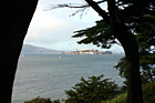
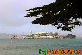
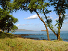
#889 — A scenic picture taken of the Alcatraz Island and prison located in the bay waters in San Francisco, California. You can see Alcatraz in this photo through two trees.
Alcatraz Between Trees
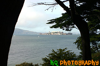
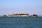
#491 — A scenic picture taken of Alcatraz Island located in San Francisco, California. Alcatraz Island served as a military fortification in the 1850s, an incarceration facility for Spanish-American War prisoners, and a federal maximum-security prison from 1934 to 1963. Alcatraz Island is now one of Golden Gate National Recreation Area's most popular destinations, offering a close-up look at a historic and infamous federal prison long off-limits to the public. Alcatraz Island is also commonly known as the "Rock."
Alcatraz Island & Prison
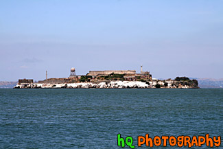
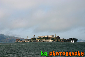
#1764 — A scenic picture taken of Alcatraz Prison and island on a sunny day in San Franciso, California. Alcatraz Island served as a military fortification in the 1850's, an incarceration facility for Spanish-American War prisoners, and a federal maximum-security prison from 1934 to 1963. Alcatraz Island is now one of Golden Gate National Recreation Area's most popular destinations.
Alcatraz Prison
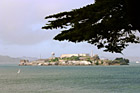
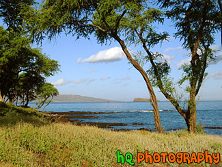
#566 — A scenic picture taken of Alcatraz Island with a tree branch in view from atop a hill in San Francisco, California.
Alcatraz with Tree Branch
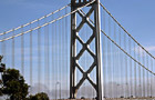
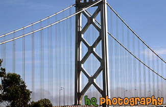
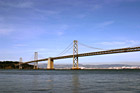
#593 — A close up picture taken on the arch of the Bay Bridge which is located in San Francisco, California and connects with Oakland. There are no pedestrian walkways or vista points on the Bay Bridge, but you can drive on it and stop midway at Treasure Island to view the span. The Bay Bridge is a very popular commuting bridge as over a quarter million vehicles cross the San Francisco Bay Bridge daily.
Arch of Bay Bridge
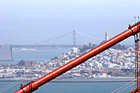
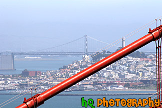
#579 — An interesting picture taken close up of the red beam of the Golden Gate bridge. Behind the beam you can see the city of San Francisco, California along with a view of the Bay Bridge and Coit Tower.
Close Up of Golden Gate Bridge & Bay Bridge in View
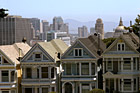
#406 — A scenic picture taken of three and a half victorian houses at the famous Alamo Square known for where the sitcom "Full House" was filmed. In the distance you can see the San Francisco Bay Bridge, the city's city hall building and other tall buildings from downtown San Francisco, California. These houses on Postcard Row are also known as the "Seven Sisters of Postcard Row" or the "Painted Ladies" and are a popular tourist attraction in San Francisco.
Famous Alamo Square in San Francisco
#594 — A scenic picture taken in San Francisco, California of the Ferry Building and the Bay Bridge in the background. The famous Bay Bridge is the bridge that connects San Francisco with Oakland. San Francisco's historic ferry building is home of the Farmer's Market and some permanent market shops, cafes, and restaurants. Its 240-foot clock tower, modeled after the 12th century bell tower in Seville, has been the San Francisco waterfront icon for more than 100 years. Developers spent nearly $90 million to renovate the building, which withstood both major earthquakes, and turn it into what they hope will become a thriving food center.
Ferry Building, Bay Bridge, & San Francisco
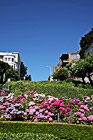
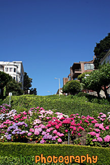
#681 — A close up picture taken of the flowers and curves of Lombard Street in downtown San Francisco, California. Lombard Street has eight sharp turns (or switchbacks) that have earned the street the distinction of being the most crooked (winding) street in the United States. One of San Francisco's car lines stops at the top of this block.
Lombard Street Close Up
#783 — A scenic picture looking at Treasure Island and Oakland in the background from San Francisco, California. In the picture you can see the Oakland-Bay Bridge on the other side of Treasure Island. You can also see the interesting buildings, apartments, and homes of San Francisco in the foreground.
Oakland & Treasure Island from S.F.
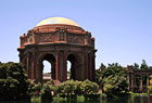
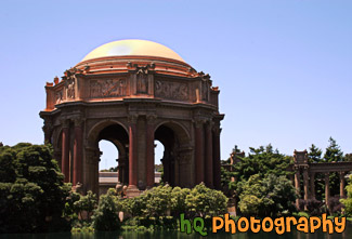
#483 — A day time picture taken of the Palace of Fine Arts Exploratorium located in San Francisco, California. The task of creating a Palace of Fine Arts for the 1915 Panama-Pacific International Exposition fell to the architect Bernard R. Maybeck, then fifty years old and known for his innovative ideas. Setting to work on this new project, he chose as his theme a Roman ruin, mutilated and overgrown, in the mood of a Piranesi engraving. The Palace of Fine Arts was meant to give delight by its exterior beauty, but its purpose was also to offer all visitors a stimulating experience within doors.
Palace of Fine Arts Exploratorium
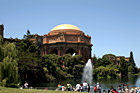
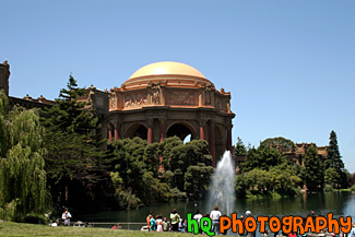
#600 — A day time picture taken of the Palace of Fine Arts Exploratorium located in San Francisco, California. In this picture you can see the many people enjoying the water fountain outside of teh exploratorium during a sunny day. The task of creating a Palace of Fine Arts for the 1915 Panama-Pacific International Exposition fell to the architect Bernard R. Maybeck, then fifty years old and known for his innovative ideas. Setting to work on this new project, he chose as his theme a Roman ruin, mutilated and overgrown, in the mood of a Piranesi engraving. The Palace of Fine Arts was meant to give delight by its exterior beauty, but its purpose was also to offer all visitors a stimulating experience within doors.
Palace of Fine Arts Exploratorium in San Francisco
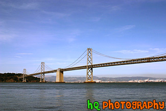
#784 — A scenic picture taken of the entire San Francisco - Oakland Bay Bridge located in San Francisco, California. This picture was taken on a sunny day in the spring season. The Bay Bridge opened to traffic on November 12, 1936. Its total cost, including an electric railroad which has since been abandoned, was $79.5 million. The best ways to enjoy the Bay Bridge are: From the San Francisco waterfont along Embarcadero Street, where you can see and photograph the span, and walk under it.
San Francisco Bay Bridge & Blue Sky
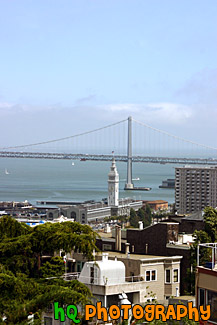
#592 — A scenic picture taken of the city of San Francisco, California from across the bay at Treasure Island. This picture was taken just before dusk as you can see the sky starting to become more dramatic and change colors.
San Francisco from Treasure Island
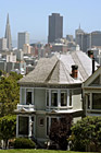
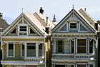
#403 — A scenic picture taken of one victorian house at the famous Alamo Square known for where the sitcom "Full House" was filmed. In the distance you can see the Transamerica Pyramid as well as other tall buildings from downtown San Francisco, California. These houses on Postcard Row are also known as the "Seven Sisters of Postcard Row" or the "Painted Ladies".
San Francisco Victorian House at Alamo Square
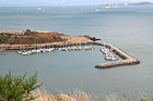
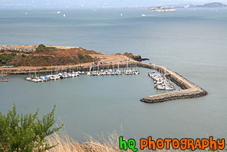
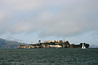
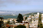
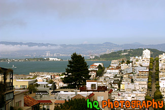
#1581 — A scenic picture taken of the San Francisco, California bay taken from a lookout point above. In this photo you can see Alcatraz Island in the background and a sailboat docking station in the foreground.
San Franicsco Bay
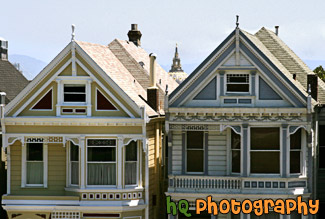
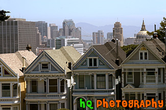
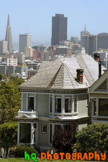
#595 — A scenic picture taken of three of two Victorian houses in Postcard Row/Alamo Square in San Francisco, California. In this picture you can see the tip of San Francisco's city hall building between the two houses.These houses on Postcard Row are also known as the "Seven Sisters of Postcard Row" or the "Painted Ladies". This row has become synonymous with San Francisco. Most visitors associate these homes with the TV show Full House, Tales of the City, Too Close for Comfort and a wide array of other films and advertisements. From a top the Alamo Square Park overlooking these houses you can view the entire city of San Francisco and skyline. This entire area is filled with Victorian style buildings with pleasant sunny lawns, mostly on mild slopes, with a few large cypress trees and tennis courts.
Two Homes of Alamo Square
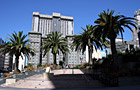
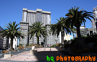
#482 — A picture taken of downtown San Francisco at Union Square. Union Square is one of San Francisco's commerce and cultural centers. The 245 foot long granite central plaza invites street performers to its four corners and has plenty of space for staged events, art exhibitions, and concerts. The area around Union Square -- Post, Stockton, Geary, Powell, and Sutter streets, are a tribute to the power of shopping. Every major department store is within easy walking distance of the square. Views of the Union Square area are best from Harry Denton's Starlight Room in the Sir Francis Drake Hotel and from some of the second and third floor galleries and shops surrounding the square.
Union Square, San Francisco
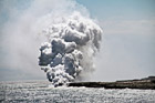
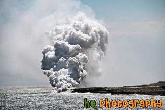
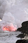
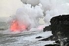
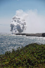
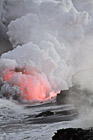
#2393 — A scenic picture taken a lava flowing into the Pacific Ocean from Kilauea volcano located on the big Island of Hawaii. The hot lava makes the huge steam cloud seen flowing out of the ocean.
Lava Entering Ocean
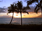
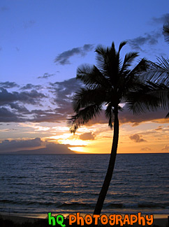
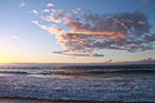
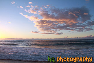
#179 — A picture of a beautiful sunset taking place in Maui, Hawaii. In this photo you can see the silouettes of three palm trees and a boat in the distance in the Pacific Ocean. The pretty colors of the sunset can be seen reflecting in the Pacific Ocean.
Maui Sunset
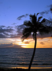
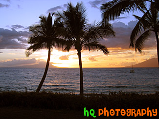
#178 — A beautiful picture of a sunset taking place on the island of Maui located in Hawaii. In this photo you can see the silhouette of the palm treen in the foreground and the beautiful colors of the sunset in the distance also reflecting in the Pacific Ocean and the waves.
Palm Tree, Ocean, & Sunset
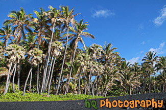
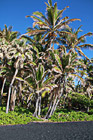
#2387 — A scenic picture taken of the black sand and palm trees located on the Big Island of Hawaii. Beautiful blue sky is seen in the background. This black sand beach is located at Punaluu Black Sand Beach. The sand is black because of the constant volcanic activity on the island.
Black Sand Beach & Palm Trees
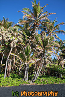
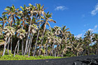
#2389 — A scenic vertical picture taken of Punaluu Black Sand Beach which green palm trees and blue sky. You can see the black sand in the foreground.
Black Sand Beach at Punaluu, Big Island
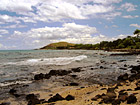
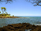
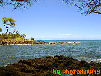
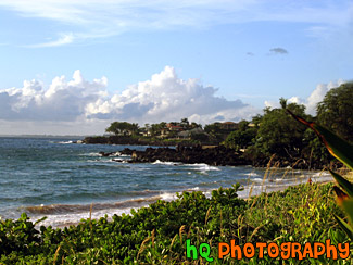
#167 — A scenic photo of the beach and a boat taken on the shore of Makena Beach located in Maui, Hawaii.
Boat & Beach of Maui, Hawaii
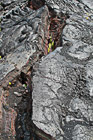
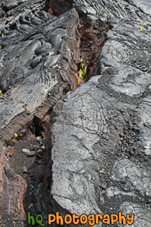
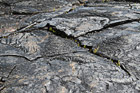
#2392 — A scenic vertical picture taken close up of a cracked lava field located on the Big Island of Hawaii at Hawaii Volcanoes National Park, Hawaii.
Cracked Lava Field
#2378 — A scenic picture taken of the sun about to set over the pacific ocean on the island of Kauai, Hawaii. This photo was taken at Polihale State Park.
Dusk at Polihale Park, Kauai
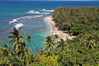
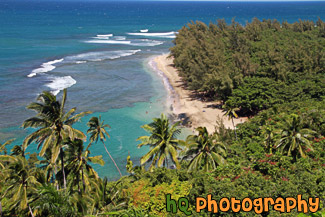
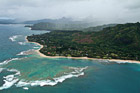
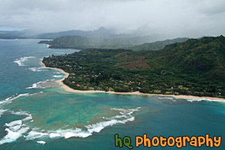
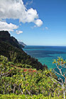
#2386 — A scenic picture looking down at Ha'ena Beach Park located on the island of Kauai, Hawaii. This photo was taken from the Kalalua Trail.
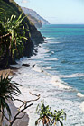
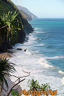
Ha'ena Beach View on Kalalua Trail
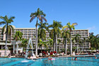
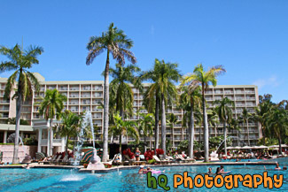
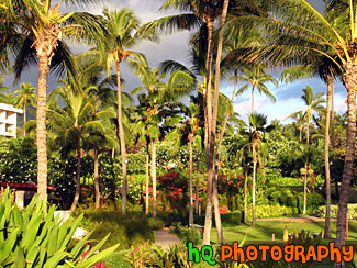
#2359 — A scenic picture taken of a hotel Resort pool area located in Kauai, Hawaii. Blue sky is seen above with the pool and palm trees in the foreground. People are in the pool enjoying the Hawaii weather.
Hotel Resort Pool Area
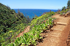
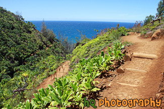
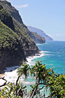
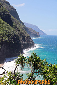
#2385 — A scenic picture taken of part of the Kalalau Trail located on the island of Kauai, Hawaii along the rugged Na Pali Coast.
Kalalau Trail on Na Pali Coast
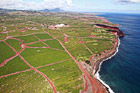
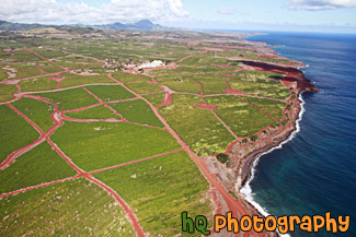
#2376 — A scenic picture taken of the island of Kauai, Hawaii from the air in a helicopter.
Kauai Aerial View
#2381 — A scenic picture taken of Kauai and the Pacific Ocean and clouds at dusk as the pink sky starts to set in. This photo was taken at Polihale State Park.
Kauai at Dusk
#2377 — A scenic picture taken of the beach shore at Polihale Park located on the island of Kauai, Hawaii. Puffy clouds and part of the Na Pali coast are seen in this photo. Beautiful waves from the Pacific Ocean are also seen as the sun is getting ready to set.
Kauai at Polihale Beach Park
#2374 — A scenic picture taken of the Kauai Coast from a helicopter. Clouds are covering the island in this photo.
Kauai Coast From Air
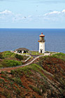
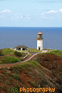
#2382 — A scenic vertical picture taken of the Kilauea Lighthouse which is located at the northernmost point of the main Hawaiian Islands at Kauai. It was built in 1913.
Kilauea Lighthouse
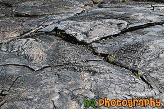
#2391 — A scenic close up picture taken of a lava field located at Hawaii Volcanoes National Park, Hawaii, which is on the Big Island.
Lava Field Close Up
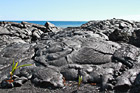
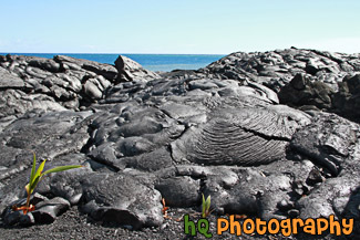
#2396 — A scenic picture taken of some dried lava fields with the Pacific Ocean seen in the background. These lava fields were found on the Big Island of Hawaii from lava that had dried up from the Kilauea volcano.
Lava Fields & Ocean
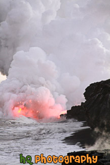
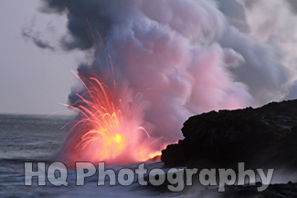
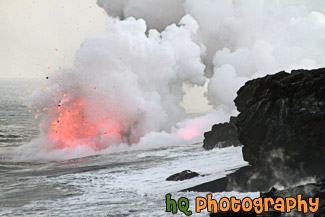
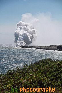
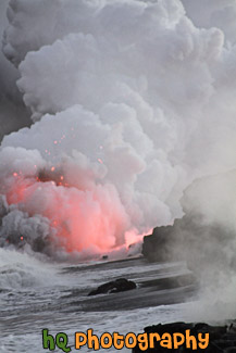
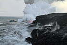
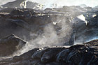
#2400 — Red lava flowing into the Pacific Ocean from the Big Island of Hawaii. When the lava flows into the ocean, it creates big steam as shown in this picture.
Lava Flowing into Ocean
#2402 — A scenic picture taken of lava flowing into the Pacific Ocean off of the coast of the Big Island, Hawaii.
Lava Going into Pacific Ocean
#2399 — Lava flowing into the Pacific Ocean off the coast of the Big Island, Hawaii.
Lava in Ocean in Hawaii
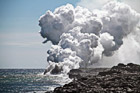
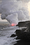
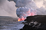
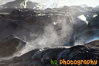
#2395 — A scenic picture taken of lava entering the Pacific Ocean off the coast of the Big Island in Hawaii. You can see the steam created from the hot lava entering the ocean. The lava is coming from the Kilauea volcano.
Lava Steam from Ocean
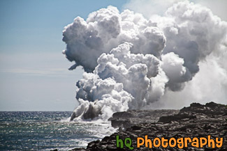
#2394 — A scenic vertical picture taken of hot lava entering the Pacific Ocean located on the coast on the Big Island of Hawaii.
Lava Steam, Pacific Ocean
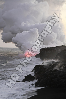
#2403 — A scenic vertical picture taken of lava entering the Pacific Ocean off the rocky coast of the Big Island, Hawaii.
Lava, Smoke, Rocky Shore
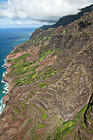
#2372 — A scenic vertical picture taken of the Na Pali Coast rugged cliffs located on the island of Kauai, Hawaii. This photo was taken in the air from aboard a helicopter.
Na Pali Coast
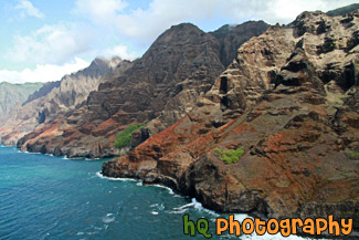
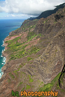
#2371 — A scenic aerial picture taken of the Na Pali Coast located on the island of Kauai, Hawaii. This photo was taken from a helicopter as this fifteen-mile stretch of rugged coastline on the northwest shore of Kauai is mostly inaccessible due to its characteristic sheer cliffs that drop straight down, thousands of feet into the ocean.
Na Pali Coast Cliffs
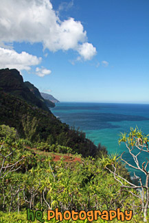
#2365 — A scenic vertical picture taken of the Na Pali coastline seen from hiking the Kalalau Trail in Kauai, Hawaii. Clouds and blue sky are seen above.
Na Pali Coast From Kalalau Trail
#2384 — A scenic vertical picture taken of the Na Pali Coast while hiking on the 11 mile long Kalalau Trail in Kauai, Hawaii.
Na Pali Coast on Kalalau Trail
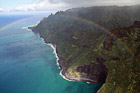
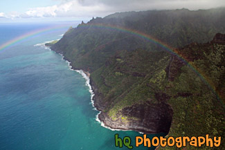
#2373 — A scenic picture taken of the Na Pali Coast of Kauai, Hawaii with a rainbow seen going across the picture. This photo was taken from the air in a helicopter.
Na Pali Coast Rainbow
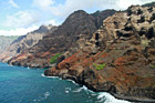
#2364 — A scenic picture taken of the Na Pali coastline located in Kauai, Hawaii from the ground. Blue waters and amazing cliffs are seen here.
Na Pali Coast, Kauai
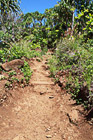
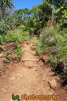
#2383 — A scenic vertical picture taken while hiking the Kalalau Trail located along the coast on Kauai, Hawaii. The Kalalau Trail is an 11 mile trail that leads from Ke'e Beach to Kalalau Beach. It is one of the most popular hikes in the world.
On the Kalalau Trail
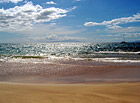
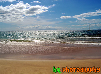
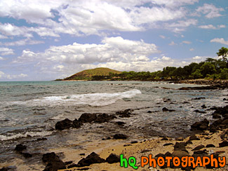
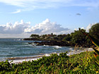
#180 — A scenic photo of the view on the coast of the Pacific Ocean off the coast of Maui, Hawaii. The water during this time in the summer is close to 80 degrees and a joy to swim or snorkel in!
Pacific Ocean, Maui
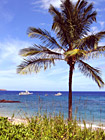
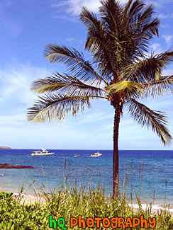
#173 — A photo of a palm tree and Pacific Ocean off the coast of Makena, Hawaii, which is on the island of Maui. In the background of this scenic photo, you can see the Pacific Ocean.
Palm Tree & Ocean of Maui
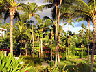
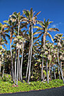
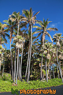
#187 — A view of the many palm trees located at the Maui Prince Hotel on the Makena Resort in Hawaii.
Palm Trees (Makena Resort, Maui)
#2388 — A scenic vertical taken taken of the bland sand and palm trees at Punaluu Black Sand Beach located on the Big Island of Hawaii. Bright blue sky is seen in the background.
Punaluu Black Sand Beach
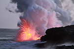
#2401 — Close up picture of red lava flowing into the Pacific Ocean located on the Big Island of Hawaii.
Red Lava Close Up
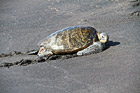
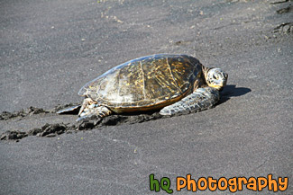
#2390 — A scenic picture of a sea turtle located on a black beach at Punaluu Black Sand Beach on the Big Island of Hawaii.
Sea Turtle on Black Beach
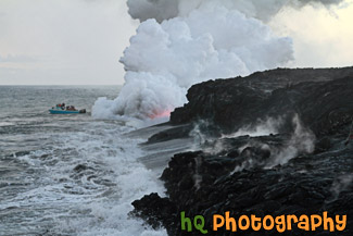
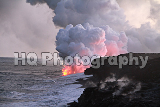
#2398 — A tourist boat is watching the steaming lava enter the Pacific Ocean off of the coast of Hawaii. This photo was taken on the Big Island of Hawaii as the Kilauea Volcano had lava flowing.
Steaming Lava and Tourists
#2397 — A scenic picture taken of steam coming up from dried lava fields as new lava is flowing underneath. This photo was taken on the Big Island of Hawaii as the Kilauea Volcano lets lava flow.
Steaming Lava Field
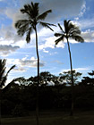
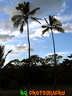
#169 — A scenic silhouette of two palm trees located in Maui, Hawaii with a beautiful sky behind them as the sun is getting ready to set on this beautiful island.
Two Palm Trees of Maui
#217 — A scenic picture taken of Maui and the Pacific Ocean off the coast of Makena, Hawaii, which is on the island of Maui.
View of Maui & Ocean
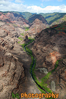
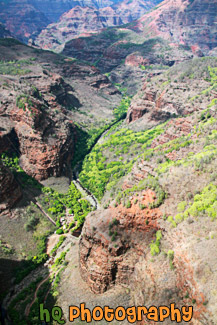
#2370 — A scenic vertical picture taken of the cliffs of Waimea Canyon from a helicopter view.
Waimea Canyon Cliffs
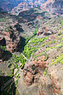
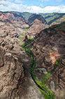
#2369 — Waimea canyon is located on the island of Kauai, Hawaii. This is an aerial picture taken of the canyon from a helicopter.
Waimea Canyon View
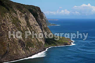
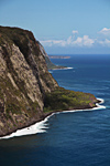
#2411 — A scenic picture taken with blue skies of the Waipio Valley located on the Big Island in Hawaii.
Waipio Valley, Hawaii
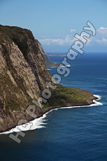
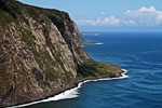
#2410 — A scenic vertical picture taken of Waipio Valley located on the Big Island of Hawaii.
Waipio Valley, Hawaii, Big Island
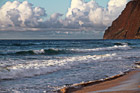
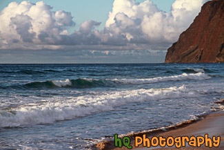
#2379 — A scenic picture taken of the Pacific Ocean waves crashing on the the beach at Polihale State Park in Kauai, Hawaii. This photo was taken at dusk as you can see the pink colors of the sky starting to set in.
Waves Crashing on Polihale Beach
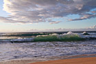
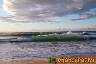
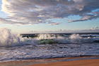
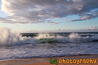
#189 — A scenic picture of the waves of Maui, Hawaii during the early evening in June.
Waves of Maui
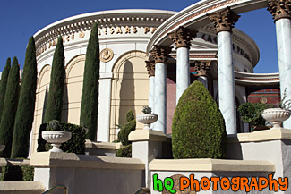
#1870 — A scenic picture taken of part of the Caesars Palace hotel located on the strip in Las Vegas, Nevada. This photo was taken on a sunny day with blue sky seen in the background.
Caesars Palace
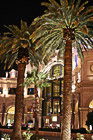
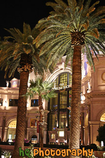
#2099 — A scenic vertical picture taken of the Las Vegas Forum Shops at night. Palm trees are seen in front of the shops.
Forum Shops at Night
#2228 — A scenic vertical picture taken of a gondola ride located outside of the Venetian Hotel at night. You can see the Venetian Hotel in the background.
Gondola Outside of Venetian Hotel
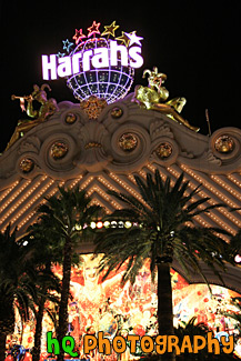
#1842 — A scenic vertical picture taken of the Harrah's Hotel lit up at night. Harrah's Hotel is located on the strip in Las Vegas, Nevada.
Harrah's Hotel at Night
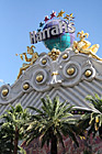
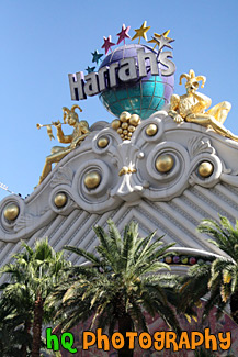
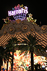
#1872 — A scenic vertical picture taken of a Las Vegas hotel, Harrah's. This is a photo of the hotel's sign and palm trees.
Harrah's Hotel Sign in Daytime
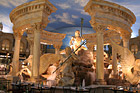
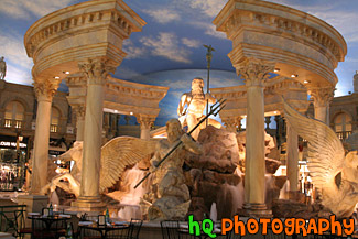
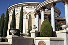
#1871 — A scenic picture taken of a statue in the inside of Caesar's Palace located on the strip in Las Vegas, Nevada.
Inside of Caesar's Palace
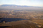
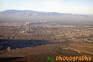
#1868 — A scenic picture taken of an aerial view of Las Vegas, NV from an airplane.
Las Vegas from the Sky

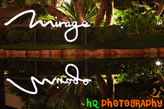
#1840 — A close up picture taken of the Mirage Hotel sign and reflection located on the strip in Las Vegas, Nevada. Palm trees can be seen in the still water reflection.
Mirage Sign Reflection
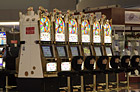
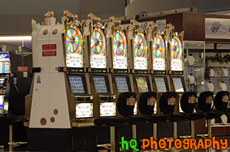
#1838 — A picture taken of a row of Wheel of Fortune slot machines located at the airport in Las Vegas, Nevada.
Slot Machines
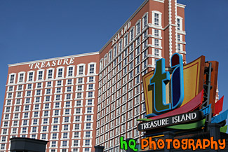
#1844 — A scenic picture taken of the Treasure Island hotel located on the strip at Las Vegas, Nevada on a sunny day.
Treasure Island Hotel
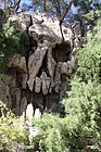
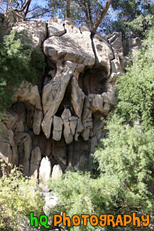
#1873 — A scenic vertical picture taken of the Treasure Island hotel wooden skull located on the strip at Las Vegas, Nevada.
Treasure Island Skull
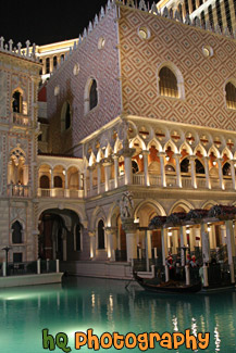
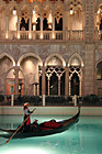
#1841 — A scenic vertical picture taken of a Venetian Hotel gondola in the water in front of the Venetian Hotel on the strip in Las Vegas, Nevada.
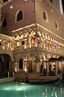
Venetian Gondola & Hotel
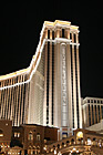
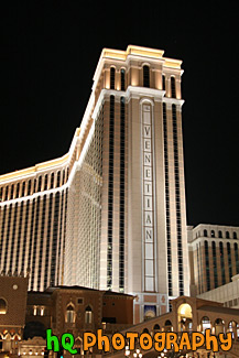
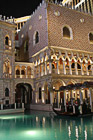
#1869 — A scenic vertical photo taken of the Venetian Las Vegas hotel at night. The Venetian hotel is located on the strip.
Venetian Hotel at Night
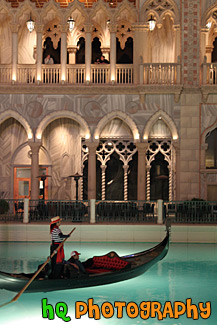
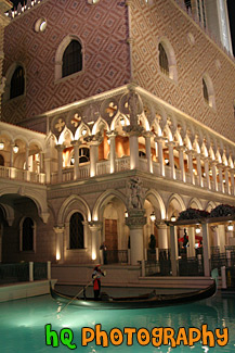
#1835 — A scenic vertical picture taken of a gondola ride at the Venetian Hotel located in Las Vegas, Nevada. The gondola ride takes you around the hotel.
Venice Gondola Ride at Las Vegas
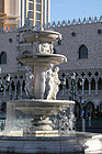
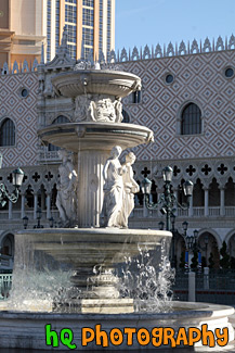
#1945 — A scenic vertical picture taken of a water fountain with statues located outside of the Venetian Hotel in Las Vegas, Nevada on a sunny day.
Water Fountain & Statues
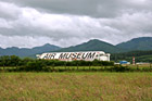
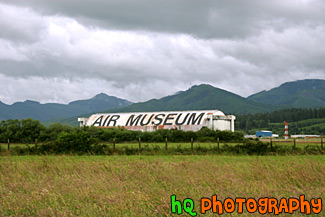
#625 — A scenic picture taken of the Air Museum with low cloudy skies. The Air Museum is located in Tillamook, Oregon. The Air Museum contains America's finest collection of over 30 War Birds including our P-38 Lightning, P-47 Thunderbolt, F4U-Corsair, P51-Mustang, PBY Catalina, B-25 Mitchell Bomber, and SBD Dauntless dive bomber. At the Air Museum you can also climb into a jet simulator, have lunch at their 40/50's Cafe or enjoy shopping in their aviation gift shop. All these things are housed in a rare World War II Blimp Hangar which is the largest wooden structure in the world.
Air Museum in Tillamook, Oregon
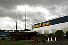
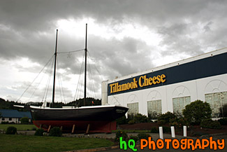
#413 — A scenic picture taken of the Tillamook Cheese Factory located in the city of Tillamook, Oregon. The Tillamook Cheese Factory is a farmer owned cooperative, and they take pride in continuing the tradition of quality cheese making which started a century ago. To this day, the corporation continues to produce top quality milk, dairy products and has a sound future for the farmers of our beautiful Oregon valley.
Tillamook Cheese Factory, Oregon

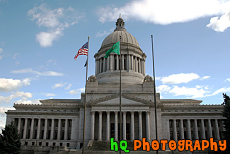
#465 — A scenic picture taken of the Washington State Capitol Building located in state capital city, Olympia on a partly cloudy day. This capitol building was first occupied by the Legislature in March, 1927. The design is reminiscent of the Acropolis in Athens, Greece. It is also closest in design to the U.S. Capitol in Washington, D.C. The building was constructed between 1912 and 1928. It is unique among state capitols in that instead of one large building, it consists of four separate buildings; the domed structure is the Legislative Building. The 287-foot high dome is the fourth tallest all-masonry dome in the world.
Washington State Capitol Building

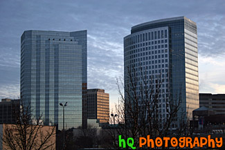
#1927 — A scenic picture taken of two of the buildings located in downtown Bellevue, Washington.
Bellevue, Washington Buildings
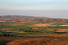
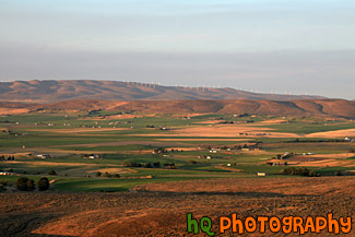
#2031 — A scenic picture taken during dusk of the country land of Ellensburg which is located in Eastern Washington State. In the background you can see some windmills on the hill generating electricity.
Country Land of Ellensburg
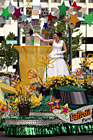
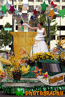
#1037 — A scenic picture taken of a lady in a white dress on a decorated float at the annual Daffodil Parade in Downtown Tacoma, Washington. The parade takes place on Pacific Avenue.
Daffodil Parade Float


#1036 — A scenic picture taken of people holding the Daffodil Parade sign while walking down Pacific Avenue in Tacoma, Washington. This parade also takes place in Sumner, Puyallup, and Orting.
Daffodil Parade Sign
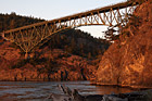
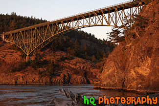
#1781 — A scenic picture taken of the Deception Pass bridge during sunset as you can see the redish-orange tint on the hill, water, and bridge. The Deception Pass Bridge is a two-lane bridge connecting Whidbey Island to Fidalgo Island in the U.S. state of Washington
Deception Pass at Sunset
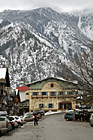
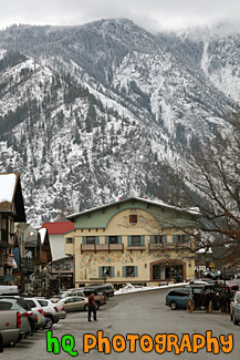
#1874 — A scenic vertical picture taken of the Bavarian shops and a big mountain in the background.
Downtown Leavenworth & Big Mountain
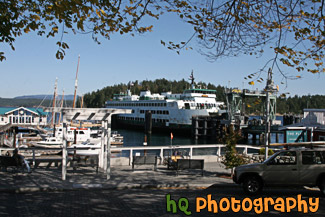
#2125 — A scenic picture taken of a ferry docking along the coast of Friday Harbor which is located on the San Juan Island in Washington State. This photo was taken on a sunny day.
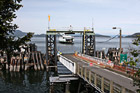
Friday Harbor Ferry Docking
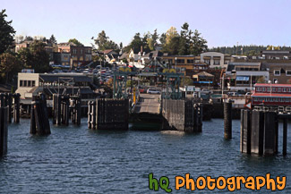
#2120 — A scenic picture pulling into the Friday Harbor ferry docking station which is located on the San Juan Islands in Washington State.
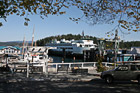
Friday Harbor Shore
#1983 — A scenic picture taken of the Grand Coulee Dam located in Eastern Washington State.
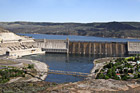
Grand Coulee Dam
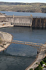
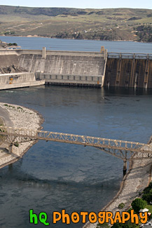
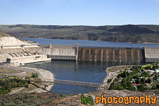
#1980 — A scenic vertical picture taken of the Grand Coulee Dam which is located in Eastern Washigton. The Grand Coulee Dam creates the Lake Roosevelt lake which is the largest lake in Washington and is over 150 miles long with some really great beaches.
Grand Coulee Dam & Bridge
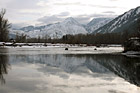
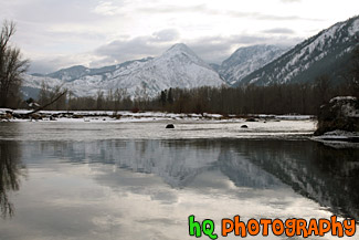
#1922 — A scenic picture taken of the mountains and reflection in Leavenworth, Washington during the winter season as you can see snow covered on the mountains.
Leavenworth Mountains Reflection
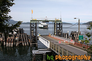
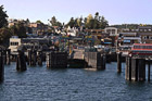
#2300 — A scenic picture taken at the Lopez Island ferry dock located in Washington State on a sunny blue sky day. You can see the ferry coming in the shore about to dock in this photo.
Lopez Island Ferry Dock
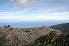
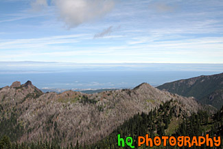
#1755 — A scenic picture taken of the Olympic Peninsula and the Strait of Juan de Fuca. This photo was taken on a trail up near Hurricane Ridge located in the Olympic Mountains.
Olympic Peninsula

Pages: [<<] 1 2 3 4 5 6 7 8 9 10 [>>]
