Photos of La (929)
There are (929) photos of the keyword, La, available on our website. They are pictured below.The pictures are organized by category.
Pages: [<<] 1 2 3 4 5 6 7 8 9 10 [>>]
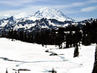
#139 — A beautiful picture of Mt. Rainier shot during the beginning of June. This photo was taken at Tipsoo Lake which is still covered in snow in Mt. Rainier's National Forest. Part of the lake can be seen in a break of the snow cover. Blue sky is above.
Mt. Rainier at Snowy Tipsoo Lake
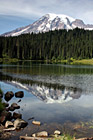
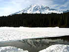
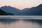
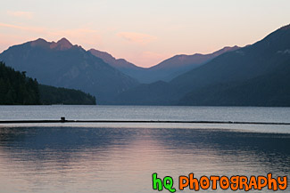
#628 — A scenic picture taken of Mt. Rainier and its' reflection sourounded by some rocks in Reflection Lakes which is located in Mt. Rainier's National Park. As an active volcano Mount Rainier stands as a reminder of the beauty and power of nature. Mt. Rainier formed about 500,000 years ago and has the potential to erupt again at some unknown time. Mount Rainier National Park was established in 1899.
Mt. Rainier Reflection & Rocks in Reflection Lakes
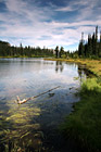
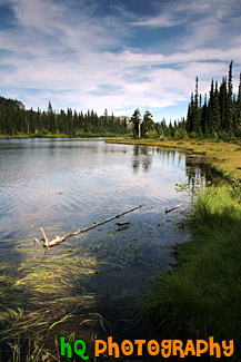
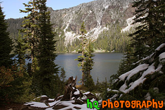
#629 — A scenic picture tkaen of Reflection Lakes which is located in the Mount Rainier National Park in Washington State. Reflection lakes is a beautiful spot in the park to take many interesting pictures.
Reflection Lakes
#141 — A beautiful picture of Mt. Rainier shot during the beginning of June. This photo was taken at Tipsoo Lake which is still covered in snow in Mt. Rainier's National Forest. "The Mountain", as it's known by natives, draws your eyes like a magnet when it is visible and not invisible behind clouds. It also draws over two million visitors each year. Mount Rainier and the surrounding foothills were designated as a national park in 1899.
Close up of Mt. Rainier at Tipsoo Lake
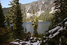
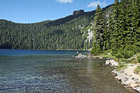
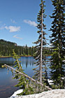
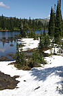
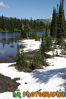
#1767 — A scenic picture taken of Eunice Lake with snow on the ground in the foreground and sunlight shining on the mountain in the background.
Eunice Lake, Snow & Mountain
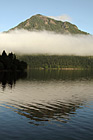
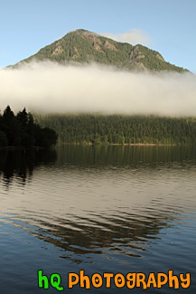
#1834 — A scenic picture taken of fog hovering over the mountain hills located near Mt. Rainier at the Sunrise Entrance. This picture was taken from the Mount Fremont lookout and taken with blue sky seen above the fog.
Fog Hovering over Mountains
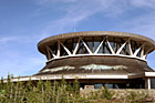
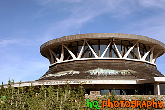
#770 — A scenic picture taken of the Henry M. Jackson Memorial Visitor Center which is located at the Paradise entrence to Mount Rainier National Park. This center offers exhibits on geology, glaciers, flora, fauna, and mountain climbing and is open from May to October.
Henry M. Jackson Memorial Visitor Center
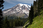
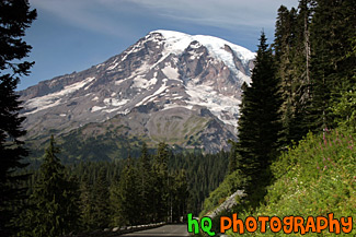
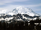
#684 — A scenic picture taken of Mount Rainier while heading west on the road through Mount Rainier National Park approaching the top at Paradise. This picture was taken in the summertime hence not very much snow on the mountain, but Mt. Rainier looks huge compared to the road going towardds it. Mount Rainier National Park lies in the Cascade chain of mountains 68 miles south-southeast of Seattle and 95 miles north-northeast of Portland, Oregon. The park is open year round, but visitation to most regions is limited to late June to early October, depending on snowfall.
Mount Rainer Appearing Big
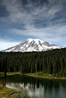
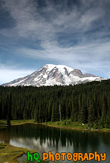
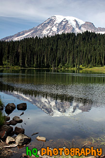
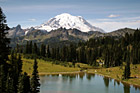
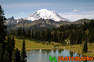
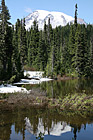
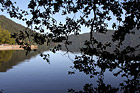
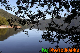
#703 — A scenic picture taken of Mount Rainier, an interesting sky, evergreen trees, and reflection lake located in Mount Rainier National Park. In this picture you can see the evergreen trees along with some of Mt. Rainier reflecting in the lake. Mt. Rainier does not have much snow on it in this picture as it was taken in the summertime.
Mount Rainier & Reflection Lake
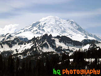
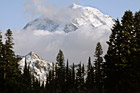
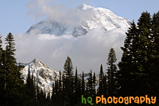
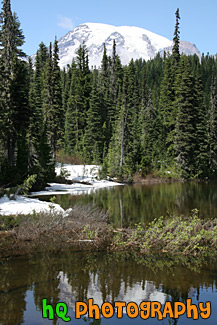
#638 — A scenic summer picture taken of Mt. Rainier and Tipsoo Lake which is located in Mount Rainier's National Forest in Washington State. When locals mention "The Mountain," there is no mistaking which peak they are referring to. At 14,411 feet, Mount Rainier towers 8,000 feet above surrounding Cascades peaks, and is such a behemoth that it creates its own weather.
Mount Rainier & Tipsoo Lake in Summer
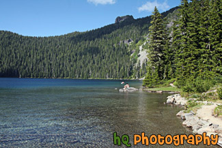
#143 — A scenic picture taken with blue skies above at Mowich Lake loacted in the Mt. Rainier National Park at the Carbon River Entrance.
Mowich Lake
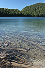
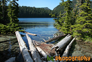
#2315 — A scenic vertical picture taken of Mowich Lake located in the Mount Rainier National Park. This lake is full of extremely clear water as you can see the logs and the bottom of the lake through the water.
Mowich Lake & Clear Water
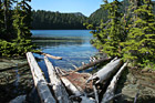
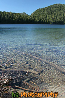
#2314 — A scenic picture taken of Mowich Lake located in Mt. Rainier National Park. Logs are seen in the foreground floating on the lake and green trees surround the lake. Mowich Lake is the largest and deepest lake in Mount Rainier National Park. The road is unpaved after the first three miles and may be rough. You can get to the lake through the Carbon River Entrance to the park. It is generally open mid-July to mid-October.
Mowich Lake & Logs
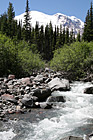
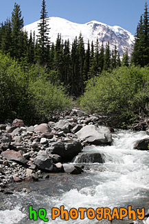
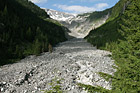
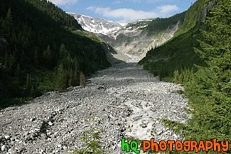
#1658 — A scenic vertical picture taken of a river in the foreground of Mt. Rainier taken of on a blue sky day. This picture was taken on the Glacier Basin trail near the White River Entrance to the park.
Mt. Rainier & River
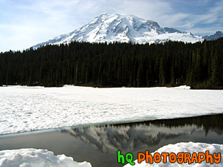
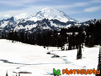
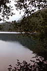
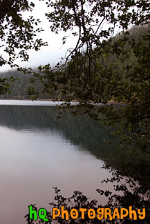
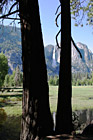
#138 — A beautiful picture of Mt. Rainier shot during the beginning of June. This photo was taken at Reflection Lake in Mt. Rainier's National Forest. The lake is still covered in snow, but there was a little opening where you can see a reflection.
Mt. Rainier at Snow Covered Reflection Lake
#140 — A beautiful picture of Mt. Rainier shot during the beginning of June. This photo was taken at Tipsoo Lake which is still covered in snow in Mt. Rainier's National Forest. "The Mountain", as it's known by natives, draws your eyes like a magnet when it is visible and not invisible behind clouds. It also draws over two million visitors each year.
Mt. Rainier Close Up at Tipsoo Lake
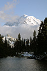
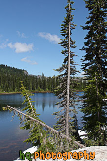
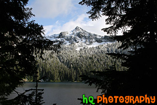
#1742 — A scenic vertical picture taken of Mt. Rainier from Eunice Lake which is located near the Carbon River entrance to the park. In this picture you can see a few clouds in front of Mt. Rainier with blue sky above.
Mt. Rainier From Eunice Lake
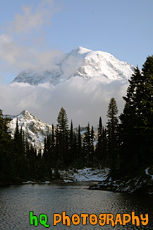
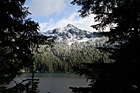
#1738 — A scenic close up picture taken of Mt. Rainier behind some clouds. The photo was taken from Eunice Lake which is located near the Carbon River entrance to the park.
Mt. Rainier in Clouds
#1641 — A scenic picture taken of the Nisqually River Glacier located on the southern side of Mt. Rainier.
Nisqually Glacier
#1713 — A scenic picture taken of Reflection Lake which is located in the Mt. Rainier National Park, Washington. This picture was taken on a sunny day with blue sky seen above and some reflections of the trees in the lake. Snow is also still seen on the shores of the lake.
Reflection Lake in Mt. Rainier National Park
#1666 — A scenic vertical picture taken of Reflection Lake which evergreen trees scene all around and snow still on the ground during this sunny summer day in July.
Reflection Lake, Trees & Snow
#1651 — A scenic vertical picture taken of Mt. Rainier and its' reflection seen in Reflection Lake which is part of the Mt. Rainier National Park. This photo was taken during the summertime.
Reflection Lake, Trees, & Mt. Rainier
#1648 — A scenic vertical picture taken of snow and evergreen trees around reflection lake during the summertime.
Snow Around Reflection Lake
#1762 — A scenic picture taken of snow covered Mother Mountains in the background of Mowich Lake located near the Caron River Entrance to Mt. Rainier National Park. Silhouettes of trees are seen in the foreground and blue sky is seen above.
Snowy Mountains Through Tree Silhouettes
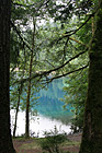
#1728 — A scenic vertical picture taken of the clouds and trees reflection in Diablo Lake which is located in the North Cascades National Park in Washington State.
Clouds & Trees Reflection in Diablo Lake
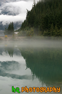
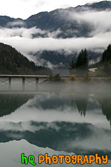
#1760 — A scenic picture taken of the Diablo Lake and reflections of the sky, clouds, bridge, and mountains in the lake. Diablo Lake is located in the North Cascades Mountains in Washington State.
Diablo Lake Reflection
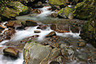
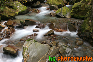
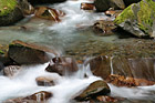
#1720 — A scenic picture taken of the Ladder Creek and rocks seen with the creek water streaming over the rocks. This photo has the cotton candy effect by using a slow shutter speed on the camera.
Ladder Creek & Rocks
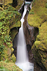
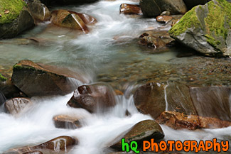
#1723 — A scenic vertical picture taken of Ladder Creek Falls located in the North Cascades National Park near the town of Diablo. This picture was taken with a slow shutter speed to get the cotton candy effect.
Ladder Creek Falls
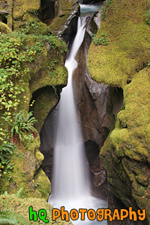
#1719 — A scenic picture showing the cotton candy effect on the Ladder Creek which is located through a narrow gorge near the Seattle City Light town of Diablo in the North Cascades National Park.
Ladder Creek, Cotton Candy Effect
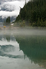
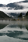
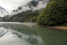
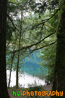
#1765 — A scenic picture looking down at Diablo Lake with clouds overhead and fog creeping down towards the lake. Diablo Lake is located in the North Cascades Park in Washington State.
Clouds, Fog & Diablo Lake
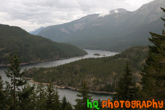
#1776 — A scenic vertical picture taken of Diablo lake and the surrounding mountains, trees, and clouds reflecting in the lake. This lake is located in the North Cascades National Park in Washington State.
Diablo Lake & Mountain Reflection
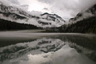
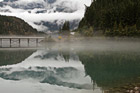
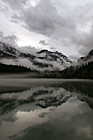
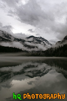
#1828 — A scenic picture taken of a dramatic Diablo Lake clouds, fog, and reflection seen on this autumn morning. You can see the mountains, hills, trees, fog, clouds, and sky reflecting into the lake.
Diablo Lake Dramatic Clouds, Fog, and Reflection
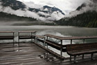
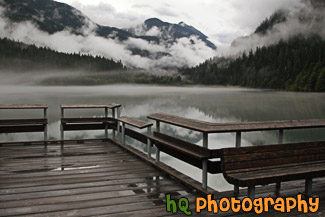
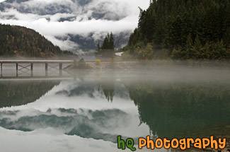
#1829 — A scenic picture taken of Diablo Lake and the dock, mountains, trees, dramatic sky and clouds, and fog. You can see reflections in the lake.
Diablo Lake Trees, Hills, & Dock
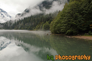
#2073 — A scenic picture taken of the lake reflection of the trees and fog in Diablo Lake which is located in the North Cascades National Park.
Lake Reflection at Diablo Lake
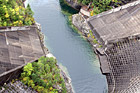
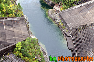
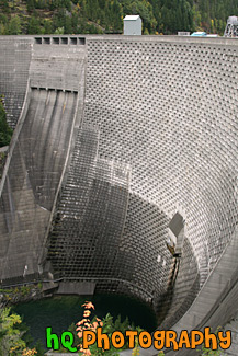
#1800 — A scenic picture looking down at the waters beneath Ross Dam which is located in the North Cascades National Park in Washington State.
Looking Down at Ross Dam
#1831 — A scenic vertical picture taken of rocks and a tree along the shore at Diablo Lake which is located in the North Cascades National Park in Washington State. You can see mountain hills and fog in the background.
Rocks & Tree Along Diablo Lake
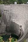
#1729 — A scenic vertical picture taken of Ross Dam which forms Ross Lake in the North Cascades National Park. It currently stands 540 feet (165 m) tall.
Ross Dam
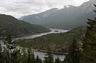
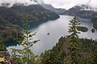
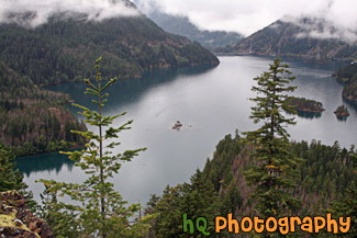
#1763 — A scenic picture taken of Ross Lake on cloudy day. Ross Lake was created by the damming of the Skagit River and is in the recreation area of the North Cascades National Park. The elevation of the lake is 1600 feet and it is over 20 miles long.
Ross Lake and Clouds
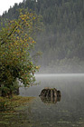
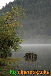
#1770 — A scenic vertical picture taken of a tree stump reflection seen in Diablo Lake located in the North Cascades National Park on a cloudy, foggy day.
Stump Reflection
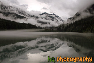
#1832 — A scenic vertical picture taken of a dramatic Diablo Lake clouds, fog, and reflection seen on this autumn morning. You can see the mountains, hills, trees, fog, clouds, and sky reflecting into the lake.
Vertical Diablo Lake Dramatic Clouds, Fog, and Reflection
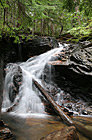
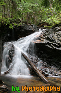
#1815 — A scenic vertical picture taken of a waterfall which is surrounded by green trees and a log laying in it. This picture was taken with the cotton candy slow shutter speed effect to get the silky looking waterfall.
Waterfall, Green Trees, and Log
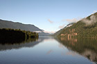
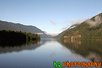
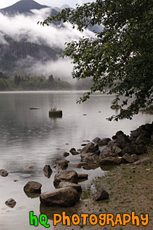
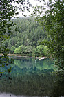
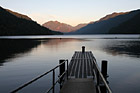
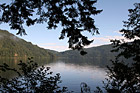
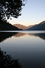
#1679 — A scenic picture taken of Lake Cresent and the hills and mountains surrounding it reflecting in the lake. Some fog that is burning off is also seen in the photo.
Lake Cresent Reflections
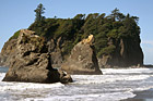
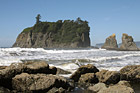
#1717 — A scenic picture taken of sea stacks located right off shore at Ruby Beach which is located in the Olympic National Park in Washington State. You can see a bird sitting on top of the second sea stack.
Ruby Beach Sea Stacks & Waves
#1669 — A scenic vertical picture taken of tree reflections in Lake Cresent which is located near Port Angeles in the Olympic National Park in Washington state. This photo was taken on the west side of the lake near the Fairholm campground.
Early Morning Lake Reflections
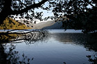
#1790 — A scenic vertical picture taken of a hill reflection and tree branches reflecting into Cresent Lake which is located in the Olympic National Park in Washington State.
Hill Reflection & Tree Branches
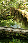
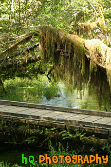
#1686 — A scenic vertical picture of all the green plants, trees, and moss located in the Hoh Rain Forest at the Olympic National Park in Washington State.
Hoh Rain Forest Bridge
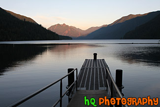
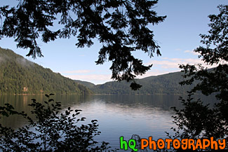
#1702 — A scenic picture taken of Lake Cresent during the dusk hours with a dock seen in the foreground. Lake Cresent is located in the Olympic National Park which is in Washington State.
Lake Cresent & Dock
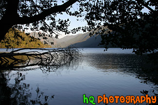
#1672 — A scenic picture taken of Lake Cresent with tree and leaves silhouettes in the foreground.
Lake Cresent & Silhouettes
#1730 — A scenic picture taken of Lake Cresent looking through tree branch silhouettes on a sunny day.
Lake Cresent & Tree Branch Silhouettes
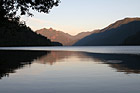
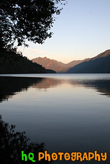
#1671 — A scenic picture taken of Lake Cresent at Sunset at which you can see the sunset colors on the mountains and in the lake.
Lake Cresent at Dusk
#1676 — A scenic picture of Lake Cresent during sunset as you can see the sunset colors shining on the mountains and the reflection in the lake.
Lake Cresent During Sunset
#1677 — A scenic vertical picture taken of Lake Cresent, fog, and the reflection of a hill and the fog in the lake.
Lake Cresent Fog & Reflection
#1678 — A scenic picture taken of hills reflecting in Lake Cresent and a tree and leaves silhouette in the foreground.
Lake Cresent Reflections & Silhouette
#1670 — An early morning vertical picture taken of Lake Cresent through trees and branches located at the west side of the lake at Fairholm campgrounds.
Lake Cresent Through Trees
#1668 — A scenic vertical picture taken of Lake Cresent which is located in the Olympic National Park, near Port Angeles. In this picture you can see a silhouette of a tree in the foreground, and the sun setting colors shining on the mountains in the background in in the lake.
Lake Cresent Tree Silhouette & Sunset
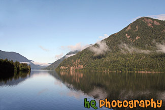
#1691 — A scenic picture taken of reflections of the hill, fog, and sky in Lake Cresent. Lake Cresent is located in the Olympic National Park which is near Port Angeles.
Lake Cresent Water Reflections
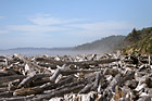
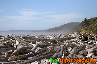
#1710 — A scenic picture taken of the logs and drift wood on the shore at Kalaloch Beach located just south of Ruby Beach in the Olympic National Park.
Logs on Kalaloch Beach
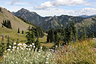
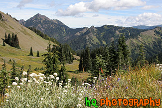
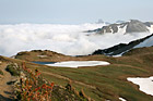
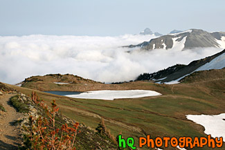
#1674 — A scenic picture taken of the Olympic Mountain landscapes located near Hurricane Ridge. In this photo you can see wildflowers, evergreen trees, and a partly cloudy sky.
Olympic Mountains Fields & Wildflowers
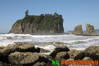
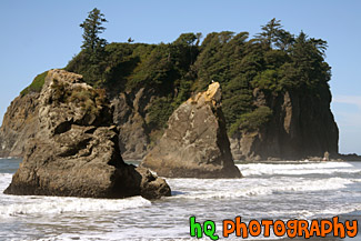
#1708 — A scenic picture taken of Ruby Beach and the sea stacks seen in the Pacific Ocean along the shore. Ruby Beach is located in the Olympic National Park in Washington State.
Ruby Beach Sea Stacks
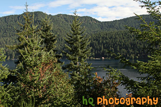
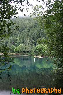
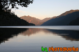
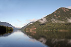
#1693 — A scenic picture taken of trees and mountains located around Lake Cresent in the Olympic National Park with partly cloudy skies.
Trees & Mountains Around Lake Cresent
#1789 — A scenic vertical picture taken of trees, branches, and silhouettes along the shore of Cresent Lake which is located in the Olympic National Park. This photo was taken on a sunny day.
Trees & Silhouettes on Shore at Cresent Lake
#405 — This picture was taken of a beautiful sunset near the entrence to Yosemite National Park just a couple miles west of Groveland and Big Oak Flat. You can see part of the reservoir to Don Pedro Lake in between the hills. Yosemite is located in east-central California and lies 105 miles north of Fresno, 195 miles east of San Francisco, 313 miles north of Los Angeles and 350 miles northwest of Las Vegas. The gross area acres for the national park is Gross Area Acres for 761,266 and receives about 3,300 total recreational visits per year. The elevation in the park ranges from from 2000 feet to over 13,000 feet. The cliffs, waterfalls, steep mountains and deep lakes of Yosemite National Park were all formed over millions of years by earthquakes, glaciers and numerous other forces of nature.
Sunset at Hills near Yosemite
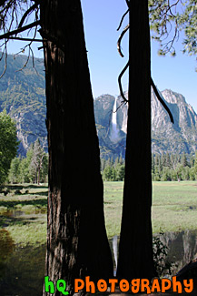
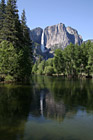
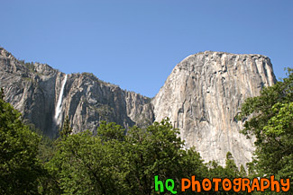
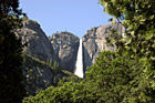
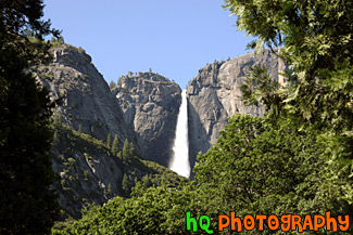
#400 — This is a scenic picture taken of Yosemite Falls during the late spring season in the popular California National Park. Yosemite Falls is the world's 5th tallest waterfall, but North America's largest and most popular waterfall in Yosemite's National Park. This waterfall is actually composed of three falls: Upper, Middle Cascades, and the Lower fall. Together they have a combined height of 2,425 feet which is more than 9 times the height of Niagara Falls. Perhaps the easiest place to view the falls is the Yosemite Falls Parking Area across from Yosemite Lodge.
Yosemite Falls & Reflection Through Trees
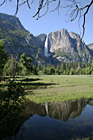
#451 — A scenic picture taken of Yosemite Falls at Yosemite National Park located in California. Yosemite Falls is the world's 5th tallest waterfall, but North America's largest and most popular waterfall in Yosemite's National Park. This waterfall is actually composed of three falls: Upper, Middle Cascades, and the Lower fall. Together they have a combined height of 2,425 feet which is more than 9 times the height of Niagara Falls. Perhaps the easiest place to view the falls is the Yosemite Falls Parking Area across from Yosemite Lodge.
Yosemite Falls Reflection
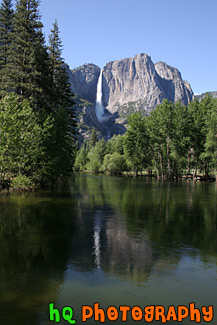
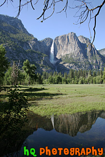
#455 — A scenic picture taken of Yosemite Falls in the popular California Yosemite National Park. In this picture you can see the reflection of the falls in the water just in front. This waterfall is actually composed of three falls: Upper, Middle Cascades, and the Lower fall. Together they have a combined height of 2,425 feet which is more than 9 times the height of Niagara Falls. Perhaps the easiest place to view the falls is the Yosemite Falls Parking Area across from Yosemite Lodge.
Yosemite Falls with Reflection
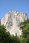
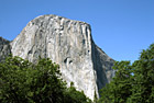
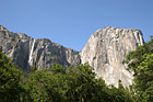
#1405 — A scenic vertical picture taken of El Capitan located in the Yosemite National Park in California. El Capitan is the largest known exposed granite block in the world and stands on the north side of the entrance to Yosemite Valley.
El Capitan
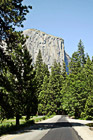
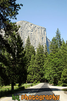
#652 — A scenic picture taken driving towards El Capitan with Forest Road leading towards it in Yosemite National Park, California. This massive, granite monolith stands 3,593 feet from the base to summit and and is claimed to be the largest single monolith of granite in the world. From spring to fall, climbers come from all over the globe to scale El Capitan.
El Capitan & Forest Road
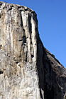
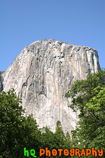
#616 — A vertical close up picture taken of El Capitan which is located in Yosemite National Park, California. This massive, granite monolith stands 3,593 feet from the base to summit and and is claimed to be the largest single monolith of granite in the world. From spring to fall, climbers come from all over the globe to scale El Capitan.
El Capitan, Yosemite
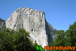
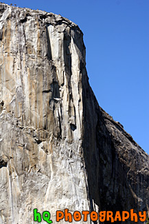
#505 — A scenic picture taken of El Capitan which is located in Yosemite National Park, California. This massive, granite monolith stands 3,593 feet from the base to summit and and is claimed to be the largest single monolith of granite in the world. From spring to fall, climbers come from all over the globe to scale El Capitan.
El Capitan, Yosemite National Park
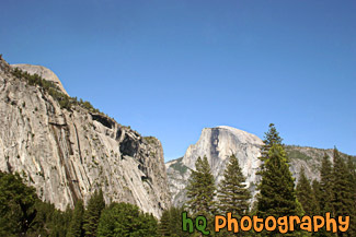
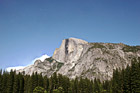
#781 — A scenic picture taken of the famous the Half Dome granite rock on a sunny day located in Yosemite National Park, California. This picture was taken during late spring / early summer. Half Dome is one of Yosemite's most famous landmarks. Half Dome stands at the elevation of 8,842 feet. It is made up from a type of granite, plutonic rock. Yosemite National Park's Half Dome's missing half is presumed to have fallen off when the Ice Age glaciers passed through.
Half Dome, Yosemite
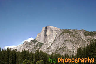
#779 — A scenic picture taken of Half Dome which is located in Yosemite National Park in California. This picture was taken during late spring / early summer. Half Dome is one of Yosemite's most famous landmarks. Half Dome stands at the elevation of 8,842 feet. It is made up from a type of granite, plutonic rock. Yosemite National Park's Half Dome's missing half is presumed to have fallen off when the Ice Age glaciers passed through.
Half Dome, Yosemite National Park
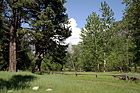
#987 — A scenic picture taken of a small lake/pond, blue sky, and trees located in the middle of Yosemite National Park.
Lake Pond & Trees in Yosemite
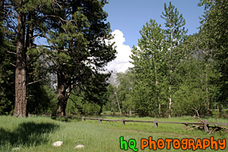
#996 — A scenic landscape picture taken of green trees, blue sky, puffy clouds, and a country fence located in Yosemite National Park.
Landscape Trees & Fence in Yosemite
#1406 — A scenic picture taken of El Capitan and a seasonal waterfall located to the left of the big granite rock structure location in Yosemite Valley. This picture was taken in the late spring on a sunny day with green trees seen below. El Capitan is claimed to be the largest single monolith of granite in the world.
Seasonal Waterfall & El Capitan
#788 — A close up picture taken of Yosemite Falls looking through green trees and blue sky in the background. Yosemite Falls is located in Yosemite National Park in California. Yosemite Falls is a waterfall actually composed of three falls: Upper, Middle Cascades, and the Lower fall. In this picture you can only see the Upper Falls. Together they have a combined height of 2,425 feet which is more than 9 times the height of Niagara Falls. Perhaps the easiest place to view the falls is the Yosemite Falls Parking Area across from Yosemite Lodge.
Yosemite Falls Through Trees
#1584 — A close up macro picture taken of a green plant located on the beach at Muir Beach in California. You can see the sand below the plant.
Plant on Beach

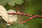
#1799 — A scenic picture taken of a brown sticker bush type plant found in northern California near the coast.
Brown Sticker Bush
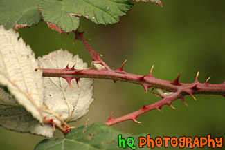
#1601 — A scenic vertical, close up picture taken of a brown sticker type bush located in Marin County, California.
Brown Sticker Type Bush
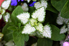
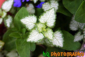
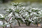
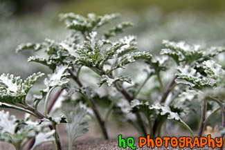
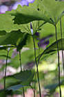
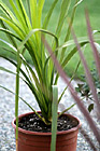
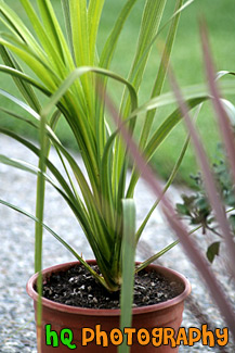
#873 — A close up picture taken of a little plant with white leaves and green trim.
Close up of a White Leaf with Green Trim
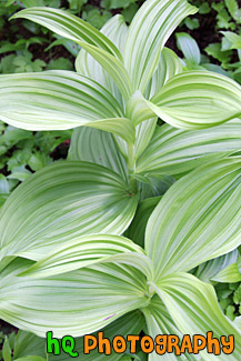
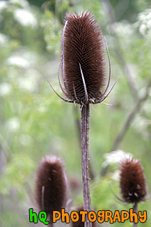
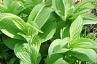
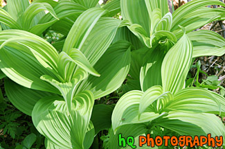
#1753 — A scenic vertical picture looking down at a corn lilly plant found located in the Mt. Rainier National Park.
Corn Lilly
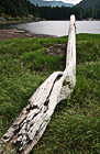
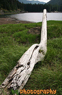
#551 — A scenic picture taken of a long piece of drift wood and Lena Lake in the background. This lake is located up in the mountains near the Hood Canal in Washington State. To get to this lake you have to hike about 3 miles.
Drift Wood
#1646 — A scenic picture looking up at a green sticker plant type bush located in the forest at Mt. Rainier National Park. The sunlight is shining down on the plant making it look really bright.
Green Sticker Plant in Sunlight
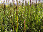
#571 — A close up picture taken of some bright green grass located on a field by a lake in Washington State.
Green Grass Field
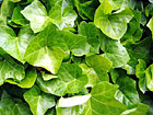
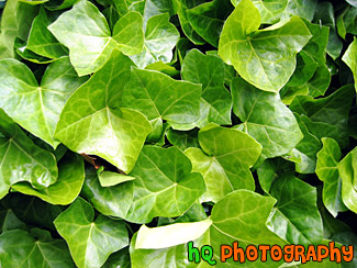
#73 — A scenic photo of some green ivy found in Washington State. This is a close up of ivy leaves.
Green Ivy
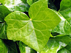
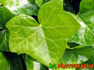
#77 — A scenic photo of a close up of one green leaf of an ivy plant. This ivy leaf was found in Washington State.
Green Ivy Close Up

#1647 — A scenic vertical picture taken of a green leaf sticker plant located in the forest at Mt. Rainier National Park.
Green Leaf Stickers
#1950 — A close up picture taken of a green sticker bush plant located in the mountains at Mt. Rainier National Park.
Green Sticker Bush
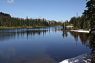
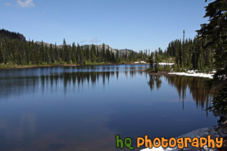
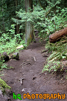
#2338 — A scenic picture of a hiking trail near Lake Chelan, Washington. Blue sky is seen in the sky.
Hiking Trail Near Chelan
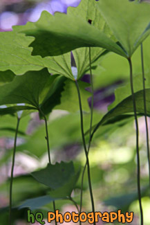
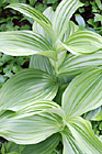
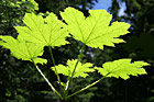
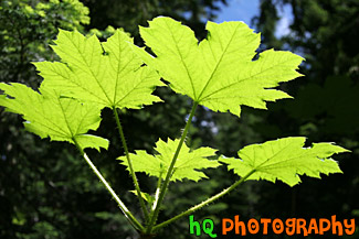
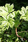
#2347 — A scenic picture looking up at green leaves. The photographer got low to the ground to take this photo.
Looking Up at Big Leaves
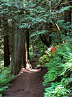
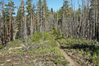
#76 — A scenic photo of the trail of Mt. Peak on a sunny day. Mt. Peak is located in Enumclaw, Washington and it is a popular site for many people of the town to come a get a great workout.
Mt. Peak Trail
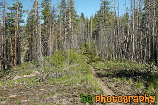
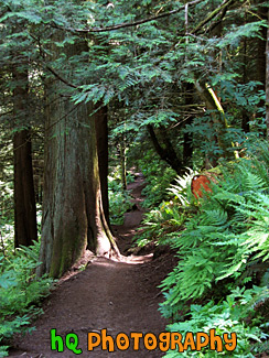
#74 — A scenic picture taken of the hiking trail on Mt. Peak. This hike is a popular workout activity that many people of Enumclaw enjoy.
Nature Trail of Mt. Peak, Enumclaw
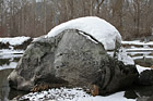
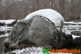
#1880 — A scenic close up picture taken of a big rock sitting in water with snow on top. The rock was found in the town of Leavenworth, Washington.
Snow on top of Big Rock
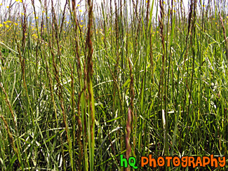
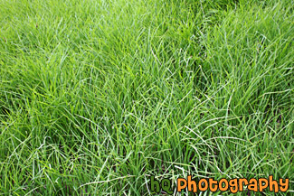
#79 — A close up of a tall, green, grassy field located in Enumclaw, Washington. All over the city of Enumclaw you can see fields just like this one as Enumclaw is a small town full of farms and farmland.
Tall Grass
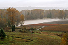
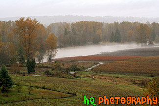
#1150 — A picture taken in the valley of Sumner, Washington after a major rain storm had flooded the Puyallup river which is seen covering a road and sneaking on the people's farmlands. This storm took place during the falls season in November.
Puyallup River Flooding Farmland
Pages: [<<] 1 2 3 4 5 6 7 8 9 10 [>>]
