Photos of La (929)
There are (929) photos of the keyword, La, available on our website. They are pictured below.The pictures are organized by category.
Pages: [<<] 1 2 3 4 5 6 7 8 9 10 [>>]
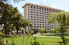
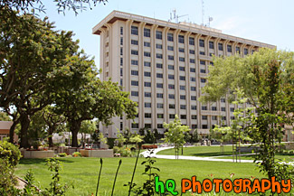
#1614 — A scenic picture taken of the Swig Residence Hall located on campus at Santa Clara University. Green grass, trees, and blue sky are seen in this photo. Swig is located next to Benson Center.
Swig Residence Hall

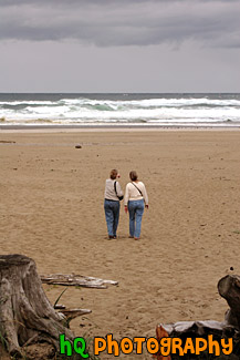
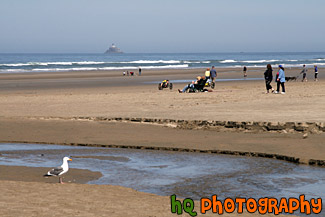
#738 — A scenic picture taken of two ladies walking towards the Pacific Ocean while on a beach located on the coast of Oregon State. This beach was located near Discovery Point, Oregon on a cloudy day. In the distance you can see the waves of the ocean and seagulls along the shore.
Ladies Walking on Beach
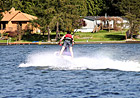

#1049 — A scenic picture taken of the back of a boy jet skiing in Lake Tapps which is located near Bonney Lake in Washington State.
Back of Boy Jet Skiing
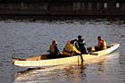
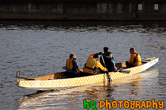
#875 — A scenic picture taken of some people learning how to canoe in Lake Union which is located in Seattle, Washington.
Canoeing in Lake Union, Seattle


#1053 — A fun picture taken of a young kid jet skiing in Lake Tapps located in Washington State. This photo was taken on a sunny day.
Jet Skiing


#1052 — A scenic picture taken of a young boy having fun jet skiing in Lake Tapps on a sunny day in Washington State.
Kid on Jet Ski
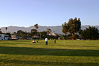
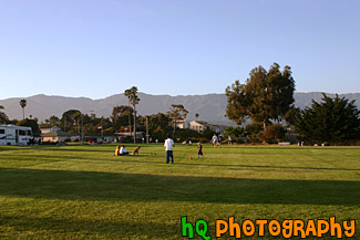
#954 — A scenic picture of people enjoying a park located in the beautiful Santa Barbara, California. This picture was taken on a sunny evening as you can see the long shadows laying over the park grass. In this picture you can see people enjoying time with their families and pets.
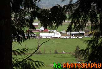
People at Park in Santa Barbara
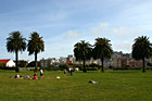
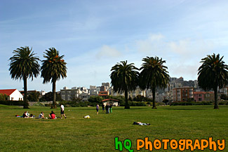
#952 — A scenic photo of many people enjoying a beautiful sunny day at a park in San Francisco, California. The park has green grass and 5 pretty palm trees seen. Behind the park you can see some apartments and houses of downtown San Francisco.
People Enjoying a San Francisco Park


#1260 — A scenic picture of people playing with their dogs in a dog park.
People Playing with Dogs in Dog Park


#2147 — A scenic picture taken of a goldendoodle dog and its' owner playing in the snow up in the mountains.
Playing in the Snow

#1410 — A scenic vertical picture taken of a girl walking her dog along the beach at Santa Cruz, California.
Walking Dog on Beach
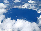
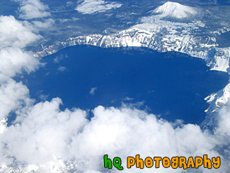
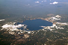
#8 — A scenic sky picture taken of Crater Lake which is located in Oregon State. Crater Lake is the deepest lake (1,949 ft or 594 m) in the United States. It is is filled with rain and melted snow that fell within the caldera basin. Crater Lake is isolated from surrounding streams and rivers, so there is no inlet or outlet to the lake. This picture was taken when there was still plenty of snow surrounding the lake.
Aerial View of Crater Lake, Oregon
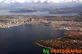
#258 — This is an aerial view of Seattle, Washington taken from an airplane flying into the SeaTac Airport. From this photo you can see the city of Seattle, the tall buildings, the Space Needle, and the bay and water. You can also see the Seahawks and the Mariner's stadiums. From this photo you can actually see it ALL! You can see I90, 520, Lake Washington, and Lake Sammamish in the far distance!
Aerial View of Seattle, Washington
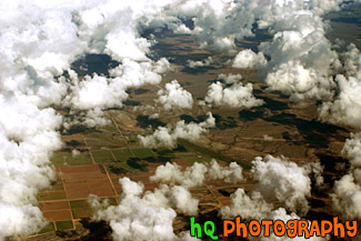
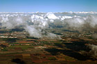
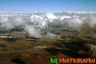
#115 — This photo is a scenic aerial shot taken over the land around Phoenix, Arizona as the plane was getting ready to land at the airport. In this photo you can see the scenic land through all the puffy clouds.
Aerial Arizona & Clouds

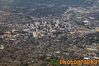
#1701 — A scenic aerial daytime photo taken of the tall building and surrounding areas of downtown San Jose, California.
Aerial Downtown San Jose, California
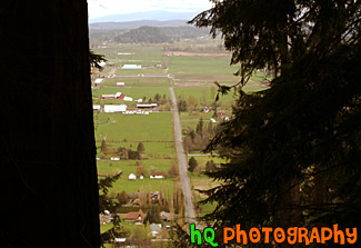
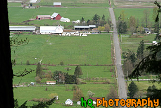
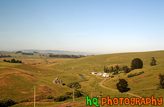
#1006 — A scenic aerial picture taken of a couple farms and farmland located in the small town of Enumclaw, Washington. This picture was taken from up Mt. Peak which is a popular local hike that people do for a great workout.
Aerial Farmland View
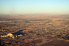
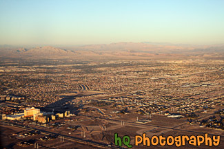
#1843 — A scenic aerial picture taken of the city of Las Vegas on a sunny evening. You can see the desert land in this picture.
Aerial View of Las Vegas
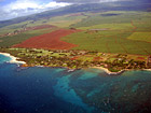
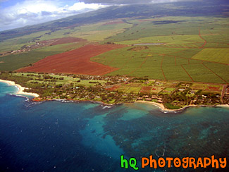
#171 — This is an aerial shot of Maui, Hawai'i as the plane was leaving the airport.
Aerial View of Maui, Hawaii
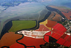
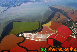
#310 — A scenic picture taken from an airplane of the bay area of San Francisco, California. In this photo you can see the colored waters of the bay area as the plane fly's north over it.
Aerial View of San Francisco Bay


#2287 — A scenic vertical picture taken of an airplane loading passengers at the terminal during sunset in Phoenix, Arizona as you can see the sunset colors in the background.
Airplane at Terminal During Sunset


#259 — This photo was taken of an American West aircraft at the Phoenix Airport in Arizona. This day was a beautiful day as the clouds were scattered and puffy. In the distance you can see the city of Phoenix.
Airplane at the Terminal


#114 — A picture taken of an airplane flying overhead on a beautiful sunny day at the Sea-Tac Airport in Tacoma / Seattle. Partly cloudy sky is seen with blue sky and puffy clouds.
Airplane Overhead in Sky


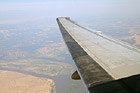
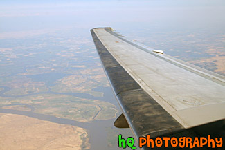
#9 — Aerial picture taken of an airplane wing while flying into the Seatac Airport in Seattle / Tacoma, Washington. This photo was taken from the airplane as it was getting ready to land. You can see the landscape of Washington State below the wing.
Airplane Wing
#1613 — A scenic picture taken of an airplane wing while the plane is flying in the sky.
Airplane Wing in the Sky


#555 — A scenic picture taken of an airplane's wing from looking out of the passenger window. Blue sky and clouds are seen in the photo.
Airplane's Wing


#2268 — A close up vertical picture taken some airport seats located at the Phoenix Airport in Arizona State.
Airport Seats


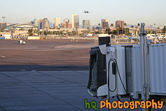
#311 — A scenic picture of an Alaska Airlines airplane getting ready to depart from the terminal during dusk/early sunset at the Seattle / Tacoma International Airport.
Alaska Airlines Airplane


#2267 — A scenic vertical picture taken of an Alaska Airline airplane at the terminal loading up passengers. In the distance you can see the city of Phoenix, Arizona.
Alaska Airlines Airplane at Phoenix Airport
#274 — This is a scenic aerial photo taken over Phoenix, Arizona on the way to landing at the airport. In this photo you can see the landscapes of Arizona as well as the puffy clouds in the sky.
Arizona Aerial View with Puffy Clouds
#70 — A scenic aerial picture view of the country land of Enumclaw, Washington looking down from Mt. Peak. You can see the countryside and farms while looking through some evergreen trees.
Country Land of Enumclaw, Washington
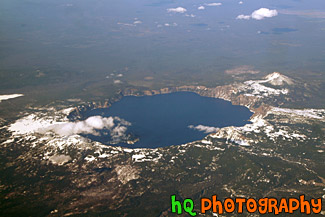
#1750 — A scenic aerial picture looking down at Crater Lake which is located in the state of Oregon.
Crater Lake, Oregon


#260 — This is a photo of an American West aircraft driving into the terminal just after it had landed so it can let all the people off the plane. This photo was taken at the Pheonix Airport.
Driving Airplane
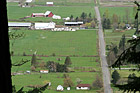
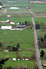
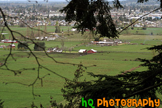
#1007 — A scenic picture looking down at a farm in Enumclaw, Washington from a trail on Mt. Peak. Mt. Peak is a popular hiking trail that the locals of Enumclaw go up for a great workout.
Farm View from Mt. Peak

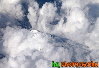
#1864 — An aerial picture taken of a mountain from an airplane. This mountain has snow covering it and is barely visible through the clouds.
Looking Down at Mountain Top
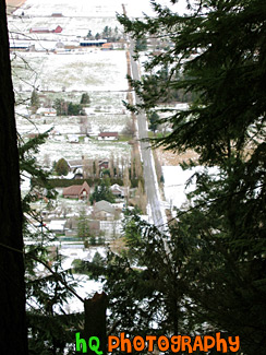
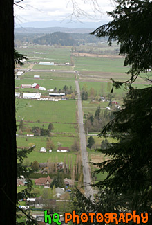
#10 — This is a scenic photo overlooking the country land of Enumclaw, WA on a snowy, icy day. This picture was taken on the trail of Mt. Peak. Mount Peak is a popular hike many people of Enumclaw and the surrounding cities go on. The hike is about 1 mile up to the top of the peak to where you can view almost the entire city of Enumclaw. Enumclaw is a small town located about 30 miles from Mt. Rainier and about 50 minutes southeast of Seattle. Most of Enumclaw's land consists of farms and fields with many houses containing acres of land.
Mt. Peak Snow View
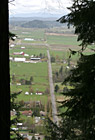
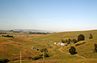
#71 — A scenic aerial view picture taken of the country land and farms of Enumclaw, Washington while looking down from Mt. Peak. Mt. Peak is a popular hiking site for the locals around this area.
Mt. Peak View of Enumclaw Country

#2286 — A scenic picture taken from the Phoenix Airport looking towards the city of Phoenix and an airplane taking off over the tall buildings.
Phoenix Airport Terminal


#2234 — A scenic picture taken of some planes taxing and landing at the Phoenix airport in Arizona. This photo was taken on a sunny day.
Planes Taxing and Landing at Airport


#312 — A scenic photo taken of some airplanes and the airport at the Seattle / Tacoma International Airport. In the sky in the background you can see an airplane that had just taken off from the airport.
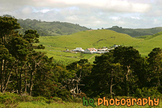
Seattle Airport

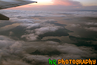
#1088 — A scenic aerial picture taken during a sunset looking down at the Puget Sound in Washington State from an airplane which has just taken off from the Seatte/Tacoma International Airport. Through the clouds you can see the sound and islands of Washington State.
Sky Sunset & Puget Sound


#2270 — A scenic picture taken of a Southwest airplane about to take off at the Phoenix, Arizona airport.
Soutwest Airplane on Runway
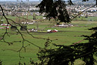
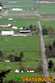
#1009 — An aerial picture taken of some farmland and the small town of Enumclaw located in the background. This picture was taken from a trail on Mt. Peak which is a place where many locals go for a great hike/workout.
View of Farms & Enumclaw
#186 — A picture of a child playing in the sand on the island and shorline of Maui, Hawaii.
Kid Playing in Sand
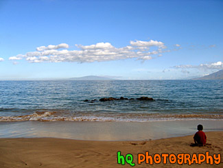
#190 — A photo of the Pacific Ocean and the beach of Maui, Hawaii at sunrise on this beautiful day in June.
Beach & Ocean at Sunrise


#2405 — A bunch of beach toys on the sand at the beach in Seaside, Oregon picture.
Beach Toys on the Sand
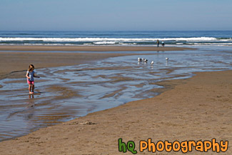
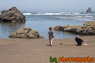
#2003 — A scenic picture taken of a popular beach in Oregon, Cannon Beach. In this photo you can see people walking along the ocean, seagulls on the sand, and a girl playing on the beach.
Beach, Seagulls & Child Playing
#2015 — A scenic picture taken of Cannon Beach which is located in Oregon State. In this photo you can see many people walking their animals along the beach, children playing in the sand, a light house in the background, and a seagull in the foreground.
Cannon Beach, People, & Lighthouse
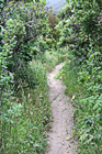
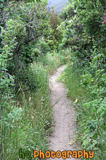
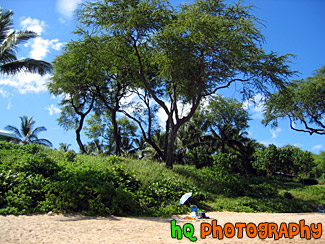
#2112 — A scenic vertical picture of a beach hiking trail at Muir Beach in Northern California near San Francisco. Green plants and shrubs surround the sandy trail.
Hiking Trail Along Beach
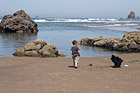
#2025 — A scenic picture of a little boy on the beach playing in the sand with his sand bucket and shovel. This photo was taken on Cannon Beach in Oregon State with the Pacific Ocean seen in the background.
Little Boy on Beach
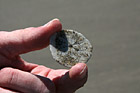
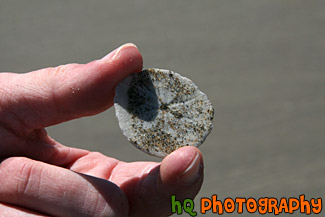
#1975 — A scenic close up picture taken of a person holding a sand dollar between his thumb and index fingers.
Sand Dollar in Hand
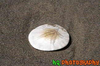
#1969 — A scenic close up picture taken of a white sand dollar with star on the shell sitting in the sand on the beach.
Sand Dollar in Sand


#1970 — A scenic picture taken of a white sand dollar seashell sitting in the sand on the beach.
Sand Dollar on Beach


#2333 — A close up picture taken of a bunch of small beach rocks located on the beach at Ruby Beach in Washington State.
Small Beach Rocks
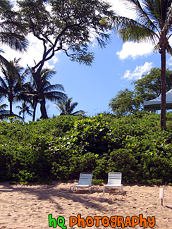
#184 — A picture of two lawn chairs on the beach of Maui, Hawaii on the resort of Makena.
Two Lawn Chairs on Beach
#367 — A scenic photo taken of a beautiful landscape scene with green grass, blue sky, close up wild flowers, and yellow flowers in Marin County, California. Marin County is just north of San Francisco. From 1850 to 1950 the population of Marin increased by 85,000 people. Twenty years later there were an additional 123,000 residents. Population growth has slowed since then and is now about 245,000. In 1972 the Golden Gate National Recreational Area was created which encompasses the Marin Headlands, Muir Woods and thousands of acres along the Pacific Coast.
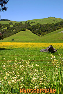
Beautiful Marin County Landscape
#364 — A scenic photo taken of a beautiful landscape scene with green grass, blue sky, and yellow flowers in Marin County, California. Marin County is just north of San Francisco. From 1850 to 1950 the population of Marin increased by 85,000 people. Twenty years later there were an additional 123,000 residents. Population growth has slowed since then and is now about 245,000. In 1972 the Golden Gate National Recreational Area was created which encompasses the Marin Headlands, Muir Woods and thousands of acres along the Pacific Coast.
Marin County Landscape of Hills
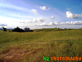
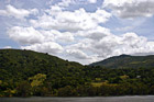
#6 — Rolling hills of Palo Alto, California on a sunny day. This photo was taken on the eastern hills between Palo Alto and Los Altos in the Bay Area.
Rolling Hills in California
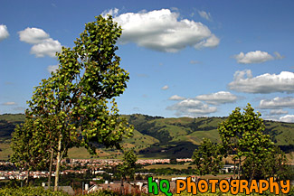
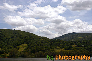
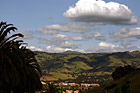
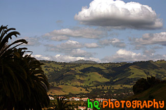
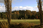
#950 — A scenic picture taken of a landscape scene in the East San Jose area near Evergreen Village. This picture was taken on a beautiful day with scattered clouds and blue sky. You can see the green hills from much rain this year in the background with shadows from the clouds over them.
Blue Sky, Green Hills, & Trees in San Jose
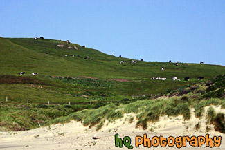
#764 — A scenic picture taken of a bunch of black and white spotted cows located on a big green hill along the coast at Kehoe Beach in Marin County California. In this picture you can see where the beach starts as the sand approaches the grass in the foreground.
Cows on Coastal Green Hill
#350 — A scenic picture and contrast between a very green hill and partly cloudy blue skies. This picture was taken in San Jose of the very green hills (which are starting to turn brown) from the tremendous early 2005 rainfall.
Green Hill & Scenic Sky Scene

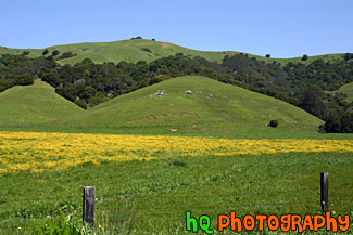
#765 — A scenic picture taken of a green hill, green trees, and yellow wildflowers blooming during spring in Northern California. This picture was taken in the East San Jose area.
Green Hill & Yellow Wildflowers
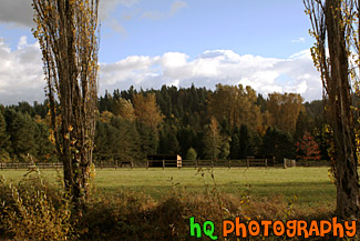
#885 — A scenic picture taken of a lake in the foreground, green rolling hills in the mid-ground, and interesting puffy white clouds and blue sky in the sky. This photo was taken near the Santa Cruz Mountains on the way to Santa Cruz, California near Highway 17.
Green Hill, Lake, & Puffy Clouds
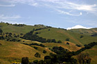
#884 — A scenic picture taken close up of one of the many rolling hills located in the San Jose Bay Area in California. In this picture you can see green hills with trees scattered over them on a sunny day.
Green Hill, Trees, & Blue Sky
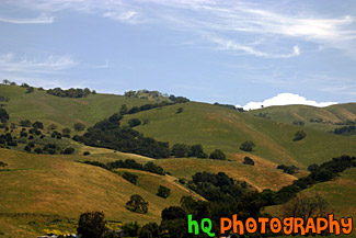
#473 — A scenic picture taken of some green hills with the shadows of the clouds on the hills from the partly cloudy sky. This picture was taken in South/East San Jose near the Silver Creek Valley area.
Green Hills & Partly Cloudy Sky
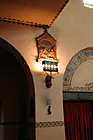
#1564 — A scenic vertical picture taken of a church light on the wall in Mission Santa Clara de Asis which is the historic church located in the center of campus at Santa Clara University in Califorina.
Church Light on Wall

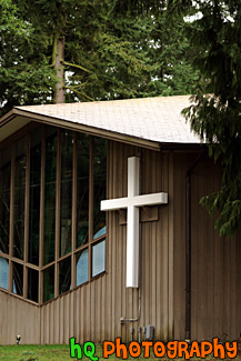
#944 — A scenic picture taken close up of a church building with a white cross located next to the large window. This church was surrounded by evergreen trees and is located in Washington State.
Close Up of Church Building & Cross

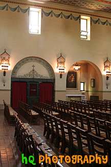
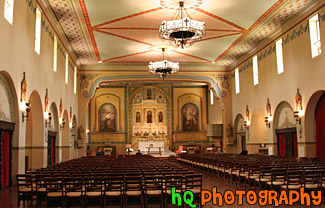
#1567 — A scenic vertical picture taken inside of the catholic church at Santa Clara University, Mission Santa Clara de Asis. In this photo there are a few people getting ready for the next mass starting at noon.
Inside of Catholic Church
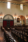
#1562 — A scenic vertical picture taken of rows of chairs and a window inside of the Mission Santa Clara de Asis church which is located on campus at Santa Clara University. The current building was constructed in 1927-28 after a fire and is a replica of the early 19th century church. Mass is held most days at noon.
Inside of Church & Window

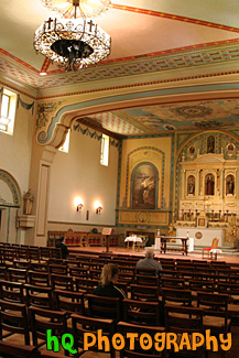
#1563 — A scenic picture taken inside of Mission Santa Clara de Asis church which is located on campus at Santa Clara University. Santa Clara University is the oldest college in California.
Inside of Mission Santa Clara de Asis

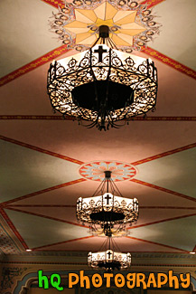
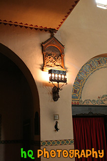
#1565 — A scenic vertical picture taken of three lights located on the ceiling wall of a church on campus at Santa Clara University.
Lights on Church Ceiling
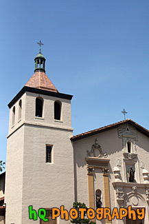
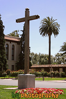
#1808 — A scenic picture taken of the Santa Clara Mission Church which is located on campus at Santa Clara University.
Mission Church & Blue Sky
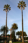
#356 — A scenic picture of tall palm trees location on campus at Santa Clara University right in front of Mission Santa Clara de Asis. A cross from the church is located between the two palm trees.
Tall Palm Trees & Cross

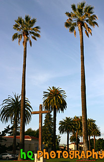
#1628 — A scenic vertical picture taken of a wooden cross located on campus at Santa Clara University with a palm tree seen in the background.
Wooden Cross on College Campus
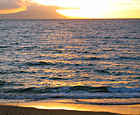
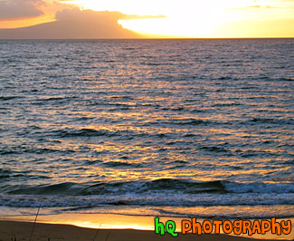
#177 — A beautiful sunset over the Pacific Ocean located in Makena on the island of Maui, Hawaii. From this photo you can see the colors of the sunset reflected in the Pacific Ocean and the beach.
Ocean Sunset
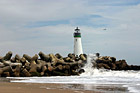
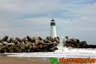
#386 — A scenic close up picture taken of the Walton Lighthouse in green on the beach at Santa Cruz, California. In this picture you can see the waves of the ocean crashing onto the rocks surrounding the lighthouse.
Santa Cruz Lighthouse (Walton)

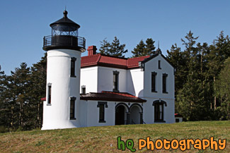
#2298 — A scenic picture taken of the Whidbey Island Lighthouse located in Washington state on a sunny day. This lighthouse is called the Admiralty Head Lighthouse. This lighthouse has a breath-taking view of the Olympic mountains.
Admiralty Head Lighthouse
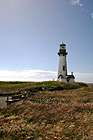
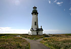
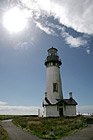
#776 — A vertical scenic picture taken of the Yaquina Head Lighthouse with a bench in the foreground located in Oregon State. Off to the left you can see glares from the sun shining toward the lighthouse. This historic lighthouse is 93 (28 m) feet tall and was built in 1872-73. Its light towers are 162 feet (49 m) above the sea, and can be seen about 19 miles (32 km) out to sea. This lighhouse was automated in 1966 in which the light flashes two seconds on, two off, two on, 14 off, then repeats. Each light has its own pattern so it will not be confused with other lights.
Bench & Yaquina Head Lighthouse
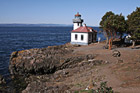
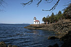
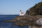
#2118 — A scenic picture taken of the Lime Kiln Lighthouse which is located on the San Juan Island. Lime Kiln Lighthouse is located on the west side of the island. It was built in the 1860's. This is also the site of a whale watching park to observe whales from the land.
Lime Kiln Lighthouse
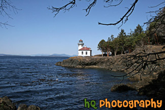
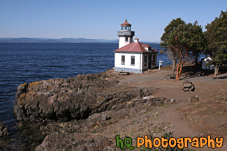
#2122 — A scenic picture taken of the Lime Kiln Lighthouse seen on a sunny day with tree branches in the foreground. Lime Kiln Lighthouse is located on the San Juan Island of Washington State. This is a popular place to whale watch from the shore.
Lime Kiln Lighthouse & Branches
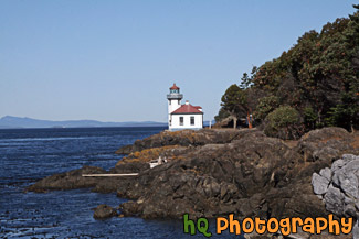
#2123 — A scenic picture taken of the Lime Kiln Lighthouse which is located on the San Juan Island in Washington State. This photo was taken on a sunny day.
Lime Kiln Lighthouse on Sunny Day
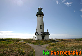
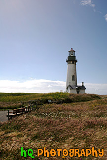
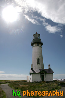
#775 — A scenic picture taken of the Yaquina Head Lighthouse with the sun glaring off to the left. Yaquina Head Lighthouse is located along the coast of Oregon State and the Pacific Ocean. This historic lighthouse is 93 (28 m) feet tall and was built in 1872-73. Its light towers are 162 feet (49 m) above the sea, and can be seen about 19 miles (32 km) out to sea. This lighhouse was automated in 1966 in which the light flashes two seconds on, two off, two on, 14 off, then repeats. Each light has its own pattern so it will not be confused with other lights.
Looking at Yaquina Head Lighthouse
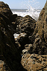
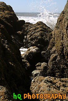
#1849 — A scenic vertical picture taken of some Pacific Ocean waves splashing up against some rocks located at Ruby Beach in Washington State.
Ocean Waves Splashing on Rocks
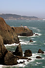
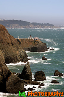
#626 — A scenic picture taken of some ocean rocks and the Point Bonita Lighthouse which is located just north - west of the Golden Gate Bridge and San Francisco, California. Point Bonita was the site of the first fog signal on the Pacific coast. The fog signal, which went into service on August 8, 1855, was an army surplus cannon fired every half hour in foggy weather. Point Bonita was the third lighthouse built in the San Francisco Bay area (in 1855) and was unique. The original tower, built separate from the residence, provided a lonely existence for the initial light keepers. There were no inhabitants for five miles and no direct communication. It was so inhospitable that seven keepers were employed within the first nine months of the operation of the light. Point Bonita was the last manned lighthouse on the California coast. The last keeper left in April 1981. It is now a part of the Golden Gate National Recreation Area and is run by the National Park Service. The Coast Guard continues to maintain the light and fog signal.
Point Bonita Lighthouse
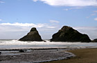
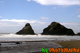
#714 — A scenic picture taken of sea stack rocks with blue sky located in the Pacific Ocean along the Oregon State coast. In the foreground you can see the beach filled with a bunch of seagulls in the water. This picture was taken just below the famous Heceta Head Lighthouse.
Scenic Oregon Coast Sea Stacks & Ocean
#584 — A scenic picture taken of the Yaquina Head Lighthouse with the sun glaring brightly off to the left. Yaquina Head Lighthouse is located along the coast of Oregon State and the Pacific Ocean. This historic lighthouse is 93 (28 m) feet tall and was built in 1872-73. Its light towers are 162 feet (49 m) above the sea, and can be seen about 19 miles (32 km) out to sea. This lighhouse was automated in 1966 in which the light flashes two seconds on, two off, two on, 14 off, then repeats. Each light has its own pattern so it will not be confused with other lights.
Yaquina Head Lighthouse & Sun


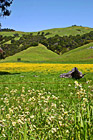
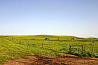
#381 — A scenic picture of a few big bundles of hay located atop a hill in Palo Alto, California.
Bundles of Hay
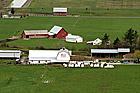
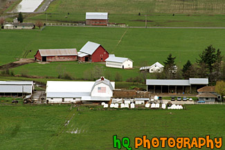
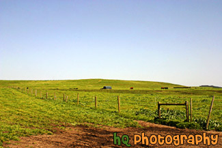
#1005 — A scenic aerial picture of a farm located in the countryside of Enumclaw, Washington. This picture was taken from up the trail at Mt. Peak. Mt. Peak is a popular hike the locals take for a great workout. In this picture you can see a couple farms located on green grass fields.
Aerial View of Farm
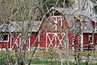
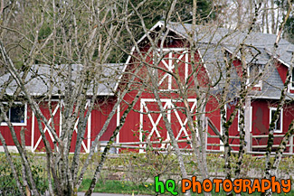
#16 — A scenic picture taken of a red barn with white markings looking through some tree branches. This barn was found on a farm located in the countryside of Enumclaw, Washington.
Barn Thourgh Tree Branches
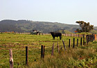
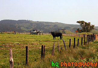
#739 — A scenic picture taken of a black cow looking at the camera. This cow was located on a farm in Marin County, California on a sunny spring day.
Black Cow on Farm
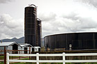
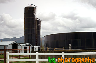
#1013 — A scenic picture taken of a blue silo located on a farm in Enumclaw, Washington. This picture was taken on a cloudy day with texturous clouds.
Blue Silo
#804 — A scenic picture taken of a farmland located in Marin County, California near the coast. In this picture you can see the green grass of the field with some cows grazing the land on this sunny spring day.
California Farmland
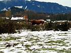
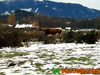
#13 — A scenic photo of a cow standing alone on a snowy and icy winter day on a farm in Enumclaw, which is located in Washington State. Enumclaw is located in the foothills of the Cascade Mountains about 30 miles from Mt. Rainier. Many other cows such as this one can be seen throughout the city of Enumclaw as it is primarily a farming town.
Cow Standing Alone

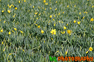
#965 — A scenic photo taken close up of green grass, crops and yellow daffodils located on some farmland in western Washington State.
Daffodil Flowers Close Up
#468 — A scenic picture taken of a farm in Marin County, California. This picture was taken in the spring season when California received tons of rain therefore explaining the very green land and hills surrounding this farm. Marin County is located just north of San Francisco across the Golden Gate Bridge.
Farm in Marin County, California
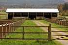
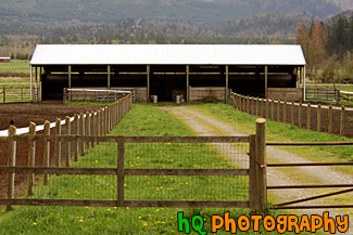
#1011 — A scenic picture taken of a farm shed looking through fence/gate located on a farm in Enumclaw, Washington. As this was taken during the spring season, you can see the dandilions in the green grass heading towards the shed.
Farm Shed & Gate
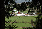
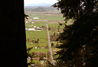
#80 — A scenic picture looking down at a farm through evergreen trees from high up on the trail of Mt. Peak located in Enumclaw, Washington.
Farm Through Trees
Pages: [<<] 1 2 3 4 5 6 7 8 9 10 [>>]
