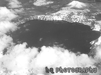
Aerial View of Crater Lake, Oregon Photo in Black and White

A scenic sky picture taken of Crater Lake which is located in Oregon State. Crater Lake is the deepest lake (1,949 ft or 594 m) in the United States. It is is filled with rain and melted snow that fell within the caldera basin. Crater Lake is isolated from surrounding streams and rivers, so there is no inlet or outlet to the lake. This picture was taken when there was still plenty of snow surrounding the lake.
Related Photos
crater lake oregon, lakes, aerial crater lake, national park, snow around lake, blue water, clouds, airplane view, looking, snow covered, sky, oregon state
Related Photos
crater lake oregon, lakes, aerial crater lake, national park, snow around lake, blue water, clouds, airplane view, looking, snow covered, sky, oregon state
Camera Settings (EXIF Data)
- Shutter Speed: 1/800 seconds
- Lens Aperture: F/4.9
- Focal Length: 21 mm
- Image Resolution: 1600 x 1200 pixels
- Image Size: 452 KB MB (JPG), 5.49 MB (TIF)
- Date Photo Taken: March 23, 2003 3:16 PM
- File Name: aerial1.jpg
- Image ID: # 8
- Date added to website: 14-May-2004
*Print size is only available up to an 16x20 size for this photo*
Even more stuff
- Large Poster Format
- Request an image
- Free wallpaper collection
- Return Policy
- Questions? Contact HQ Photography.
