Photos of Trail (55)
There are (55) photos of the keyword, Trail, available on our website. They are pictured below.The pictures are organized by category.
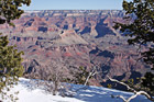
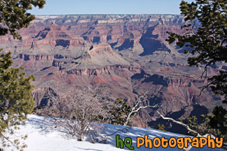
#2230 — A scenic picture taken during the winter season of the Grand Canyon with snow seen on the rim in the foreground. This photo was taken on the South Rim near Mather Point.
Grand Canyon Rim & Snow
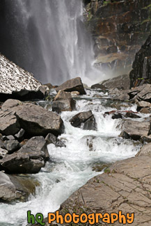
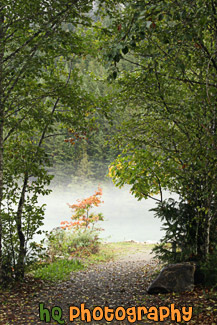
#2150 — A scenic vertical picture taken of Comet Falls and a river which is located in the Longmire area of Mt. Rainier National Park.
Comet Falls & River
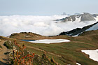
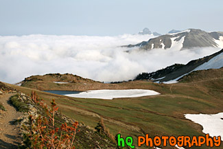
#1834 — A scenic picture taken of fog hovering over the mountain hills located near Mt. Rainier at the Sunrise Entrance. This picture was taken from the Mount Fremont lookout and taken with blue sky seen above the fog.
Fog Hovering over Mountains
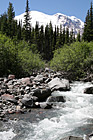
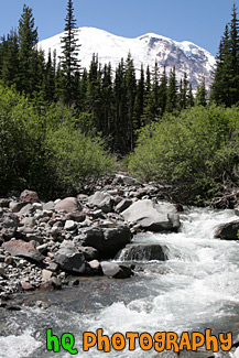
#1658 — A scenic vertical picture taken of a river in the foreground of Mt. Rainier taken of on a blue sky day. This picture was taken on the Glacier Basin trail near the White River Entrance to the park.
Mt. Rainier & River
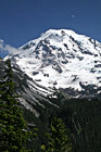
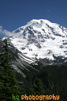
#2312 — A scenic vertical picture taken of Mt. Rainier with the moon seen faintly above on a blue sky sunny day. This photo was taken from the Spray Park trail which starts at Mowich Lake from the Carbon River Entrance to the park. A few clouds can be seen in front of the mountain.
Mt. Rainier With Moon Faintly Above
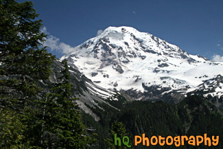
#2313 — A scenic picture taken of Mt. Rainier with the moon seen faintly above on a blue sky day. This photo was taken from the Spray Park trail which starts at Mowich Lake from the Carbon River Entrance to the park. A few scattered clouds can be seen in front of the mountain.
Mt. Rainier, Faint Moon & Blue Sky
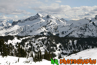
#1505 — A scenic picture taken of snow covered hills located in Mt. Rainier National Park. This picture was taken from a trail in the Paradise area on a partly cloudy winter day.
Snowy Hills
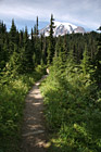
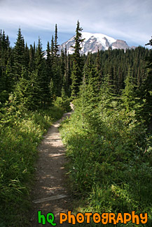
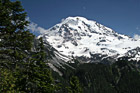
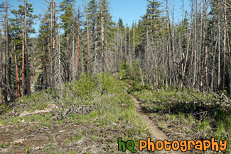
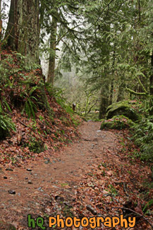
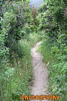
#1292 — A scenic picture taken of a trail in Mt. Rainier National Forest where Mt. Rainier is seen in the background.
Trail Leading to Mt. Rainier
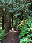
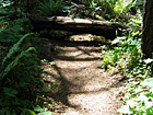
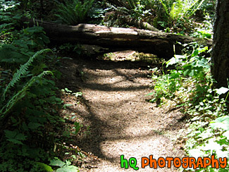
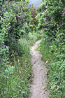
#1700 — A scenic vertical picture taken of a nature trail located in the Hoh Rain Forest which is located in the Olympic National Park in Washington State.
Hoh Rain Forest Trail
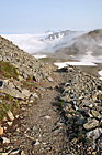
#1707 — A scenic vertical picture taken of a trail located in the Hurricane Ridge area of the Olympic National Park.
Hurricane Ridge Trail
#1634 — A scenic picture taken of a hiking trail located near the Sunrise entrance in Mt. Rainier National Park.
Hiking Trail in Mt. Rainier National Park
#2338 — A scenic picture of a hiking trail near Lake Chelan, Washington. Blue sky is seen in the sky.
Hiking Trail Near Chelan
#76 — A scenic photo of the trail of Mt. Peak on a sunny day. Mt. Peak is located in Enumclaw, Washington and it is a popular site for many people of the town to come a get a great workout.
Mt. Peak Trail
#2190 — A scenic vertical photo taken of a nature hiking trail located in Oregon State along the Columbia River Gorge area. This photo was taken during the winter season.
Nature Trail
#74 — A scenic picture taken of the hiking trail on Mt. Peak. This hike is a popular workout activity that many people of Enumclaw enjoy.
Nature Trail of Mt. Peak, Enumclaw
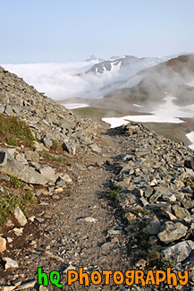
#1751 — A scenic vertical picture taken of a hiking trail with rocks all around it. This trail was located in Mt. Rainier National Park in Washington State with fog seen over the mountains and blue sky above.
Rock Hiking Trail
#78 — Sun shining and shadows showing over the trail of Mt. Peak located in Enumclaw, Wa.
Shadows and Trail
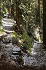
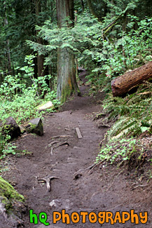
#1758 — A scenic vertical picture taken of a switchback point in a hiking trail. This trail was located in the Mt. Rainier National Park near Eunice Lake.
Switchback Hiking Trail
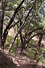
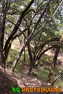
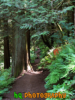
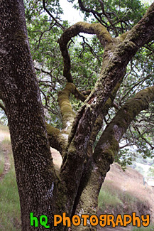
#1591 — A scenic picture taken of a trail with shadows from the mossy trees over it. This picture was taken on a trail near the Mt. Tamalpais Watershed District in Marin County, California.
Trail, Trees, & Shadows
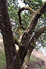
#1596 — A scenic vertical picture taken of a mossy tree close up on a hiking trail near Mt. Tamalpais Watershed District in Marin County, California.
Mossy Tree
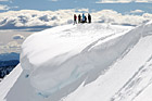
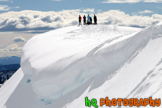
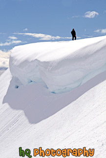
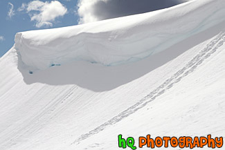
#1501 — A scenic, beautiful picture taken of people standing on top of a snow cliff near the edge of a snow overhang on a snowshoeing trail at Paradise which is located at the base of Mt. Rainier in Washington State. This picture was taken on a partly sunny day as you can see the sun shining on the snow.
People on Top of Snowy Hill for Snowshoe Trip
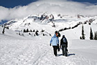
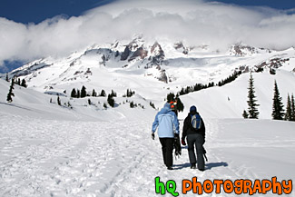
#1502 — A scenic picture taken of some people hiking in the snow walking right towards Mt. Rainier as it is seen in the background (with clouds covering the top). The trail is located at Paradise which is in the Mt. Rainier National Park. The hikers are carrying snowshoes and will strap them on a little later in the hike.
Snow Hiking Towards Mt. Rainier
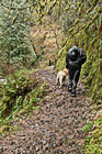
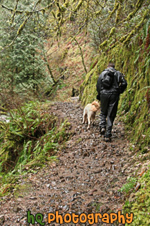
#2195 — A scenic vertical photo taken of a hiker and dog on a nature hiking trail during the winter season in Oregon State.
Hiker & Dog on Trail

#160 — A scenic picture taken of a man with a red stocking cap on snowshoeing up a hill near Snoqualmie Pass, Washington State.
Man Snowshoeing Up Hill

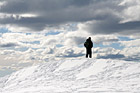
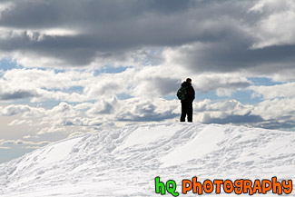
#1507 — A scenic picture taken of a man standing on top of a snowy hill near a snow overhang on a sunny winter afternoon. This picture was taken on a snowshoeing trail at Paradise which is located in Mt. Rainier National Park.
Man Standing Near a Snow Overhang
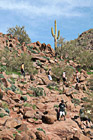
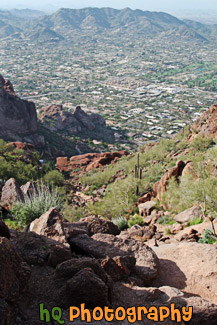
#2288 — A scenic vertical picture taken of people hiking up a popular hike near Scottsdale and Phoenix, the Camelback Mountain. This hike mostly consists of hiking up and climbing over big rocks.
People Hiking up Camelback Mountain
#2112 — A scenic vertical picture of a beach hiking trail at Muir Beach in Northern California near San Francisco. Green plants and shrubs surround the sandy trail.
Hiking Trail Along Beach
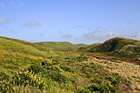
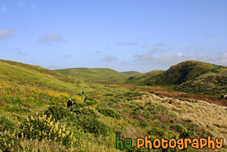
#805 — A scenic picture of people hiking on a trail near the coast at Kehoe Beach which is located in Marin County California. This is a beautiful picture as you can see the green hills and wildflowers of marin county along with some patchy fog in the background with the blue sky.
People Hiking on Green Trail
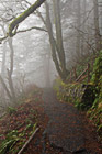
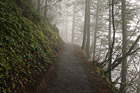
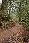
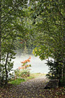
#2187 — A scenic vertical picture taken of a foggy hiking trail during a winter morning. This photo was taken on the trail up to the top of Multnomah Falls located in Oregon State.
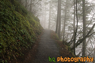
Foggy Trail
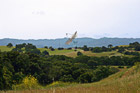
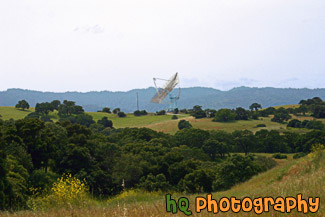
#1866 — A scenic picture taken of The Dish located in the Stanford Foothills. The Dish is a popular hike for the locals. It is 4 mile walk round trip with paved road. It's great for runner and walkers. The first part of The Dish is an incline for about a quarter of a mile.
The Dish at Stanford Foothills
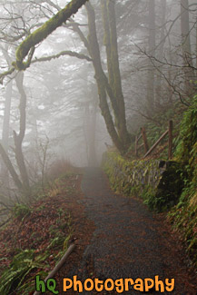
#1862 — A scenic vertical picture taken of a trail located in the North Cascades National Park which is leading to fog hovering over a lake.
Trail Leading to Fog
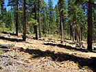
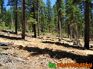
#200 — A view of the trees in the mountains of Lake Tahoe. Lake Tahoe is the second deepest lake in the United States and the tenth deepest in the world, with a maximum depth measured at 1,645 ft (501 m), average depth of 1,000 ft (305 m). The Lake Tahoe Basin was formed by geologic block (normal) faulting about 2 to 3 million years ago. A geologic block fault is a fracture in the Earth's crust causing blocks of land to move up or down. Snow, rain, and streams filled the southern and lowest part of the basin, forming the ancestral Lake Tahoe. Modern Lake Tahoe was shaped and landscaped by the scouring glaciers during the Ice Age. Many streams flow into Lake Tahoe, but the lake is drained only by the Truckee River, which flows northeast through Reno and into Pyramid Lake in Nevada.
Trees in the Mountains of Lake Tahoe


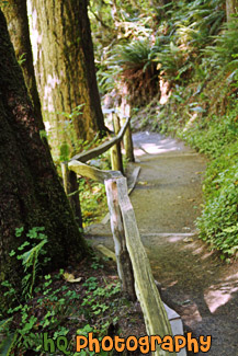
#949 — A scenic picture taken of an old brown wooden fence which curves around in a field of bright green grass. This photo was taken on the popular hike trail by Stanford University called "The Dish." When you reach the top of this trail you can see the entire Stanford University campus along with a lot of the bay area.
Wooden Fence & Green Grass
#2168 — A scenic picture taken of a ton of icicles surrounding Snoqualmie Falls which is located in Washington State during the December freeze of 2009. This was a spectacular site to see.
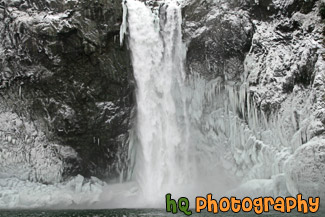
Icicles Surrounding Snoqualmie Falls
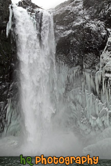
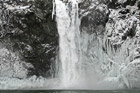
#2180 — A scenic vertical picture taken of Snoqualmie Falls located in Washington State during a December 2009 freeze. Icicles are forming around the falls and water is freezing due to the cold weather. Snoqualmie Falls is the most famous waterfall in Washington State. It is 268 feet high with the width ranging from 50 to 150 feet, depending on water levels.
Snoqualmie Falls During Winter
#1503 — A scenic photo of a snow overhang located on a snowshoe trail at Paradise which is located in the Mt. Rainier National Park. This photo was taken on a beautiful sunny afternoon.
Snow Overhang up Close
#1508 — A scenic photo of a man looking over a ledge/cliff on a snowshoeing trail at Paradise which is located in Mt. Rainier National Park.
Man Looking Over Ledge
#51 — "Mt. Peak" as the locals call this small mountain located in Enumclaw, Washington, is one known throughout the whole city of one of the major places to get a great workout. The trail goes a mile up and can be challenging. This photo was taken in the winter time after a snow storm of the icy trail of Mt. Peak.
Mt. Peak Icy Trail
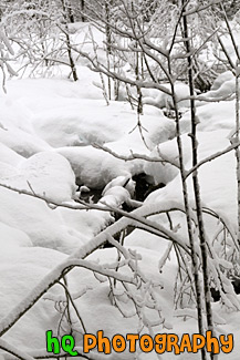
#1469 — A scenic vertical snowy landscape picture taken on the Trail of the Shadows self guided hike at Longmire, Washington which is located in the Mt. Rainier National Park. In this photo you can see some water under the piling of snow. Trail of the Shadows is located directly across from the National Park Inn at Longmire. It is a 0.7 mile loop through an old growth forest known as the Trail of the Shadows.
Snow Scene at Longmire, Wa
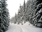
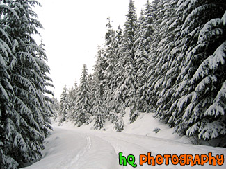
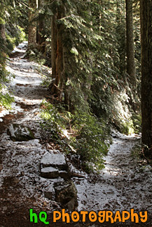
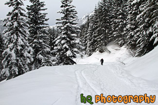
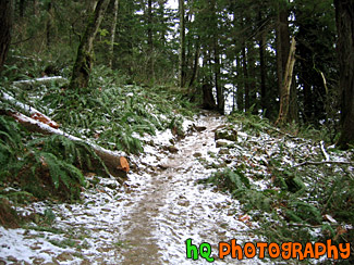
#50 — Snow covered trail at Snoqualmie, Washington. This is a photo of a scenic snowy trail with evergreen trees on both sides covered with thick snow.
Snowy Trail

#1494 — A scenic picture taken of a snowy and white wilderness scene located in Mt. Rainier National Park near the Longmire area.
Snowy Winter Wilderness


#769 — A close up picture taken of a white recreation vehicle (RV) which is sitting in the back behind someone's house. Recreation vehicles are a popular way to get away for a weekend trip without having to worry about hotels or a place to stay.
Recreation Vehicle Trailer
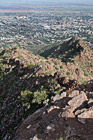
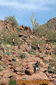
#2276 — A scenic vertical picture taken of a trail and hills of camelback mountain located in Arizona State near Scottsdale and Phoenix.
Camelback Mountain Trail
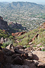
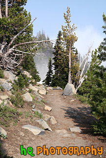
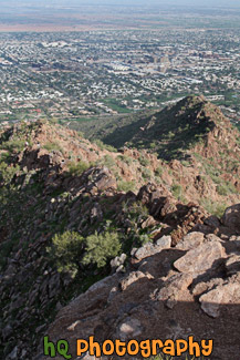
#2277 — A scenic vertical picture taken looking down on the trail at Camelback Mountain in Arizona State. You can see hills in the distance and the big rocks on the trail that you have to climb over.
Rocks & Trail on Camelback Mountain

#421 — A scenic picture of a hiking trail in Marin County, California near the coast at Kehoe Beach. Marin County is a county located in California's San Francisco Bay Area across the Golden Gate Bridge fom San Franicsco.
Hiking Through Marin County Wildflowers

#806 — A scenic picture of a beautiful hiking trail located by the coast in Marin County, California at Kehoe Beach. Marin County is a county located in California's San Francisco Bay Area across the Golden Gate Bridge fom San Franicsco. In this picture you can see Marin county's beautiful green hills along with the yellow falselupine wildflowers.
Marin County Coastal Trail


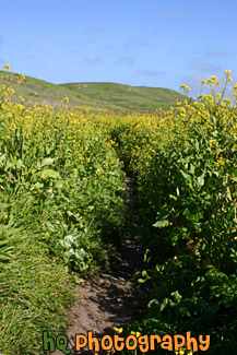
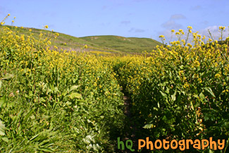
#991 — A scenic picture taken of yellow wildflowers located on the sides of a trail leading to the Golden Gate Bridge. You can also see the city of San Francisco and the bay waters in the distance on this beautiful sunny day.
Golden Gate Bridge & Wildflowers on Trail

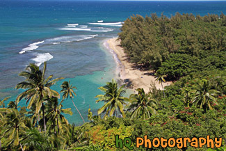
#2386 — A scenic picture looking down at Ha'ena Beach Park located on the island of Kauai, Hawaii. This photo was taken from the Kalalua Trail.
Ha'ena Beach View on Kalalua Trail
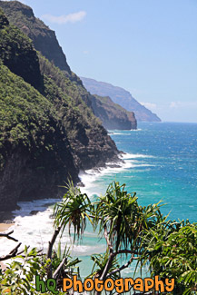
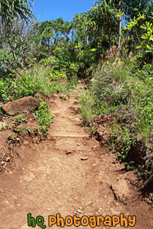
#2385 — A scenic picture taken of part of the Kalalau Trail located on the island of Kauai, Hawaii along the rugged Na Pali Coast.
Kalalau Trail on Na Pali Coast
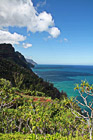
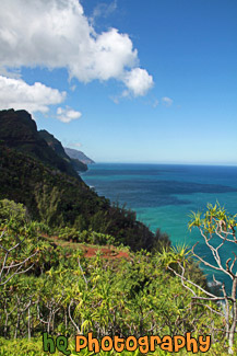
#2365 — A scenic vertical picture taken of the Na Pali coastline seen from hiking the Kalalau Trail in Kauai, Hawaii. Clouds and blue sky are seen above.
Na Pali Coast From Kalalau Trail
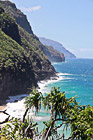
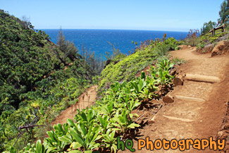
#2384 — A scenic vertical picture taken of the Na Pali Coast while hiking on the 11 mile long Kalalau Trail in Kauai, Hawaii.
Na Pali Coast on Kalalau Trail
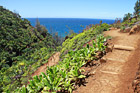
#2383 — A scenic vertical picture taken while hiking the Kalalau Trail located along the coast on Kauai, Hawaii. The Kalalau Trail is an 11 mile trail that leads from Ke'e Beach to Kalalau Beach. It is one of the most popular hikes in the world.
On the Kalalau Trail