Photos of Pretty Hills (10)
There are (10) photos of the keyword, Pretty Hills, available on our website. They are pictured below.The pictures are organized by category.
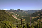
#533 — A scenic picture taken of the trees and landscape at Gifford Pinchot National Forest which is the Forest in which Mount St. Helens National Volcanic Monument lies. In this picture to the left you can see the tip of Mt. Rainier sticking over the top of the hill. The Gifford Pinchot National Forest is located in southwest Washington State. The Forest provides a wide variety of recreation opportunities. This forest was formerly known as the Columbia National Forest, but in 1949 it was renamed for Gifford Pinchot, an active conservationist and visionary environmentalist who became the first Chief of the Forest Service.
Gifford Pinchot National Forest
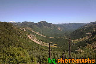
#649 — A beautiful picture taken of the hills of Mount Rainier's National Park and the Cascade Mountains. This picture was taken looking west at a lookout while approaching Paradise.
Hills of Mount Rainier National Park
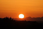
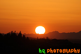
#270 — A beautiful close up picture taken of the big orange sun stetting over the Olympic Mountains located in Washington State. This picture was taken from Bonney Lake looking towards Tacoma and the Olympic Mountains. In the foreground you can see the silhouettes of some hills with houses on them.
Big Sun Setting Over Olympic Mountains
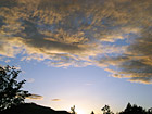
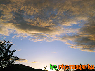
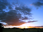
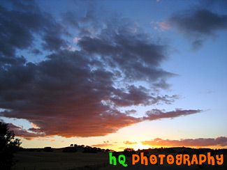
#26 — A pretty sunset while darkness is starting to set in. This photo was taken in the foothills of the Cascade Mountains in Washington State. Many sunsets like this one can be captured year round in this state.
Sunset & Silhouette
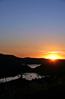
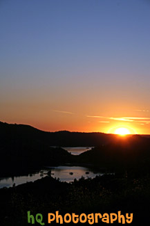
#665 — A scenic picture taken of a sunset behind the reservoir to Don Pedro Lake in between the hills and mountains surrounding Yosemite National Park in California. The picture was taken near the entrence to Yosemite National Park just a couple miles west of Groveland and Big Oak Flat. Yosemite is located in east-central California and lies 105 miles north of Fresno, 195 miles east of San Francisco, 313 miles north of Los Angeles and 350 miles northwest of Las Vegas.
Sunset Behind Don Pedro Lake
#224 — A pretty sunset along the coast of Highway 101 in California just north of Santa Barbara.
Sunset on the 101
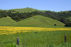
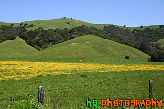
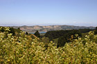
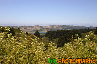
#364 — A scenic photo taken of a beautiful landscape scene with green grass, blue sky, and yellow flowers in Marin County, California. Marin County is just north of San Francisco. From 1850 to 1950 the population of Marin increased by 85,000 people. Twenty years later there were an additional 123,000 residents. Population growth has slowed since then and is now about 245,000. In 1972 the Golden Gate National Recreational Area was created which encompasses the Marin Headlands, Muir Woods and thousands of acres along the Pacific Coast.
Marin County Landscape of Hills
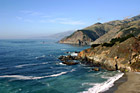
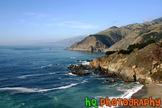
#352 — A scenic picture of the coast along the Pacific Ocean in Northern California. This picture was taken along the scenic highway of Highway 1 between Monterey and Santa Barbara. In the distance you can see a scenic bridge along the road.
Coast Scene & Hills
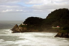
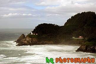
#457 — A scenic picture taken of the Heceta Head Lighhouse located on the Oregon coast, just after the famous Sea Lion Caves. The lighthouse is a working lighthouse and has a height of 205 feet above the Pacific Ocean. To the right of the lighthouse is the Keeper's house. There are some spectacular view seen from the front porch of the Keeper's house. Whales sometimes stop by at high tide and use the shallow rocks to scratch the barnacles off their sides. Up by the light house is some of the best whale watching one can do from dry land. Heceta Head Lighthouse is one of the most visited lighthouses in the United States drawing thousands of visitors each year to sense its history, romantic aura, and spectacular view. The Heceta (pronounced he-SEE-tuh) Head Lighthouse, constructed in 1874, was named for Spanish explorer Don Bruno De Heceta. Its light is the most powerful beacon on the Oregon coast, visible 21 miles out to sea.
Heceta Head Lighthouse, Oregon Coast
#956 — A scenic photo taken of the wesstern Bay Area in California looking towards the 280 freeway which runs near Half Moon Bay, Stanford, Los Altos, and Palo Alto. In this picture you can see the golden hills which surround the Bay Area and a small lake in the middle of the photo. This photo was taken on a sunny day.
Bay Area Landscape Scene
