Photos of Green Hill (70)
There are (70) photos of the keyword, Green Hill, available on our website. They are pictured below.The pictures are organized by category.
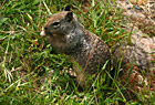

#385 — A picture of a squirrel eating something in the grass on the hills of Palo Alto, California.
Close up of a Squirrel
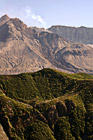
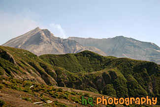
#541 — A close up picture taken of Mount St. Helens with a green hill in front and steam coming out of the dome. This picture was taken 25 years after the 1980 eruption and as you can see from the green hill there is re-growth from the destruction. Mount St. Helens is located in Gifford Pinchot National Forest and is a popular landmark of Washington State.
Mount St. Helens Close Up
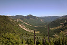
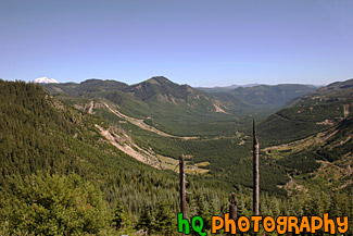
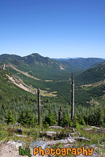
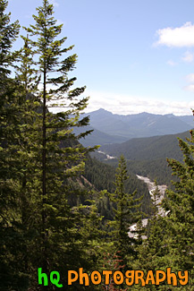
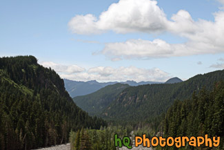
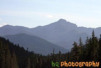
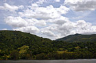
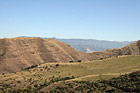
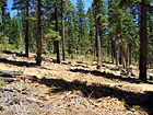
#533 — A scenic picture taken of the trees and landscape at Gifford Pinchot National Forest which is the Forest in which Mount St. Helens National Volcanic Monument lies. In this picture to the left you can see the tip of Mt. Rainier sticking over the top of the hill. The Gifford Pinchot National Forest is located in southwest Washington State. The Forest provides a wide variety of recreation opportunities. This forest was formerly known as the Columbia National Forest, but in 1949 it was renamed for Gifford Pinchot, an active conservationist and visionary environmentalist who became the first Chief of the Forest Service.
Gifford Pinchot National Forest
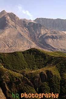
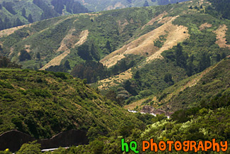
#528 — A scenic picture taken of Mount St. Helens National Volcanic Monument on a sunny day. In this picture you can see the volcano is active and letting out some steam. On this day there was a warning of 2 out of 3 and later this evening there was a 3.2 earthquake which the volcano let out even more steam. The last time Mount St. Helens really erupted was at 8:32 Sunday morning, May 18, 1980. Today, 25 years later, you can still see the destruction left from that blast, but you can also see a lot more green as things are starting to grow back. Back on May 18, 1980, Mount St. Helens was shaken by an earthquake measuring 5.1 on the Richter scale. Nearly 230 square miles of forest was blown over or left dead and standing. The eruption lasted 9 hours, but Mount St. Helens and the surrounding landscape were dramatically changed within moments.
Mount St. Helens & Steam
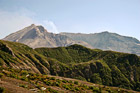
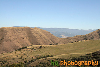
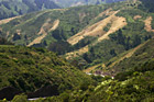
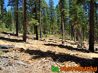
#1267 — A scenic picture taken of the surrounding mountains and new growth of Gifford Pinchot National Forest after the erruption of Mt. St. Helens.
Mountains and New Growth of Gifford Pinchot
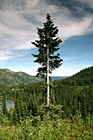
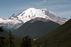
#654 — A scenic picture taken of a single evergreen tree on the hill above a lake in the Louise Lake in the Mount Rainier National Park. You can see part of the Louise Lake to the left and the hills in the national park in the background.
Evergreen Tree in Forest
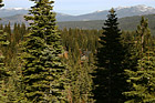
#1645 — A scenic vertical picture taken evergreen trees and hills seen in the background located at Mt. Rainier National Park in Washington.
Evergreen Trees & Hills
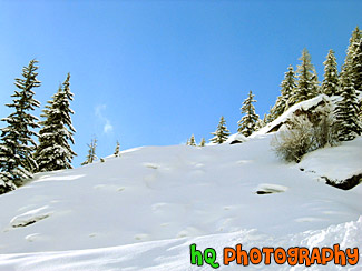
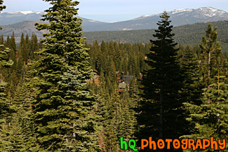
#1506 — A scenic picture taken of evergreen trees seen in the foreground and snow-capped hills seen in the background of Mt. Rainier National Park. This picture was taken from the Paradise area of Mt. Rainier.
Evergreen Trees & Snowy Hills
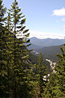
#1643 — A scenic picture taken of blue sky, clouds, and hills located in Mt. Rainier National Park. Tons of evergreen trees can be seen in this photo.
Hills & Clouds in Mt Rainier Park
#649 — A beautiful picture taken of the hills of Mount Rainier's National Park and the Cascade Mountains. This picture was taken looking west at a lookout while approaching Paradise.
Hills of Mount Rainier National Park
#1640 — A scenic picture taken of many hills seen in Mt. Rainier National Park during the summer season.
Hills of Mt. Rainier National Park
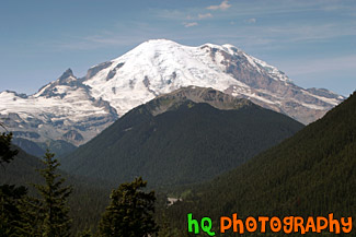
#142 — A beautiful picture of Mt. Rainier shot during August. This photo was taken near the White River Entrance in Mt. Rainier's National Forest. Blue sky is seen above the mountain with hills in the foreground.
Mt. Rainier Near White River Entrance
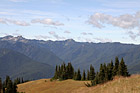
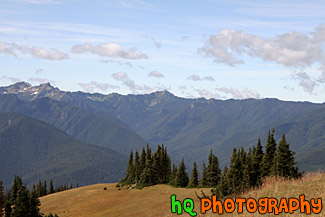
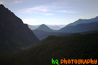
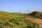
#1718 — A scenic picture taken of the hills and mountains of the Olympic National Park. This photo was taken from the Hurricane Ridge area on a sunny day.
Olympic Mountain Hills & Field
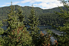
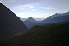
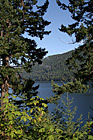
#1693 — A scenic picture taken of trees and mountains located around Lake Cresent in the Olympic National Park with partly cloudy skies.
Trees & Mountains Around Lake Cresent
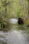
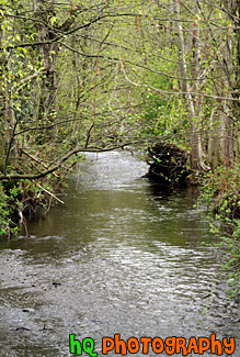
#36 — A photo of a small creek located near the Cascade Mountains foothills in Washington State. The Cascade Mountains are located close to Mt. Rainier.
Small Creek & Trees
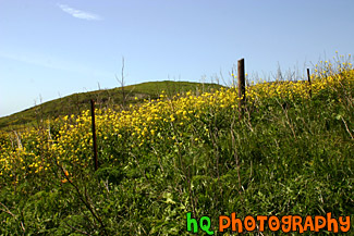
#374 — A scenic picture taken on of California Falselupine (Thermopsis Macrophylla) past Pt. Reyes near the California coast and Pacific Ocean in Marin County. This picture was taken on a sunny spring day in April.
California Yellow Wildflowers
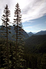
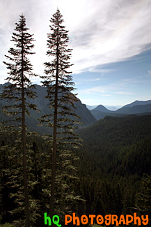
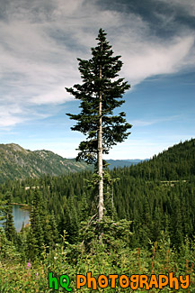
#161 — A scenic picture of two tall evergreen trees located in the middle of Mt. Rainier's National Park near Paradise and Mt. Rainier. This is a view looking west to the forest and some hills. This picture was taken during the summertime in August.
Two Tall Evergreen Trees
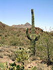
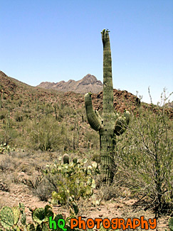
#148 — A scenic photo of a green catcus tree taken in the state of Arizona. This photo was taken on the desert land on a beautiful sunny day with blue sky overhead.
Cactus Tree
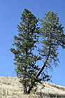
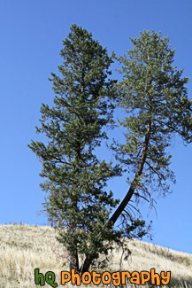
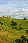
#2156 — A scenic vertical picture taken of a lone tree on a hill located in the state of Idaho.
Tree on Hill


#1356 — A scenic vertical picture taken of a bunch of graves on a green grass hill during the early morning as frost can be seen on the ground. The grave in the center as American flags on both sides of it.
Graves on a Hill
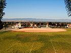
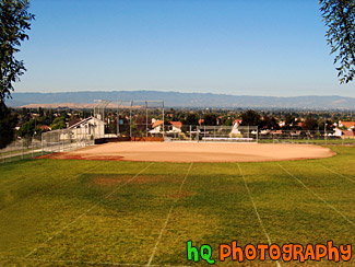
#218 — A scenic picture taken of a baseball field of a local high school located in the Evergreen San Jose, California area. This photo was taken of a baseball field through two trees on a beautiful sunny day. In the distance you can see the city of San Jose and the buildings.
High School Baseball Field
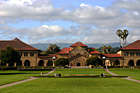
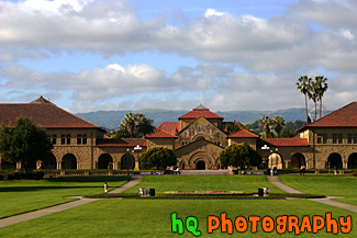
#358 — A scenic picture taken at the "Oval" at Stanford University in Palo Alto, California. The Oval is located down Palm Drive on the Stanford University campus. In this picture you can see the Stanford Memorial Church as well as the scenic green hills of Palo Alto behind the buildings in the distance.
Oval at Stanford University
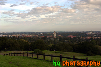
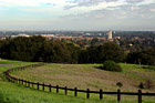
#330 — A scenic view of Stanford University taken from a hill up high just behind the campus. From this picture you can see Hoover Tower amongst all the other scenic buildings of Stanford University.
View of Stanford University from Hill
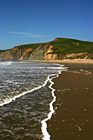
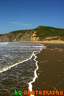
#369 — A scenic picture taken at Kehoe Beach in Marin County, California. In this picture you can see the white bubbles from the ocean wave coming to shore and making interesting lines towards the hill in the background.
Kehoe Beach Wave Lines
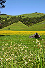
#367 — A scenic photo taken of a beautiful landscape scene with green grass, blue sky, close up wild flowers, and yellow flowers in Marin County, California. Marin County is just north of San Francisco. From 1850 to 1950 the population of Marin increased by 85,000 people. Twenty years later there were an additional 123,000 residents. Population growth has slowed since then and is now about 245,000. In 1972 the Golden Gate National Recreational Area was created which encompasses the Marin Headlands, Muir Woods and thousands of acres along the Pacific Coast.
Beautiful Marin County Landscape
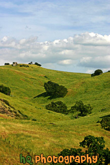
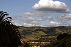
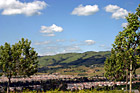
#318 — Scenic picture of the green hills of San Jose during February of 2005. This picture was taken at a spot on the east San Jose hills just north of the Evergreen area. The hills are especially green right now in February because of the tremendous rainfall the bay area has experienced this season. The rain has made for a some beautiful green hills surrounding San Jose, California.
Green Hills of San Jose
#364 — A scenic photo taken of a beautiful landscape scene with green grass, blue sky, and yellow flowers in Marin County, California. Marin County is just north of San Francisco. From 1850 to 1950 the population of Marin increased by 85,000 people. Twenty years later there were an additional 123,000 residents. Population growth has slowed since then and is now about 245,000. In 1972 the Golden Gate National Recreational Area was created which encompasses the Marin Headlands, Muir Woods and thousands of acres along the Pacific Coast.
Marin County Landscape of Hills
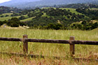
#6 — Rolling hills of Palo Alto, California on a sunny day. This photo was taken on the eastern hills between Palo Alto and Los Altos in the Bay Area.
Rolling Hills in California
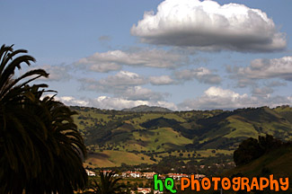
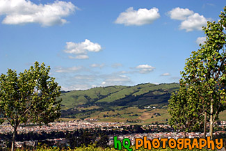
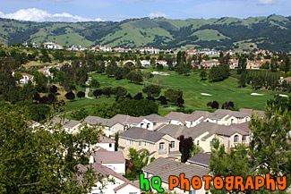
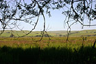
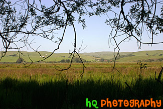
#950 — A scenic picture taken of a landscape scene in the East San Jose area near Evergreen Village. This picture was taken on a beautiful day with scattered clouds and blue sky. You can see the green hills from much rain this year in the background with shadows from the clouds over them.
Blue Sky, Green Hills, & Trees in San Jose
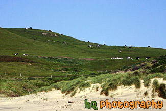
#764 — A scenic picture taken of a bunch of black and white spotted cows located on a big green hill along the coast at Kehoe Beach in Marin County California. In this picture you can see where the beach starts as the sand approaches the grass in the foreground.
Cows on Coastal Green Hill
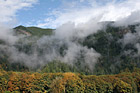
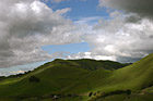
#1850 — A scenic picture taken of foggy hills near the entrance to the North Cascades National Park located in Washington State. In this picture you can see the fall colors starting to change on the trees and blue sky seen above.
Foggy Hills & Blue Sky
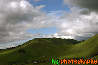
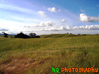
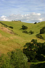
#350 — A scenic picture and contrast between a very green hill and partly cloudy blue skies. This picture was taken in San Jose of the very green hills (which are starting to turn brown) from the tremendous early 2005 rainfall.
Green Hill & Scenic Sky Scene
#766 — A scenic picture taken of a green hill filled with lots of green trees on a blue sky sunny day in East San Jose, California.
Green Hill & Trees
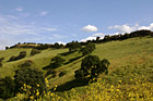

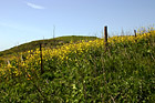
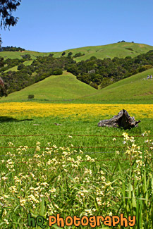
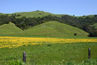
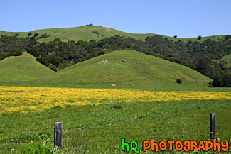
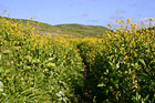
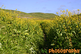
#765 — A scenic picture taken of a green hill, green trees, and yellow wildflowers blooming during spring in Northern California. This picture was taken in the East San Jose area.
Green Hill & Yellow Wildflowers
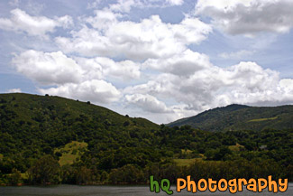
#885 — A scenic picture taken of a lake in the foreground, green rolling hills in the mid-ground, and interesting puffy white clouds and blue sky in the sky. This photo was taken near the Santa Cruz Mountains on the way to Santa Cruz, California near Highway 17.
Green Hill, Lake, & Puffy Clouds
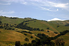
#884 — A scenic picture taken close up of one of the many rolling hills located in the San Jose Bay Area in California. In this picture you can see green hills with trees scattered over them on a sunny day.
Green Hill, Trees, & Blue Sky
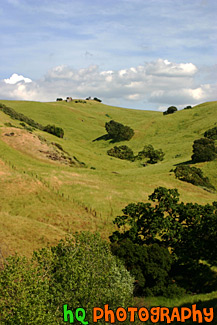
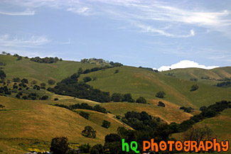
#473 — A scenic picture taken of some green hills with the shadows of the clouds on the hills from the partly cloudy sky. This picture was taken in South/East San Jose near the Silver Creek Valley area.
Green Hills & Partly Cloudy Sky
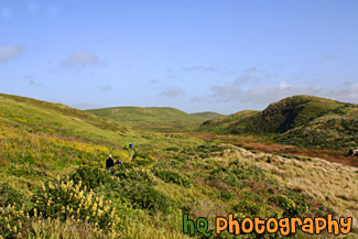
#805 — A scenic picture of people hiking on a trail near the coast at Kehoe Beach which is located in Marin County California. This is a beautiful picture as you can see the green hills and wildflowers of marin county along with some patchy fog in the background with the blue sky.
People Hiking on Green Trail
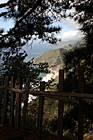
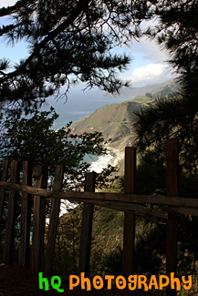
#1774 — A scenic vertical picture taken along the Highway 1 coast in California. This picture was taken looking down at the Pacific Ocean through a fence and trees on a hill. Hills along the coast are seen in the background.
Highway 1 Coast
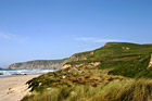
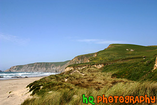
#763 — A scenic picture of a Marin County coastal view located at Kehoe Beach in California. In this picture you can see the green hills and long grass as the wind blows on this beautiful spring day.
Marin County Coast View
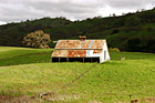
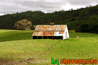
#317 — This is a scenic picture of an old barn in the middle of a big green grass field and hills. This barn is located over the hills of East San Jose. The hills are extremely green because of the un normal amount of rainfall that has hit this area in 2005 so far.
Green Grass and Old Barn
#468 — A scenic picture taken of a farm in Marin County, California. This picture was taken in the spring season when California received tons of rain therefore explaining the very green land and hills surrounding this farm. Marin County is located just north of San Francisco across the Golden Gate Bridge.
Farm in Marin County, California
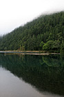
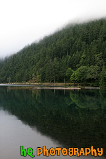
#1704 — A scenic vertical picture taken of a hill and its' reflection seen in Lake Cresent, located in the Olympic National Park.
Hill Reflection in Lake
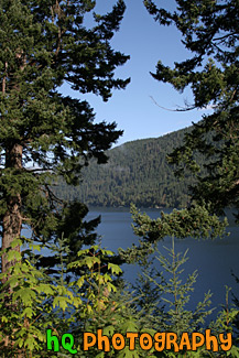
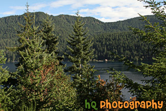
#1703 — A scenic vertical picture taken of Lake Cresent in the background seen through some green trees in the foreground. This photo was taken on a sunny day in the Olympic Mountains.
Lake Cresent and Trees
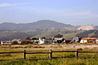
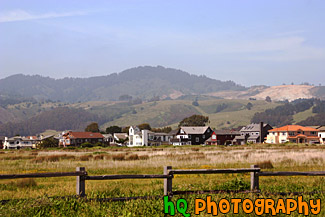
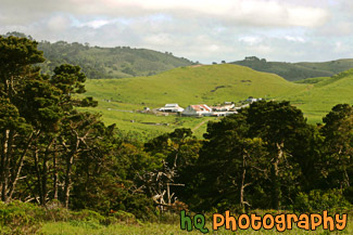
#955 — A scenic picture taken of a beautiful landscape scene located along the coast in California at Half Moon Bay. In this picture you see an old wooden fence in the foreground with a grass field that leads to some houses and green hills in the background. Half Moon Bay is located about 30 miles south of San Francisco, and only an hour's drive from pretty much anywhere in the Bay Area. Half Moon Bays' community offers numerous Bed and Breakfasts, several motels and some world-renowned hotels. Activities include surfing, whale watching, horseback riding on the beach, a historical Main Street with unique shops, two wineries, bird refuges, hiking and two lighthouses.
Half Moon Bay Hills & Houses
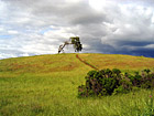
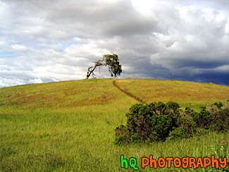
#4 — A photo of a lonely tree with a storm approaching on the golden hills of the California Bay Area. This photo was taken during Spring 2003 in Palo Alto area in CA.
Lonely Tree & Storm
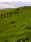
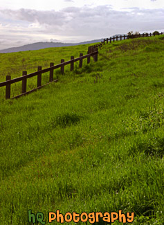
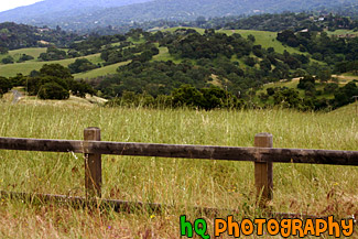
#329 — This is a scenic beautiful picture taken of a bright green grass field following a cury wooden fence in the hills of Palo Alto, California. This picture was taken up a trail behind the campus of Stanford University. The grass is especially green right now because of the tremendous rainfall the bay area has been having during this time period. Usually these fields are a golden yellow color because of the sunshine and lack of rainfall, hence the name "Golden Hills" of California. This hills can no longer live up to that name since they are all green! But they are so beautiful!
Bright Green Grass & Fence in Palo Alto
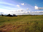
#2159 — A scenic picture taken of a landscape of some brown hills with a hint of green located in the state of Idaho. This was taken on a sunny day with blue skies seen above.
Brown Hills
#785 — A scenic picture taken close up of some golden and green hills located on the path towards Half Moon Bay, California. During late spring and the summer months in California, these golden hills are a very common site.
Close up of Golden Green Hills
#887 — A scenic picture taken in the country side of the Los Altos Hills in the Bay Area of California. In this picture an old wooden fence lines the foreground and the country green fields and hills can be seen in the background.
Country Fence & Green Fields
#888 — A scenic picture taken of the East San Jose landscape, green hills, blue sky, and houses in the area. This photo was taken in the Evergreen area.
East San Jose Landscape & Houses
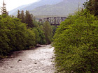
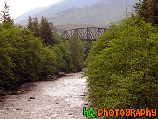
#91 — A river with an old bridge in the background. This photo was taken on a bridge looking out at the Green River located in Washington State. In this photo you can see the bunches of Evergreen trees.
Green River & Old Bridge
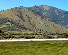
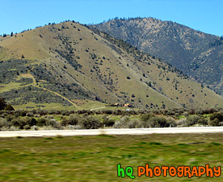
#68 — A scenic view of a little house off the I5 freeway heading towards California. You can tell this photo was taken while the car was moving because the grass in the foreground is blurry while the house and mountain in the distance are in focus.
House off the Freeway
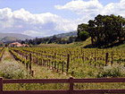
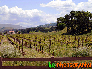
#21 — A photo of a farm in the countryside of Northern California. This farm was located out near Sacramento but not quite in the city. A fence and a wine field can be seen in the picture.
Out in the Country
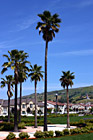
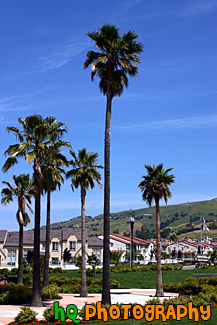
#750 — A scenic picture taken of some tall palm trees which are located at a park in the center of a housing development in East San Jose, California (the Evergreen area). This picture was taken on a sunny day with blue skies in the background.
Palm Trees in Housing Development
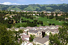
#357 — A scenic picture taken of the Silver Creek Valley area in East San Jose. From all the rain this area has been having during 2005, you can see the very green hills in the background.
Silver Creek Valley, San Jose
#200 — A view of the trees in the mountains of Lake Tahoe. Lake Tahoe is the second deepest lake in the United States and the tenth deepest in the world, with a maximum depth measured at 1,645 ft (501 m), average depth of 1,000 ft (305 m). The Lake Tahoe Basin was formed by geologic block (normal) faulting about 2 to 3 million years ago. A geologic block fault is a fracture in the Earth's crust causing blocks of land to move up or down. Snow, rain, and streams filled the southern and lowest part of the basin, forming the ancestral Lake Tahoe. Modern Lake Tahoe was shaped and landscaped by the scouring glaciers during the Ice Age. Many streams flow into Lake Tahoe, but the lake is drained only by the Truckee River, which flows northeast through Reno and into Pyramid Lake in Nevada.
Trees in the Mountains of Lake Tahoe
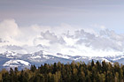
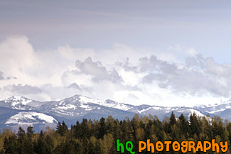
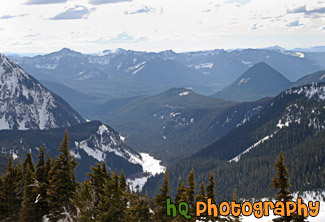
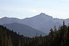
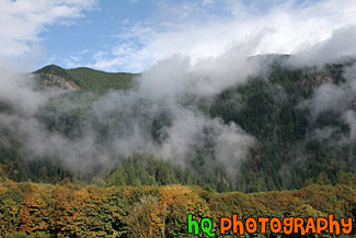
#1029 — A scenic picture taken of the Cascade Foothills located in Washington State near Mt. Rainier. In this photo you can see snow on the foothills, green evergreen trees in the foreground and some low clouds hovering over the mountains.
Cascade Foothills & Clouds
#55 — Bright blue sky among the snow in Snoqualmie, Washington. Snoqualmie is a popular place in the winter to go skiing among many people.
Blue Sky & Snow
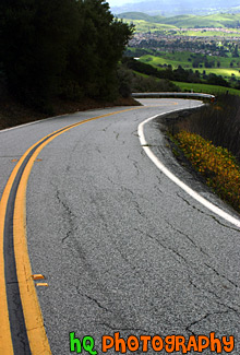
#326 — A scenic picture taken of a curvy road going down the hills of East San Jose. In this photo you can see the bright green hills in the distance from all the rain the bay area has been having during this time.
Road Leading to Green San Jose Hills
#287 — Scenic photo of a Lake Tahoe ski resort. Looking through the Evergreen trees you can see the buildings of the resort surrounded by the trees. Every winter tons of people migrate to Lake Tahoe to take advantage of the great skiing.
Tahoe Ski Resort View
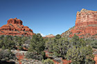
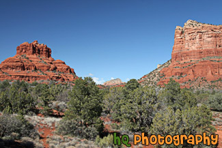
#2239 — A scenic picture taken of some of the Red Rock hills seen in Sedona Arizona State. This photo was taken with blue sky seen in the background. The rocks surrounding Sedona are red because of iron. Sandstone is porous, and when water carrying dissolved iron drains through the sandstone, some of the iron is left behind, and it is this iron in the form of iron oxide, which is red, that coats the grains of quartz and gives it color.
Red Rock in Sedona
#806 — A scenic picture of a beautiful hiking trail located by the coast in Marin County, California at Kehoe Beach. Marin County is a county located in California's San Francisco Bay Area across the Golden Gate Bridge fom San Franicsco. In this picture you can see Marin county's beautiful green hills along with the yellow falselupine wildflowers.
Marin County Coastal Trail
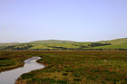
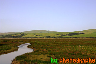
#948 — A scenic picture taken of the grasslands and hills in Marin County, California. This photo was taken near Point Reyes. In the photo you can see a stream of water along with the green hills in the background and green grassy field in the foreground. This photo was taken on a beautiful sunny day with blue sky seen all around.
Marin County Fieldland and Hills
#365 — A scenic picture taken in Point Reyes, California in Marin County. Point Reyes is home to many native land mammals which number about 37 species. Marine mammals also add to this total by another 12 species. The biological diversity stems from a favorable location in the middle of California and the natural occurrence of many distinct habitats which makes Point Reyes a fun place to visit.
Point Reyes Landscape Scene
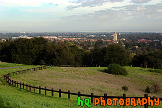
#331 — A scenic view of Stanford University taken from a hill up high just behind the campus. From this picture you can see Hoover Tower amongst all the other scenic buildings of Stanford University. In the foreground there is a wooden fence that curves along the trail.
Stanford University Hill Scene
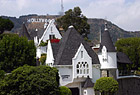
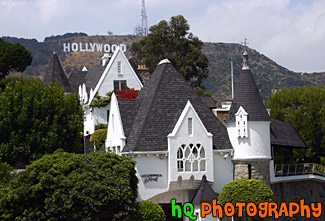
#388 — A scenic picture of the famous Los Angeles landmark, the Hollywood sign. This sign is located on the hills just north of the Hollywood strip and was taking with a scenic white, pointy house in the foreground. The Hollywood Sign originally said "Hollywoodland" in 1923 before it was shortened in 1945. The Hollywood Sign is the most famous sign in the world. It is located on Mount Lee in Griffith Park overlooking the city of Hollywood. It's illegal to hike to the Hollywood Sign, but there are many good vantage points from the streets of Hollywood. The Sign is a trademark of the Hollywood Chamber of Commerce. The Sign was declared Los Angeles Cultural-Historical Monument #111 in 1973 by the Cultural Heritage Board of the City of Los Angeles.
Hollywood Sign & Scenic House
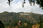
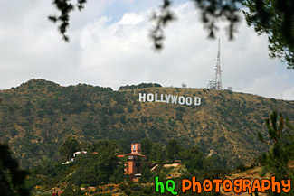
#390 — This is a picture taken of the famous Los Angeles landmark, The "Hollywood" sign. The Hollywood Sign originally said "Hollywoodland" in 1923 before it was shortened in 1945. The Hollywood Sign is the most famous sign in the world. It is located on Mount Lee in Griffith Park overlooking the city of Hollywood. It's illegal to hike to the Hollywood Sign, but there are many good vantage points from the streets of Hollywood. The Sign is a trademark of the Hollywood Chamber of Commerce. The Sign was declared Los Angeles Cultural-Historical Monument #111 in 1973 by the Cultural Heritage Board of the City of Los Angeles.
Hollywood Sign on Hill
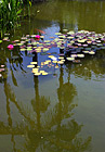
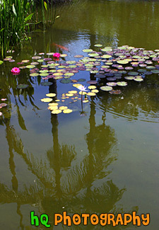
#389 — A scenic picture of a flower, water lillies, and reflection of a palm tree taken at Rogers Memorial Park in Beverly Hills, California. The Will Rogers Memorial Park was the first municipal park in Beverly Hills, originally opened under the name of Sunset Park in 1915. The park was renamed in 1952 to honor the entertainer and honorary mayor of Beverly Hills, Will Rogers.
Lilly, Pond & Palm Tree Reflection
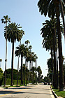
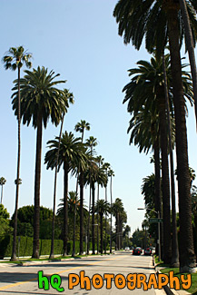
#751 — A scenic picture taken of the hundreds of palm trees located in Beverly Hills while approaching the famous Sunset Boulevard street. This picture was taken on a sunny day with blue sky above the palm trees. Sunset Boulevard is one of the world's most famous streets. Sunset Boulevard passes through Hollywood, then becomes the Sunset Strip as it passes through West Hollywood, weaves its way through Beverly Hills and Bel-Air, and finally winds its way through the rustic foothills of the Santa Monica mountains, to finally end at the Pacific Ocean near Malibu.
Palm Trees Leading to Sunset Blvd.
