Photos of Beautiful (114)
There are (114) photos of the keyword, Beautiful, available on our website. They are pictured below.The pictures are organized by category.


#731 — A close up picture taken of a brown horse's face. This horse was located in Half Moon Bay, California on a ranch.
Close Up of Brown Horse Face
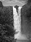
#90 — A black and white photo of the Snoqualmie Falls, which is located in Snoqualmie, Washington. This waterfall is an historic site in the state of Washington. Snoqualmie Falls is one of Washington state's most popular scenic attractions.
Black & White Snoqualmie Falls
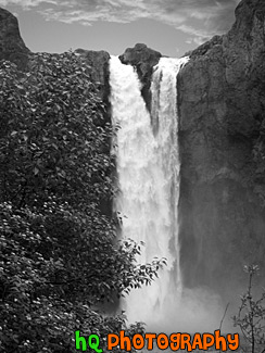
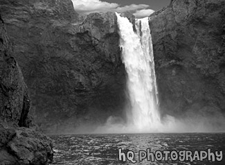
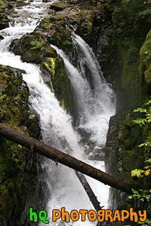
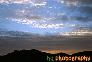
#89 — A black and white picture taken of the Snoqualmie Falls which is located in Snoqualmie, Washington. This waterfall is an historic site in the state of Washington. Snoqualmie Falls is one of Washington state's most popular scenic attractions. More than 1.5 million visitors come to the Falls every year.
Snoqualmie Falls in Black & White
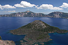
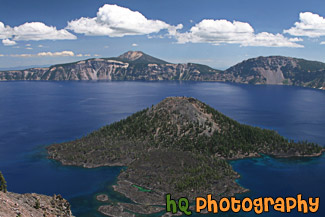
#2351 — A scenic picture taken of the blue waters of Crater Lake and Wizard Island. This photo was taken on a sunny summer day.
Crater Lake & Wizard Island
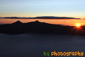
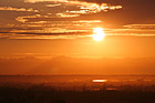
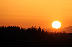
#2353 — A scenic picture taken of the sun setting at Crater Lake National Park in Oregon. In this photo you can see the orange sky from the sunset and the silhouette of the mountains surrounding the lake.
Crater Lake Sunset
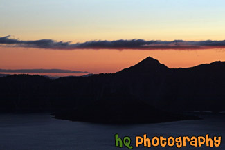
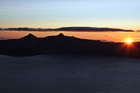
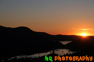
#2350 — A scenic picture taken of the sunset located at Crater Lake National Park in Oregon. In this picture you can see the orange sky of the sunset and the black silhouette of the mountains surrounding the lake.
Crater Lake Sunset Silhouette
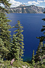
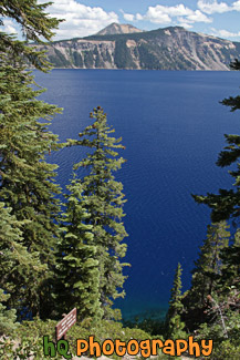
#2352 — A scenic picture taken of Crater Lake National Park located in Oregon State. In this picture you can see the super blue waters of the lake.
Crater Lake Through Trees
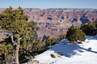
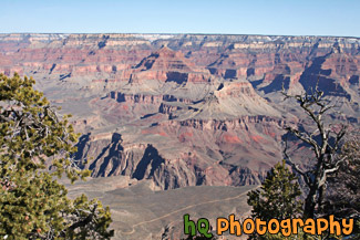
#2327 — A scenic picture taken of the Grand Canyon during March of 2010 when snow is still seen at the top. Green trees are seen in front of the snow and blue sky is above.
Grand Canyon Snow and View
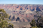
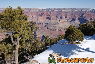
#2326 — A scenic picture taken of the Grand Canyon from the South Rim during March of 2010. Green trees can be seen in the foreground and blue sky is above.
Grand Canyon View
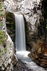
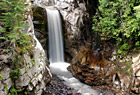
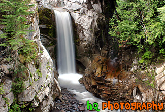
#633 — A close up picture taken of Christine Falls which is located in Mount Rainier's National Park in Washington State. This picture was taken with a slow shutter speed to get the streaming / silky effects of the waterfall.
Christine Falls
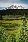
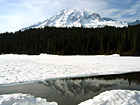
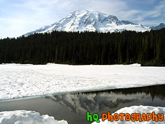
#748 — A scenic picture taken of Mount Rainer, some evergreen tress in the foreground and background, and part of Reflection Lake in the distance. This picture was taken during summertime which is why there is not very much snow on the mountain and everything is so green.
Mount Rainier, Trees, & Lake
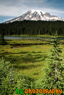
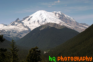
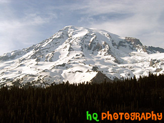
#137 — A beautiful picture of Mt. Rainier shot during the beginning of June. This photo was taken near Paradise in Mt. Rainier's National Forest. "The Mountain", as it's known by natives, draws your eyes like a magnet when it is visible and not invisible behind clouds. It also draws over two million visitors each year. Mount Rainier and the surrounding foothills were designated as a national park in 1899. On clear days, Mount Rainier dominates the Seattle - Tacoma skyline, towering over the metropolis in breathtaking beauty. Mount Rainier is 14,410 feet high at the Summit, also called Columbia Crest.
Mt. Rainier Through Evergreen Trees

#630 — A beautiful picture taken of Nickel Creek which turns into Cougar Falls and is located in Mount Rainier's National Park in Washington State. This picture was taken with a slow shutter speed to get the effects of the "streaming" like water coming off the rocks.
Nickel Creek
#629 — A scenic picture tkaen of Reflection Lakes which is located in the Mount Rainier National Park in Washington State. Reflection lakes is a beautiful spot in the park to take many interesting pictures.
Reflection Lakes
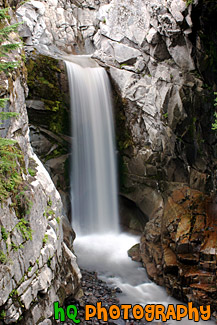
#641 — A beautiful picture taken of Christine Falls which is located in Mount Rainier's National Park in Washington State. This picture was taken with a slow shutter speed to get the streaming / silky effects of the waterfall. Christine Falls is located west of Paradise and about 1-2 miles away from Narada Falls.
Christine Falls, Cotton Candy Effect
#649 — A beautiful picture taken of the hills of Mount Rainier's National Park and the Cascade Mountains. This picture was taken looking west at a lookout while approaching Paradise.
Hills of Mount Rainier National Park
#138 — A beautiful picture of Mt. Rainier shot during the beginning of June. This photo was taken at Reflection Lake in Mt. Rainier's National Forest. The lake is still covered in snow, but there was a little opening where you can see a reflection.
Mt. Rainier at Snow Covered Reflection Lake
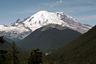
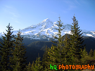
#142 — A beautiful picture of Mt. Rainier shot during August. This photo was taken near the White River Entrance in Mt. Rainier's National Forest. Blue sky is seen above the mountain with hills in the foreground.
Mt. Rainier Near White River Entrance
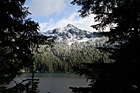
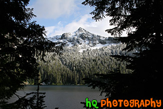
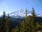
#1762 — A scenic picture taken of snow covered Mother Mountains in the background of Mowich Lake located near the Caron River Entrance to Mt. Rainier National Park. Silhouettes of trees are seen in the foreground and blue sky is seen above.
Snowy Mountains Through Tree Silhouettes
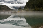
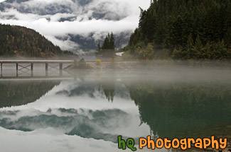
#1760 — A scenic picture taken of the Diablo Lake and reflections of the sky, clouds, bridge, and mountains in the lake. Diablo Lake is located in the North Cascades Mountains in Washington State.
Diablo Lake Reflection
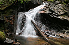
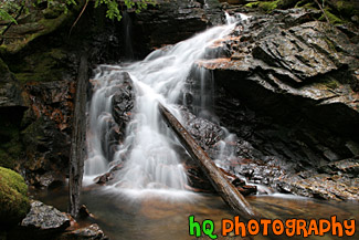
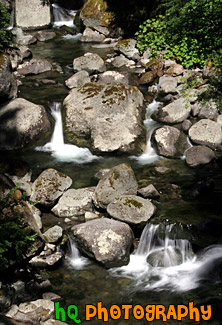
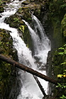
#1777 — A scenic picture taken of a waterfall with the cotton candy silky effect. This photo was taken with a slow shutter speed to get the streaming look of the waterfall.
Waterfall, Rocks, & Logs
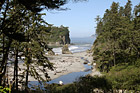
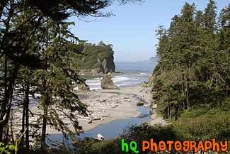
#1695 — A scenic picture looking down at Ruby Beach from the lookout point at the top of the trail heading down to the beach. Ruby Beach is located in the Olympic National Park in Washington State. This photo was taken of a sunny day as you can see people on the beach enjoying the nice weather.
Looking Down at Ruby Beach
#1685 — A scenic vertical picture taken of Sol Duc Fall which is formed from the Sol Duc River spilling out over the cliff. The Sol Duc Falls is one of the wonders of Olympic National Park and is located on the north side of a lush rain forest.
Sol Duc Falls
#405 — This picture was taken of a beautiful sunset near the entrence to Yosemite National Park just a couple miles west of Groveland and Big Oak Flat. You can see part of the reservoir to Don Pedro Lake in between the hills. Yosemite is located in east-central California and lies 105 miles north of Fresno, 195 miles east of San Francisco, 313 miles north of Los Angeles and 350 miles northwest of Las Vegas. The gross area acres for the national park is Gross Area Acres for 761,266 and receives about 3,300 total recreational visits per year. The elevation in the park ranges from from 2000 feet to over 13,000 feet. The cliffs, waterfalls, steep mountains and deep lakes of Yosemite National Park were all formed over millions of years by earthquakes, glaciers and numerous other forces of nature.
Sunset at Hills near Yosemite
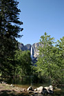
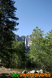
#728 — A scenic picture taken of the famous Yosemite Falls from a distance with beautiful foreground of trees, rocks, and water during a sunny day in early mid June. This waterfall is actually composed of three falls: Upper, Middle Cascades, and the Lower fall. Together they have a combined height of 2,425 feet which is more than 9 times the height of Niagara Falls.
Yosemite Falls in Distance

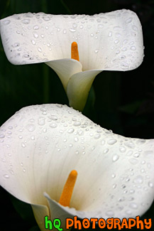
#328 — A scenic picture taken of two beautiful white Arum Lily flowers which were taken in Santa Cruz, California. When you look closely at the flowers you can see the early morning water droplets laying on the pedals of the flowers. The Arum Lily has soft leaves and a spongy stem. Male and female flowers are clustered on a central yellow spadix with a creamy-white spathe. The Arum Lily grows in marshy areas from sea level to mountains.
Close Up of White Arum Lily Flowers


#1373 — A beautiful scenic picture taken of two purple flowers up close with the background out of focus.
Purple Flowers Up Close

#1376 — A scenic vertical picture taken close up of three purple flowers with sunlight shining on them. The background in this photo is out of focus.
Scenic Purple Flowers

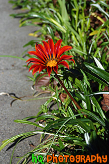
#290 — A photo of a scenic red flower taken in the Mission Gardens at Santa Clara University. The Mission Gardens are full of all kinds of beautiful flowers.
Scenic Red Flower


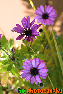
#322 — A scenic picture of three purple flowers close up. These flowers were photographed at the San Francisco Zoo.
Three Purple Flowers


#2308 — A scenic picture taken up close of a bunch of red and yellow tulip flowers with water drops seen on them. These tulips were found at the skagit valley tulip festival in Mount Vernon, Washington.
Red & Yellow Tulips Up Close


#2303 — A close up scenic vertical picture taken of some red tulip flowers with water drops on them. These flowers were taken at the Tulip Festival located in Skagit Valley, Washington State.
Red Tulips Close Up


#2043 — A scenic close up vertical picture taken of a yellow sunflower located in western Idaho.
Sunflower


#2339 — A close up picture taken of a lot of yellow tulip flowers located in Skagit Valley, Washington during the annual tulip festival.
Yellow Tulips
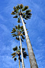
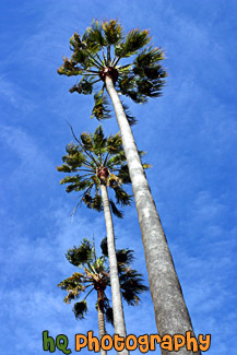
#288 — A beautiful scenic photo of looking up at three palm trees on a sunny day. In this photo the blue sky is bright with few clouds and all three palm trees are lined up perfectly. This photo was taken on the campus at Santa Clara University in the Mission Gardens.
Three Palm Trees & Blue Sky
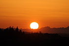
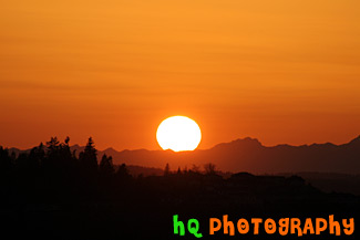
#270 — A beautiful close up picture taken of the big orange sun stetting over the Olympic Mountains located in Washington State. This picture was taken from Bonney Lake looking towards Tacoma and the Olympic Mountains. In the foreground you can see the silhouettes of some hills with houses on them.
Big Sun Setting Over Olympic Mountains

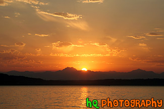
#1119 — A beautiful picture of an orange sunset with blue sky seen above, clouds, and the sun rays shining through. This photo was taken from Bonney Lake looking over the valley towards Tacoma, Washington.
Blue Sky, Clouds & Orange Sunset
#543 — A scenic picture taken of a sunset with blue sky, dramatic clouds, and orange sunet beams shining over the black silhouette hill. This picture was taken looking towards the Pacific Ocean from San Francisco, California.
Dramatic Sunset
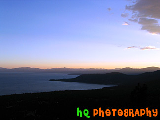
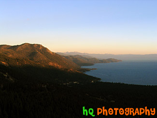
#204 — A pretty view at Lake Tahoe during July 2004. Lake Tahoe is the second deepest lake in the United States and the tenth deepest in the world, with a maximum depth measured at 1,645 ft (501 m), average depth of 1,000 ft (305 m). The Lake Tahoe Basin was formed by geologic block (normal) faulting about 2 to 3 million years ago. A geologic block fault is a fracture in the Earth's crust causing blocks of land to move up or down. Snow, rain, and streams filled the southern and lowest part of the basin, forming the ancestral Lake Tahoe. Modern Lake Tahoe was shaped and landscaped by the scouring glaciers during the Ice Age. Many streams flow into Lake Tahoe, but the lake is drained only by the Truckee River, which flows northeast through Reno and into Pyramid Lake in Nevada.
Lake Sunset, Lake Tahoe

#1117 — A scenic picture taken of a beautiful sunset taking place over the Olympic Mountains in Washington State. This photo was taken from across the city of Seattle at Alki Beach. In the photo you can see a ferry boat in the Puget Sound.
Olympic Mountains Sunset from Alki Beach
#1118 — A scenic picture taken of an orange sunset looking at the Olympic Mountains in Washington State. This photo was taken across from Seattle at Alki Beach. You can see the sun's reflection in the Puget Sound as it falls behind the mountains.
Orange Sunset Behind Olympic Mountains
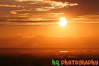
#1099 — A beautiful orange sunset taken looking at Tacoma, Washington. In this photo you can see the reflection of the sun in the sound waters in Tacoma. Also in the background you can see the Olympic Mountains faintly.
Orange Sunset in Tacoma, Wa
#372 — A scenic picture taken of a sunset over the hills of Mt. Tamalpais State Park near San Francisco. This picture was taken at the Golden Gate Bridge looking over towards the Pacific Ocean. You can see a silhouette of the hills in the foreground.
San Francisco Sunset
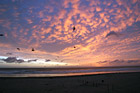
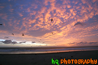
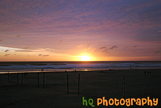
#432 — A scenic picture taken of a colorful pink and purple sunset at Seaside, Oregon with birds flying in the picture. Seaside contains 3 miles of powder-soft beach and 2 miles of manicured, ocean front boardwalk which make Seaside a popular tourist town. A pleasant 90 minute drive from Portland, Seaside is a first choice destination for north and southbound travelers. In Seaside you'll find dozens of delightful mini-malls, specialty boutiques, antique shops, art galleries, museums, arcades and cinemas.
Seaside, Oregon Sunset & Birds
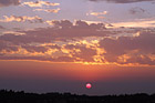
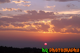
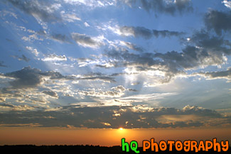
#1818 — An interesting sunset picture with a red sun and the sky showing colors of blue, purple, pink, and orange.
Beautiful Sunset & Red Sun
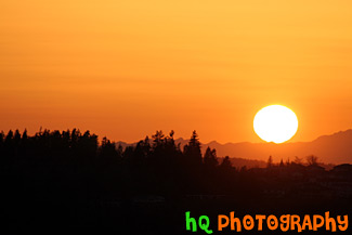
#1397 — A beautiful close up picture taken of a big orange sun settting over the Olympic Mountains located in Washington State. Ths sun is just about to go behind the mountains.
Big Orange Sunset

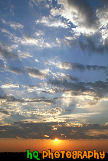
#1120 — A scenic vertical picture taken of blue sky, clouds, and an orange sunset over a hill. This picture was taken in Washington State looking towards Tacoma. In this photo you can see the sun rays shining through the clouds.
Interesting Sky With Clouds & Sunset
#544 — A scenic picture taken of a beautiful sunset over the Pacific Ocean just off the coast of San Franicsco, California. In this picture you can see a silhouette of the hills along the California coast.
Pacific Ocean California Sunset
#24 — A scenic picture taken of a sunset in Washington State where beautiful sunsets are seen during the evenings. This picture captured a colorful pink and purple sunset on this particular evening in Washington.
Pink and Purple Sunset
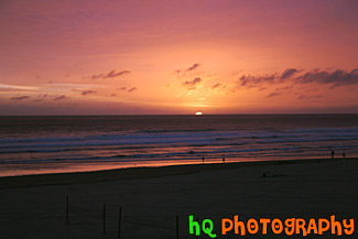
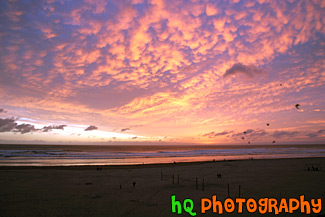
#994 — A beautiful sunset picture taken along the coast at Seaside, Oregon. In this picture you can see volleyball nets in the sand and some people walking along the shore enjoying this spectacular sunset. Seaside is a popular tourists destination in Oregon.
Seaside, Oregon Beautiful Sunset
#683 — A scenic picture of the sun setting behind the Pacific Ocean along the coast of Seaside, Oregon. This dramatic orange, pink, and purple sunset made for a beautiful night at the beach.
Sun Setting Behind Ocean
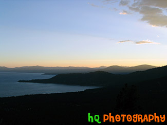
#203 — A pretty view at Lake Tahoe during July 2004. Lake Tahoe is the second deepest lake in the United States and the tenth deepest in the world, with a maximum depth measured at 1,645 ft (501 m), average depth of 1,000 ft (305 m). The Lake Tahoe Basin was formed by geologic block (normal) faulting about 2 to 3 million years ago. A geologic block fault is a fracture in the Earth's crust causing blocks of land to move up or down. Snow, rain, and streams filled the southern and lowest part of the basin, forming the ancestral Lake Tahoe. Modern Lake Tahoe was shaped and landscaped by the scouring glaciers during the Ice Age. Many streams flow into Lake Tahoe, but the lake is drained only by the Truckee River, which flows northeast through Reno and into Pyramid Lake in Nevada.
Sunset & Sky of Lake Tahoe
#665 — A scenic picture taken of a sunset behind the reservoir to Don Pedro Lake in between the hills and mountains surrounding Yosemite National Park in California. The picture was taken near the entrence to Yosemite National Park just a couple miles west of Groveland and Big Oak Flat. Yosemite is located in east-central California and lies 105 miles north of Fresno, 195 miles east of San Francisco, 313 miles north of Los Angeles and 350 miles northwest of Las Vegas.
Sunset Behind Don Pedro Lake
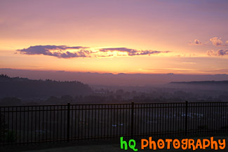
#1061 — A scenic picture taken of a beautiful pink and purple sunset over the Olympic Mountains seen in the background. This picture was taken looking over the valley of Sumner, Washington from Bonney Lake looking through a black cast iron fence.
Sunset Over Valley
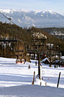
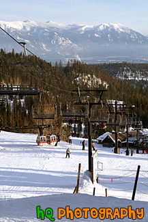
#1179 — A scenic picture taken at the Big Mountain Ski Resort located in Montana State. This picture is taken of a ski lift with the mountains of Montana seen in the background. This photo was taken on a beautiful sunny day.
Big Mountain, Montana Ski Lift
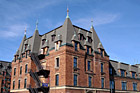
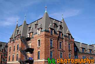
#937 — A close up scenic picture taken of the historic Stadium High School on a sunny blue sky day. Stadium High School is located in downtown Tacoma, Washington and is an 100 year old high school. The building was originally intended by its financiers, the Northern Pacific Railroad Company and Tacoma Land Company, to be one of the finest luxury hotels on the Pacific Coast. Over the years, Stadium students have created and installed stained glass windows, metal sculptures, ceramic mosaics and other works of art, enhancing the beauty of the building. Since 1977, Stadium has been listed in the National Register of Historic Places. Its exterior was used in the 1999 movie 10 Things I Hate About You.
Blue Sky & Stadium High School

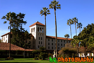
#289 — A scenic photo of the Mission Gardens and Nobili Hall located at Santa Clara University on a beautiful sunny day with bright blue sky. Santa Clara University is located in the heart of California's Silicon Valley. It offers a rigorous undergraduate curriculum in the arts and sciences, business, and engineering. It has nationally recognized graduate and professional schools in business, law, engineering, pastoral ministries, and counseling psychology and education.
The 8,047-student, Catholic, Jesuit university has a 153-year tradition of educating the whole person for a life of service and leadership. Santa Clara was founded in 1851 by the Society of Jesus as "Santa Clara College," is California's oldest institution of higher learning. It was established on the site of the Mission Santa Clara de Asis, the eighth of the original 21 California missions. At the center of the campus is the Mission Santa Clara de Asis, surrounded by the roses and palm trees of the historic Mission Gardens.
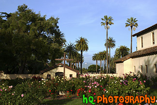
Mission Gardens, Santa Clara University
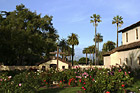
#355 — A scenic picture taken at Santa Clara University from the right side of Mission Santa Clara de Asis looking out towards Santa Clara's main entrance. This campus is very beautiful as it is covered with these pretty palm trees, beautiful flowers, and wonderful architecture. You can also see the scenic green hills of San Jose in the background. These hills make this view even more beautiful as its not always that these hills are this green.
Beautiful Palms of Santa Clara University
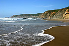
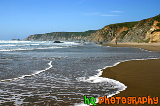
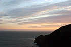
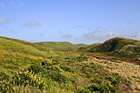
#1395 — A scenic picture taken of the Kehoe Beach located near Marin County, California along the coast of the Pacific Ocean. The waves are washing up onto the shore of this big beach.
Kehoe Beach, California
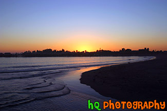
#291 — Scenic photo of a sunset taking place over the beach and ocean at Santa Cruz, California. Santa Cruz is a popular travel spot for surfers and people that want to come visit the ocean.
Sunset at Santa Cruz, California
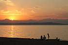
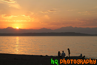
#1124 — A scenic picture taken of a family enjoying a beautiful sunset along the beach at Alki Beach which is located across the Puget Sound from Seattle, Washington. The sun is setting over the Olympic Mountains in this photo.
Alki Beach Sunset & People
#791 — A scenic picture taken of a beautiful pink and purple sunset sky at the beach in Seaside, Oregon. In this picture you can see people on the beach and some birds flying in the sky. Seaside contains 3 miles of powder-soft beach and 2 miles of manicured, ocean front boardwalk which make Seaside a popular tourist town. A pleasant 90 minute drive from Portland, Seaside is a first choice destination for north and southbound travelers. In Seaside you'll find dozens of delightful mini-malls, specialty boutiques, antique shops, art galleries, museums, arcades and cinemas.
Seaside Oregon Beach Sunset
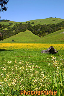
#367 — A scenic photo taken of a beautiful landscape scene with green grass, blue sky, close up wild flowers, and yellow flowers in Marin County, California. Marin County is just north of San Francisco. From 1850 to 1950 the population of Marin increased by 85,000 people. Twenty years later there were an additional 123,000 residents. Population growth has slowed since then and is now about 245,000. In 1972 the Golden Gate National Recreational Area was created which encompasses the Marin Headlands, Muir Woods and thousands of acres along the Pacific Coast.
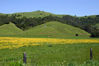
Beautiful Marin County Landscape
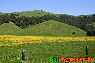
#318 — Scenic picture of the green hills of San Jose during February of 2005. This picture was taken at a spot on the east San Jose hills just north of the Evergreen area. The hills are especially green right now in February because of the tremendous rainfall the bay area has experienced this season. The rain has made for a some beautiful green hills surrounding San Jose, California.
Green Hills of San Jose
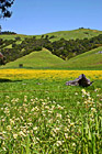
#364 — A scenic photo taken of a beautiful landscape scene with green grass, blue sky, and yellow flowers in Marin County, California. Marin County is just north of San Francisco. From 1850 to 1950 the population of Marin increased by 85,000 people. Twenty years later there were an additional 123,000 residents. Population growth has slowed since then and is now about 245,000. In 1972 the Golden Gate National Recreational Area was created which encompasses the Marin Headlands, Muir Woods and thousands of acres along the Pacific Coast.
Marin County Landscape of Hills
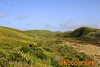
#805 — A scenic picture of people hiking on a trail near the coast at Kehoe Beach which is located in Marin County California. This is a beautiful picture as you can see the green hills and wildflowers of marin county along with some patchy fog in the background with the blue sky.
People Hiking on Green Trail
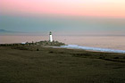
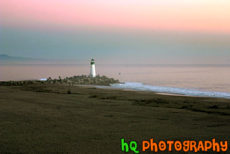
#293 — A scenic photo of a lighthouse taken on the beach at Santa Cruz, California. Downtown Santa Cruz is a year-round recreation and tourist destination with over 300 days of sunshine per year. It also has many shopping and entertainment opportunities available for all types of people.
Lighthouse at Santa Cruz, California
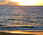
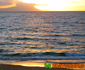
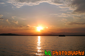
#177 — A beautiful sunset over the Pacific Ocean located in Makena on the island of Maui, Hawaii. From this photo you can see the colors of the sunset reflected in the Pacific Ocean and the beach.
Ocean Sunset
#793 — A scenic picture taken of the Pacific Ocean and the west coast in California in a beautiful sunny day. In this picture you can see many hills of the coast along with rocks and the scenic road and a beautiful bridge in the background.
Pacific Ocean Coast in California
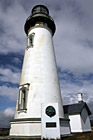
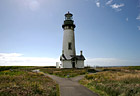
#583 — A close up scenic picture taken of the Yaquina Head Lighthouse which is located along the coast of Oregon State and the Pacific Ocean. This picture was taken on a partly cloudy day. This historic lighthouse is 93 (28 m) feet tall and was built in 1872-73. Its light towers are 162 feet (49 m) above the sea, and can be seen about 19 miles (32 km) out to sea. This lighhouse was automated in 1966 in which the light flashes two seconds on, two off, two on, 14 off, then repeats. Each light has its own pattern so it will not be confused with other lights.
Yaquina Head Lighthouse
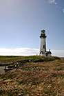
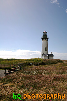
#776 — A vertical scenic picture taken of the Yaquina Head Lighthouse with a bench in the foreground located in Oregon State. Off to the left you can see glares from the sun shining toward the lighthouse. This historic lighthouse is 93 (28 m) feet tall and was built in 1872-73. Its light towers are 162 feet (49 m) above the sea, and can be seen about 19 miles (32 km) out to sea. This lighhouse was automated in 1966 in which the light flashes two seconds on, two off, two on, 14 off, then repeats. Each light has its own pattern so it will not be confused with other lights.
Bench & Yaquina Head Lighthouse
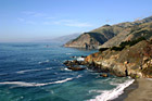
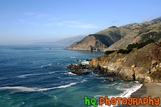
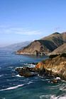
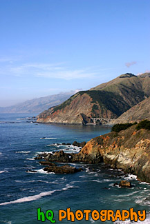
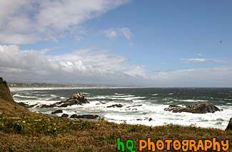
#352 — A scenic picture of the coast along the Pacific Ocean in Northern California. This picture was taken along the scenic highway of Highway 1 between Monterey and Santa Barbara. In the distance you can see a scenic bridge along the road.
Coast Scene & Hills
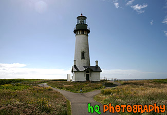
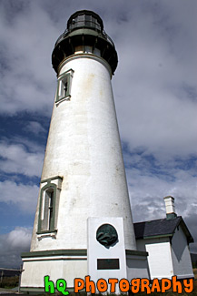
#775 — A scenic picture taken of the Yaquina Head Lighthouse with the sun glaring off to the left. Yaquina Head Lighthouse is located along the coast of Oregon State and the Pacific Ocean. This historic lighthouse is 93 (28 m) feet tall and was built in 1872-73. Its light towers are 162 feet (49 m) above the sea, and can be seen about 19 miles (32 km) out to sea. This lighhouse was automated in 1966 in which the light flashes two seconds on, two off, two on, 14 off, then repeats. Each light has its own pattern so it will not be confused with other lights.
Looking at Yaquina Head Lighthouse
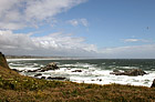
#778 — A scenic picture taken of the beautiful coast and Pacific Ocean along the shore of Newport, Oregon. This picture was taken near the Yaquina Head Lighthouse looking toward the shore. The puffy clouds and blue sky add character to this picture. Newport today is a bustling coastal community of over 9,000. It's heart is along a working waterfront on Yaquina Bay where fishing fleets and fresh seafood markets coexist with galleries, gift shops, restaurants and family attractions. Across the bay is the acclaimed Oregon Coast Aquarium and the Hatfield Marine Science Center. Historic Nye Beach, 2 lighthouses, museums and wide sandy beaches provide activity for people of all ages.
Newport, Oregon Coastal Scene
#626 — A scenic picture taken of some ocean rocks and the Point Bonita Lighthouse which is located just north - west of the Golden Gate Bridge and San Francisco, California. Point Bonita was the site of the first fog signal on the Pacific coast. The fog signal, which went into service on August 8, 1855, was an army surplus cannon fired every half hour in foggy weather. Point Bonita was the third lighthouse built in the San Francisco Bay area (in 1855) and was unique. The original tower, built separate from the residence, provided a lonely existence for the initial light keepers. There were no inhabitants for five miles and no direct communication. It was so inhospitable that seven keepers were employed within the first nine months of the operation of the light. Point Bonita was the last manned lighthouse on the California coast. The last keeper left in April 1981. It is now a part of the Golden Gate National Recreation Area and is run by the National Park Service. The Coast Guard continues to maintain the light and fog signal.
Point Bonita Lighthouse
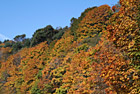
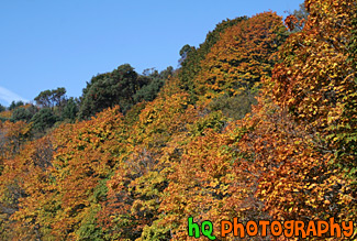
#1146 — A scenic picture taken of a bunch of trees changing color together during a beautiful sunny fall day as you can see blue sky above the trees.
Trees Changing Color
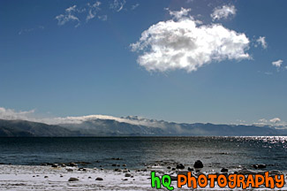
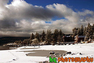
#285 — Beautiful scenic view of lake tahoe taken right after a snow storm. This photo is gorgeous because of the blue skies contrasting the freshly fallen snow covereing the shore and beach.
Beautiful Lake Tahoe Snow View
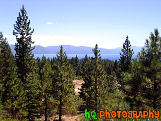
#199 — A pretty view at Lake Tahoe looking through the trees of the mountains during July 2004. Lake Tahoe is the second deepest lake in the United States and the tenth deepest in the world, with a maximum depth measured at 1,645 ft (501 m), average depth of 1,000 ft (305 m). The Lake Tahoe Basin was formed by geologic block (normal) faulting about 2 to 3 million years ago. A geologic block fault is a fracture in the Earth's crust causing blocks of land to move up or down. Snow, rain, and streams filled the southern and lowest part of the basin, forming the ancestral Lake Tahoe. Modern Lake Tahoe was shaped and landscaped by the scouring glaciers during the Ice Age. Many streams flow into Lake Tahoe, but the lake is drained only by the Truckee River, which flows northeast through Reno and into Pyramid Lake in Nevada.
Lake Tahoe Through Trees
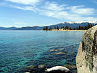
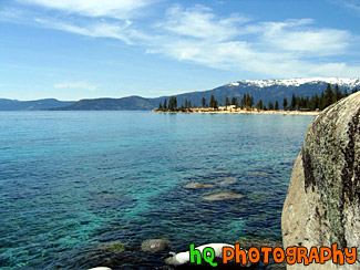
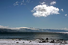
#18 — A pretty view of Lake Tahoe during Spring 2003. Lake Tahoe is the second deepest lake in the United States and the tenth deepest in the world, with a maximum depth measured at 1,645 ft (501 m). In this photo you can see a big rock on the right and the see through water of the lake. Mountains are also visible that surround the lake.
Lake Tahoe Waters
#205 — A pretty view at Lake Tahoe during July 2004. Lake Tahoe is the second deepest lake in the United States and the tenth deepest in the world, with a maximum depth measured at 1,645 ft (501 m), average depth of 1,000 ft (305 m). The Lake Tahoe Basin was formed by geologic block (normal) faulting about 2 to 3 million years ago. A geologic block fault is a fracture in the Earth's crust causing blocks of land to move up or down. Snow, rain, and streams filled the southern and lowest part of the basin, forming the ancestral Lake Tahoe. Modern Lake Tahoe was shaped and landscaped by the scouring glaciers during the Ice Age. Many streams flow into Lake Tahoe, but the lake is drained only by the Truckee River, which flows northeast through Reno and into Pyramid Lake in Nevada.
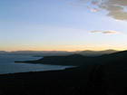
Overall View of Lake Tahoe
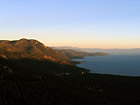
#202 — A pretty view at Lake Tahoe during July 2004. Lake Tahoe is the second deepest lake in the United States and the tenth deepest in the world, with a maximum depth measured at 1,645 ft (501 m), average depth of 1,000 ft (305 m). The Lake Tahoe Basin was formed by geologic block (normal) faulting about 2 to 3 million years ago. A geologic block fault is a fracture in the Earth's crust causing blocks of land to move up or down. Snow, rain, and streams filled the southern and lowest part of the basin, forming the ancestral Lake Tahoe. Modern Lake Tahoe was shaped and landscaped by the scouring glaciers during the Ice Age. Many streams flow into Lake Tahoe, but the lake is drained only by the Truckee River, which flows northeast through Reno and into Pyramid Lake in Nevada.
Shadow over the Mountains, Lake Tahoe
#201 — A pretty view at Lake Tahoe during July 2004. Lake Tahoe is the second deepest lake in the United States and the tenth deepest in the world, with a maximum depth measured at 1,645 ft (501 m), average depth of 1,000 ft (305 m). The Lake Tahoe Basin was formed by geologic block (normal) faulting about 2 to 3 million years ago. A geologic block fault is a fracture in the Earth's crust causing blocks of land to move up or down. Snow, rain, and streams filled the southern and lowest part of the basin, forming the ancestral Lake Tahoe. Modern Lake Tahoe was shaped and landscaped by the scouring glaciers during the Ice Age. Many streams flow into Lake Tahoe, but the lake is drained only by the Truckee River, which flows northeast through Reno and into Pyramid Lake in Nevada.
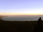
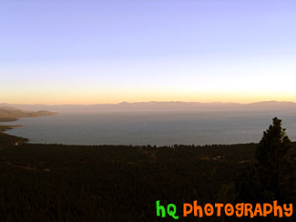
Sky, Mountains, and Sunset of Lake Tahoe
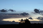
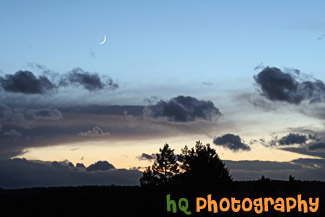
#913 — A very beautiful, scenic picture taken at sunset of a crescent moon with blue sky surrounding it along with a sunset near the horizon. Colorful and interesting shaped clouds and a silhouette of the hill and trees also make for a pretty picture. This photo was taken looking towards the west from Bonney Lake, Washington.
Crescent Moon, Sunset, & Hill Silhouette
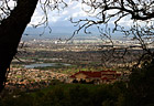
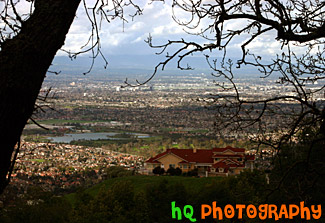
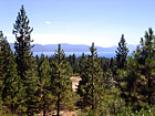
#319 — A scenic picture taken a top a hill in East San Jose overlooking the entire city. This picture shows a scenic house amongst the view of the city. From this aerial photo you can see the buildings of San Jose, the airport, and the amazing view that this multi-million dollar home also sees.
Scenic View of San Jose From A Hill
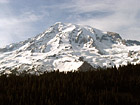
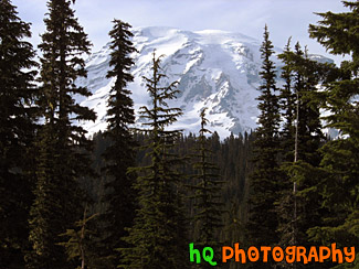
#136 — A beautiful picture of Mt. Rainier shot during the beginning of June. This photo was taken near Paradise in Mt. Rainier's National Forest. Blue sky and clouds are seen above the mountain in this photo.
Big Mt. Rainier
#164 — A beautiful picture of Mt. Rainier shot during the beginning of June. This photo was taken near Paradise in Mt. Rainier's National Forest. "The Mountain", as it's known by natives, draws your eyes like a magnet when it is visible and not invisible behind clouds. It also draws over two million visitors each year. Mount Rainier and the surrounding foothills were designated as a national park in 1899. On clear days, Mount Rainier dominates the Seattle - Tacoma skyline, towering over the metropolis in breathtaking beauty. Mount Rainiers highest elevation is 14,410 feet which is located at the summit, also called Columbia Crest. The glaciers on Mount Rainier are the sources of five major river systems: Nisqually, Cowlitz, White, Carbon, and Puyallup. These rivers provide water for plants, animals, and humans throughout western Washington.
Blue Sky & Mt. Rainier
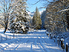
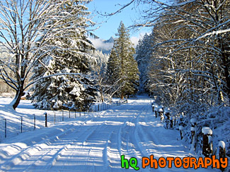
#29 — A beautiful winter scene picture taken when Washington state had a blast of cold weather and snow. This photo was taken in the foothills of the Cascade Mountains in Enumclaw, Washington. In this picture you can see a snow covered driveway with shadows from the sun shining over it. The trees surrounding the driveway are covered in snow.
Beautiful Winter Snow Scene
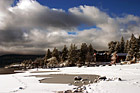
#198 — A pretty view at Lake Tahoe during a November snow storm in 2004. The Lake Tahoe Basin was formed by geologic block (normal) faulting about 2 to 3 million years ago. A geologic block fault is a fracture in the Earth's crust causing blocks of land to move up or down. Snow, rain, and streams filled the southern and lowest part of the basin, forming the ancestral Lake Tahoe.
Lake Tahoe Snow, Clouds, & Beach
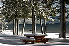
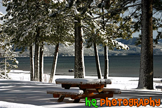
#286 — A pretty view of a snow covered picnic table at Lake Tahoe during a November snow storm. Lake Tahoe is the second deepest lake in the United States and the tenth deepest in the world, with a maximum depth measured at 1,645 ft (501 m), average depth of 1,000 ft (305 m).
Picnic Table & Lake Tahoe Snow
#1469 — A scenic vertical snowy landscape picture taken on the Trail of the Shadows self guided hike at Longmire, Washington which is located in the Mt. Rainier National Park. In this photo you can see some water under the piling of snow. Trail of the Shadows is located directly across from the National Park Inn at Longmire. It is a 0.7 mile loop through an old growth forest known as the Trail of the Shadows.
Snow Scene at Longmire, Wa

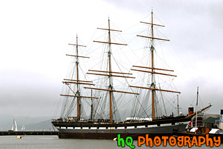
#341 — A scenic picture taken of a The Balclutha beautiful boat located in the San Francisco bay. This was taken on a cloudy day in the bay. The overall length of The Balclutha is 301 feet, length of deck is 256.5 feet, the beam is 38.6 feet, the depth is 22.7 feet, the gross tonnage is 1689, and the height of teh mainmast is 145 feet.
In 1954 the San Francisco Maritime Museum purchased Pacific Queen (The Balclutha was renamed this when Frank Kissinger purchased it in 1933) for $25,000. Assisted by donations of cash, materials and labor from the local community, the Museum restored the vessel and returned her original name. The ship was transferred to the National Park Service in 1978, and Balclutha was designated a National Historic Landmark in 1985.
Balclutha Boat in San Francisco Bay
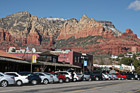
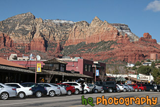
#2240 — A scenic picture taken of the downtown area of Sedona, which is located in Arizona State. The famous red rock of Sedona is seen in the backround which surrounds the entire city of Sedona. Blue sky is seen in the background too.
Downtown Sedona, Arizona
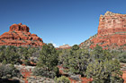
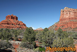
#2239 — A scenic picture taken of some of the Red Rock hills seen in Sedona Arizona State. This photo was taken with blue sky seen in the background. The rocks surrounding Sedona are red because of iron. Sandstone is porous, and when water carrying dissolved iron drains through the sandstone, some of the iron is left behind, and it is this iron in the form of iron oxide, which is red, that coats the grains of quartz and gives it color.
Red Rock in Sedona
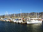
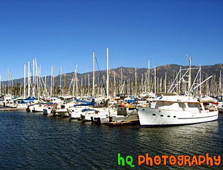
#263 — This is a photo taken of the many boats and sailboats parked in front of the ocean on the shore of Santa Barbara located in Southern California. This photo was taken on a beautiful sunny day and you can see the Santa Barbara mountains in the background behind the boats.
Boats of Santa Barbara, California
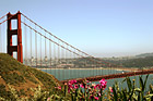
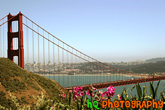
#484 — A scenic picture of the Golden Gate Bridge in San Francisco, California with pink flowers in the foreground. The Golden Gate Bridge is a historic symbol that represents the city of San Francisco. Joseph B. Strauss was the original chief engineer of the bridge and designed a rather unsightly cantilever and suspension structure in 1916. Though attempts were made to refine the design, it wasn't until consulting architects Irving F. Morrow and his wife Gertrude C. Morrow stepped in that the current look and design were imagined and implemented. The bridge opened for traffic 1937.
Golden Gate Bridge & Flowers

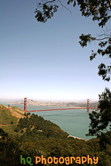
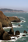
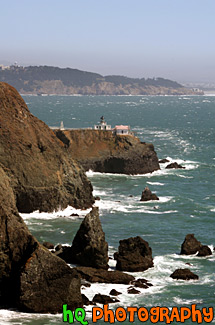
#733 — A scenic picture taken of the Golden Gate Bridge which is located in San Francisco, California. In this picture you can see the tall buildings of San Francisco in the distance. This picture was taken near Hawk Hill in San Francisco. Hawk Hill is located just north of San Francisco, California in the Marin Headlands. From this position you are actually above the Golden Gate Bridge looking down at it and the city.
Golden Gate Bridge framed by Tree
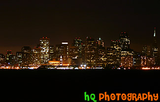
#470 — A scenic picture taken of the city of San Francisco, California from across the bay at Treasure Island. This picture was taken at night and you can see all the tall buildings of the city lit up in the darkness.
City of San Francisco at Night

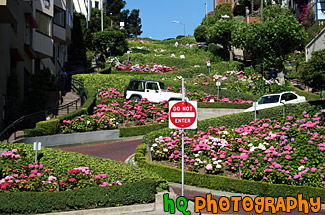
#568 — A scenic picture taken of the famous Lombard Street which is located in downtown San Francisco, California. Lombard Street has eight sharp turns (or switchbacks) that have earned the street the distinction of being the most crooked (winding) street in the United States. One of San Francisco's car lines stops at the top of this block. The crooked section of the street is reserved for one way traffic traveling east (downhill), and is paved with bricks. The section was built in 1923 to accommodate the steepness of the slope of the hill. The road is surrounded with beautiful shrubs and flowers and stunning bay views that draw in tourists day after day. From the top of the hill you will see amazing views of the bay such as Telegraph Hill and North Beach.
Lombard Street

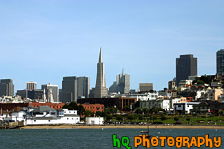
#891 — A scenic picture taken of the downtown San Francisco financial district seen with the bay waters in the foreground. The Transamerica Pyramid building stands high in the middle of this photograph. The picture was taken on a beautiful sunny day in San Francisco. Sail boats can be seen in the water and people can be seen on the shore enjoying the sunshine.
San Francisco City & Bay