Photos of Scenic Sky (362)
There are (362) photos of the keyword, Scenic Sky, available on our website. They are pictured below.The pictures are organized by category.
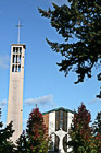
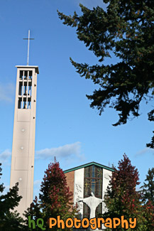
#2138 — A scenic vertical picture taken of the Trinity Lutheran Church located on campus at Pacific Lutheran University in Tacoma, Washington. This photo was taken on a blue sky sunny fall day.
Trinity Lutheran Church at PLU
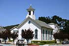
#1602 — A scenic picture taken of a white and blue church located in Half Moon Bay, California. This picture was taken on a sunny day.
White & Blue Church
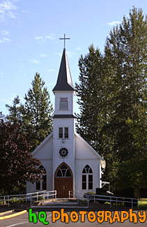
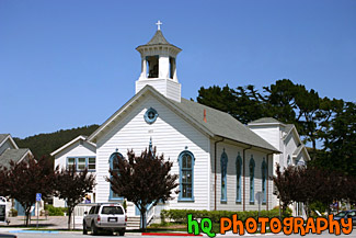
#1316 — A scenic vertical picture of a small white church with blue sky seen in the background and trees surrounding it.
White Church

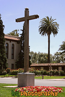
#1628 — A scenic vertical picture taken of a wooden cross located on campus at Santa Clara University with a palm tree seen in the background.
Wooden Cross on College Campus
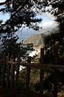
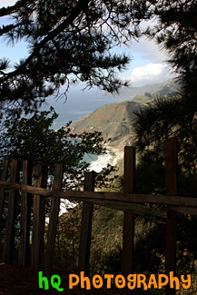
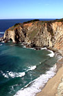
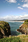
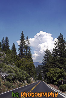
#1774 — A scenic vertical picture taken along the Highway 1 coast in California. This picture was taken looking down at the Pacific Ocean through a fence and trees on a hill. Hills along the coast are seen in the background.
Highway 1 Coast
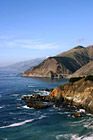
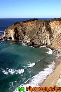
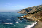
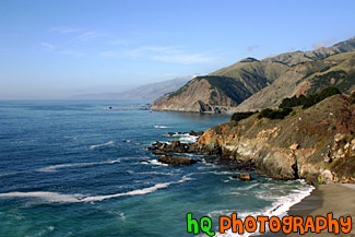
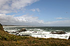
#793 — A scenic picture taken of the Pacific Ocean and the west coast in California in a beautiful sunny day. In this picture you can see many hills of the coast along with rocks and the scenic road and a beautiful bridge in the background.
Pacific Ocean Coast in California
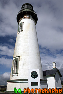
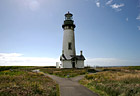
#583 — A close up scenic picture taken of the Yaquina Head Lighthouse which is located along the coast of Oregon State and the Pacific Ocean. This picture was taken on a partly cloudy day. This historic lighthouse is 93 (28 m) feet tall and was built in 1872-73. Its light towers are 162 feet (49 m) above the sea, and can be seen about 19 miles (32 km) out to sea. This lighhouse was automated in 1966 in which the light flashes two seconds on, two off, two on, 14 off, then repeats. Each light has its own pattern so it will not be confused with other lights.
Yaquina Head Lighthouse
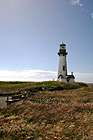
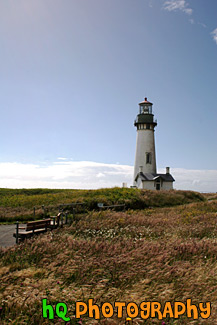
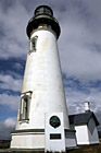
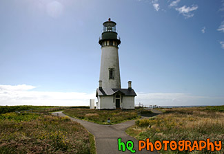
#776 — A vertical scenic picture taken of the Yaquina Head Lighthouse with a bench in the foreground located in Oregon State. Off to the left you can see glares from the sun shining toward the lighthouse. This historic lighthouse is 93 (28 m) feet tall and was built in 1872-73. Its light towers are 162 feet (49 m) above the sea, and can be seen about 19 miles (32 km) out to sea. This lighhouse was automated in 1966 in which the light flashes two seconds on, two off, two on, 14 off, then repeats. Each light has its own pattern so it will not be confused with other lights.
Bench & Yaquina Head Lighthouse
#1773 — A scenic picture taken along the west coast of the Pacific Ocean. In this picture you can see a bridge, the ocean, and the blue sky on this sunny day along the hills seen to the east.
Bridge Along West Coast
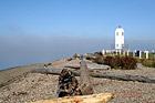
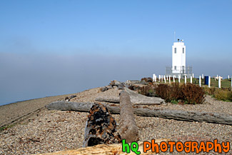
#1139 — A scenic picture taken of the Brown's Point lighthouse with fog in the distance and the shore in the foreground. Browns Point is situated on the eastern side of the entrance to Commencement Bay, which leads from Puget Sound to the port of Tacoma. The Brown's Point lighthouse is located in Browns Point Lighthouse Park lies on the tip of historic Browns Point, and provides the community waterfront access, enticing beachcombers year round and sunbathers and picnickers during the summer.
Brown's Point Lighthouse and Shore
#296 — This is a scenic photo taken along the coast of highway 1 in California. Highway 1 is a highway that runs along the coast of the Pacific Ocean with some breathtaking views.
Coast Along Highway 1, California
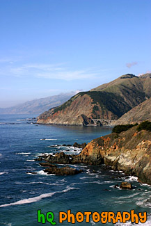
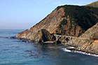
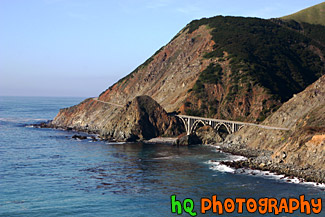
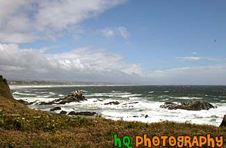
#352 — A scenic picture of the coast along the Pacific Ocean in Northern California. This picture was taken along the scenic highway of Highway 1 between Monterey and Santa Barbara. In the distance you can see a scenic bridge along the road.
Coast Scene & Hills
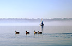
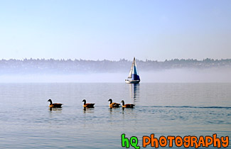
#1206 — A scenic picture taken of 4 ducks swimming in front of a sailboat located in Commencement Bay in Tacoma, Washington. Blue sky is seen above and fog in seen in the distance over the water.
Ducks & Sailboat
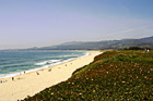
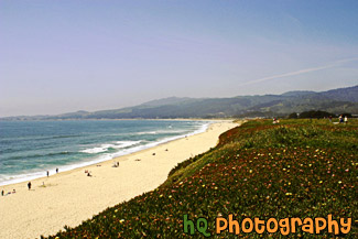
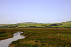
#475 — A scenic picture taken of the coastline located at Half Moon Bay, California. In this picture you can see people enjoying the beach at Half Moon Bay on a gorgeous blue sky sunny day. Half Moon Bay is located just 30 mile south of San Francisco. It also provides many outdoor activities such as scenic country roads, ocean panoramic views, golf courses & a driving range, deep sea fishing, whale watching, surfing, horseback riding on the beach, fields of glorious flowers, vegetables, pumpkins, and Christmas trees, marvelous restaurants, and superb hotels and inns.
Half Moon Bay Coast
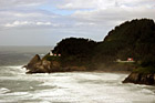
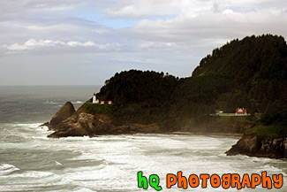
#457 — A scenic picture taken of the Heceta Head Lighhouse located on the Oregon coast, just after the famous Sea Lion Caves. The lighthouse is a working lighthouse and has a height of 205 feet above the Pacific Ocean. To the right of the lighthouse is the Keeper's house. There are some spectacular view seen from the front porch of the Keeper's house. Whales sometimes stop by at high tide and use the shallow rocks to scratch the barnacles off their sides. Up by the light house is some of the best whale watching one can do from dry land. Heceta Head Lighthouse is one of the most visited lighthouses in the United States drawing thousands of visitors each year to sense its history, romantic aura, and spectacular view. The Heceta (pronounced he-SEE-tuh) Head Lighthouse, constructed in 1874, was named for Spanish explorer Don Bruno De Heceta. Its light is the most powerful beacon on the Oregon coast, visible 21 miles out to sea.
Heceta Head Lighthouse, Oregon Coast
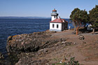
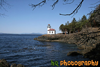
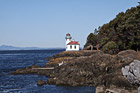
#2118 — A scenic picture taken of the Lime Kiln Lighthouse which is located on the San Juan Island. Lime Kiln Lighthouse is located on the west side of the island. It was built in the 1860's. This is also the site of a whale watching park to observe whales from the land.
Lime Kiln Lighthouse
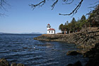
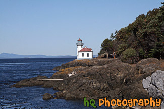
#2122 — A scenic picture taken of the Lime Kiln Lighthouse seen on a sunny day with tree branches in the foreground. Lime Kiln Lighthouse is located on the San Juan Island of Washington State. This is a popular place to whale watch from the shore.
Lime Kiln Lighthouse & Branches
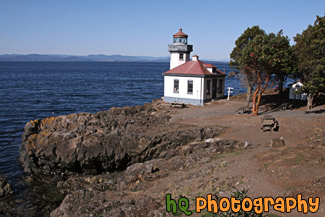
#2123 — A scenic picture taken of the Lime Kiln Lighthouse which is located on the San Juan Island in Washington State. This photo was taken on a sunny day.
Lime Kiln Lighthouse on Sunny Day
#775 — A scenic picture taken of the Yaquina Head Lighthouse with the sun glaring off to the left. Yaquina Head Lighthouse is located along the coast of Oregon State and the Pacific Ocean. This historic lighthouse is 93 (28 m) feet tall and was built in 1872-73. Its light towers are 162 feet (49 m) above the sea, and can be seen about 19 miles (32 km) out to sea. This lighhouse was automated in 1966 in which the light flashes two seconds on, two off, two on, 14 off, then repeats. Each light has its own pattern so it will not be confused with other lights.
Looking at Yaquina Head Lighthouse
#778 — A scenic picture taken of the beautiful coast and Pacific Ocean along the shore of Newport, Oregon. This picture was taken near the Yaquina Head Lighthouse looking toward the shore. The puffy clouds and blue sky add character to this picture. Newport today is a bustling coastal community of over 9,000. It's heart is along a working waterfront on Yaquina Bay where fishing fleets and fresh seafood markets coexist with galleries, gift shops, restaurants and family attractions. Across the bay is the acclaimed Oregon Coast Aquarium and the Hatfield Marine Science Center. Historic Nye Beach, 2 lighthouses, museums and wide sandy beaches provide activity for people of all ages.
Newport, Oregon Coastal Scene
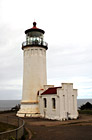
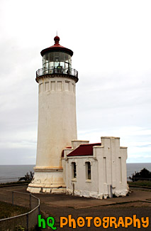
#995 — A scenic picture taken of the North Head Lighthouse located along the coast in Washington State. This lighthouse has a red tip. The North Head is the windiest lighthouse area on the West Coast and the third windiest in the nation. Winds of 120 miles per hour have been recorded at the site.
North Head Lighthouse in Washington
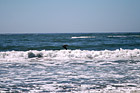
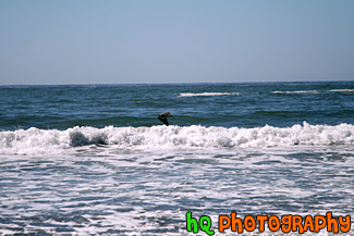
#1709 — A scenic picture taken of the Pacific Ocean waves on a blue sky, sunny day with a crane bird flying over the water.
Ocean Waves & Crane Flying
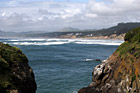
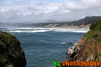
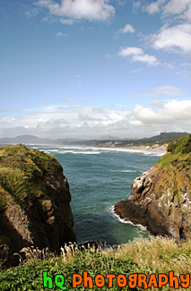
#668 — A scenic picture of the Oregon coast and Pacific Ocean looking to the North from Yaquina Head Lighthouse which is near Newport and Depoe Bay. In this picture the sky is thick with low puffy clouds that are about to be burned off.
Oregon Coast
#459 — A scenic picture taken of Oregon coast near the Yaquina Head Lighthouse.
Oregon Coastal Scene
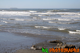
#1921 — A scenic coastal picture taken of the Pacific Ocean, waves, and rocks at Ruby Beach in Washington State.
Pacifc Ocean, Waves & Rocks
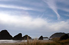
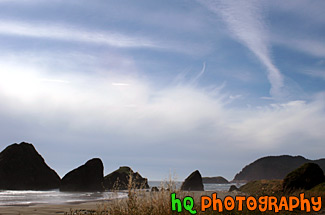
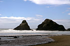
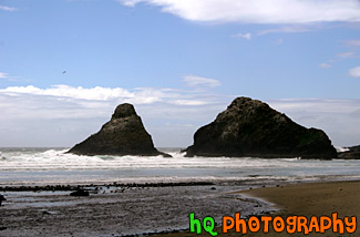
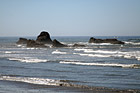
#689 — A scenic picture of some big sea stack rocks and scenic sky located along the coast in the Pacific Ocean of Oregon State. Some of the rocks are in the ocean while some on the beach.
Rocks on Oregon Coast
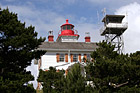
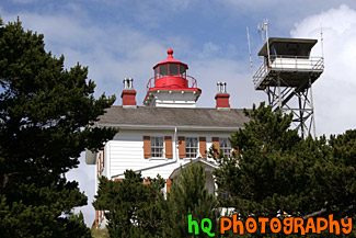
#1404 — A scenic picture taken close up of a white lighthouse with a red top being surrounded by green trees along the coast of Oregon state. This picture was taken on a sunny day.
Scenic Lighthouse
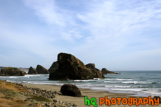
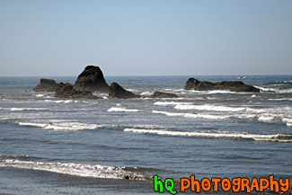
#714 — A scenic picture taken of sea stack rocks with blue sky located in the Pacific Ocean along the Oregon State coast. In the foreground you can see the beach filled with a bunch of seagulls in the water. This picture was taken just below the famous Heceta Head Lighthouse.
Scenic Oregon Coast Sea Stacks & Ocean
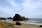
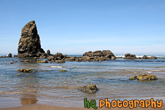
#715 — A scenic picture of some big sea stacks rocks and blue sky located along the Oregon State coast and the Pacific Ocean.
Sea Stacks Along Oregon Coast
#1711 — A scenic picture taken of some small sea stacks located right off the shore at Ruby Beach, Washington. Ruby Beach is located in the Olympic National Park. This photo was taken on a sunny day.
Sea Stacks off Ruby Beach
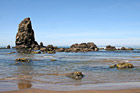
#2021 — A scenic picture taken of some seastacks and rocks located in the Pacific Ocean along the coast of Cannon Beach, Oregon. This picture was taken on a blue sky sunny day.
Seastacks & Rocks in Pacific Ocean
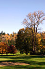
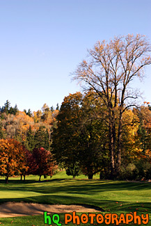
#250 — A scenic photo of a golf course in Washington State taken during Autumn when all the leaves are changing colors. In the background you can see the many trees with colorful leaves. Washington is a great state to see the Fall colors take place.
Fall Colors on Golf Course
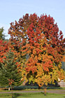
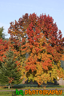
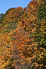
#1362 — A scenic picture taken of a big tree with its' leaves changing colors during the fall season. The leaves are changing from green to red, yellow, and orange. This photo was taken on a sunny day.
Red, Orange & Yellow Tree
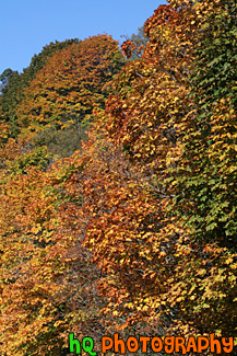
#1134 — A scenic vertical picture taken of many tree's leaves changing color during the fall season. This picture was taken on a sunny autumn day as you can see the blue sky in the background. All kinds of colors are seen throughout the trees: green, yellow, brown, red, and orange.
Fall Trees Changing Color

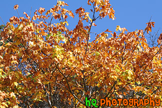
#1133 — A scenic close up picture taken during fall season of orange leaves on a tree with blue sky seen in the background on a sunny autumn day.
Orange Leaves & Blue Sky

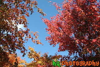
#1792 — A scenic picture looking up at red and orange colored leaves changing color during the fall season. This picture was taken on a sunny day as blue sky is seen above.
Red & Orange Colored Leaves on Trees
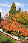
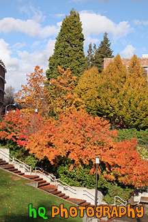
#1783 — A scenic picture taken of the fall colors seen on trees located on campus at the University of Washington. In this picture you can see the colors red, orange, green, yellow, and blue (in the sky). Leaves are also seen on the ground below the trees.
Scenic Colors of Fall
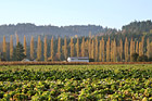
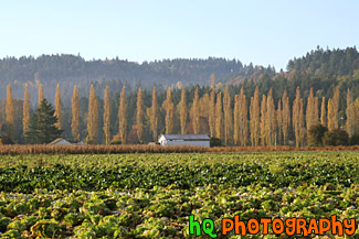
#1357 — A scenic picture taken of a farm during the fall season as you can see the brown trees in the distance. In the forground are rows of cabbage. This photo was taken on a sunny day.
Farm in the Fall
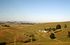
#907 — A scenic picture taken of farmlands located in Northern California on a beautiful blue sky sunny day.
Farmland in Northern California
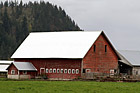
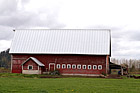
#1003 — A scenic picture taken at an agle of a red barn located on a farm in Enumclaw, Washington. This picture was taken on a cloudy day and you can see the right side of Mt. Peak in the background.
Red Barn on Farm
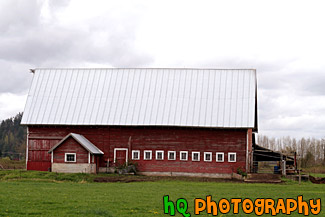
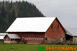
#1004 — A scenic picture taken of the side of a red barn located on a farm in Enumclaw, Washington. This photograph was taken on a cloudy day.
Side of Red Barn
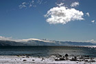
#285 — Beautiful scenic view of lake tahoe taken right after a snow storm. This photo is gorgeous because of the blue skies contrasting the freshly fallen snow covereing the shore and beach.
Beautiful Lake Tahoe Snow View
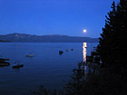
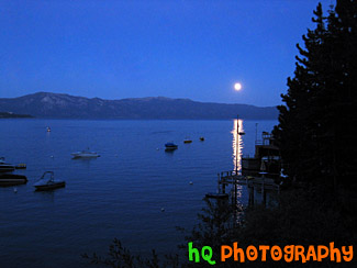
#194 — A pretty view of the moon rising at Lake Tahoe during July 2004. Lake Tahoe is the second deepest lake in the United States and the tenth deepest in the world, with a maximum depth measured at 1,645 ft (501 m), average depth of 1,000 ft (305 m). The Lake Tahoe Basin was formed by geologic block (normal) faulting about 2 to 3 million years ago. A geologic block fault is a fracture in the Earth's crust causing blocks of land to move up or down. Snow, rain, and streams filled the southern and lowest part of the basin, forming the ancestral Lake Tahoe. Modern Lake Tahoe was shaped and landscaped by the scouring glaciers during the Ice Age. Many streams flow into Lake Tahoe, but the lake is drained only by the Truckee River, which flows northeast through Reno and into Pyramid Lake in Nevada.
Lake Tahoe - Moon Rising
#1984 — A scenic picture taken of Lake Chelan which is located in central Washington State, nestled in the North Cascades National Forest. The Chelan Valley encompasses the communities of Chelan, Manson & Stehekin. Lake Chelan is a 50.5 mile glacier-fed lake and is 1.5 miles at its widest. 1486 feet is its deepest point.
Lake Chelan
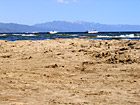
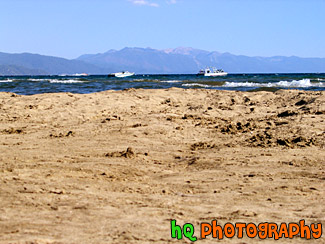
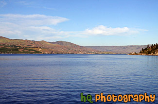
#195 — A pretty view at Lake Tahoe during July 2004. Lake Tahoe is the second deepest lake in the United States and the tenth deepest in the world, with a maximum depth measured at 1,645 ft (501 m), average depth of 1,000 ft (305 m). The Lake Tahoe Basin was formed by geologic block (normal) faulting about 2 to 3 million years ago. A geologic block fault is a fracture in the Earth's crust causing blocks of land to move up or down. Snow, rain, and streams filled the southern and lowest part of the basin, forming the ancestral Lake Tahoe. Modern Lake Tahoe was shaped and landscaped by the scouring glaciers during the Ice Age. Many streams flow into Lake Tahoe, but the lake is drained only by the Truckee River, which flows northeast through Reno and into Pyramid Lake in Nevada.
Lake Tahoe - Sand & Boats
#205 — A pretty view at Lake Tahoe during July 2004. Lake Tahoe is the second deepest lake in the United States and the tenth deepest in the world, with a maximum depth measured at 1,645 ft (501 m), average depth of 1,000 ft (305 m). The Lake Tahoe Basin was formed by geologic block (normal) faulting about 2 to 3 million years ago. A geologic block fault is a fracture in the Earth's crust causing blocks of land to move up or down. Snow, rain, and streams filled the southern and lowest part of the basin, forming the ancestral Lake Tahoe. Modern Lake Tahoe was shaped and landscaped by the scouring glaciers during the Ice Age. Many streams flow into Lake Tahoe, but the lake is drained only by the Truckee River, which flows northeast through Reno and into Pyramid Lake in Nevada.
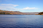
Overall View of Lake Tahoe
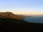
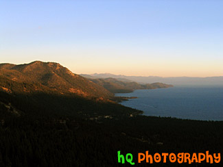
#202 — A pretty view at Lake Tahoe during July 2004. Lake Tahoe is the second deepest lake in the United States and the tenth deepest in the world, with a maximum depth measured at 1,645 ft (501 m), average depth of 1,000 ft (305 m). The Lake Tahoe Basin was formed by geologic block (normal) faulting about 2 to 3 million years ago. A geologic block fault is a fracture in the Earth's crust causing blocks of land to move up or down. Snow, rain, and streams filled the southern and lowest part of the basin, forming the ancestral Lake Tahoe. Modern Lake Tahoe was shaped and landscaped by the scouring glaciers during the Ice Age. Many streams flow into Lake Tahoe, but the lake is drained only by the Truckee River, which flows northeast through Reno and into Pyramid Lake in Nevada.
Shadow over the Mountains, Lake Tahoe
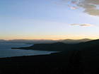
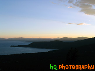
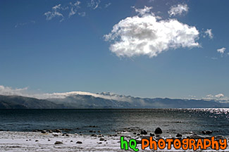
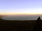
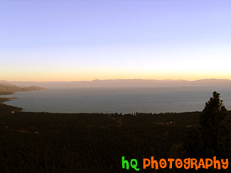
#201 — A pretty view at Lake Tahoe during July 2004. Lake Tahoe is the second deepest lake in the United States and the tenth deepest in the world, with a maximum depth measured at 1,645 ft (501 m), average depth of 1,000 ft (305 m). The Lake Tahoe Basin was formed by geologic block (normal) faulting about 2 to 3 million years ago. A geologic block fault is a fracture in the Earth's crust causing blocks of land to move up or down. Snow, rain, and streams filled the southern and lowest part of the basin, forming the ancestral Lake Tahoe. Modern Lake Tahoe was shaped and landscaped by the scouring glaciers during the Ice Age. Many streams flow into Lake Tahoe, but the lake is drained only by the Truckee River, which flows northeast through Reno and into Pyramid Lake in Nevada.
Sky, Mountains, and Sunset of Lake Tahoe
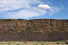
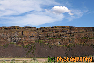
#1978 — A scenic picture taken of a rock cliff next to the freeway with an interesting puffy cloud and blue sky seen above. This photo was taken in Eastern Washington near Steamboat Rock State Park.
Rock Cliff and Puffy Cloud
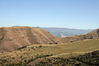
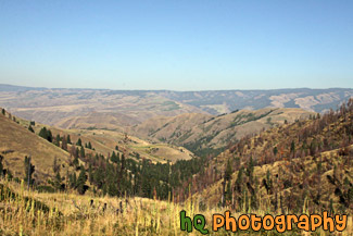
#2159 — A scenic picture taken of a landscape of some brown hills with a hint of green located in the state of Idaho. This was taken on a sunny day with blue skies seen above.
Brown Hills
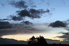
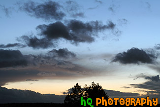
#914 — A beautiful night picture taken of a scenic sunset, clouds, and sky along with a silhouette of the trees in the middle of the photo. High in the sky blue sky is still visible, but as you get closer to the horizon you can see the sunset starting to take place with the pink-ish sky. This photo was taken looking towards the west from Bonney Lake, Washington.
Night Sunset & Landscape Silhouette
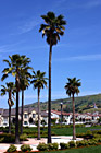
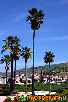
#750 — A scenic picture taken of some tall palm trees which are located at a park in the center of a housing development in East San Jose, California (the Evergreen area). This picture was taken on a sunny day with blue skies in the background.
Palm Trees in Housing Development
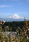
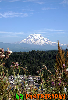
#525 — A scenic picture taken of the big Mt. Rainier located in Washington State. This picture was taken from Bonney Lake at the Sky Island housing development.
Mt. Rainier from Bonney Lake
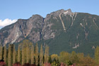
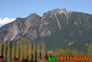
#1935 — A scenic picture taken of Mount Si which is located in North Bend, Washington State. Mount Si is a popular hike for a lot of hikers in Washington. The climb is 4,167 feet (1,270 meters) and 4 miles from the parking lot to the summit plateau. Vertical elevation change is about 3700 feet and starts at about 700 feet. The route meanders through several different ecosystems as temperatures and average rainfall vary with elevation.
Mount Si
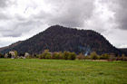
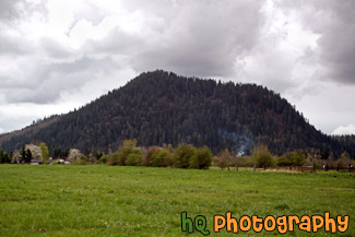
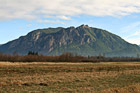
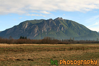
#1008 — A scenic picture taken of the local small mountain in which people of the area hike up to receive and excellent workout. This picture was taken on a cloudy day in Enumclaw, Washington. A green grass field is seen in the foreground and a little bit of smoke is seen just before the mountain.
Mt. Peak, Enumclaw
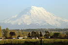
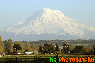
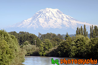
#1759 — A scenic picture taken of Mt. Rainer on a clear, blue sky. This photo was taken in the farmland in Enumclaw, Washington where the mountain looks big.
Mt. Rainer & Farmland
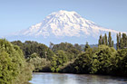
#1101 — A scenic picture taken of Mt. Rainier with the Puyallup River in the foreground. This photo was taken on a beautiful sunny day with blue skies in Washington State.
Mt. Rainier & Puyallup River
#2178 — A scenic picture of the popular Mount Si located in North Bend, Washington. Mount Si is a popular hike that many locals take. This photo was taken on a sunny winter afternoon.
Mt. Si in North Bend
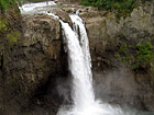
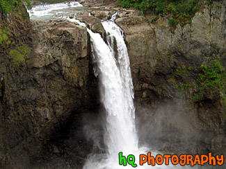
#83 — A fantastic photo of the Snoqualmie Falls, which is located in Snoqualmie, Washington. This waterfall is an historic site in the state of Washington. Snoqualmie Falls is one of Washington state's most popular scenic attractions. More than 1.5 million visitors come to the Falls every year. At the Falls, you will find a two-acre park, observation deck, gift shop, the Salish Lodge and the famous 270 foot waterfall.
Snoqualmie Falls, Wa

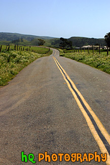
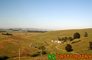
#371 — A photo of a scenic road taken in the farm lands of Marin County out toward the coast of the Pacific Ocean. This picture was taken out past Pt. Reyes, California.
Marin County Farm Road
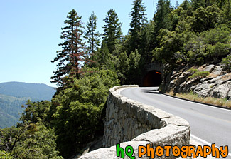
#854 — A scenic picture taken of a tunnel near a cliff in Yosemite National Park which is located in northern California. This picture was taken on a sunny blue sky day.
Cliff & Tunnel
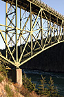
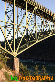
#1817 — A scenic vertical picture taken of the side of the Deception Pass Bridge which is located in Washington State. This picture was taken on a sunny evening.
Deception Pass Bridge (Side View)
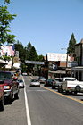
#988 — A scenic picture taken of a street in the downtown portion of Yosemite just before you head into the National Park.
Downtown Yosemite Street
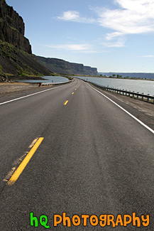
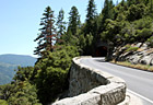
#1979 — A scenic vertical picture taken of a road located in Eastern Washington between a lake and a rock cliff wall.
Road Between Lake and Cliff
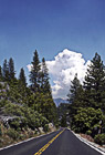
#617 — A scenic picture taken of a road located in Yosemite National Park which is located in California. This road was leading towards to only cloud in the sky which was a big puffy one.
Road in Yosemite National Park
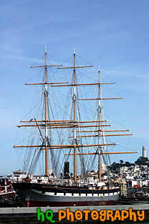
#603 — A scenic picture taken of a the Balclutha boat on a blue sky sunny day located in the San Francisco, California bay. In the background you can see Coit Tower sitting on Telegraph Hill. The overall length of The Balclutha is 301 feet, length of deck is 256.5 feet, the beam is 38.6 feet, the depth is 22.7 feet, the gross tonnage is 1689, and the height of teh mainmast is 145 feet. On January 15, 1887, with a twenty-six-man crew, Balclutha sailed under British registry from Cardiff, Wales, on her maiden voyage towards San Francisco. The ship entered the San Francisco Golden Gate after 140 days at sea, unloaded cargo of 2,650 tons of coal, and took on sacks of California wheat. Besides sailing to San Francisco, in 1899 The Balclutha for three years sailed north to the Puget Sound, Washington and then across Austrailia.
Balclutha Boat
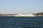
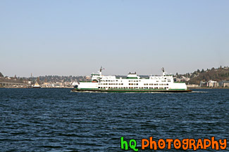
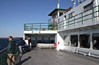
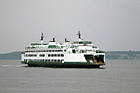
#1427 — A scenic picture taken of a Seattle ferry boat in the Puget Sound of Washington state on a sunny day.
Ferry Boat

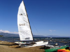
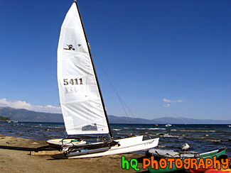
#196 — A pretty view at Lake Tahoe of a type of sail boat during July 2004. Lake Tahoe is the second deepest lake in the United States and the tenth deepest in the world, with a maximum depth measured at 1,645 ft (501 m), average depth of 1,000 ft (305 m). The Lake Tahoe Basin was formed by geologic block (normal) faulting about 2 to 3 million years ago. A geologic block fault is a fracture in the Earth's crust causing blocks of land to move up or down. Snow, rain, and streams filled the southern and lowest part of the basin, forming the ancestral Lake Tahoe. Modern Lake Tahoe was shaped and landscaped by the scouring glaciers during the Ice Age. Many streams flow into Lake Tahoe, but the lake is drained only by the Truckee River, which flows northeast through Reno and into Pyramid Lake in Nevada.
Lake Tahoe Sailboat
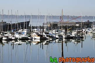
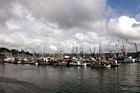
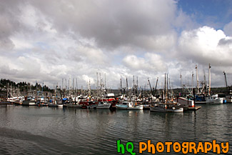
#1165 — A scenic picture taken of many sailboats located in Commencement Bay in Tacoma, Washington. In this picture you can see the sailboat's reflections in the water.
Boats & Reflections
#2119 — A scenic picture on board the Elwha Ferry Boat which travels from Anacortes to Friday Harbor and the San Juan Islands. This photo was taken on a blue sky day.
Elwha Ferry Boat
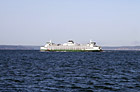
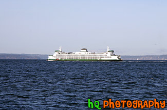
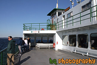
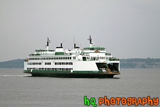
#1444 — A scenic picture taken of a single ferry boat in the Puget Sound of Washington state on a sunny day.
Ferry Boat & Blue Sky
#1543 — A scenic picture taken of a Mukilteo, Washington ferry boat on a cloudy day.
Ferry Boat & Cloudy Day
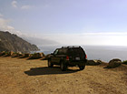
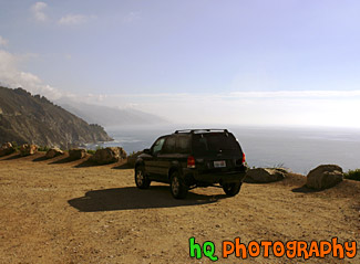
#431 — A scenic picture taken of a 2003 Ford Escape located on a dirt road close to the cliff by the coast of the Pacific Ocean on California's coast.
Ford Escape on Dirt Road Ocean View
#206 — A pretty view at Lake Tahoe of a type of sail boat during July 2004. Lake Tahoe is the second deepest lake in the United States and the tenth deepest in the world, with a maximum depth measured at 1,645 ft (501 m), average depth of 1,000 ft (305 m). The Lake Tahoe Basin was formed by geologic block (normal) faulting about 2 to 3 million years ago. A geologic block fault is a fracture in the Earth's crust causing blocks of land to move up or down. Snow, rain, and streams filled the southern and lowest part of the basin, forming the ancestral Lake Tahoe. Modern Lake Tahoe was shaped and landscaped by the scouring glaciers during the Ice Age. Many streams flow into Lake Tahoe, but the lake is drained only by the Truckee River, which flows northeast through Reno and into Pyramid Lake in Nevada.
Sailboat & View of Lake Tahoe
#585 — A scenic picture taken of a bunch of sailboats located in the water along the coast at Newport, Oregon. In this picture you can see the partly cloudy skies with the big puffy clouds. Newport was etablished in 1882 and is now a bustling coastal community of over 9,000 people. It's heart is along a working waterfront on Yaquina Bay where fishing fleets and fresh seafood markets coexist with galleries, gift shops, restaurants and family attractions.
Sailboats of Newport, Oregon
#1449 — A scenic picture taken of the big Balclutha boat located in the San Francisco bay of California. A cruise ship can be seen in the background. On January 15, 1887, with a twenty-six-man crew, Balclutha sailed under British registry from Cardiff, Wales, on her maiden voyage towards San Francisco. The ship entered the San Francisco Golden Gate after 140 days at sea, unloaded cargo of 2,650 tons of coal, and took on sacks of California wheat.
San Francisco Balclutha Boat
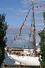
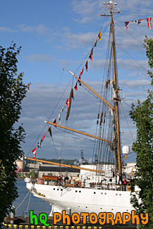
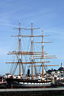
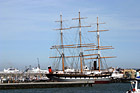
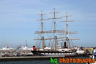
#1655 — A scenic vertical picture taken of a tall white ship located at the Tall Ships Festival in Tacoma, Washington during the 4th of July Freedom Fair.
Tall Ship and Flags
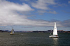
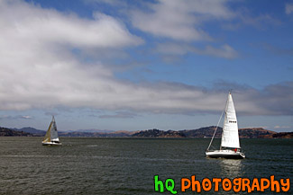
#1848 — A scenic picture taken of two sailboats sailing in the bay area waters of San Francisco. This picture was taken on a partly cloudy sky with blue sky seen.
Two Sailboats in San Francisco Bay
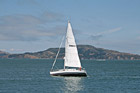
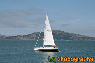
#2105 — A scenic picture taken of a white sailboat floating the the waters of the San Francisco Bay in California.
White Sailboat in San Francisco Bay
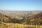
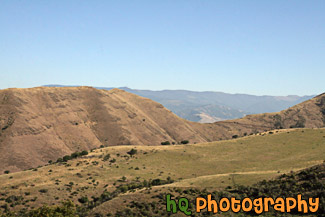
#2157 — A scenic picture taken of some hills located in the State of Idaho just near Hells Canyon.
Idaho Hills
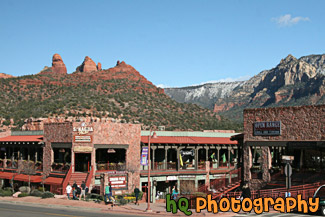
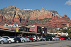
#2241 — A scenic picture taken of the downtown Sedona area in Arizona with red rocks seen in the background. This photo was taken on a sunny day with blue sky seen in the background. People are out on the streets enjoying the downtown.
Downtown Sedona & Red Rocks
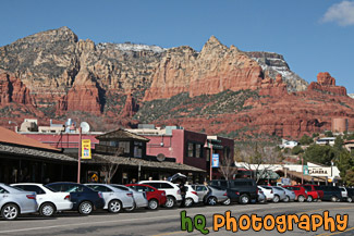
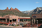
#2240 — A scenic picture taken of the downtown area of Sedona, which is located in Arizona State. The famous red rock of Sedona is seen in the backround which surrounds the entire city of Sedona. Blue sky is seen in the background too.
Downtown Sedona, Arizona
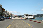
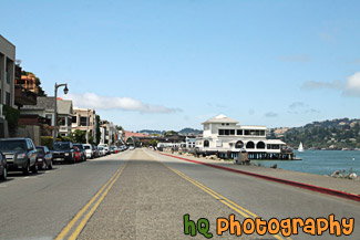
#2107 — A scenic picture taken of the city of Sausalito, California on a sunny, blue sky day.
Entering Sausalito
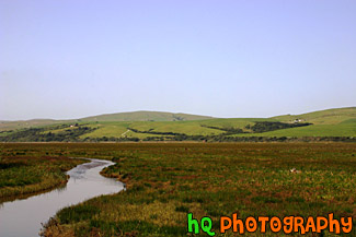
#948 — A scenic picture taken of the grasslands and hills in Marin County, California. This photo was taken near Point Reyes. In the photo you can see a stream of water along with the green hills in the background and green grassy field in the foreground. This photo was taken on a beautiful sunny day with blue sky seen all around.
Marin County Fieldland and Hills
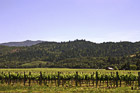
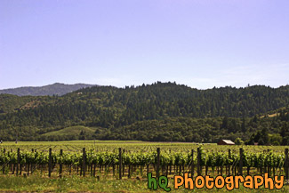
#479 — A scenic picture taken of a Napa Valley, California Vineyard. Napa Valley is located northeast of San Francisco. Napa Valley is known for their wines... There are the 300-plus opportunities to taste some of the world's best wines. Nearly 60% of California's wineries are located in Napa and the parallel Sonoma Valley, together the traditional heart of California's "Wine Country".
Napa Valley, California
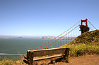
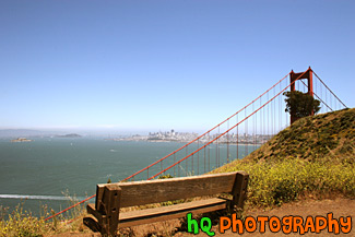
#992 — A scenic picture taken of an empty bench and the Golden Gate Bridge off to the right along with the city of San Francisco, the bay waters, and Alcatraz in the background. This picture was taken on a beautiful sunny day.
Bench & Golden Gate Bridge
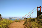
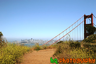
#991 — A scenic picture taken of yellow wildflowers located on the sides of a trail leading to the Golden Gate Bridge. You can also see the city of San Francisco and the bay waters in the distance on this beautiful sunny day.
Golden Gate Bridge & Wildflowers on Trail

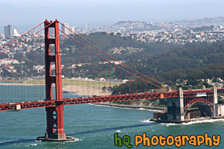
#2063 — A scenic picture taken of the Golden Gate Bridge located in San Francisco on a blue sky sunny day. This photo is taken of just one section of the bridge.
Golden Gate Bridge in San Franciso
#299 — This is a scenic picture taken of the Golden Gate Bridge at the Presidio in San Francisco. It was taken just about as the sun was going to set as you can see from the changing colors in the sky. Today the Presidio is enjoyed by many people through the history and beauty it contains. Within the Presidio boundaries there are more than 500 historic buildings, a collection of coastal defense fortifications, a national cemetery, an historic airfield, a saltwater marsh, forests, beaches, native plant habitats, coastal bluffs, miles of hiking and biking, and some of the most spectacular vistas in the world... not to mention the spectacular views of the Golden Gate Bridge.
Golden Gate Bridge Scene
#2065 — A scenic picture taken of the San Francisco side of the Golden Gate Bridge on a beautiful sunny afternoon.
Golden Gate Bridge Side View

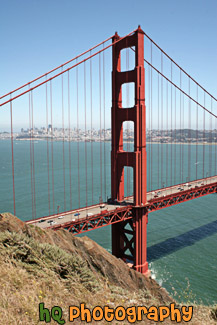
#2064 — A scenic vertical picture taken of the Golden Gate Bridge during the day with blue sky seen above. San Francisco can be seen in the background.
Golden Gate Bridge Vertical View
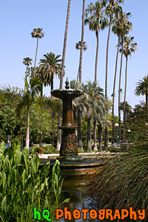
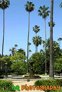
#1403 — A scenic vertical picture taken of the fountain at Will Rogers Memorial Park located in the Beverly Hills area of Los Angeles, California. Blue sky and palm trees are seen surrounding this fountain.
Fountain at Will Rogers Memorial Park
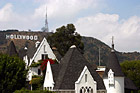
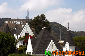
#1394 — A scenic picture taken of a white house with the famous Hollywood sign seen in the background on a hill.
Hollywood Sign & White House
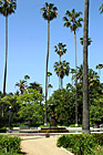
#720 — A scenic picture taken of the tall palm trees surrounding the beautiful Rogers Memorial Park located in Beverly Hills, California. The Will Rogers Memorial Park was the first municipal park in Beverly Hills, originally opened under the name of Sunset Park in 1915. The park was renamed in 1952 to honor the entertainer and honorary mayor of Beverly Hills, Will Rogers.
Palms of Rogers Memorial Park
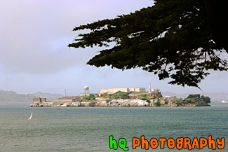
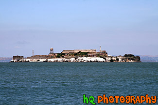
#1573 — A scenic picture taken of Alcatraz Island and a white sailboat floating in front with blue sky seen above.
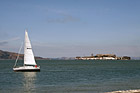
Alcatraz & Sailboat
#568 — A scenic picture taken of the famous Lombard Street which is located in downtown San Francisco, California. Lombard Street has eight sharp turns (or switchbacks) that have earned the street the distinction of being the most crooked (winding) street in the United States. One of San Francisco's car lines stops at the top of this block. The crooked section of the street is reserved for one way traffic traveling east (downhill), and is paved with bricks. The section was built in 1923 to accommodate the steepness of the slope of the hill. The road is surrounded with beautiful shrubs and flowers and stunning bay views that draw in tourists day after day. From the top of the hill you will see amazing views of the bay such as Telegraph Hill and North Beach.
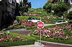
Lombard Street


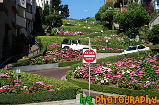
#430 — A scenic picture taken of the crookedest street in the U.S. which is also more commonly known as Lombard Street. Lombard Street is located in downtown San Francisco, California. Lombard Street is a major east to west street that crosses the entire city of San Francisco. It is best known for one block on Russian Hill between Hyde and Leavenworth Streets, with eight sharp turns (or switchbacks) that have earned the street the distinction of being the most crooked (winding) street in the United States. Lombard Street is a major tourist's attraction of San Francisco.
San Francisco's Lombard Street
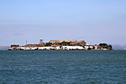
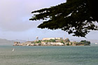
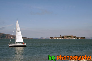
#1764 — A scenic picture taken of Alcatraz Prison and island on a sunny day in San Franciso, California. Alcatraz Island served as a military fortification in the 1850's, an incarceration facility for Spanish-American War prisoners, and a federal maximum-security prison from 1934 to 1963. Alcatraz Island is now one of Golden Gate National Recreation Area's most popular destinations.
Alcatraz Prison