Photos of California (283)
There are (283) photos of the keyword, California, available on our website. They are pictured below.The pictures are organized by category.
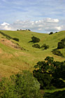
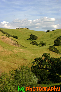
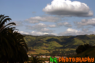
#766 — A scenic picture taken of a green hill filled with lots of green trees on a blue sky sunny day in East San Jose, California.
Green Hill & Trees
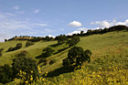

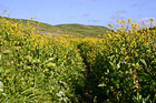
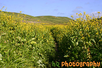
#765 — A scenic picture taken of a green hill, green trees, and yellow wildflowers blooming during spring in Northern California. This picture was taken in the East San Jose area.
Green Hill & Yellow Wildflowers
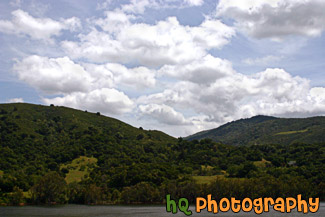
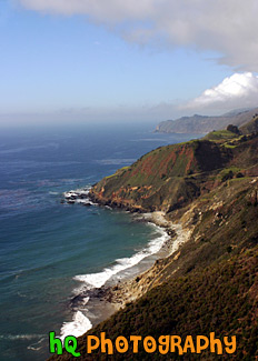
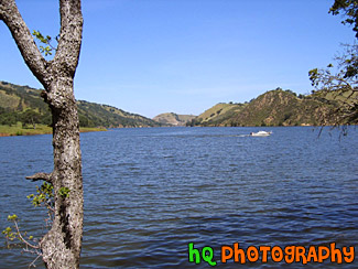
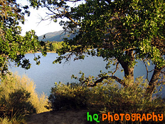
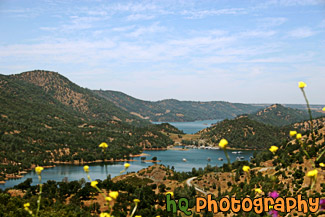
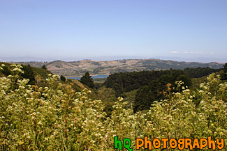
#885 — A scenic picture taken of a lake in the foreground, green rolling hills in the mid-ground, and interesting puffy white clouds and blue sky in the sky. This photo was taken near the Santa Cruz Mountains on the way to Santa Cruz, California near Highway 17.
Green Hill, Lake, & Puffy Clouds
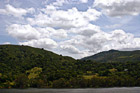
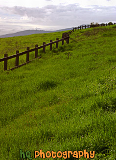
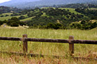
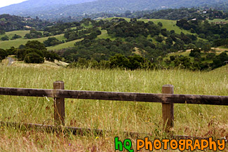
#473 — A scenic picture taken of some green hills with the shadows of the clouds on the hills from the partly cloudy sky. This picture was taken in South/East San Jose near the Silver Creek Valley area.
Green Hills & Partly Cloudy Sky
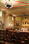
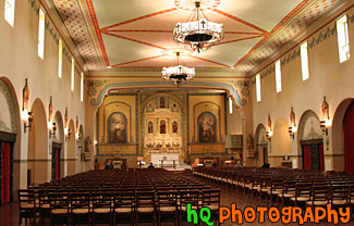
#1567 — A scenic vertical picture taken inside of the catholic church at Santa Clara University, Mission Santa Clara de Asis. In this photo there are a few people getting ready for the next mass starting at noon.
Inside of Catholic Church
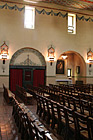
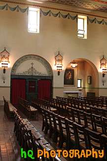
#1562 — A scenic vertical picture taken of rows of chairs and a window inside of the Mission Santa Clara de Asis church which is located on campus at Santa Clara University. The current building was constructed in 1927-28 after a fire and is a replica of the early 19th century church. Mass is held most days at noon.
Inside of Church & Window
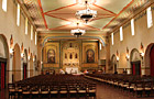
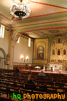
#1563 — A scenic picture taken inside of Mission Santa Clara de Asis church which is located on campus at Santa Clara University. Santa Clara University is the oldest college in California.
Inside of Mission Santa Clara de Asis

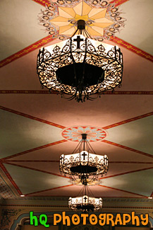
#1565 — A scenic vertical picture taken of three lights located on the ceiling wall of a church on campus at Santa Clara University.
Lights on Church Ceiling
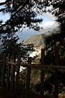
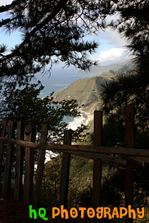
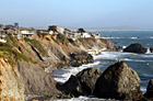
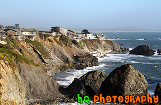
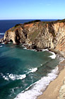
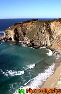
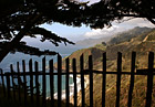
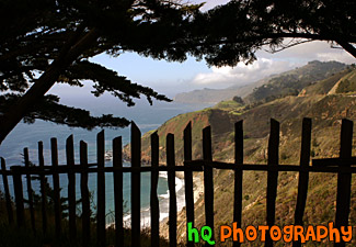
#1774 — A scenic vertical picture taken along the Highway 1 coast in California. This picture was taken looking down at the Pacific Ocean through a fence and trees on a hill. Hills along the coast are seen in the background.
Highway 1 Coast
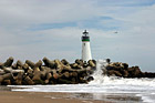
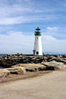
#293 — A scenic photo of a lighthouse taken on the beach at Santa Cruz, California. Downtown Santa Cruz is a year-round recreation and tourist destination with over 300 days of sunshine per year. It also has many shopping and entertainment opportunities available for all types of people.
Lighthouse at Santa Cruz, California
#294 — A scenic photograph taken along the coast of Highway 1 going south towards Los Angeles in California. This photo displays the beautiful Pacific Ocean with the blue and sunny skies.
Pacific Ocean Along Highway 1, California
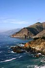
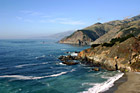
#793 — A scenic picture taken of the Pacific Ocean and the west coast in California in a beautiful sunny day. In this picture you can see many hills of the coast along with rocks and the scenic road and a beautiful bridge in the background.
Pacific Ocean Coast in California
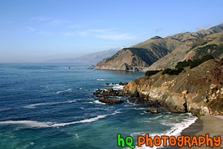
#346 — A scenic view of the Pacific Ocean driving down the coast view on Highway 1 in California. This picture was taken between the cities of Monterey and Santa Barabara by the coast. In this picture you can see the low clouds finishing up fading away from the raise of the sun which makes for a beautiful scene.
Pacific Ocean Scenic Coast
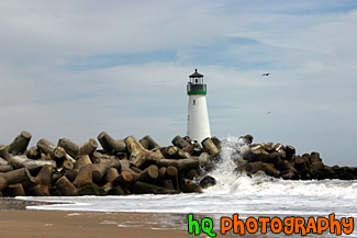
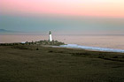
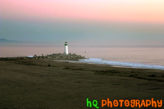
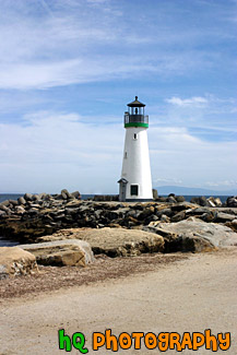
#386 — A scenic close up picture taken of the Walton Lighthouse in green on the beach at Santa Cruz, California. In this picture you can see the waves of the ocean crashing onto the rocks surrounding the lighthouse.
Santa Cruz Lighthouse (Walton)
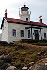
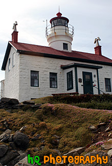
#686 — A scenic picture of Battery Point Lighthouse which is located in Crescent City, California. Battery Point Lighthouse was built in 1856 for a cost of $15,000. It was the 10th lighthouse built on the west coast. Crescent City is California's northernmost town, located on the flats behind Point George a few miles from the Oregon border. It has always been the main port for this remote corner of the state and has an important fishing fleet.
Battery Point Lighthouse
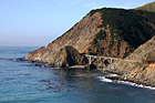
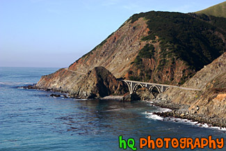
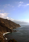
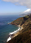
#1773 — A scenic picture taken along the west coast of the Pacific Ocean. In this picture you can see a bridge, the ocean, and the blue sky on this sunny day along the hills seen to the east.
Bridge Along West Coast
#490 — A scenic picture of houses along the coast of highway 1 in California located just north of Marin County and Point Reyes. Sea stacks can also be seen in the ocean.
California Coast Along Highway 1
#296 — This is a scenic photo taken along the coast of highway 1 in California. Highway 1 is a highway that runs along the coast of the Pacific Ocean with some breathtaking views.
Coast Along Highway 1, California
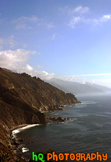
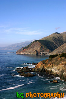
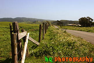
#352 — A scenic picture of the coast along the Pacific Ocean in Northern California. This picture was taken along the scenic highway of Highway 1 between Monterey and Santa Barbara. In the distance you can see a scenic bridge along the road.
Coast Scene & Hills
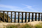
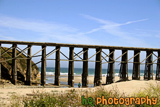
#454 — A scenic picture along the coast of Highway 1 near Fort Bragg, California. This picture is taken along the beach of the Pacific Ocean with railroad tracks passing over the beach.
Coastal Fort Bragg, California
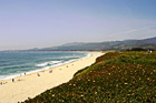
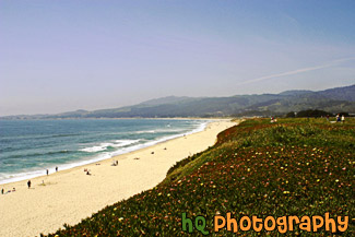
#475 — A scenic picture taken of the coastline located at Half Moon Bay, California. In this picture you can see people enjoying the beach at Half Moon Bay on a gorgeous blue sky sunny day. Half Moon Bay is located just 30 mile south of San Francisco. It also provides many outdoor activities such as scenic country roads, ocean panoramic views, golf courses & a driving range, deep sea fishing, whale watching, surfing, horseback riding on the beach, fields of glorious flowers, vegetables, pumpkins, and Christmas trees, marvelous restaurants, and superb hotels and inns.
Half Moon Bay Coast
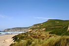
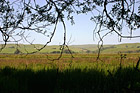
#718 — A scenic picture taken of Kehoe Beach with a green grass field being blown in the foreground by the wind and the Pacific Ocean in the background. Kehoe Beach is located along the coast in Marin County in northern California.
Kehoe Beach, Grass & Ocean
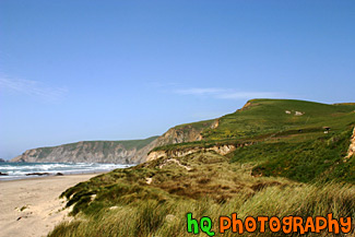
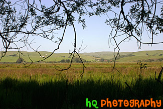
#763 — A scenic picture of a Marin County coastal view located at Kehoe Beach in California. In this picture you can see the green hills and long grass as the wind blows on this beautiful spring day.
Marin County Coast View
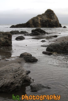
#2109 — A scenic vertical picture taken of some big ocean rocks located along the shore at Muir Beach in California.
Ocean Rocks Along Beach
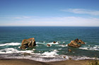
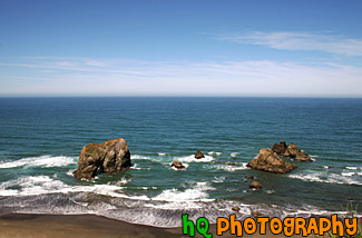
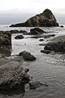
#871 — A scenic coastal photo of the Pacific Ocean with a couple of big rocks near the coast. This photo was taken along the coast in Northern California on a beautiful sunny day.
Pacific Ocean & Rocks
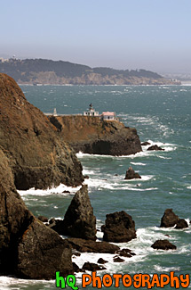
#626 — A scenic picture taken of some ocean rocks and the Point Bonita Lighthouse which is located just north - west of the Golden Gate Bridge and San Francisco, California. Point Bonita was the site of the first fog signal on the Pacific coast. The fog signal, which went into service on August 8, 1855, was an army surplus cannon fired every half hour in foggy weather. Point Bonita was the third lighthouse built in the San Francisco Bay area (in 1855) and was unique. The original tower, built separate from the residence, provided a lonely existence for the initial light keepers. There were no inhabitants for five miles and no direct communication. It was so inhospitable that seven keepers were employed within the first nine months of the operation of the light. Point Bonita was the last manned lighthouse on the California coast. The last keeper left in April 1981. It is now a part of the Golden Gate National Recreation Area and is run by the National Park Service. The Coast Guard continues to maintain the light and fog signal.
Point Bonita Lighthouse
#795 — A scenic vertical picture taken of the lighthouse located along the Pacific Ocean in Santa Cruz, California. This lighthouse is situation just down the beach from the famous Boardwalk at Santa Cruz. Downtown Santa Cruz is a year-round recreation and tourist destination with over 300 days of sunshine per year. It also has many shopping and entertainment opportunities available for all types of people.
Santa Cruz Lighthouse Up Close
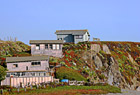
#452 — A scenic picture taken of three houses on a hill along the coast of Highway 1 in California. The beach to the Pacific Ocean starts right at the bottom of the hill as you can see the sand in the right corner. This picture was taken along the coast north of Marin County.
Three Coastal Houses on Hill

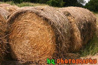
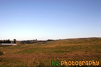
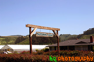
#381 — A scenic picture of a few big bundles of hay located atop a hill in Palo Alto, California.
Bundles of Hay
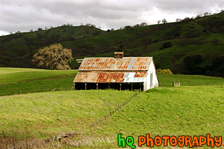
#317 — This is a scenic picture of an old barn in the middle of a big green grass field and hills. This barn is located over the hills of East San Jose. The hills are extremely green because of the un normal amount of rainfall that has hit this area in 2005 so far.
Green Grass and Old Barn
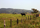
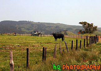
#739 — A scenic picture taken of a black cow looking at the camera. This cow was located on a farm in Marin County, California on a sunny spring day.
Black Cow on Farm
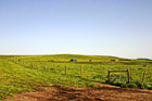
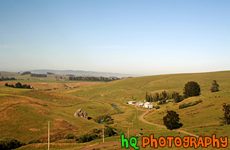
#804 — A scenic picture taken of a farmland located in Marin County, California near the coast. In this picture you can see the green grass of the field with some cows grazing the land on this sunny spring day.
California Farmland
#655 — A scenic picture of a farm, some cows, and hay located on a ranch somewhere in Marin County, California on the way to the Pacific Ocean coast.
Cows, Hay, & Farm
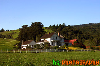
#468 — A scenic picture taken of a farm in Marin County, California. This picture was taken in the spring season when California received tons of rain therefore explaining the very green land and hills surrounding this farm. Marin County is located just north of San Francisco across the Golden Gate Bridge.
Farm in Marin County, California
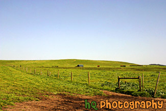
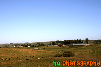
#904 — A scenic picture taken of a farm located in Northern California near Marin County with a bunch of hay stacks neatly placed over the fields. This picture was taken on a beautiful day with blue skies all around.
Farm With Hay Stacks
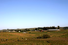
#907 — A scenic picture taken of farmlands located in Northern California on a beautiful blue sky sunny day.
Farmland in Northern California
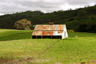
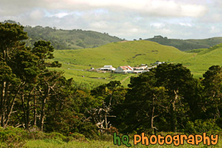
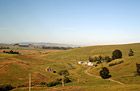
#214 — A photo of a little ranch or farm that is located in the hills of Half Moon Bay, California.
View of a Ranch at Half Moon Bay
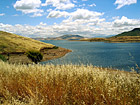
#651 — A scenic picture taken of a boat floating in Don Pedro Reservoir near the historic town of Jacksonville, California. Nestled in the Sierra-Nevada foothills east of Modesto, California, Don Pedro Reservoir/Lake is the sixth-largest body of water in California. When full, the reservoir is 26-miles-long, has a capacity of more than two million acre-feet and 160 miles of shoreline. The reservoir and dam were built with multiple benefits in mind: water storage, power generation, flood control and recreation.
Boat in Don Pedro Reservoir
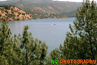
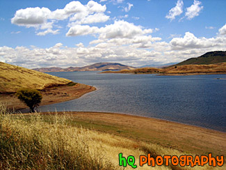
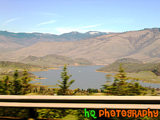
#15 — A scenic photo taken of a lake out in the country side of the sate of California. This lake is a popular campground for many outdoor people. It is located on the out-skirts of the bay area, east of San Francisco more towards Sacramento.
California Lake
#45 — A scenic photo of a lake scene taken in Northern California on a partly cloudy day.
California Lake Scene
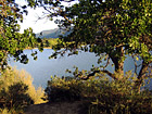
#46 — A photo of a lake looking through some trees and branches. This photo was taken at a campground in Northern California.
Lake & Scenic Trees
#67 — A view of Lake Shasta, California while driving North on I5. You can tell this photo was taken while the car was moving because the trees in the foreground are blurry but the lake itself is in focus.
Lake Shasta from I5
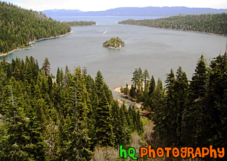
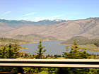
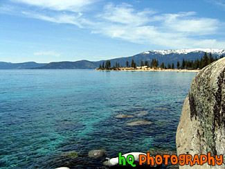
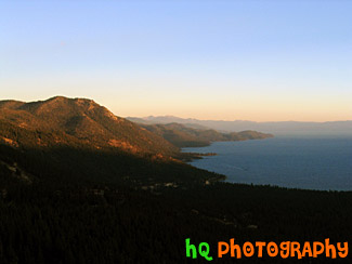
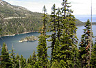
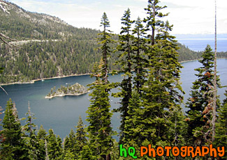
#19 — View of Lake Tahoe from high in the mountains looking over Emerald Bay. Lake Tahoe is the second deepest lake in the United States and the tenth deepest in the world. The Lake Tahoe Basin was formed by geologic block (normal) faulting about 2 to 3 million years ago. Snow, rain, and streams filled the southern and lowest part of the basin, forming the ancestral Lake Tahoe. Modern Lake Tahoe was shaped and landscaped by the scouring glaciers during the Ice Age. Many streams flow into Lake Tahoe, but the lake is drained only by the Truckee River, which flows northeast through Reno and into Pyramid Lake in Nevada.
Lake Tahoe and Emerald Bay
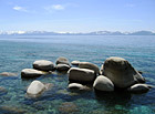
#17 — A pretty view of a some big rocks in Lake Tahoe. Lake Tahoe is the second deepest lake in the United States and the tenth deepest in the world, with a maximum depth measured at 1,645 ft (501 m), average depth of 1,000 ft (305 m). The Lake Tahoe Basin was formed by geologic block (normal) faulting about 2 to 3 million years ago. Snow, rain, and streams filled the southern and lowest part of the basin, forming the ancestral Lake Tahoe. Modern Lake Tahoe was shaped and landscaped by the scouring glaciers during the Ice Age. Many streams flow into Lake Tahoe, but the lake is drained only by the Truckee River, which flows northeast through Reno and into Pyramid Lake in Nevada.
Lake Tahoe Rocks
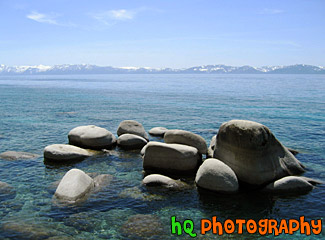
#18 — A pretty view of Lake Tahoe during Spring 2003. Lake Tahoe is the second deepest lake in the United States and the tenth deepest in the world, with a maximum depth measured at 1,645 ft (501 m). In this photo you can see a big rock on the right and the see through water of the lake. Mountains are also visible that surround the lake.
Lake Tahoe Waters
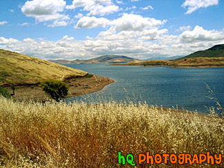
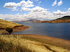
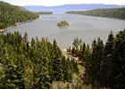
#44 — A landscape scene in Northern California near Gilroy of a lake and puffy clouds on a sunny day.
Landscape Lake Scene
#650 — Moccasin Point Marina can be seen on your drive to Yosemite National Park if you take Highway 120 (Yosemite Highway). Moccasin, California is situated in the foothills of California's beautiful Sierra Nevada Mountains. Moccasin Point Marina and recreation area is 60 miles west of the Yosemite National Park and 2 1/2 hours east of San Francisco.
Moccasin Point Marina, California
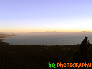
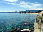
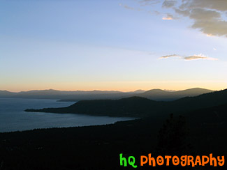
#205 — A pretty view at Lake Tahoe during July 2004. Lake Tahoe is the second deepest lake in the United States and the tenth deepest in the world, with a maximum depth measured at 1,645 ft (501 m), average depth of 1,000 ft (305 m). The Lake Tahoe Basin was formed by geologic block (normal) faulting about 2 to 3 million years ago. A geologic block fault is a fracture in the Earth's crust causing blocks of land to move up or down. Snow, rain, and streams filled the southern and lowest part of the basin, forming the ancestral Lake Tahoe. Modern Lake Tahoe was shaped and landscaped by the scouring glaciers during the Ice Age. Many streams flow into Lake Tahoe, but the lake is drained only by the Truckee River, which flows northeast through Reno and into Pyramid Lake in Nevada.
Overall View of Lake Tahoe
#202 — A pretty view at Lake Tahoe during July 2004. Lake Tahoe is the second deepest lake in the United States and the tenth deepest in the world, with a maximum depth measured at 1,645 ft (501 m), average depth of 1,000 ft (305 m). The Lake Tahoe Basin was formed by geologic block (normal) faulting about 2 to 3 million years ago. A geologic block fault is a fracture in the Earth's crust causing blocks of land to move up or down. Snow, rain, and streams filled the southern and lowest part of the basin, forming the ancestral Lake Tahoe. Modern Lake Tahoe was shaped and landscaped by the scouring glaciers during the Ice Age. Many streams flow into Lake Tahoe, but the lake is drained only by the Truckee River, which flows northeast through Reno and into Pyramid Lake in Nevada.
Shadow over the Mountains, Lake Tahoe
#201 — A pretty view at Lake Tahoe during July 2004. Lake Tahoe is the second deepest lake in the United States and the tenth deepest in the world, with a maximum depth measured at 1,645 ft (501 m), average depth of 1,000 ft (305 m). The Lake Tahoe Basin was formed by geologic block (normal) faulting about 2 to 3 million years ago. A geologic block fault is a fracture in the Earth's crust causing blocks of land to move up or down. Snow, rain, and streams filled the southern and lowest part of the basin, forming the ancestral Lake Tahoe. Modern Lake Tahoe was shaped and landscaped by the scouring glaciers during the Ice Age. Many streams flow into Lake Tahoe, but the lake is drained only by the Truckee River, which flows northeast through Reno and into Pyramid Lake in Nevada.
Sky, Mountains, and Sunset of Lake Tahoe
#955 — A scenic picture taken of a beautiful landscape scene located along the coast in California at Half Moon Bay. In this picture you see an old wooden fence in the foreground with a grass field that leads to some houses and green hills in the background. Half Moon Bay is located about 30 miles south of San Francisco, and only an hour's drive from pretty much anywhere in the Bay Area. Half Moon Bays' community offers numerous Bed and Breakfasts, several motels and some world-renowned hotels. Activities include surfing, whale watching, horseback riding on the beach, a historical Main Street with unique shops, two wineries, bird refuges, hiking and two lighthouses.
Half Moon Bay Hills & Houses
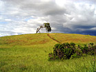
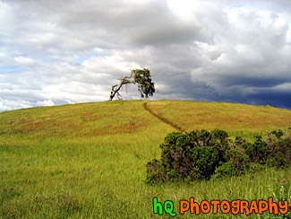
#4 — A photo of a lonely tree with a storm approaching on the golden hills of the California Bay Area. This photo was taken during Spring 2003 in Palo Alto area in CA.
Lonely Tree & Storm
#295 — This is a scenic photo that was taken along the coast of the Pacific Ocean along Highway 1 in California. This photo looks through a fence down at the coast and Pacific Ocean. Highway 1 is a coastal highway running down the coast of California.
Pacific Ocean View Through Fence
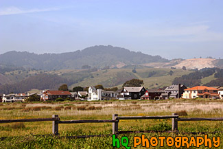
#956 — A scenic photo taken of the wesstern Bay Area in California looking towards the 280 freeway which runs near Half Moon Bay, Stanford, Los Altos, and Palo Alto. In this picture you can see the golden hills which surround the Bay Area and a small lake in the middle of the photo. This photo was taken on a sunny day.
Bay Area Landscape Scene
#329 — This is a scenic beautiful picture taken of a bright green grass field following a cury wooden fence in the hills of Palo Alto, California. This picture was taken up a trail behind the campus of Stanford University. The grass is especially green right now because of the tremendous rainfall the bay area has been having during this time period. Usually these fields are a golden yellow color because of the sunshine and lack of rainfall, hence the name "Golden Hills" of California. This hills can no longer live up to that name since they are all green! But they are so beautiful!
Bright Green Grass & Fence in Palo Alto
#785 — A scenic picture taken close up of some golden and green hills located on the path towards Half Moon Bay, California. During late spring and the summer months in California, these golden hills are a very common site.
Close up of Golden Green Hills
#887 — A scenic picture taken in the country side of the Los Altos Hills in the Bay Area of California. In this picture an old wooden fence lines the foreground and the country green fields and hills can be seen in the background.
Country Fence & Green Fields
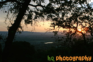
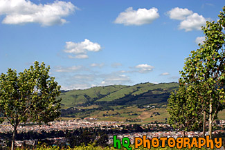
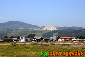
#373 — A scenic picture taken a top a hill in East San Jose overlooking the entire city and bay area. This picture shows a scenic house amongst the view of the city during a spectacular sunset.
East San Jose Hill Sunset
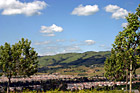
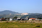
#888 — A scenic picture taken of the East San Jose landscape, green hills, blue sky, and houses in the area. This photo was taken in the Evergreen area.
East San Jose Landscape & Houses
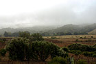
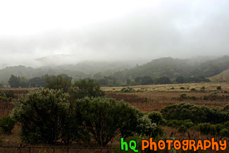
#251 — A scenic view of a foggy landscape area located in the country side of East San Jose, California. This photo was taken in the end of 2004 during winter season.
Foggy Landscape Scene
#477 — A scenic picture taken of a landscape scene located in Half Moon Bay, California. Half Moon Bay is located just 30 mile south of San Francisco. It also provides many outdoor activities such as scenic country roads, ocean panoramic views, golf courses & a driving range, deep sea fishing, whale watching, surfing, horseback riding on the beach, fields of glorious flowers, vegetables, pumpkins, and Christmas trees, marvelous restaurants, and superb hotels and inns.
Half Moon Bay, California
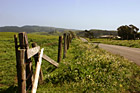
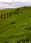
#760 — A scenic picture taken of a country road, farms, and wooden fence located out in Marin County, California towards to coast. This picture was taken on a sunny spring day.
Marin County Country Road & Fence
#22 — A photo up high in the Mountains of Lake Tahoe overlooking the Lake Tahoe and Emerald Bay. Green trees can be see in the foreground and the sky looks to be overcast.
Mountains of Lake Tahoe
#21 — A photo of a farm in the countryside of Northern California. This farm was located out near Sacramento but not quite in the city. A fence and a wine field can be seen in the picture.
Out in the Country
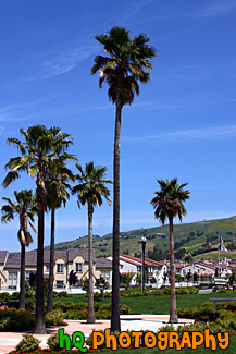
#750 — A scenic picture taken of some tall palm trees which are located at a park in the center of a housing development in East San Jose, California (the Evergreen area). This picture was taken on a sunny day with blue skies in the background.
Palm Trees in Housing Development
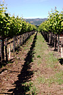
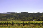
#610 — A scenic picture taken down a row of a winery located in Napa Valley, California. Napa Valley is known for many vineyards and wine tasting.
Winery Row
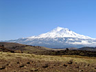
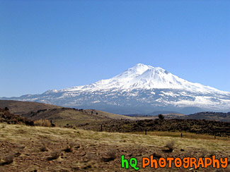
#66 — Mt. Shasta located in Northern California on the Cascade Range. Mount Shasta stands 14,162 feet high. Avalanche Gulch route is one of the most popular and climbed routes in the United States with an estimated 15,000 climbers that attempt the summit annually. With 17 established routes, each with variations, there is climbing available for beginners as well as advanced mountaineers. The terrain consists of loose volcanic talus, rock & ice, and glaciers. This photo was taken on a sunny day.
Mount Shasta
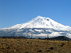
#65 — Mt. Shasta located in Northern California on the Cascade Range. Mount Shasta stands 14,162 feet high. Avalanche Gulch route is one of the most popular and climbed routes in the United States with an estimated 15,000 climbers that attempt the summit annually. With 17 established routes, each with variations, there is climbing available for beginners as well as advanced mountaineers. The terrain consists of loose volcanic talus, rock & ice, and glaciers.
Mt. Shasta
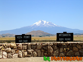
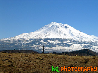
#192 — A view of Mt. Shasta, Ca. Mt. Shasta located in Northern California on the Cascade Range. Mount Shasta stands 14,162 feet high. Avalanche Gulch route is one of the most popular and climbed routes in the United States with an estimated 15,000 climbers that attempt the summit annually. With 17 established routes, each with variations, there is climbing available for beginners as well as advanced mountaineers. The terrain consists of loose volcanic talus, rock & ice, and glaciers.
View of Mt. Shasta
#371 — A photo of a scenic road taken in the farm lands of Marin County out toward the coast of the Pacific Ocean. This picture was taken out past Pt. Reyes, California.
Marin County Farm Road
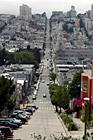
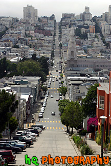
#384 — A scenic picture taken of a road in San Francisco, California from one end of the city going down a hill and back up another to the other end of the city. From this picture you can also see the scenic San Francisco buildings and houses.
San Francisco Road
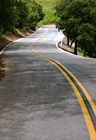
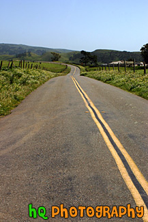
#1183 — A scenic picture of a curvy road with bright green trees located on both sides of the road. This photo was taken of a road in San Jose, California.
Road Between Green Trees
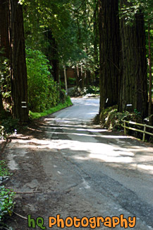
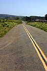
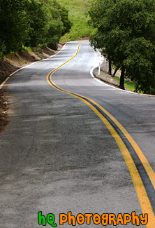
#947 — A scenic picture taken of a road which curves and is located in Mill Valley, California. Tall trees line both sides of this road and shadows from the sun and the trees are seen on the road.
Road Between Trees with Shadows

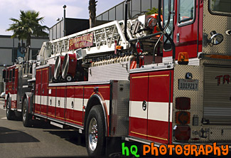
#396 — A scenic picture taken of a Fire Truck in downtown Beverly Hills, California. The fire truck says "Beverly Hills" on the sign on the ladder of the truck.
Beverly Hills Fire Truck
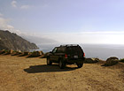
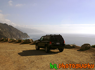
#431 — A scenic picture taken of a 2003 Ford Escape located on a dirt road close to the cliff by the coast of the Pacific Ocean on California's coast.
Ford Escape on Dirt Road Ocean View
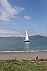
#2106 — A scenic vertical picture taken of a white sailboat floating in the San Francisco Bay Area waters with a black bird seen sitting on shore.
White Sailboat & Bird on Shore
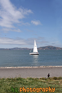
#2105 — A scenic picture taken of a white sailboat floating the the waters of the San Francisco Bay in California.
White Sailboat in San Francisco Bay
#263 — This is a photo taken of the many boats and sailboats parked in front of the ocean on the shore of Santa Barbara located in Southern California. This photo was taken on a beautiful sunny day and you can see the Santa Barbara mountains in the background behind the boats.
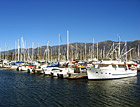
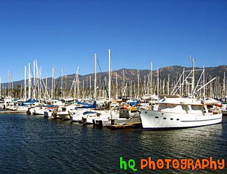
Boats of Santa Barbara, California
#719 — A scenic picture taken of the Santa Cruz Boardwalk taken from the beach looking in. The Santa Cruz Boardwalk is located on a mile-long beach between Monterey and San Francisco. The Santa Cruz Beach Boardwalk is an admission-free hot spot for beach fun and classic rides! It is California's oldest amusement park and a State Historic Landmark. The two National Historic Landmarks are: the 1911 Looff Carousel and the 1924 Giant Dipper roller coaster.
Santa Cruz Boardwalk
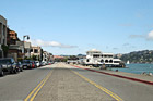
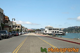
#2107 — A scenic picture taken of the city of Sausalito, California on a sunny, blue sky day.
Entering Sausalito
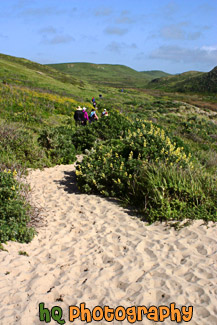
#420 — A scenic picture of some people hiking back to their cars after spending some time at the beach at Kehoe Beach, California which is near Point Reyes in Marin County. Marin County is a county located in California's San Francisco Bay Area across the Golden Gate Bridge fom San Franicsco.
Hiking at Kehoe Beach, California
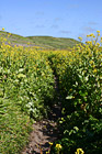
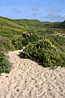
#421 — A scenic picture of a hiking trail in Marin County, California near the coast at Kehoe Beach. Marin County is a county located in California's San Francisco Bay Area across the Golden Gate Bridge fom San Franicsco.
Hiking Through Marin County Wildflowers
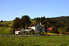
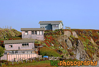
#545 — A scenic picture taken of a house / farm with green fields surrounding it in Marin County, California.
House in Marin County, California
#513 — A scenic picture taken of Lockheed Martin which is located in Sunnyvale, California. Lockheed Martin Corporation was formed in March 1995 with the merger of two of the world's premier technology companies, Lockheed Corporation and Martin Marietta Corporation. In 1996, Lockheed Martin completed its strategic combination with the defense electronics and systems integration businesses of Loral.
Lockheed Martin
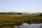
#803 — A scenic picture taken of the Tomales Bay near Point Reyes in Marin County, California. In this picture you can see the hills in the background of marin county and a sail boat parked by this boat launch in the foreground. Tomales bay is a coastal estuary located on the central California coast approximately 40 miles northwest of San Francisco.
Marin County Boat Launch
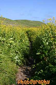
#806 — A scenic picture of a beautiful hiking trail located by the coast in Marin County, California at Kehoe Beach. Marin County is a county located in California's San Francisco Bay Area across the Golden Gate Bridge fom San Franicsco. In this picture you can see Marin county's beautiful green hills along with the yellow falselupine wildflowers.
Marin County Coastal Trail
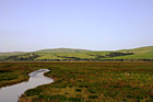
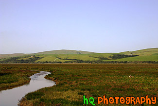
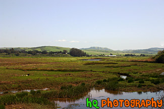
#948 — A scenic picture taken of the grasslands and hills in Marin County, California. This photo was taken near Point Reyes. In the photo you can see a stream of water along with the green hills in the background and green grassy field in the foreground. This photo was taken on a beautiful sunny day with blue sky seen all around.
Marin County Fieldland and Hills
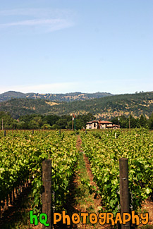
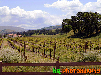
#478 — A picture taken of a Napa Valley Vineyard called Cakebread Cellars. The Cakebread family, owners of Cakebread Cellars in Rutherford, is among the most creative and successful winery families in California's famed Napa Valley. Since its founding in 1973, the winery has developed a reputation for producing world-class wines. Its success is built on quality, consistency and continuity, characteristics which apply equally to the grapes, the wines, the people and the operation of the winery. Napa Valley is known for their wines... There are the 300-plus opportunities to taste some of the world's best wines. Nearly 60% of California's wineries are located in Napa and the parallel Sonoma Valley, together the traditional heart of California's "Wine Country".
Napa Valley Cakebread Cellars Vineyard
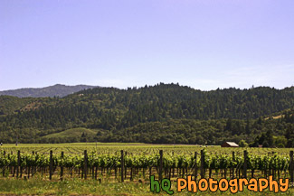
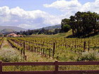
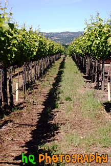
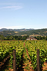
#479 — A scenic picture taken of a Napa Valley, California Vineyard. Napa Valley is located northeast of San Francisco. Napa Valley is known for their wines... There are the 300-plus opportunities to taste some of the world's best wines. Nearly 60% of California's wineries are located in Napa and the parallel Sonoma Valley, together the traditional heart of California's "Wine Country".
Napa Valley, California
#365 — A scenic picture taken in Point Reyes, California in Marin County. Point Reyes is home to many native land mammals which number about 37 species. Marine mammals also add to this total by another 12 species. The biological diversity stems from a favorable location in the middle of California and the natural occurrence of many distinct habitats which makes Point Reyes a fun place to visit.
Point Reyes Landscape Scene
#501 — A scenic picture taken of a Point Reyes landscape scene in Marin County, Califorina. Point Reyes is home to many native land mammals which number about 37 species. Marine mammals also add to this total by another 12 species. The biological diversity stems from a favorable location in the middle of California and the natural occurrence of many distinct habitats which makes Point Reyes a fun place to visit.
Point Reyes, Marin County
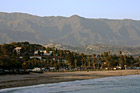
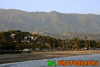
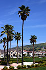
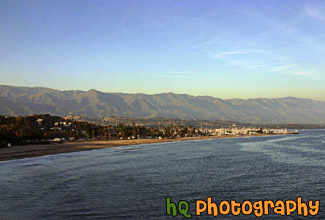
#752 — A scenic picture taken of Santa Barbara, California along the beach with a view of the many palm trees along the coast and the mountains in the background on a sunny day. In front of the mountain you can see the little hills filled with houses of the rich and famous.
Santa Barbara Beach & Mountains
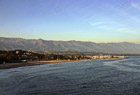
#495 — A scenic picture of the beach and waterfront of Santa Barbara, California. Santa Barbara is filled with beautiful beaches, majestic mountains and a colorful culture that make Santa Barbara a premier resort destination. Santa Barbara is located a little more than an hour's drive north from Los Angeles. Santa Barbara's harbor is home to the world famous Stearns Wharf; a great destination for the entire family. The zoological gardens are known as a great family day-trip. From the City, you are just minutes away from the Santa Barbara wine country. Whether you enjoy hiking, fine-dining, water sports, being lazy on the beach, culture, or a great night-life, Santa Barbara has something for you.
Santa Barbara, California
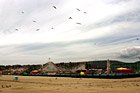
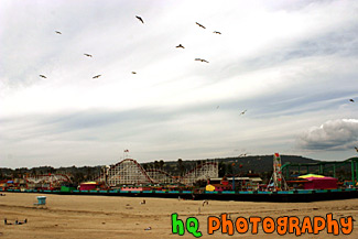
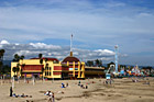
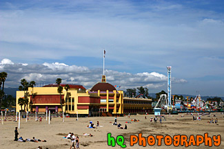
#434 — A scenic picture taken of the Santa Cruz Boardwalk and games from the beach. In this picture you can see all the many seagulls in the sky which surround this beach. The City of Santa Cruz, California, is situated on the northern part of Monterey Bay about 74 miles south of San Francisco and 30 miles from San Jose. Downtown Santa Cruz is a year-round recreation and tourist destination with over 300 days of sunshine per year. It also has many shopping and entertainment opportunities available for all types of people.
Santa Cruz Boardwalk from Beach
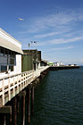
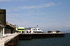
#448 — A scenic picture of Santa Cruz, California's Pier by the ocean. On thie Pier you will find little shops and restaurants along with boat rentals and places to fish.
Santa Cruz Pier
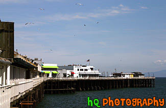
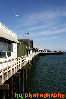
#727 — A scenic picture taken of a Santa Cruz Pier and seagulls flying overhead located in the state of California's by the Pacific ocean. On thie Pier you will find little shops and restaurants along with boat rentals and places to fish.
Santa Cruz Pier & Seagulls
#1582 — A scenic picture taken of a restaurant called Scomas located along the waterfront in Sausalito, California which is right across the Golden Gate Bridge on the Marin County side from San Francisco.
Scomas Restaurant
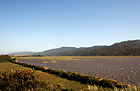
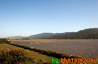
#502 — A scenic picture taken of Tomales Bay located in Marin County, California. Tomales bay is a coastal estuary located on the central California coast approximately 40 miles northwest of San Francisco. Tomales Bay is a vital ecosystem with clean water and diverse wildlife. Residents and visitors cherish its open waters, shoreline, scenic beauty and serenity. People enjoy diverse activities in a landscape that expresses rural and wilderness qualities, and supports limited and sustainable levels of use and development.
Tomales Bay, California
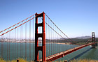
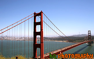
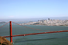
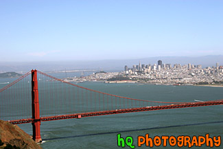
#578 — A scenic wide angle view of the Golden Gate Bridge taken from the Marin County side of the bridge. In this picture you can see the start of the Pacific Ocean off the the right and the city of San Francisco, California off to the left. The Golden Gate bridge is arguably one of the world's most beautiful bridges as the Golden Gate Bridge is an internationally recognized symbol of San Francisco.
Golden Gate Bridge