Photos of Blue (684)
There are (684) photos of the keyword, Blue, available on our website. They are pictured below.The pictures are organized by category.
Pages: [<<] 1 2 3 4 5 6 7 [>>]
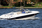
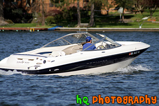
#145 — A close up picture taken of a white and blue speed boat located in a lake in Washington State.
Speed Boat
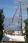
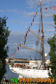
#1655 — A scenic vertical picture taken of a tall white ship located at the Tall Ships Festival in Tacoma, Washington during the 4th of July Freedom Fair.
Tall Ship and Flags
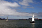
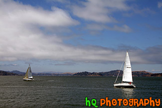
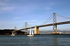
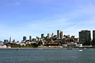
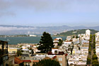
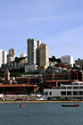
#1848 — A scenic picture taken of two sailboats sailing in the bay area waters of San Francisco. This picture was taken on a partly cloudy sky with blue sky seen.
Two Sailboats in San Francisco Bay
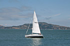
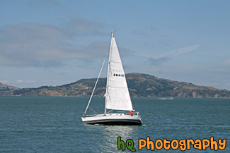
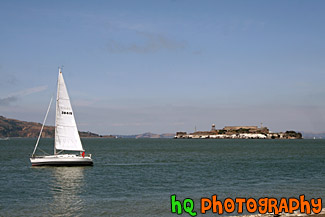
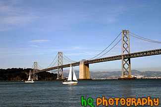
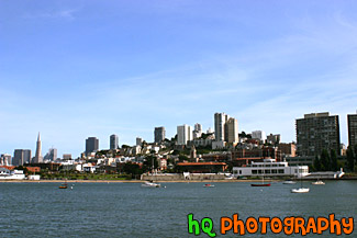
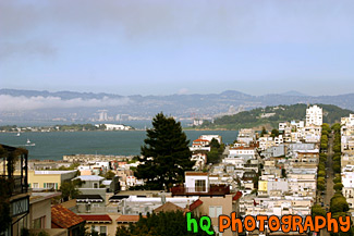
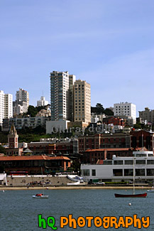
#2105 — A scenic picture taken of a white sailboat floating the the waters of the San Francisco Bay in California.
White Sailboat in San Francisco Bay
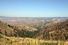
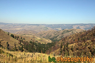
#2157 — A scenic picture taken of some hills located in the State of Idaho just near Hells Canyon.
Idaho Hills
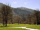
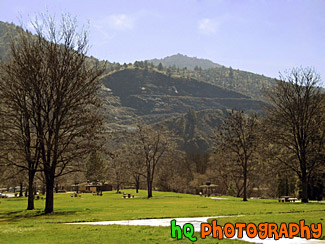
#69 — A pretty rest stop off I5 on the way to California. This scenic photo was taken on a sunny day during the end of winter season.
Rest Stop
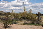
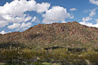
#2281 — A scenic picture taken of an Arizona landscape scene with lots of cacti and puffy clouds in the sky. This photo was taken in the desert at San Tan Mountain Regional Park.
Arizona Cacti & Clouds
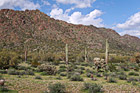
#2322 — A scenic picture taken of an Arizona landscape located at the San Tan Mountain Regional Park. The mountain can been seen in the background behind some cacti trees. Partly cloudy sky is above.
Arizona Landscape
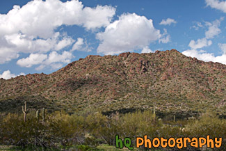
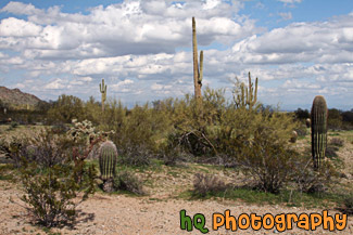
#2283 — A scenic picture taken of the Arizona desert landscape seen at San Tan Mountain Regional Park. You can see some puffy clouds above the mountain and some cacti trees in the foreground.
Arizona Landscape at San Tan Mountain

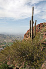
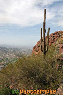
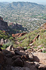
#2272 — A scenic picture taken of a pretty view from the hike on Camelback Mountain near Phoenix, Arizona. You can see a cactus tree in the foreground.
Cactus & Camelback Mountain View
#2279 — A scenic vertical picture taken of a Camelback Mountain view and a cactus tree in the foreground in Arizona State.
Camelback Mountain & Cactus
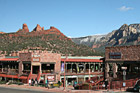
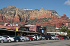
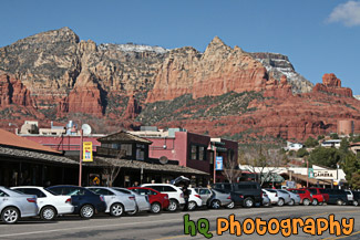
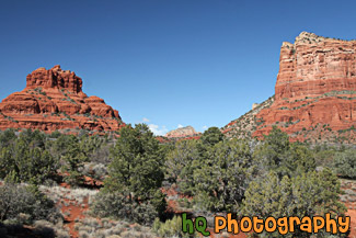
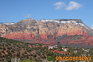
#2241 — A scenic picture taken of the downtown Sedona area in Arizona with red rocks seen in the background. This photo was taken on a sunny day with blue sky seen in the background. People are out on the streets enjoying the downtown.
Downtown Sedona & Red Rocks
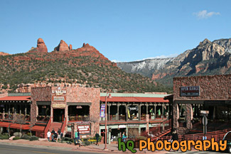
#2240 — A scenic picture taken of the downtown area of Sedona, which is located in Arizona State. The famous red rock of Sedona is seen in the backround which surrounds the entire city of Sedona. Blue sky is seen in the background too.
Downtown Sedona, Arizona
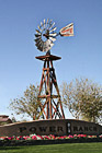
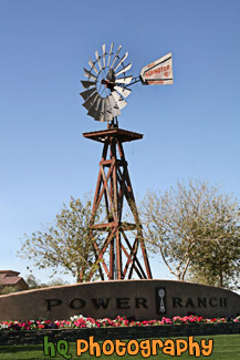
#2271 — A scenic vertical picture taken of the Power Ranch Windmill located in Gilbert, Arizona. Power Ranch is a housing community that offers comfort, family lifestyle living, and an abundance of large scale amenities.
Power Ranch Windmill
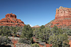
#2239 — A scenic picture taken of some of the Red Rock hills seen in Sedona Arizona State. This photo was taken with blue sky seen in the background. The rocks surrounding Sedona are red because of iron. Sandstone is porous, and when water carrying dissolved iron drains through the sandstone, some of the iron is left behind, and it is this iron in the form of iron oxide, which is red, that coats the grains of quartz and gives it color.
Red Rock in Sedona
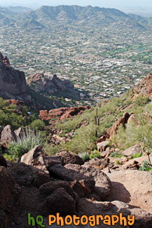
#2277 — A scenic vertical picture taken looking down on the trail at Camelback Mountain in Arizona State. You can see hills in the distance and the big rocks on the trail that you have to climb over.
Rocks & Trail on Camelback Mountain
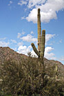
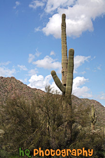
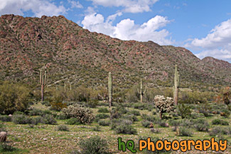
#2323 — A scenic vertical picture taken of a tall Saguaro cactus tree located in the San Tan Mountain Regional Park in Arizona. The photo was taken on a partly cloudy day.
Saguaro Cactus
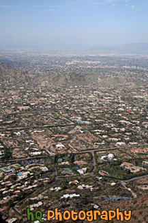
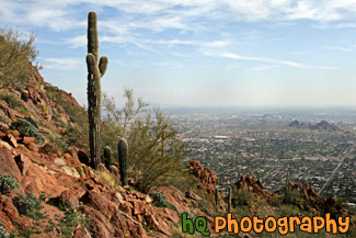
#2275 — A scenic vertical picture taken of a view of the city of Scottsdale, Arizona from on top of Camelback Mountain.
Scottsdale from Camelback Mountain
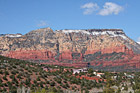
#2284 — A scenic picture taken in Sedona, Arizona of the red rock hills and some houses on a hill. Some snow is visible on top of the red rock hill.
Sedona Red Rock & Houses on Hill
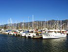
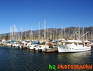
#263 — This is a photo taken of the many boats and sailboats parked in front of the ocean on the shore of Santa Barbara located in Southern California. This photo was taken on a beautiful sunny day and you can see the Santa Barbara mountains in the background behind the boats.
Boats of Santa Barbara, California
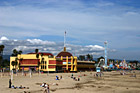
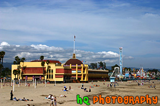
#719 — A scenic picture taken of the Santa Cruz Boardwalk taken from the beach looking in. The Santa Cruz Boardwalk is located on a mile-long beach between Monterey and San Francisco. The Santa Cruz Beach Boardwalk is an admission-free hot spot for beach fun and classic rides! It is California's oldest amusement park and a State Historic Landmark. The two National Historic Landmarks are: the 1911 Looff Carousel and the 1924 Giant Dipper roller coaster.
Santa Cruz Boardwalk
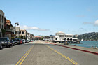
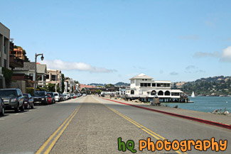
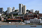
#2107 — A scenic picture taken of the city of Sausalito, California on a sunny, blue sky day.
Entering Sausalito
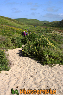
#420 — A scenic picture of some people hiking back to their cars after spending some time at the beach at Kehoe Beach, California which is near Point Reyes in Marin County. Marin County is a county located in California's San Francisco Bay Area across the Golden Gate Bridge fom San Franicsco.
Hiking at Kehoe Beach, California
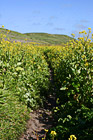
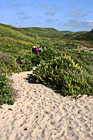
#421 — A scenic picture of a hiking trail in Marin County, California near the coast at Kehoe Beach. Marin County is a county located in California's San Francisco Bay Area across the Golden Gate Bridge fom San Franicsco.
Hiking Through Marin County Wildflowers
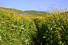
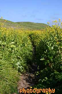
#806 — A scenic picture of a beautiful hiking trail located by the coast in Marin County, California at Kehoe Beach. Marin County is a county located in California's San Francisco Bay Area across the Golden Gate Bridge fom San Franicsco. In this picture you can see Marin county's beautiful green hills along with the yellow falselupine wildflowers.
Marin County Coastal Trail
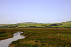
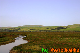
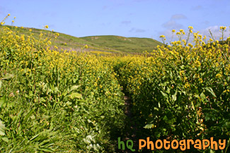
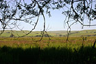
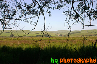
#948 — A scenic picture taken of the grasslands and hills in Marin County, California. This photo was taken near Point Reyes. In the photo you can see a stream of water along with the green hills in the background and green grassy field in the foreground. This photo was taken on a beautiful sunny day with blue sky seen all around.
Marin County Fieldland and Hills
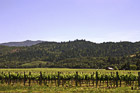
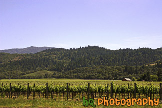
#479 — A scenic picture taken of a Napa Valley, California Vineyard. Napa Valley is located northeast of San Francisco. Napa Valley is known for their wines... There are the 300-plus opportunities to taste some of the world's best wines. Nearly 60% of California's wineries are located in Napa and the parallel Sonoma Valley, together the traditional heart of California's "Wine Country".
Napa Valley, California
#365 — A scenic picture taken in Point Reyes, California in Marin County. Point Reyes is home to many native land mammals which number about 37 species. Marine mammals also add to this total by another 12 species. The biological diversity stems from a favorable location in the middle of California and the natural occurrence of many distinct habitats which makes Point Reyes a fun place to visit.
Point Reyes Landscape Scene
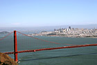
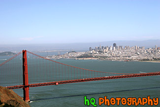
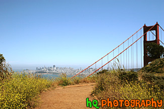
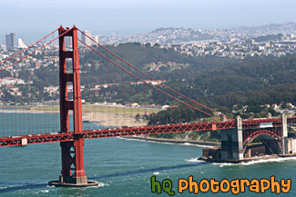
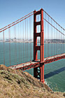
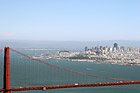
#1390 — A scenic picture taken looking down at the Golden Gate Bridge with the city of San Francisco seen in the background on this sunny fog-free day in the bay area.
Golden Gate Bridge & The City
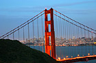
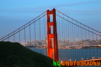
#362 — A scenic picture of the Golden Gate Bridge in San Francisco at night with a view of San Francisco city in the background. In the distance you can see the lights of the city lit up as well as the lights of the bridge. The Golden Gate Bridge seems to be "glowing" in this picture from the effect of night-fall approaching and city lights beginning to come on. This picture was taken from the Marin Headlands (north side) of the bridge from a place called Battery Spencer just slightly after dusk.
Golden Gate Bridge at Night & San Francisco City
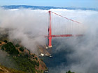
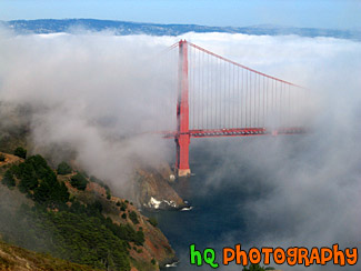
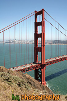
#215 — A scenic photo of fog covering the Golden Gate Bridge located in San Francisco, California. This picture was taken during the summer months when the fog really covers the Golden Gate Bridge. The real "Golden Gate" is the strait that the bridge spans. It was first named "Chrysopylae," meaning "golden gate," by Captain John C. Fremont in 1846. This photo was taken from the top of Hawk Hill which is located just north of San Francisco in the Marin Headlands. Total length of the bridge is 1.7 miles and the clearance above the high water is 220 feet.
Golden Gate Bridge Covered in Fog
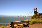
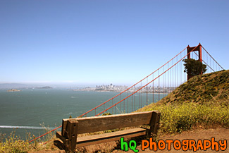
#992 — A scenic picture taken of an empty bench and the Golden Gate Bridge off to the right along with the city of San Francisco, the bay waters, and Alcatraz in the background. This picture was taken on a beautiful sunny day.
Bench & Golden Gate Bridge
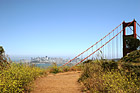
#991 — A scenic picture taken of yellow wildflowers located on the sides of a trail leading to the Golden Gate Bridge. You can also see the city of San Francisco and the bay waters in the distance on this beautiful sunny day.
Golden Gate Bridge & Wildflowers on Trail
#587 — A scenic picture taken of the Golden Gate Bridge in California. In this picture you can see the city of San Francisco in the background and Alcatraz Island off to the left. This picture of the Golden Gate Bridge was taken from a place called Battery Spencer in the Marin Headlands.
Golden Gate Bridge from Battery Spencer
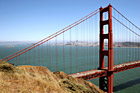
#2063 — A scenic picture taken of the Golden Gate Bridge located in San Francisco on a blue sky sunny day. This photo is taken of just one section of the bridge.
Golden Gate Bridge in San Franciso
#2065 — A scenic picture taken of the San Francisco side of the Golden Gate Bridge on a beautiful sunny afternoon.
Golden Gate Bridge Side View
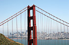
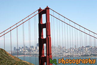
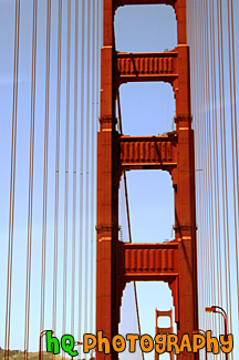
#426 — A scenic picture of a close up of the tip of the famous Golden Gate Bridge located in San Francisco, California on a sunny blue sky day. The Golden Gate Bridge is a historic symbol that represents the city of San Francisco. Joseph B. Strauss was the original chief engineer of the bridge and designed a rather unsightly cantilever and suspension structure in 1916. Though attempts were made to refine the design, it wasn't until consulting architects Irving F. Morrow and his wife Gertrude C. Morrow stepped in that the current look and design were imagined and implemented. The bridge opened for traffic 1937.
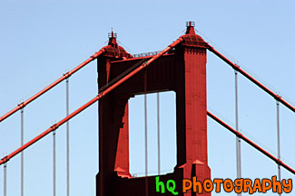
Golden Gate Bridge Tip
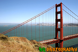
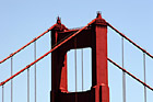
#2064 — A scenic vertical picture taken of the Golden Gate Bridge during the day with blue sky seen above. San Francisco can be seen in the background.
Golden Gate Bridge Vertical View
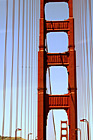
#590 — An interesting vertical picture taken of the famous Golden Gate Bridge located in San Francisco, California. This picture was taken while driving in a car on the bridge looking up at the red frame on a sunny blue sky day.
On The Golden Gate Bridge
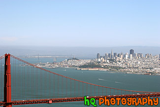
#1391 — A scenic picture taken of the city of San Francisco in the background and the Golden Gate Bridge in the foreground in this sunny fog-free day in the bay area.
San Franicsco & Golden Gate
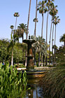
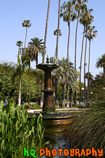
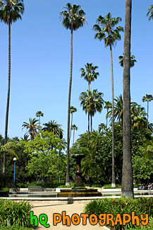
#1403 — A scenic vertical picture taken of the fountain at Will Rogers Memorial Park located in the Beverly Hills area of Los Angeles, California. Blue sky and palm trees are seen surrounding this fountain.
Fountain at Will Rogers Memorial Park
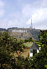
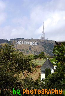
#1771 — A scenic vertical picture taken of the Hollywood Sign on the hill in Los Angeles, California. Partly cloudy, blue sky is seen above.
Hollywood Sign
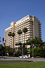
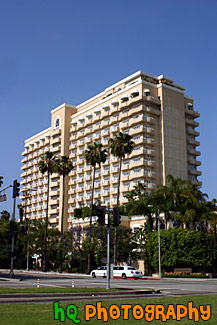
#953 — A scenic picture taken of a hotel located in downtown Beverly Hills, California. A limousine is driving in front of the hotel on this beautiful sunny day.
Hotel in Downtown Beverly Hills
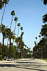
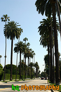
#723 — A scenic picture taken of many palm trees alternating between tall and short along a road perpendicular to Sunset Blvd. in Beverly Hills, California.
Palm Trees Along Beverly Hills Road
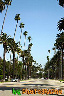
#751 — A scenic picture taken of the hundreds of palm trees located in Beverly Hills while approaching the famous Sunset Boulevard street. This picture was taken on a sunny day with blue sky above the palm trees. Sunset Boulevard is one of the world's most famous streets. Sunset Boulevard passes through Hollywood, then becomes the Sunset Strip as it passes through West Hollywood, weaves its way through Beverly Hills and Bel-Air, and finally winds its way through the rustic foothills of the Santa Monica mountains, to finally end at the Pacific Ocean near Malibu.
Palm Trees Leading to Sunset Blvd.
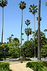
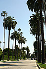
#720 — A scenic picture taken of the tall palm trees surrounding the beautiful Rogers Memorial Park located in Beverly Hills, California. The Will Rogers Memorial Park was the first municipal park in Beverly Hills, originally opened under the name of Sunset Park in 1915. The park was renamed in 1952 to honor the entertainer and honorary mayor of Beverly Hills, Will Rogers.
Palms of Rogers Memorial Park
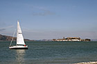
#1573 — A scenic picture taken of Alcatraz Island and a white sailboat floating in front with blue sky seen above.
Alcatraz & Sailboat
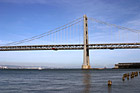
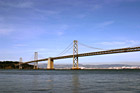
#449 — A scenic picture taken of the Bay Bridge in San Francisco, California with sail boats sailing underneath. This bridge connects the cities of San Francisco and Oakland. The Bay Bridge opened to traffic on November 12, 1936. Its total cost, including an electric railroad which has since been abandoned, was $79.5 million. The best ways to enjoy the Bay Bridge are: From the San Francisco waterfont along Embarcadero Street, where you can see and photograph the span, and walk under it.
Bay Bridge, San Francisco & Sail Boats
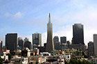
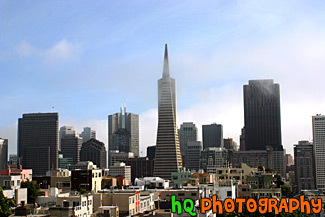
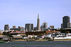
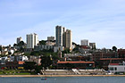
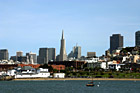
#782 — A scenic picture taken of the tall buildings the downtown San Franicsco, California financial district including the Transamerica pyramid. San Francisco's financial district is ranked as one of the top four financial centers in the nation and some of the most highest paying jobs reside here.
Financial District, San Francisco
#348 — A picture taken of Ghirardelli Square in San Francisco, California. This picture was taken out on a dock looking in towards the shore and the square. Ghirardelli Square is a historic San Francisco destination, offering shopping San Francisco style, waterfront dining near Fisherman's Wharf, art galleries, family events, walking tours and more. Today the original 1860 cast iron chocolate grinder from France is located on the lower plaza, and other chocolate-making equipment is still operating on a small scale in the Ghirardelli Chocolate Manufacture.
Ghirardelli Square in San Francisco
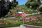
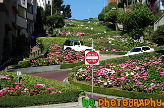
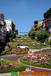
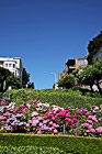
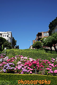
#568 — A scenic picture taken of the famous Lombard Street which is located in downtown San Francisco, California. Lombard Street has eight sharp turns (or switchbacks) that have earned the street the distinction of being the most crooked (winding) street in the United States. One of San Francisco's car lines stops at the top of this block. The crooked section of the street is reserved for one way traffic traveling east (downhill), and is paved with bricks. The section was built in 1923 to accommodate the steepness of the slope of the hill. The road is surrounded with beautiful shrubs and flowers and stunning bay views that draw in tourists day after day. From the top of the hill you will see amazing views of the bay such as Telegraph Hill and North Beach.
Lombard Street
#404 — This is a scenic picture taken of Lombard Street which is located in downtown San Francisco, California. Lombard Street is a major east to west street that crosses the entire city of San Francisco. It is best known for one block on Russian Hill between Hyde and Leavenworth Streets, with eight sharp turns (or switchbacks) that have earned the street the distinction of being the most crooked (winding) street in the United States. One of San Francisco's car lines stops at the top of this block. The crooked section of the street is reserved for one way traffic traveling east (downhill), and is paved with bricks. The section was built in 1923 to accommodate the steepness of the slope of the hill. The road is surrounded with beautiful shrubs and flowers and stunning bay views that draw in tourists day after day. From the top of the hill you will see amazing views of the bay such as Telegraph Hill and North Beach.
Lombard Street, San Francisco
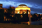
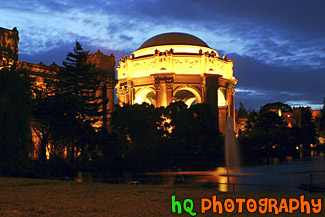
#368 — A scenic picture taken of the Palace of Fine Arts building at night in downtown San Francisco. With this picture taken at night you can see the palace lit up and the water fountain streaming. The task of creating a Palace of Fine Arts for the 1915 Panama-Pacific International Exposition fell to the architect Bernard R. Maybeck, then fifty years old and known for his innovative ideas. Setting to work on this new project, he chose as his theme a Roman ruin, mutilated and overgrown, in the mood of a Piranesi engraving. The Palace of Fine Arts was meant to give delight by its exterior beauty, but its purpose was also to offer all visitors a stimulating experience within doors
Palace of Fine Arts Exploratorium at Night


#430 — A scenic picture taken of the crookedest street in the U.S. which is also more commonly known as Lombard Street. Lombard Street is located in downtown San Francisco, California. Lombard Street is a major east to west street that crosses the entire city of San Francisco. It is best known for one block on Russian Hill between Hyde and Leavenworth Streets, with eight sharp turns (or switchbacks) that have earned the street the distinction of being the most crooked (winding) street in the United States. Lombard Street is a major tourist's attraction of San Francisco.
San Francisco's Lombard Street
#383 — A scenic picture taken of Alactraz Island and a flag in the foreground in San Francisco. This picture was taken from the Coit Tower.
Alcatraz & Flag
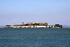
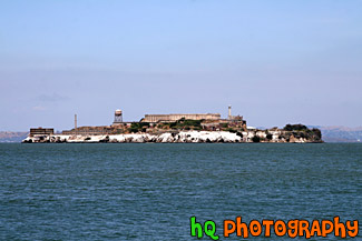
#1764 — A scenic picture taken of Alcatraz Prison and island on a sunny day in San Franciso, California. Alcatraz Island served as a military fortification in the 1850's, an incarceration facility for Spanish-American War prisoners, and a federal maximum-security prison from 1934 to 1963. Alcatraz Island is now one of Golden Gate National Recreation Area's most popular destinations.
Alcatraz Prison
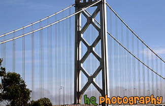
#593 — A close up picture taken on the arch of the Bay Bridge which is located in San Francisco, California and connects with Oakland. There are no pedestrian walkways or vista points on the Bay Bridge, but you can drive on it and stop midway at Treasure Island to view the span. The Bay Bridge is a very popular commuting bridge as over a quarter million vehicles cross the San Francisco Bay Bridge daily.
Arch of Bay Bridge
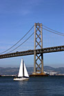

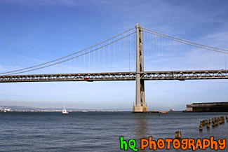
#564 — A scenic picture taken of the Bay Bridge which is located in San Francisco, California and connects with the city of Oakland. In this picture there is a single sailboat floating in front of the bridge on a blue sky sunny day.
Bay Bridge & Sailboat
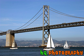
#1392 — A scenic picture taken of one of the archs of the Bay Bridge which is located in San Francisco, California. This photo was taken on a sunny day with blue sky all around. A sail boat can be seen under the bridge.
Bay Bridge Arch
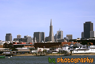
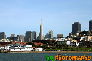
#1209 — A scenic picture taken of the Financial District in downtown San Francisco with the Transamerica Pyramid seen in the center. This photo was taken from a dock in the San Francisco bay.
Financial District from Water
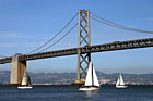
#565 — A full view picture taken of the Bay Bridge and some sailboats sailing by on a sunny day in San Francisco, California. The bay bridge connects the city of San Francisco with the city of Oakland.
Full View of Bay Bridge & Sailboats
#604 — A scenic picture taken of the Ghirardelli Square on a sunny day which is located in San Francisco, California. Ghirardelli Square is a historic San Francisco destination, offering shopping San Francisco style, waterfront dining near Fisherman's Wharf, art galleries, family events, walking tours and more. Today the original 1860 cast iron chocolate grinder from France is located on the lower plaza, and other chocolate-making equipment is still operating on a small scale in the Ghirardelli Chocolate Manufactory.
Ghirardelli Square
#1408 — A scenic picture taken of Ghirardelli Square with the city of San Francisco seen surrounding it. You can see the Transamerica pyramid and San Francisco's financial district as well as the bay waters and sailboats in the foreground. This photo was taken on a sunny fog-free day in the bay area.
Ghirardelli Square & The City
#1409 — A scenic picture taken of Ghirardelli Square looking at it from the bay waters of San Francisco, California. Ghirardelli Square is a historic San Francisco destination, offering shopping San Francisco style, waterfront dining near Fisherman's Wharf, art galleries, family events, walking tours and more. This picture was taken on a fog-gree sunny day in the bay area.
Ghirardelli Square from the Bay
#681 — A close up picture taken of the flowers and curves of Lombard Street in downtown San Francisco, California. Lombard Street has eight sharp turns (or switchbacks) that have earned the street the distinction of being the most crooked (winding) street in the United States. One of San Francisco's car lines stops at the top of this block.
Lombard Street Close Up
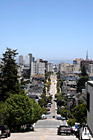
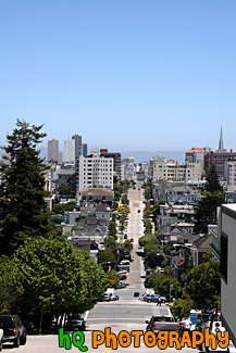
#993 — A scenic picture taken of a long downhill road in San Francisco, California. This picture was taken on a beautiful sunny blue sky day.
Long Street in Downtown San Francisco
#783 — A scenic picture looking at Treasure Island and Oakland in the background from San Francisco, California. In the picture you can see the Oakland-Bay Bridge on the other side of Treasure Island. You can also see the interesting buildings, apartments, and homes of San Francisco in the foreground.
Oakland & Treasure Island from S.F.
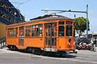
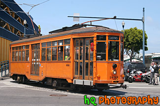
#1574 — A scenic picture taken of an orange cable car in downtown San Francisco right by the warf.
Orange Cable Car
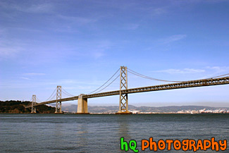
#784 — A scenic picture taken of the entire San Francisco - Oakland Bay Bridge located in San Francisco, California. This picture was taken on a sunny day in the spring season. The Bay Bridge opened to traffic on November 12, 1936. Its total cost, including an electric railroad which has since been abandoned, was $79.5 million. The best ways to enjoy the Bay Bridge are: From the San Francisco waterfont along Embarcadero Street, where you can see and photograph the span, and walk under it.
San Francisco Bay Bridge & Blue Sky
#801 — A scenic picture taken of downtown San Francisco, California. In this picture you can see the Bay Bridge in the background, a palm tree in the foreground and the many unique buildings, apartments, and homes of San Francisco in the middle. This picture was taken on an sunny day with blue sky and some low fog in the background.
San Francisco Buildings & Bay Bridge
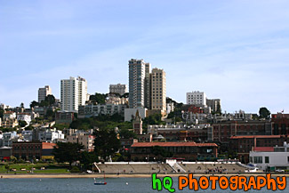
#891 — A scenic picture taken of the downtown San Francisco financial district seen with the bay waters in the foreground. The Transamerica Pyramid building stands high in the middle of this photograph. The picture was taken on a beautiful sunny day in San Francisco. Sail boats can be seen in the water and people can be seen on the shore enjoying the sunshine.
San Francisco City & Bay
#890 — A scenic picture taken of a stick in the bay waters in the foreground in line with Coit Tower seen in the background of San Francisco, California.
Stick & Coit Tower
#605 — A vertical picture taken of the Ghirardelli Square on a blue sky sunny day in San Francisco, California. This picture was taken out on a dock looking in towards the shore and the square. Ghirardelli Square is a historic San Francisco destination, offering shopping San Francisco style, waterfront dining near Fisherman's Wharf, art galleries, family events, walking tours and more.
Vertical Ghirardelli Square
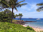
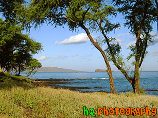
#207 — A scenic photo taken of a palm tree, boat, and the Pacific Ocean off the coast of Makena, Hawaii, which is on the island of Maui.
Beautiful Maui, Boat, and Pacific Ocean
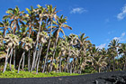
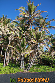
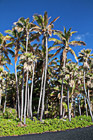
#2387 — A scenic picture taken of the black sand and palm trees located on the Big Island of Hawaii. Beautiful blue sky is seen in the background. This black sand beach is located at Punaluu Black Sand Beach. The sand is black because of the constant volcanic activity on the island.
Black Sand Beach & Palm Trees
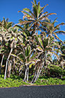
#2389 — A scenic vertical picture taken of Punaluu Black Sand Beach which green palm trees and blue sky. You can see the black sand in the foreground.
Black Sand Beach at Punaluu, Big Island
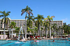
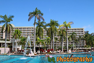
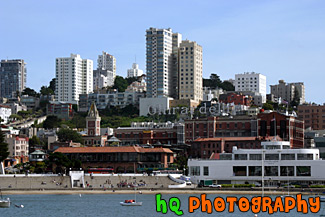
#2359 — A scenic picture taken of a hotel Resort pool area located in Kauai, Hawaii. Blue sky is seen above with the pool and palm trees in the foreground. People are in the pool enjoying the Hawaii weather.
Hotel Resort Pool Area
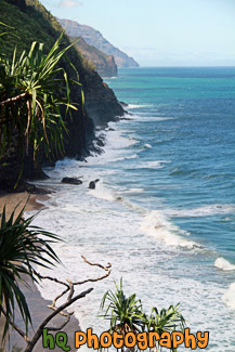
#2385 — A scenic picture taken of part of the Kalalau Trail located on the island of Kauai, Hawaii along the rugged Na Pali Coast.
Kalalau Trail on Na Pali Coast
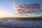
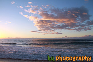
#2381 — A scenic picture taken of Kauai and the Pacific Ocean and clouds at dusk as the pink sky starts to set in. This photo was taken at Polihale State Park.
Kauai at Dusk
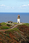
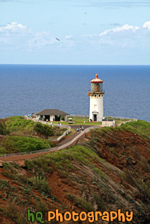
#2382 — A scenic vertical picture taken of the Kilauea Lighthouse which is located at the northernmost point of the main Hawaiian Islands at Kauai. It was built in 1913.
Kilauea Lighthouse
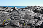
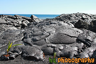
#2396 — A scenic picture taken of some dried lava fields with the Pacific Ocean seen in the background. These lava fields were found on the Big Island of Hawaii from lava that had dried up from the Kilauea volcano.
Lava Fields & Ocean
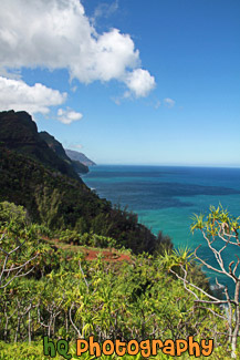
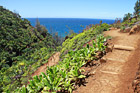
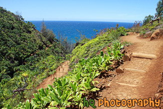
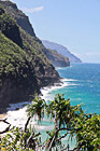
#2365 — A scenic vertical picture taken of the Na Pali coastline seen from hiking the Kalalau Trail in Kauai, Hawaii. Clouds and blue sky are seen above.
Na Pali Coast From Kalalau Trail
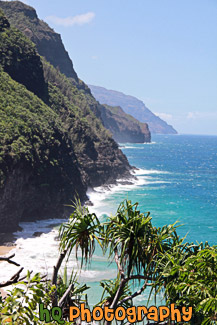
#2384 — A scenic vertical picture taken of the Na Pali Coast while hiking on the 11 mile long Kalalau Trail in Kauai, Hawaii.
Na Pali Coast on Kalalau Trail
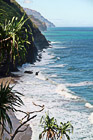
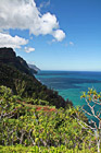
#2364 — A scenic picture taken of the Na Pali coastline located in Kauai, Hawaii from the ground. Blue waters and amazing cliffs are seen here.
Na Pali Coast, Kauai
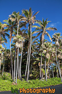
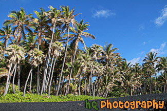
#2388 — A scenic vertical taken taken of the bland sand and palm trees at Punaluu Black Sand Beach located on the Big Island of Hawaii. Bright blue sky is seen in the background.
Punaluu Black Sand Beach
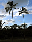
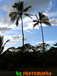
#169 — A scenic silhouette of two palm trees located in Maui, Hawaii with a beautiful sky behind them as the sun is getting ready to set on this beautiful island.
Two Palm Trees of Maui
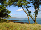
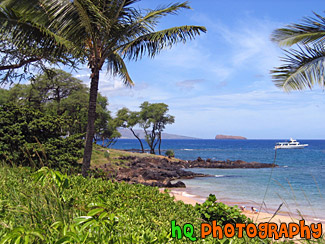
#217 — A scenic picture taken of Maui and the Pacific Ocean off the coast of Makena, Hawaii, which is on the island of Maui.
View of Maui & Ocean
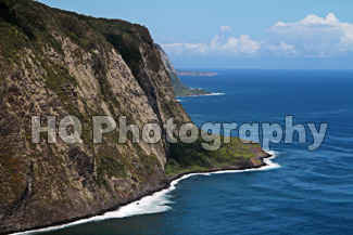
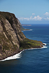
#2411 — A scenic picture taken with blue skies of the Waipio Valley located on the Big Island in Hawaii.
Waipio Valley, Hawaii
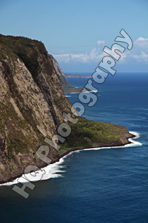
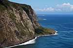
#2410 — A scenic vertical picture taken of Waipio Valley located on the Big Island of Hawaii.
Waipio Valley, Hawaii, Big Island
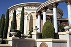
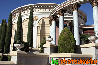
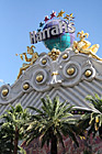
#1870 — A scenic picture taken of part of the Caesars Palace hotel located on the strip in Las Vegas, Nevada. This photo was taken on a sunny day with blue sky seen in the background.
Caesars Palace
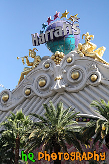
#1872 — A scenic vertical picture taken of a Las Vegas hotel, Harrah's. This is a photo of the hotel's sign and palm trees.
Harrah's Hotel Sign in Daytime
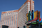
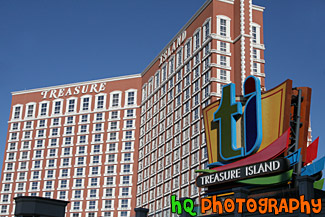
#1844 — A scenic picture taken of the Treasure Island hotel located on the strip at Las Vegas, Nevada on a sunny day.
Treasure Island Hotel
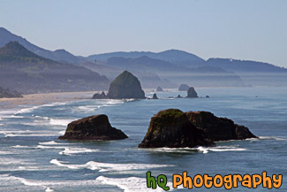
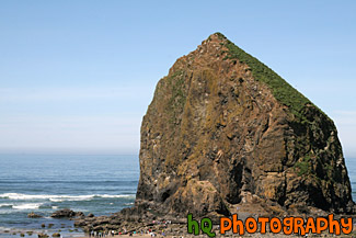
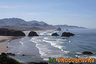
#2002 — A scenic coastal picture taken in Oregon State at Cannon Beach. In this picture you can see sea stack rocks and the well-known Haystack Rock in the distance.
Cannon Beach & Ocean Rocks
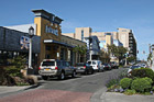
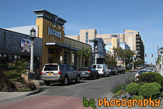
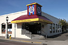
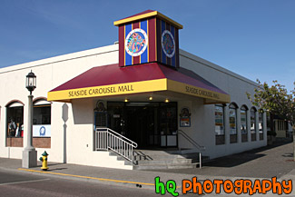
#2053 — A scenic picture taken of the downtown area of Seaside, Oregon. Seaside is a tourist town located on the coast of Oregon.
Downtown Seaside, Oregon
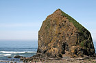
#2020 — A scenic picture taken of the popular Cannon Beach landmark, Haystack Rock. This photo was taken from a hill looking slightly down at the rock. You can see all of the people below observing Haystack Rock.
Haystack Rock From a Hill
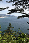
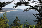
#2164 — A scenic vertical picture taken of the Oregon State coast and Pacific Ocean looking down through trees from the top of a hiking trail. This photo was taken on a pretty blue sky day.
Oregon Coast & Pacific Ocean
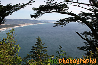
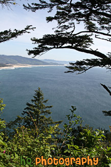
#2163 — A scenic picture taken of the scenic Oregon State coast and the Pacific Ocean from a top a hiking trail on a hill looking down at the ocean and shoreline. This photo was taken on a beautiful sunny day.
Oregon Coast Through Trees
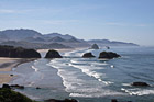
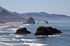
#2332 — A scenic coastal picture taken along the cast in Oregon State at Cannon Beach. In this picture you can see a lot of sea stack rocks and the well-known Haystack Rock in the distance. Blue sky is seen above the Pacific Ocean.
Pacific Ocean at Cannon Beach
Pages: [<<] 1 2 3 4 5 6 7 [>>]
