Photos of Scenic National Park (119)
There are (119) photos of the keyword, Scenic National Park, available on our website. They are pictured below.The pictures are organized by category.
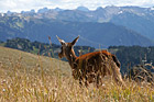
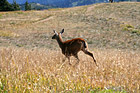
#1673 — A scenic close up picture taken of a deer running through the fields located at the Olympic National Park at Hurricane Ridge.
Deer Running
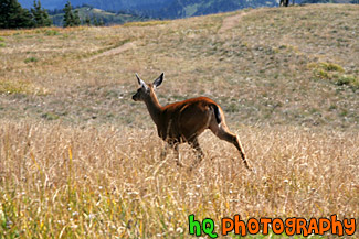
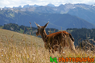
#1697 — A scenic picture taken of a deer running in a field located in the Olympic Mountains in Washington State. This photo was taken near Hurricane Ridge.
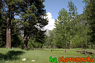
Deer Running in Field
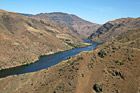
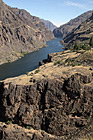
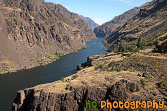
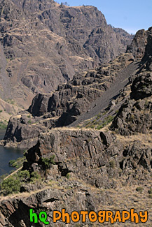
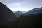
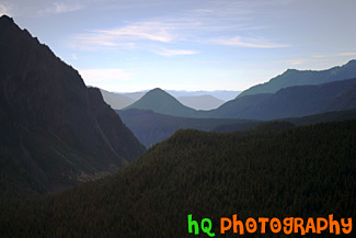
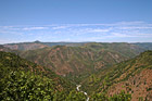
#2041 — A scenic picture taken looking down at Hells Canyon National Recreation Area and Snake River flowing through the canyon. This picture was taken on a sunny day on top of a surrounding hill.
Aerial Hells Canyon National Recreation Park
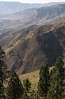
#2046 — A scenic vertical picture taken of some hills of Hells Canyon National Recreation Area located in the northeastern Oregon and western Idaho areas.
Hells Canyon Hills
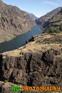
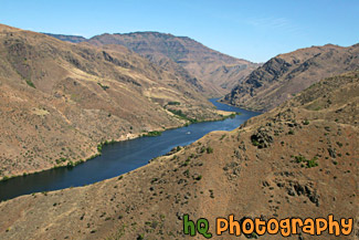
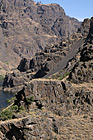
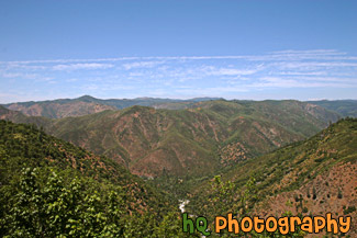
#2032 — A scenic vertical picture taken of Hells Canyon and the Snake River running through it. This picture was taken on a sunny day on the Idaho side of the canyon. Hells Canyon runs along the North East border of Oregon State and western Idaho. Hells Canyon is a National Recreation Area and is the deepest river gorge in North America.
Hells Canyon in Idaho
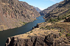
#2033 — A scenic picture taken of Hells Canyon National Recreation Park located in northeastern Oregon and western Idaho. This photo was taken on a sunny day as you can see the Snake River flowing in the canyon.
Hells Canyon National Recreation Park
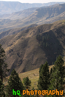
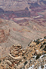
#2040 — A close up vertical picture of some rocks located at Hells Canyon National Recreation Area in northeastern Oregon and western Idaho.
Hells Canyon Rocks
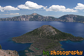
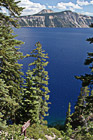
#2351 — A scenic picture taken of the blue waters of Crater Lake and Wizard Island. This photo was taken on a sunny summer day.
Crater Lake & Wizard Island
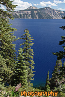
#2352 — A scenic picture taken of Crater Lake National Park located in Oregon State. In this picture you can see the super blue waters of the lake.
Crater Lake Through Trees
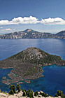
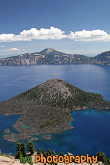
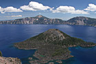
#2349 — A scenic vertical picture taken of Crater Lake and Wizard Island seen in the middle of it. This photo was taken on a pretty blue sky day during the summer month of August.
Wizard Island in Crater Lake
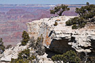
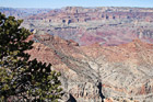
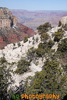
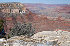
#2255 — A scenic picture taken of tree located on the edge of the South Rim cliff at the Grand Canyon National Park in Arizona. Blue sky is seen above on this sunny winter day.
Cliff, Tree & Grand Canyon
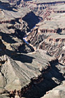
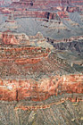
#2231 — A close up vertical picture taken from the South Rim zoomed in on the Colorado River seen in the Grand Canyon.
Colorado River Seen in Grand Canyon
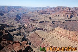
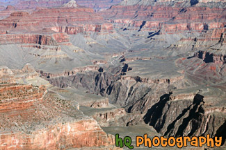
#2257 — A scenic picture of the Grand Canyon National Park taken at Desert View of the East Rim. In this photo you can see the Colorado River and a wide view of the canyon.
Desert View of Grand Canyon National Park
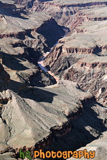
#2265 — A scenic vertical picture taken of the grand canyon national park with the Colorado River seen at the bottom. The river is a muddy brown color in this photo.
Grand Canyon & Colorado River
#2259 — A scenic picture taken of the Grand Canyon National Park from the East Rim near Desert View. This photo was taken during a sunny winter day as you can see blue skies above. A tree is seen in the foreground on the left side.
Grand Canyon & Desert View at South Rim
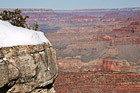
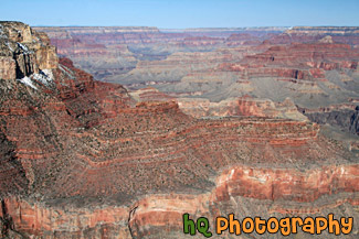
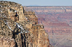
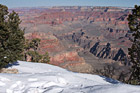
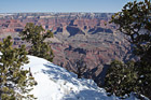
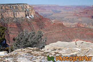
#2247 — A scenic picture taken of the Grand Canyon during the winter season with snow seen on the cliff to the left. This photo was taken at the South Rim of the National Park.
Grand Canyon & Snow at the South Rim
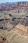
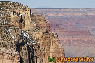
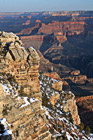
#2248 — A scenic vertical picture taken close up of the Grand Canyon at the South Rim of the National Park.
Grand Canyon Close Up at South Rim
#2258 — A scenic vertical picture taken of the Grand Canyon National Park from Desert View located on the East Rim.
Grand Canyon From Desert View
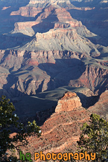
#2256 — A scenic vertical picture taken of the Grand Canyon National Park from the South Rim. Trees, and canyon peaks can be seen in this photo with blue sky above.
Grand Canyon National Park at South Rim
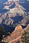
#2251 — A scenic picture taken of the Grand Canyon National Park from the South Rim. This photo was taken on a sunny day with blue skies seen above.
Grand Canyon National Park View
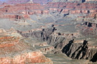
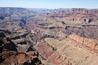
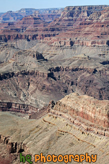
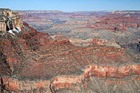
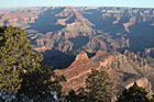
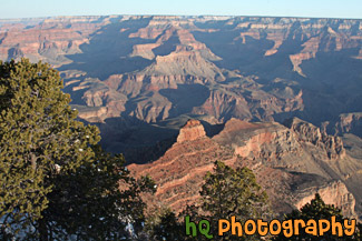
#2249 — A scenic picture taken of a big view of the grand canyon from the south rim just past the Yavapai Observation Station. This photo was taken on a sunny day at the park. You can see the Colorado River very faint at the bottom on the canyon in this photo.
Grand Canyon South Rim View
#2246 — A scenic vertical picture taken of the Gran Canyon National Park during sunrise at Yaki Point on the South Rim. Yaki Point is one of the many lookouts along the south rim that provides sightseers with an extraordinary view into the canyon.
Grand Canyon Sunrise at Yaki Point
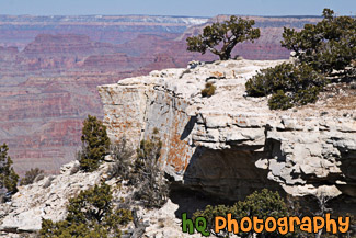
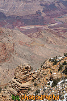
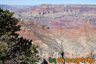
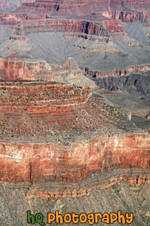
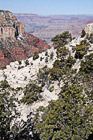
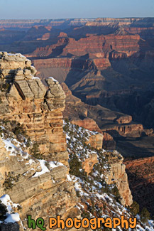
#2254 — A scenic close up picture taken of a wall of the grand canyon located on the south rim with blue sky seen above.
Grand Canyon Wall View
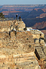
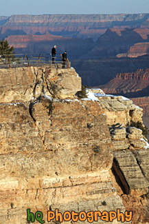
#2242 — A scenic vertical picture taken of two people looking at the view of the Grand Canyon near Mather Point at sunrise.
People Looking at View During Sunrise
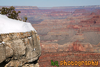
#2261 — A scenic picture taken of snow along the bank of the South Rim located at the Grand Canyon National Park on a sunny winter season day. Two trees are also seen in the foreground with the snow.
Snow Along South Rim & Canyon View
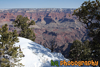
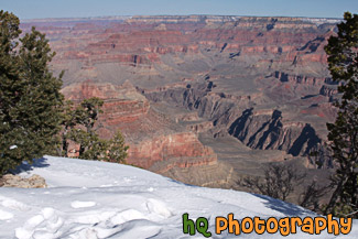
#2253 — A scenic picture taken of snow, trees, and a view of the grand canyon national park from the south rim. This photo was taken on a sunny winter day.
Snow, Trees, & Grand Canyon View
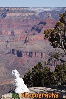
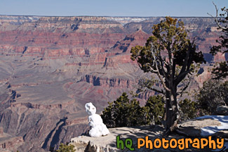
#2252 — A scenic vertical picture taken of a snowman that was built just along the edge of the South Rim at the Grand Canyon National Park. This photo was taken on a sunny winter day.
Snowman & Grand Canyon
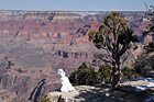
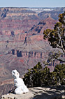
#2229 — A scenic picture taken of a snowman sitting at the rim of the Grand Canyon and looking at the view. This photo was taken in March during the winter season on a sunny day. A tree is seen next to the snowman.
Snowman Looking at Grand Canyon
#2250 — A scenic picture taken of a view of the grand canyon national park from the south rim on a sunny blue sky winter day. This photo was taken near the Yavapai Observation Station.
South Rim Grand Canyon View
#2232 — A scenic vertical picture taken of a view of the grand canyon during sunrise from Mather Point on the South Rim.
Sunrise Grand Canyon View at Mather Point
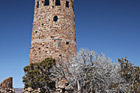
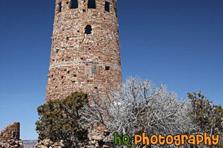
#2260 — A scenic picture taken of the Watch Tower located at Desert View on the East Rim of the Grand Canyon National Park. This photo was taken on a sunny winter day with blue sky seen above.
Watch Tower at Desert View
#2243 — A scenic picture taken at Yaki point during Sunrise at the Grand Canyon National Park. A few green trees are seen in the foreground and blue sky is in the background. Yaki point is located on the southeast rim of the Grand Canyon.
Yaki Point at Sunrise
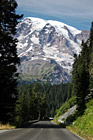
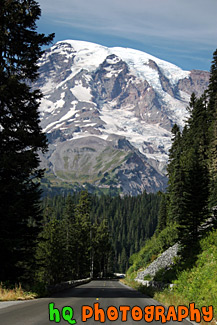
#640 — A scenic picture taken of Mount Rainier while heading west on the road through Mount Rainier National Park approaching the top at Paradise. This picture was taken in the summertime hence not very much snow on the mountain, but Mt. Rainier looks huge compared to the road going towardds it. Mount Rainier National Park lies in the Cascade chain of mountains 68 miles south-southeast of Seattle and 95 miles north-northeast of Portland, Oregon. The park is open year round, but visitation to most regions is limited to late June to early October, depending on snowfall.
Approaching Mount Rainier
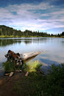
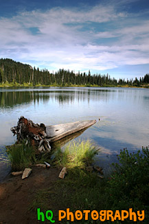
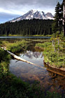
#647 — A scenic picture taken of a log, dramatic sky, and reflection lakes which is located in Mount Rainier's National Park in Washington State.
Log & Reflection Lake
#637 — A beautiful picture taken of Mt. Rainier at Tipsoo Lake in the Mount Rainier National Park in Washington State. This picture was taken in mid August which makes the lake completely snow free. The lake is surrounding by many evergreen trees and many hiking trails for recreation.
Mount Rainier at Tipsoo Lake
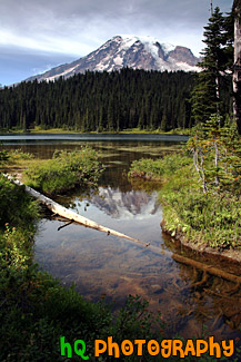
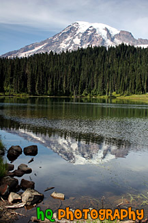
#648 — A scenic picture taken of Mount Rainier's reflection and a log in Reflection Lakes. Reflection Lakes is located in Mount Rainier's National Park in Washington State. This picture was taken in the summertime which is why there is not much snow on the mountain.
Mount Rainier Reflection & Log
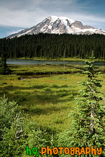
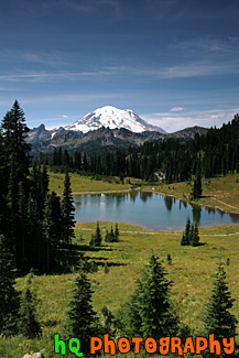
#748 — A scenic picture taken of Mount Rainer, some evergreen tress in the foreground and background, and part of Reflection Lake in the distance. This picture was taken during summertime which is why there is not very much snow on the mountain and everything is so green.
Mount Rainier, Trees, & Lake
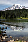
#628 — A scenic picture taken of Mt. Rainier and its' reflection sourounded by some rocks in Reflection Lakes which is located in Mt. Rainier's National Park. As an active volcano Mount Rainier stands as a reminder of the beauty and power of nature. Mt. Rainier formed about 500,000 years ago and has the potential to erupt again at some unknown time. Mount Rainier National Park was established in 1899.
Mt. Rainier Reflection & Rocks in Reflection Lakes
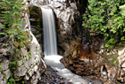
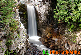
#641 — A beautiful picture taken of Christine Falls which is located in Mount Rainier's National Park in Washington State. This picture was taken with a slow shutter speed to get the streaming / silky effects of the waterfall. Christine Falls is located west of Paradise and about 1-2 miles away from Narada Falls.
Christine Falls, Cotton Candy Effect
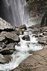
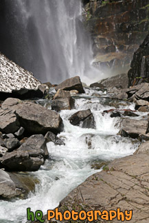
#2150 — A scenic vertical picture taken of Comet Falls and a river which is located in the Longmire area of Mt. Rainier National Park.
Comet Falls & River
#1645 — A scenic vertical picture taken evergreen trees and hills seen in the background located at Mt. Rainier National Park in Washington.
Evergreen Trees & Hills
#1506 — A scenic picture taken of evergreen trees seen in the foreground and snow-capped hills seen in the background of Mt. Rainier National Park. This picture was taken from the Paradise area of Mt. Rainier.
Evergreen Trees & Snowy Hills
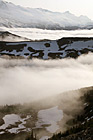
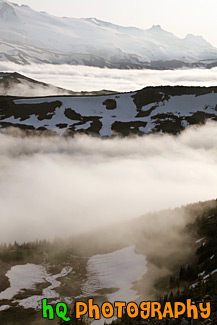
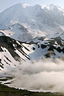
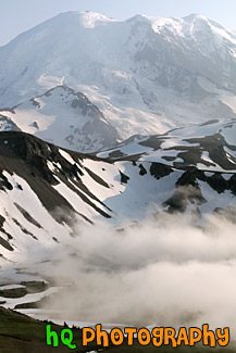
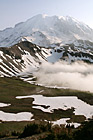
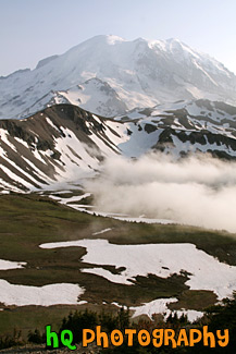
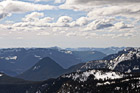
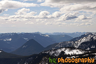
#1834 — A scenic picture taken of fog hovering over the mountain hills located near Mt. Rainier at the Sunrise Entrance. This picture was taken from the Mount Fremont lookout and taken with blue sky seen above the fog.
Fog Hovering over Mountains
#1643 — A scenic picture taken of blue sky, clouds, and hills located in Mt. Rainier National Park. Tons of evergreen trees can be seen in this photo.
Hills & Clouds in Mt Rainier Park
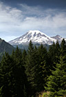
#649 — A beautiful picture taken of the hills of Mount Rainier's National Park and the Cascade Mountains. This picture was taken looking west at a lookout while approaching Paradise.
Hills of Mount Rainier National Park
#1637 — A scenic vertical picture taken of some hills with snow on them which are located right next to Mt Rainier near the Sunrise entrance. This picture was taken from the Mount Fremont lookout.
Hills with Snow Near Mt. Rainier
#1629 — A scenic picture taken of the Mt. Rainier National Park from a view located up at Mount Fremont lookout which is near the Sunrise area.
Mount Fremont Lookout View
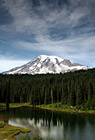
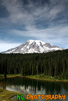
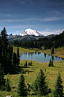
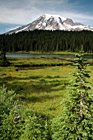
#703 — A scenic picture taken of Mount Rainier, an interesting sky, evergreen trees, and reflection lake located in Mount Rainier National Park. In this picture you can see the evergreen trees along with some of Mt. Rainier reflecting in the lake. Mt. Rainier does not have much snow on it in this picture as it was taken in the summertime.
Mount Rainier & Reflection Lake
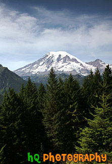
#680 — A scenic picture taken of Mt. Rainier with evergreen trees in the foreground and an interesting cloud formation in the sky. This picture was taken during the summer in Mount Rainier National Park. Mount Rainier National Park lies in the Cascade chain of mountains 68 miles south-southeast of Seattle and 95 miles north-northeast of Portland, Oregon. The park is open year round, but visitation to most regions is limited to late June to early October, depending on snowfall.
Mount Rainier Behind Evergreen Trees
#1638 — A scenic vertical picture taken close up of Mt. Rainier with some fog seen at the base. This picture was taken at the Mount Fremont lookout located at the Sunrise entrance to the park.
Mt. Rainier & Fog
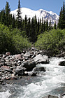
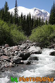
#1658 — A scenic vertical picture taken of a river in the foreground of Mt. Rainier taken of on a blue sky day. This picture was taken on the Glacier Basin trail near the White River Entrance to the park.
Mt. Rainier & River
#1633 — A scenic picture taken of Mt. Rainier from the Mount Freemont Lookout which is located in the Sunrise area of the national park.
Mt. Rainier From Mount Freemont Lookout
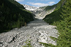
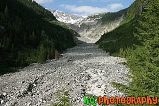
#1641 — A scenic picture taken of the Nisqually River Glacier located on the southern side of Mt. Rainier.
Nisqually Glacier
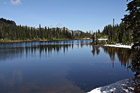
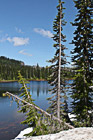
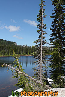
#1713 — A scenic picture taken of Reflection Lake which is located in the Mt. Rainier National Park, Washington. This picture was taken on a sunny day with blue sky seen above and some reflections of the trees in the lake. Snow is also still seen on the shores of the lake.
Reflection Lake in Mt. Rainier National Park
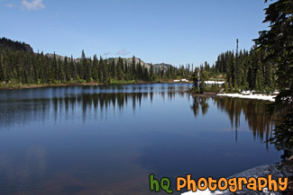
#1666 — A scenic vertical picture taken of Reflection Lake which evergreen trees scene all around and snow still on the ground during this sunny summer day in July.
Reflection Lake, Trees & Snow
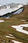
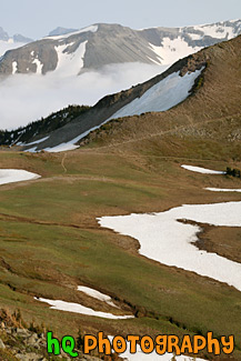
#1504 — A scenic picture overlooking the snow-capped hills of Mt. Rainier National Park. This picture was taken from a snowshoeing trail at Paradise on a partly cloudy day.
Snow Capped Hills from Paradise
#1505 — A scenic picture taken of snow covered hills located in Mt. Rainier National Park. This picture was taken from a trail in the Paradise area on a partly cloudy winter day.
Snowy Hills
#1762 — A scenic picture taken of snow covered Mother Mountains in the background of Mowich Lake located near the Caron River Entrance to Mt. Rainier National Park. Silhouettes of trees are seen in the foreground and blue sky is seen above.
Snowy Mountains Through Tree Silhouettes
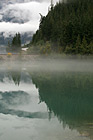
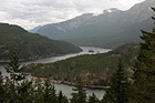
#1728 — A scenic vertical picture taken of the clouds and trees reflection in Diablo Lake which is located in the North Cascades National Park in Washington State.
Clouds & Trees Reflection in Diablo Lake
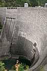
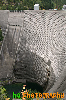
#1729 — A scenic vertical picture taken of Ross Dam which forms Ross Lake in the North Cascades National Park. It currently stands 540 feet (165 m) tall.
Ross Dam
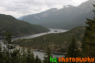
#1763 — A scenic picture taken of Ross Lake on cloudy day. Ross Lake was created by the damming of the Skagit River and is in the recreation area of the North Cascades National Park. The elevation of the lake is 1600 feet and it is over 20 miles long.
Ross Lake and Clouds
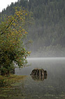
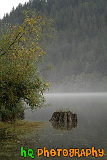
#1770 — A scenic vertical picture taken of a tree stump reflection seen in Diablo Lake located in the North Cascades National Park on a cloudy, foggy day.
Stump Reflection
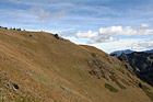
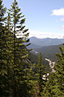
#1769 — A scenic picture taken of a hill located in the Olympic National Park. The hills is covered with dried up grass and there are people standing on the top of it (seen very small).
Hill in the Olympic Mountains
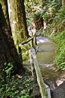
#1700 — A scenic vertical picture taken of a nature trail located in the Hoh Rain Forest which is located in the Olympic National Park in Washington State.
Hoh Rain Forest Trail
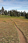
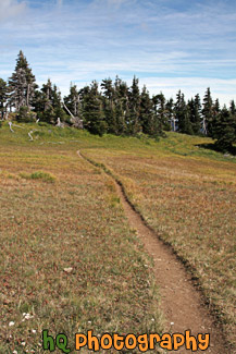
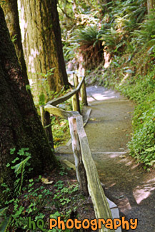
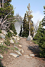
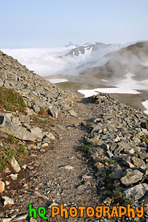
#1707 — A scenic vertical picture taken of a trail located in the Hurricane Ridge area of the Olympic National Park.
Hurricane Ridge Trail
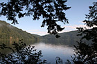
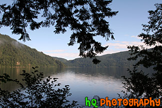
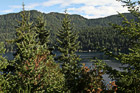
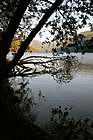
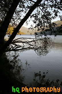
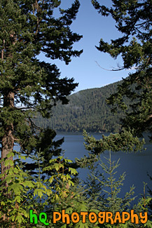
#1730 — A scenic picture taken of Lake Cresent looking through tree branch silhouettes on a sunny day.
Lake Cresent & Tree Branch Silhouettes
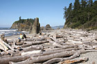
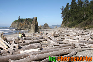
#1688 — A scenic picture taken of a bunch of logs laying on the beach of Ruby Beach with is located in the Olympic National Park in Washington State. People are also see enjoying the beach on this sunny day.
Logs & People on Ruby Beach
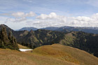
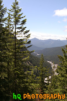
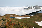
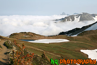
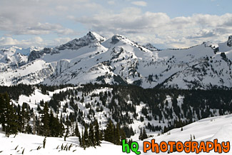
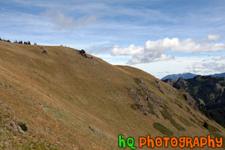
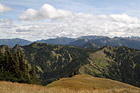
#1779 — A scenic picture taken of the hills of the Olympic Mountains during a nice late summer day. In this picture you can see two people in distance sitting on the ground enjoying their surroundings. This photo was taken near Hurricane Ridge.
Olympic Mountain Hills & Scenic Sky
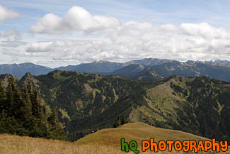
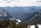
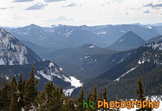
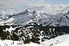
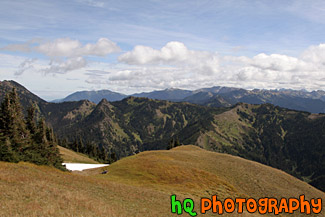
#2010 — A scenic picture taken of the Olympic Mountain Ranges on a partly cloudy sunny day. This photo was taken near Hurricane Ridge.
Olympic Mountain Ranges
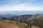
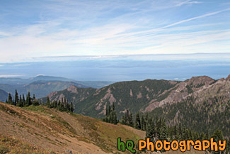
#1920 — A scenic view looking out towards the coast of the Strait of Juan de Fuca from a hike on top of a hill in the Olympic National Park.
Olympic National Park View
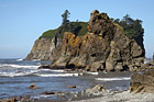
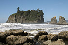
#1833 — A scenic picture taken of rocks and sea stacks located at Ruby Beach, Washington which is part of the Olympic National Park. This picture was taken on a sunny day at the beach.
Ruby Beach Rocks & Seastacks
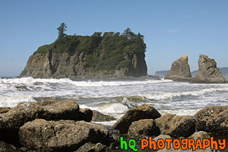
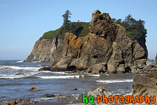
#1708 — A scenic picture taken of Ruby Beach and the sea stacks seen in the Pacific Ocean along the shore. Ruby Beach is located in the Olympic National Park in Washington State.
Ruby Beach Sea Stacks
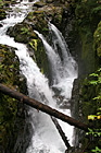
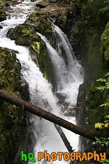
#1685 — A scenic vertical picture taken of Sol Duc Fall which is formed from the Sol Duc River spilling out over the cliff. The Sol Duc Falls is one of the wonders of Olympic National Park and is located on the north side of a lush rain forest.
Sol Duc Falls
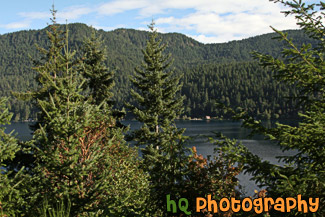
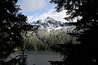
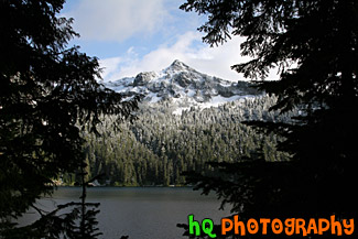
#1693 — A scenic picture taken of trees and mountains located around Lake Cresent in the Olympic National Park with partly cloudy skies.
Trees & Mountains Around Lake Cresent
#1789 — A scenic vertical picture taken of trees, branches, and silhouettes along the shore of Cresent Lake which is located in the Olympic National Park. This photo was taken on a sunny day.
Trees & Silhouettes on Shore at Cresent Lake
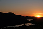
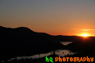
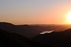
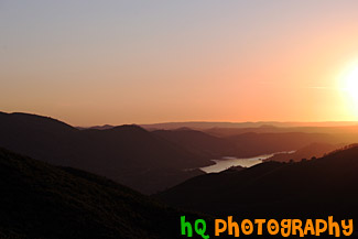
#405 — This picture was taken of a beautiful sunset near the entrence to Yosemite National Park just a couple miles west of Groveland and Big Oak Flat. You can see part of the reservoir to Don Pedro Lake in between the hills. Yosemite is located in east-central California and lies 105 miles north of Fresno, 195 miles east of San Francisco, 313 miles north of Los Angeles and 350 miles northwest of Las Vegas. The gross area acres for the national park is Gross Area Acres for 761,266 and receives about 3,300 total recreational visits per year. The elevation in the park ranges from from 2000 feet to over 13,000 feet. The cliffs, waterfalls, steep mountains and deep lakes of Yosemite National Park were all formed over millions of years by earthquakes, glaciers and numerous other forces of nature.
Sunset at Hills near Yosemite
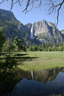
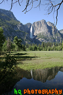
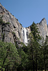
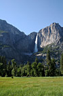
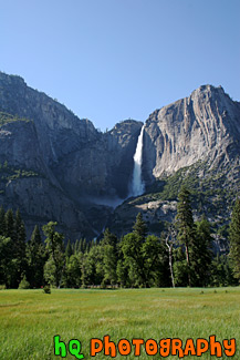
#451 — A scenic picture taken of Yosemite Falls at Yosemite National Park located in California. Yosemite Falls is the world's 5th tallest waterfall, but North America's largest and most popular waterfall in Yosemite's National Park. This waterfall is actually composed of three falls: Upper, Middle Cascades, and the Lower fall. Together they have a combined height of 2,425 feet which is more than 9 times the height of Niagara Falls. Perhaps the easiest place to view the falls is the Yosemite Falls Parking Area across from Yosemite Lodge.
Yosemite Falls Reflection
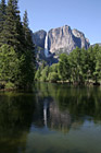
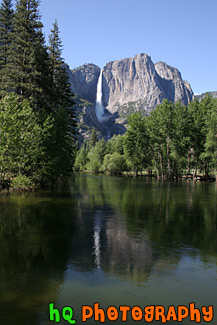
#455 — A scenic picture taken of Yosemite Falls in the popular California Yosemite National Park. In this picture you can see the reflection of the falls in the water just in front. This waterfall is actually composed of three falls: Upper, Middle Cascades, and the Lower fall. Together they have a combined height of 2,425 feet which is more than 9 times the height of Niagara Falls. Perhaps the easiest place to view the falls is the Yosemite Falls Parking Area across from Yosemite Lodge.
Yosemite Falls with Reflection

#682 — A scenic picture taken of Bridalveil Fall located in Yosemite National Park, California. Although Bridalveil Fall appears small when viewd against the surrounding canyon walls, it actually has a 620 foot drop, the height of a 62 story building. Bridalveil Fall is one of the most prominent waterfalls in the Yosemite Valley in California, seen yearly by millions of visitors to Yosemite National Park. When the wind blows briskly, the waterfall will appear to be falling sideways.
Bridalveil Fall
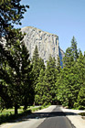
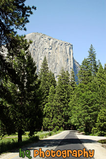
#652 — A scenic picture taken driving towards El Capitan with Forest Road leading towards it in Yosemite National Park, California. This massive, granite monolith stands 3,593 feet from the base to summit and and is claimed to be the largest single monolith of granite in the world. From spring to fall, climbers come from all over the globe to scale El Capitan.
El Capitan & Forest Road
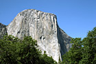
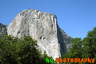
#505 — A scenic picture taken of El Capitan which is located in Yosemite National Park, California. This massive, granite monolith stands 3,593 feet from the base to summit and and is claimed to be the largest single monolith of granite in the world. From spring to fall, climbers come from all over the globe to scale El Capitan.
El Capitan, Yosemite National Park
#987 — A scenic picture taken of a small lake/pond, blue sky, and trees located in the middle of Yosemite National Park.
Lake Pond & Trees in Yosemite
#996 — A scenic landscape picture taken of green trees, blue sky, puffy clouds, and a country fence located in Yosemite National Park.
Landscape Trees & Fence in Yosemite
#456 — A scenic picture of the mountains and hills surrounding Yosemite National Park and the Tuolumne River flowing below. The Tuolumne River was designated Wild and Scenic in 1984 by the United State Congress. The Wild and Scenic Act provieds that rivers possessing extraordinary scenic, recreational, fishery, or wildlife values shall be preserved for the benefit and enjoyment of Forest visitors. It also limits land development surrounding these rivers and water diversion from them. The Tuolumne River begins as small rivulets trickling from Mount Dana and Mount Lyell in Yosemite National Park high in the Sierra Nevada. It ends at the San Joaquin River.
Yosemite & Tuolumne River View
#621 — A scenic picture taken of the tall Yosemite Falls with a big grass field in the foreground. Yosemite Falls is located in Yosemite National Park in California. Yosemite Falls is the world's 5th tallest waterfall, but North America's largest and most popular waterfall in Yosemite's National Park. This waterfall is actually composed of three falls: Upper, Middle Cascades, and the Lower fall. Together they have a combined height of 2,425 feet which is more than 9 times the height of Niagara Falls. Perhaps the easiest place to view the falls is the Yosemite Falls Parking Area across from Yosemite Lodge.
Yosemite Falls & Grass Field

#1647 — A scenic vertical picture taken of a green leaf sticker plant located in the forest at Mt. Rainier National Park.
Green Leaf Stickers
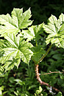
#1692 — A scenic vertical picture taken of green leaves on a maple tree close up. This tree was found in the Olympic National Park near Lake Cresent.
Green Leaves Close Up

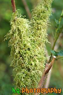
#1830 — A scenic close up vertical picture taken of some bright green moss growing on a branch. This picture was taken in the Hoh Rain Forest which is located in the Olympic National Park in Washington State.
Green Moss on Branch
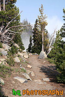
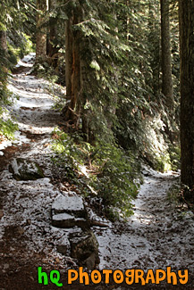
#1634 — A scenic picture taken of a hiking trail located near the Sunrise entrance in Mt. Rainier National Park.
Hiking Trail in Mt. Rainier National Park
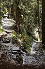
#1751 — A scenic vertical picture taken of a hiking trail with rocks all around it. This trail was located in Mt. Rainier National Park in Washington State with fog seen over the mountains and blue sky above.
Rock Hiking Trail
#1758 — A scenic vertical picture taken of a switchback point in a hiking trail. This trail was located in the Mt. Rainier National Park near Eunice Lake.
Switchback Hiking Trail
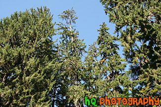
#1698 — A scenic picture looking up at a row of Sitka Spruce trees located in the Hoh Rain Forest in the Olympic National Park in Washington State.
Looking Up at Sitka Spurce Trees
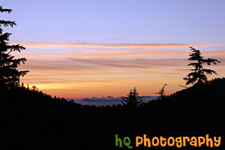
#1726 — A scenic blue and red/orange sunset picture taken from a trail in the Mt. Rainier National Park at the Carbon River entrance side of the park.
Sunset & Silhouette Trees
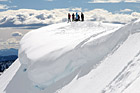
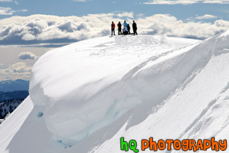
#1501 — A scenic, beautiful picture taken of people standing on top of a snow cliff near the edge of a snow overhang on a snowshoeing trail at Paradise which is located at the base of Mt. Rainier in Washington State. This picture was taken on a partly sunny day as you can see the sun shining on the snow.
People on Top of Snowy Hill for Snowshoe Trip
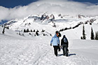
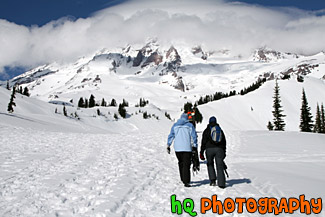
#1502 — A scenic picture taken of some people hiking in the snow walking right towards Mt. Rainier as it is seen in the background (with clouds covering the top). The trail is located at Paradise which is in the Mt. Rainier National Park. The hikers are carrying snowshoes and will strap them on a little later in the hike.
Snow Hiking Towards Mt. Rainier
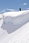
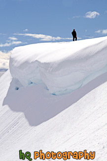
#1507 — A scenic picture taken of a man standing on top of a snowy hill near a snow overhang on a sunny winter afternoon. This picture was taken on a snowshoeing trail at Paradise which is located in Mt. Rainier National Park.
Man Standing Near a Snow Overhang
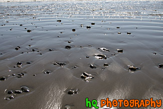
#1694 — A scenic picture taken close up of small rocks located in the sand on Ruby Beach which is located in the Olympic National Park in Washington State.
Small Rocks on Beach
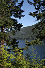
#1703 — A scenic vertical picture taken of Lake Cresent in the background seen through some green trees in the foreground. This photo was taken on a sunny day in the Olympic Mountains.
Lake Cresent and Trees
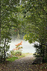
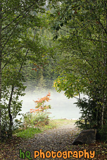
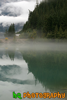
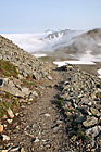
#1862 — A scenic vertical picture taken of a trail located in the North Cascades National Park which is leading to fog hovering over a lake.
Trail Leading to Fog
#515 — A scenic picture taken of the hills and mountains surrounding Yosemite National Park in California during sunset. The picture was taken near the entrence to Yosemite National Park just a couple miles west of Groveland and Big Oak Flat. Yosemite is located in east-central California and lies 105 miles north of Fresno, 195 miles east of San Francisco, 313 miles north of Los Angeles and 350 miles northwest of Las Vegas.
Yosemite Hills Sunset
