Photos of Entrance (26)
There are (26) photos of the keyword, Entrance, available on our website. They are pictured below.The pictures are organized by category.
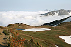
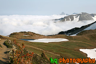
#1834 — A scenic picture taken of fog hovering over the mountain hills located near Mt. Rainier at the Sunrise Entrance. This picture was taken from the Mount Fremont lookout and taken with blue sky seen above the fog.
Fog Hovering over Mountains
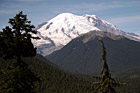
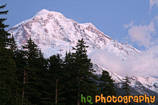
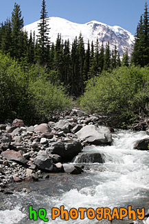
#636 — A scenic picture of Mt. Rainier and two evergreen trees taken from the top of the White River entrance to the Mount Rainier National Park. This picture was taken in August hence the lack of snow on the mountain.
Mount Rainier at White River Entrance
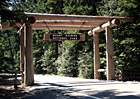
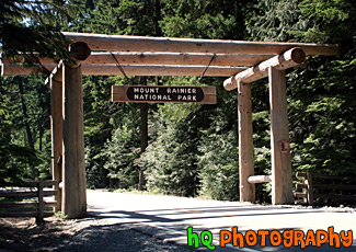
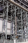
#634 — A picture of a wooden entrence and sign to the Mount Rainier National Park coming from highway 410 past Crystal Mountain. Mount Rainier National Park was established in 1899 and contains 235,625 acres (97% is designated Wilderness). The national park includes Mount Rainier (14,410 feet high), an active volcano encased in over 35 square miles of snow and ice and outstanding examples of old growth forests and subalpine meadows. Nearly two million people come to enjoy hiking, climbing, snowshoeing, cross-country skiing, camping, photographing, or admiring the views of Mount Rainier each year.
Mount Rainier National Park Entrence
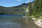
#143 — A scenic picture taken with blue skies above at Mowich Lake loacted in the Mt. Rainier National Park at the Carbon River Entrance.
Mowich Lake
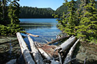
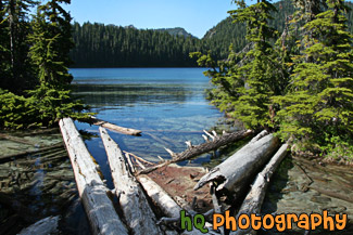
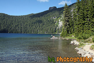
#2314 — A scenic picture taken of Mowich Lake located in Mt. Rainier National Park. Logs are seen in the foreground floating on the lake and green trees surround the lake. Mowich Lake is the largest and deepest lake in Mount Rainier National Park. The road is unpaved after the first three miles and may be rough. You can get to the lake through the Carbon River Entrance to the park. It is generally open mid-July to mid-October.
Mowich Lake & Logs
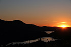
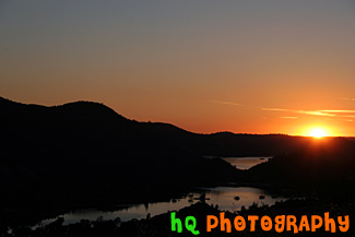
#1740 — A scenic picture taken of Mt. Rainier during sunset as you can see the glow of the sun reflecting onto the mountain. This picture was taken from the Carbon River entrance side of the park.
Mt. Rainier & Sunset Glow
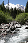
#1658 — A scenic vertical picture taken of a river in the foreground of Mt. Rainier taken of on a blue sky day. This picture was taken on the Glacier Basin trail near the White River Entrance to the park.
Mt. Rainier & River
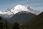
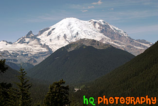
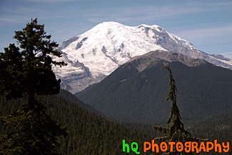
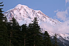
#142 — A beautiful picture of Mt. Rainier shot during August. This photo was taken near the White River Entrance in Mt. Rainier's National Forest. Blue sky is seen above the mountain with hills in the foreground.
Mt. Rainier Near White River Entrance
#405 — This picture was taken of a beautiful sunset near the entrence to Yosemite National Park just a couple miles west of Groveland and Big Oak Flat. You can see part of the reservoir to Don Pedro Lake in between the hills. Yosemite is located in east-central California and lies 105 miles north of Fresno, 195 miles east of San Francisco, 313 miles north of Los Angeles and 350 miles northwest of Las Vegas. The gross area acres for the national park is Gross Area Acres for 761,266 and receives about 3,300 total recreational visits per year. The elevation in the park ranges from from 2000 feet to over 13,000 feet. The cliffs, waterfalls, steep mountains and deep lakes of Yosemite National Park were all formed over millions of years by earthquakes, glaciers and numerous other forces of nature.
Sunset at Hills near Yosemite
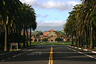
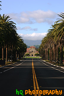
#380 — A scenic picture taken of Stanford University from Palm Drive looking at the "Oval" and "Stanford Mall." The building in the distance is Stanford Memorial Church which is located at the center of the campus. Palm Drive is a mile-long, palm tree-lined entrance to the Stanford campus. It connects Stanford with the neighboring town of Palo Alto. Bike and walking paths and an arboretum border Palm Drive, and the street culminates at the Oval, a lawn at the front of campus where students often study or play volleyball and Frisbee.
Stanford University from Palm Drive
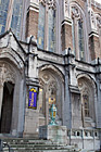
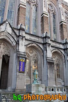
#1916 — A close up vertical picture taken of the front entrance to the University of Washington campus library.
Front Entrance to UW Library
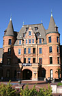
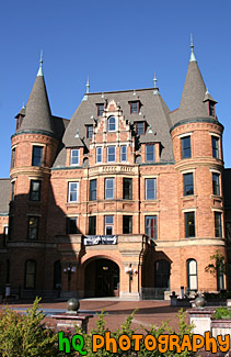
#1338 — A scenic vertical picture taken of the front entrance to Stadium High School which is located in downtown Tacoma, Washington. This picture was taken on a sunny day seen with blue sky in the background.
Front of Stadium High School
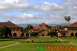
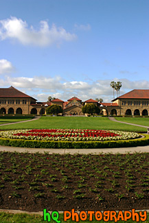
#358 — A scenic picture taken at the "Oval" at Stanford University in Palo Alto, California. The Oval is located down Palm Drive on the Stanford University campus. In this picture you can see the Stanford Memorial Church as well as the scenic green hills of Palo Alto behind the buildings in the distance.
Oval at Stanford University
#1336 — A scenic picture taken of the front entrance to Stadium High School which is located in Tacoma, Washington. This picture was taken on a sunny day.
Stadium High School Entrance
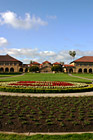
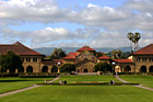
#315 — A scenic picture of Stanford University's main entrance taken from the oval. Stanford Memorial Church stands at the center of the campus, and was one of the earliest and is still among the most prominent interdenominational churches in the West. This photo was taken on a sunny blue sky day. The flowers in the front of the photo spell a cardinal "S" for Stanford.
Stanford University Main Entrance
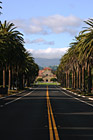
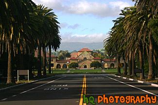
#1244 — A scenic vertical picture taken of Stanford University's main entrance on Palm Drive. This road is lined with palm trees all the way down to the university heading towards the Memorial Church seen in the background.
Stanford University Palm Drive Entrance
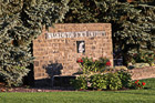
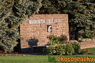
#2049 — A close up picture taken of the Washington State University sign located at the entrance to the school in Pullman, Washington.
Washington State University Entrance
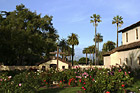
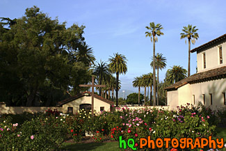
#355 — A scenic picture taken at Santa Clara University from the right side of Mission Santa Clara de Asis looking out towards Santa Clara's main entrance. This campus is very beautiful as it is covered with these pretty palm trees, beautiful flowers, and wonderful architecture. You can also see the scenic green hills of San Jose in the background. These hills make this view even more beautiful as its not always that these hills are this green.
Beautiful Palms of Santa Clara University

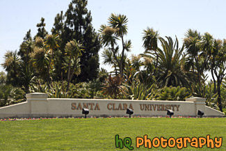
#1396 — A scenic picture taken of palm trees surrounding the entrance to Santa Clara University which is located in the silicon valley of California.
Entrance to Santa Clara University
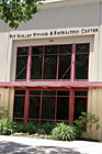
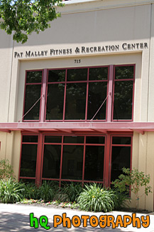
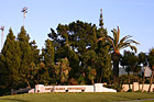
#1884 — A scenic vertical picture taken of the Pat Malley Recreational Gym entrance located on campus at Santa Clara University.
Pat Malley Gym Entrance
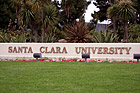

#1085 — A close up picture taken of the Santa Clara University sign located at the entrance to the campus.
Santa Clara University Entrance Sign
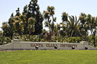
#1735 — A scenic picture taken of the sign located at the main entrance to Santa Clara University which is located in Santa Clara, California.
Santa Clara University Main Entrance
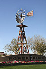
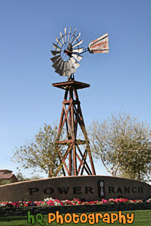
#2271 — A scenic vertical picture taken of the Power Ranch Windmill located in Gilbert, Arizona. Power Ranch is a housing community that offers comfort, family lifestyle living, and an abundance of large scale amenities.
Power Ranch Windmill
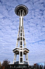
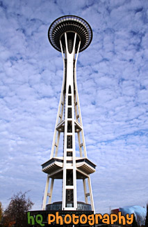
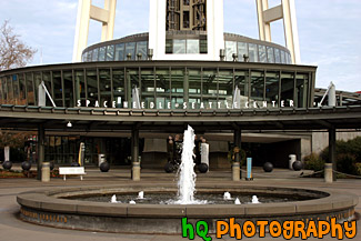
#845 — A scenic picture taken looking towards the front or entrence to the Seattle Space Needle. The Space Needle is located at the Seattle Center right across the street from the KOMO News 4 building. This picture was taken with a beautiful sky background with blue sky and patchy clouds.
Front of Seattle Space Needle