Photos of Big Lake (10)
There are (10) photos of the keyword, Big Lake, available on our website. They are pictured below.The pictures are organized by category.
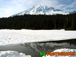
#139 — A beautiful picture of Mt. Rainier shot during the beginning of June. This photo was taken at Tipsoo Lake which is still covered in snow in Mt. Rainier's National Forest. Part of the lake can be seen in a break of the snow cover. Blue sky is above.
Mt. Rainier at Snowy Tipsoo Lake
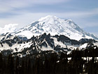
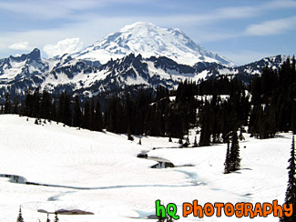
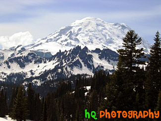
#141 — A beautiful picture of Mt. Rainier shot during the beginning of June. This photo was taken at Tipsoo Lake which is still covered in snow in Mt. Rainier's National Forest. "The Mountain", as it's known by natives, draws your eyes like a magnet when it is visible and not invisible behind clouds. It also draws over two million visitors each year. Mount Rainier and the surrounding foothills were designated as a national park in 1899.
Close up of Mt. Rainier at Tipsoo Lake
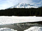
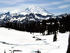
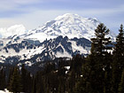
#138 — A beautiful picture of Mt. Rainier shot during the beginning of June. This photo was taken at Reflection Lake in Mt. Rainier's National Forest. The lake is still covered in snow, but there was a little opening where you can see a reflection.
Mt. Rainier at Snow Covered Reflection Lake
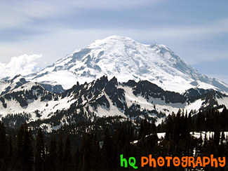
#140 — A beautiful picture of Mt. Rainier shot during the beginning of June. This photo was taken at Tipsoo Lake which is still covered in snow in Mt. Rainier's National Forest. "The Mountain", as it's known by natives, draws your eyes like a magnet when it is visible and not invisible behind clouds. It also draws over two million visitors each year.
Mt. Rainier Close Up at Tipsoo Lake
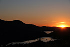
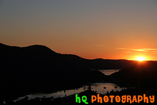
#405 — This picture was taken of a beautiful sunset near the entrence to Yosemite National Park just a couple miles west of Groveland and Big Oak Flat. You can see part of the reservoir to Don Pedro Lake in between the hills. Yosemite is located in east-central California and lies 105 miles north of Fresno, 195 miles east of San Francisco, 313 miles north of Los Angeles and 350 miles northwest of Las Vegas. The gross area acres for the national park is Gross Area Acres for 761,266 and receives about 3,300 total recreational visits per year. The elevation in the park ranges from from 2000 feet to over 13,000 feet. The cliffs, waterfalls, steep mountains and deep lakes of Yosemite National Park were all formed over millions of years by earthquakes, glaciers and numerous other forces of nature.
Sunset at Hills near Yosemite
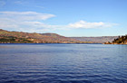
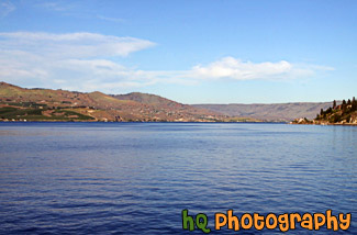
#1984 — A scenic picture taken of Lake Chelan which is located in central Washington State, nestled in the North Cascades National Forest. The Chelan Valley encompasses the communities of Chelan, Manson & Stehekin. Lake Chelan is a 50.5 mile glacier-fed lake and is 1.5 miles at its widest. 1486 feet is its deepest point.
Lake Chelan
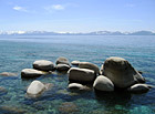
#17 — A pretty view of a some big rocks in Lake Tahoe. Lake Tahoe is the second deepest lake in the United States and the tenth deepest in the world, with a maximum depth measured at 1,645 ft (501 m), average depth of 1,000 ft (305 m). The Lake Tahoe Basin was formed by geologic block (normal) faulting about 2 to 3 million years ago. Snow, rain, and streams filled the southern and lowest part of the basin, forming the ancestral Lake Tahoe. Modern Lake Tahoe was shaped and landscaped by the scouring glaciers during the Ice Age. Many streams flow into Lake Tahoe, but the lake is drained only by the Truckee River, which flows northeast through Reno and into Pyramid Lake in Nevada.
Lake Tahoe Rocks
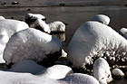
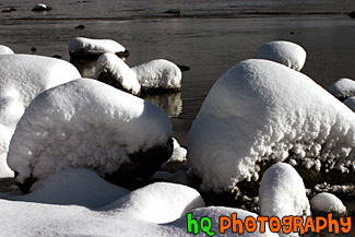
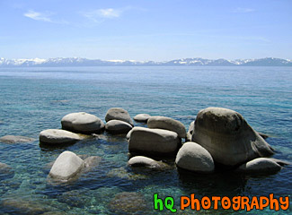
#283 — A scenic photo taken of rocks covered in snow right on the beach at Lake Tahoe. This photo was taken right after a huge snow storm at the end of November in 2004.
Snow Covered Rocks in Lake Tahoe
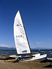
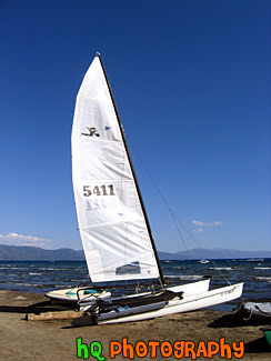
#196 — A pretty view at Lake Tahoe of a type of sail boat during July 2004. Lake Tahoe is the second deepest lake in the United States and the tenth deepest in the world, with a maximum depth measured at 1,645 ft (501 m), average depth of 1,000 ft (305 m). The Lake Tahoe Basin was formed by geologic block (normal) faulting about 2 to 3 million years ago. A geologic block fault is a fracture in the Earth's crust causing blocks of land to move up or down. Snow, rain, and streams filled the southern and lowest part of the basin, forming the ancestral Lake Tahoe. Modern Lake Tahoe was shaped and landscaped by the scouring glaciers during the Ice Age. Many streams flow into Lake Tahoe, but the lake is drained only by the Truckee River, which flows northeast through Reno and into Pyramid Lake in Nevada.
Lake Tahoe Sailboat