Photos of Aerial Mountains (2)
There are (2) photos of the keyword, Aerial Mountains, available on our website. They are pictured below.The pictures are organized by category.
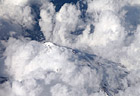
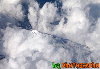
#1864 — An aerial picture taken of a mountain from an airplane. This mountain has snow covering it and is barely visible through the clouds.
Looking Down at Mountain Top
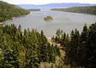
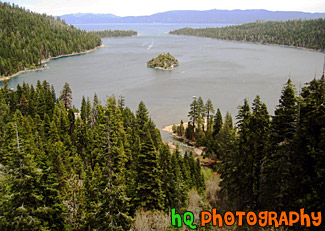
#19 — View of Lake Tahoe from high in the mountains looking over Emerald Bay. Lake Tahoe is the second deepest lake in the United States and the tenth deepest in the world. The Lake Tahoe Basin was formed by geologic block (normal) faulting about 2 to 3 million years ago. Snow, rain, and streams filled the southern and lowest part of the basin, forming the ancestral Lake Tahoe. Modern Lake Tahoe was shaped and landscaped by the scouring glaciers during the Ice Age. Many streams flow into Lake Tahoe, but the lake is drained only by the Truckee River, which flows northeast through Reno and into Pyramid Lake in Nevada.
Lake Tahoe and Emerald Bay
