Photos of Aerial (46)
There are (46) photos of the keyword, Aerial, available on our website. They are pictured below.The pictures are organized by category.
Categories Search Results
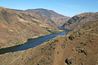
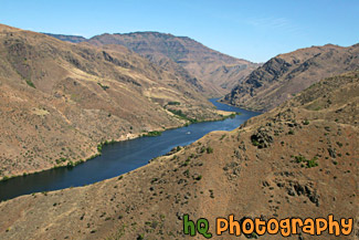
#2041 — A scenic picture taken looking down at Hells Canyon National Recreation Area and Snake River flowing through the canyon. This picture was taken on a sunny day on top of a surrounding hill.
Aerial Hells Canyon National Recreation Park
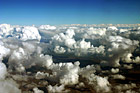
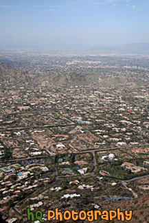
#130 — Puffy clouds and blue sky on a beautiful day flying into Phoenix, Arizona. On this day the clouds were exceptionally puffy and it was a site to see!
Blue Sky & Puffy Clouds taken from Above
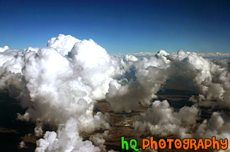
#25 — A scenic photo of puffy clouds taken from an airplane flying into Phoenix, Arizona. This picture was taken looking out of the airplane window. The clouds were especially puffy on this day and was a site to see.
Puffy Clouds Aerial View
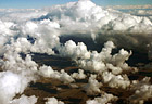
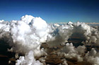
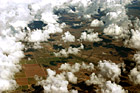
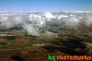
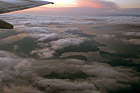
#265 — This photo is taken from an airplane looking out of all the puffy clouds on the way to the Phoenix Airport in Arizona. The turbulance was pretty bad flying through all these puffy clouds! Through all the puffy clouds you can see the land of Phoenix, Arizona from the sky.
Aerial Puffy Clouds
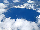
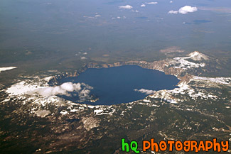
#8 — A scenic sky picture taken of Crater Lake which is located in Oregon State. Crater Lake is the deepest lake (1,949 ft or 594 m) in the United States. It is is filled with rain and melted snow that fell within the caldera basin. Crater Lake is isolated from surrounding streams and rivers, so there is no inlet or outlet to the lake. This picture was taken when there was still plenty of snow surrounding the lake.
Aerial View of Crater Lake, Oregon
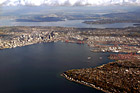
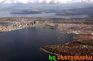
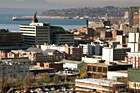
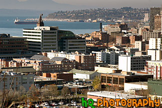
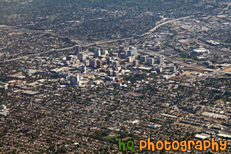
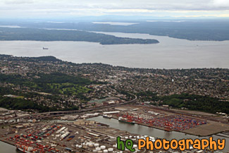
#258 — This is an aerial view of Seattle, Washington taken from an airplane flying into the SeaTac Airport. From this photo you can see the city of Seattle, the tall buildings, the Space Needle, and the bay and water. You can also see the Seahawks and the Mariner's stadiums. From this photo you can actually see it ALL! You can see I90, 520, Lake Washington, and Lake Sammamish in the far distance!
Aerial View of Seattle, Washington
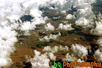
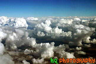
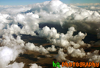
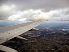
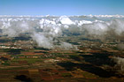
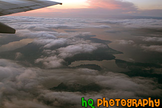
#115 — This photo is a scenic aerial shot taken over the land around Phoenix, Arizona as the plane was getting ready to land at the airport. In this photo you can see the scenic land through all the puffy clouds.
Aerial Arizona & Clouds
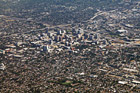
#1701 — A scenic aerial daytime photo taken of the tall building and surrounding areas of downtown San Jose, California.
Aerial Downtown San Jose, California
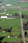
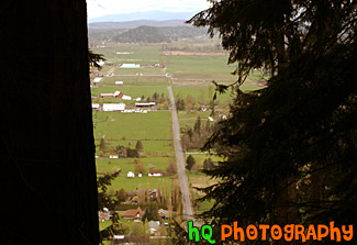
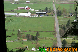
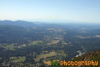
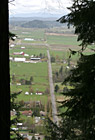
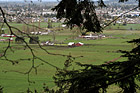
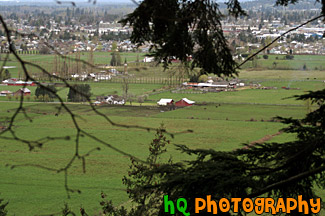
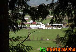
#1006 — A scenic aerial picture taken of a couple farms and farmland located in the small town of Enumclaw, Washington. This picture was taken from up Mt. Peak which is a popular local hike that people do for a great workout.
Aerial Farmland View
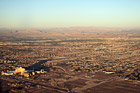
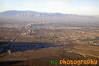
#1843 — A scenic aerial picture taken of the city of Las Vegas on a sunny evening. You can see the desert land in this picture.
Aerial View of Las Vegas
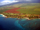
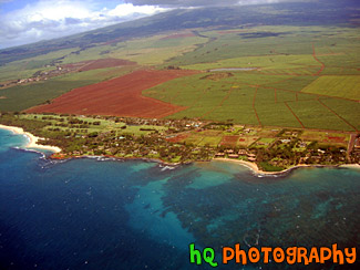
#171 — This is an aerial shot of Maui, Hawai'i as the plane was leaving the airport.
Aerial View of Maui, Hawaii
#1883 — A scenic aerial picture taken of the Puget Sound area in Washington State. This picture was taken on an overcast, cloudy day.
Aerial View of Puget Sound
#310 — A scenic picture taken from an airplane of the bay area of San Francisco, California. In this photo you can see the colored waters of the bay area as the plane fly's north over it.
Aerial View of San Francisco Bay
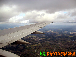
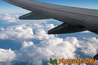
#9 — Aerial picture taken of an airplane wing while flying into the Seatac Airport in Seattle / Tacoma, Washington. This photo was taken from the airplane as it was getting ready to land. You can see the landscape of Washington State below the wing.
Airplane Wing
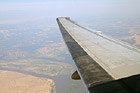
#1613 — A scenic picture taken of an airplane wing while the plane is flying in the sky.
Airplane Wing in the Sky

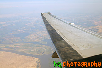
#555 — A scenic picture taken of an airplane's wing from looking out of the passenger window. Blue sky and clouds are seen in the photo.
Airplane's Wing
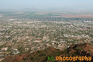
#274 — This is a scenic aerial photo taken over Phoenix, Arizona on the way to landing at the airport. In this photo you can see the landscapes of Arizona as well as the puffy clouds in the sky.
Arizona Aerial View with Puffy Clouds
#70 — A scenic aerial picture view of the country land of Enumclaw, Washington looking down from Mt. Peak. You can see the countryside and farms while looking through some evergreen trees.
Country Land of Enumclaw, Washington
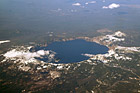
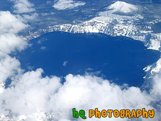
#1750 — A scenic aerial picture looking down at Crater Lake which is located in the state of Oregon.
Crater Lake, Oregon
#1007 — A scenic picture looking down at a farm in Enumclaw, Washington from a trail on Mt. Peak. Mt. Peak is a popular hiking trail that the locals of Enumclaw go up for a great workout.
Farm View from Mt. Peak
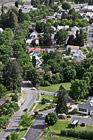
#1981 — A scenic vertical picture looking down at a neighborhoold located in Eastern Washington at Grand Coulee.
Looking Down at a Neighborhood
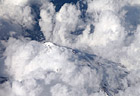
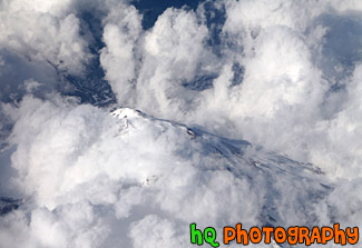
#1864 — An aerial picture taken of a mountain from an airplane. This mountain has snow covering it and is barely visible through the clouds.
Looking Down at Mountain Top
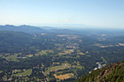
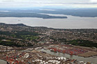
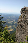
#2008 — A scenic aerial photo taken of Western Washington and the Puget Sound area from the top of Mt. Si which is located in North Bend.
Looking Down From Mt. Si
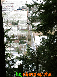
#10 — This is a scenic photo overlooking the country land of Enumclaw, WA on a snowy, icy day. This picture was taken on the trail of Mt. Peak. Mount Peak is a popular hike many people of Enumclaw and the surrounding cities go on. The hike is about 1 mile up to the top of the peak to where you can view almost the entire city of Enumclaw. Enumclaw is a small town located about 30 miles from Mt. Rainier and about 50 minutes southeast of Seattle. Most of Enumclaw's land consists of farms and fields with many houses containing acres of land.
Mt. Peak Snow View
#71 — A scenic aerial view picture taken of the country land and farms of Enumclaw, Washington while looking down from Mt. Peak. Mt. Peak is a popular hiking site for the locals around this area.
Mt. Peak View of Enumclaw Country
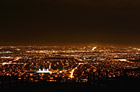
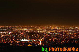
#226 — This shot was taken from South East San Jose, California on the eastern hills during the night time. The shot is overlooking the South Bay and San Jose. In the middle of the photo you can see a football field lit up in the dark.
San Jose Night Lights
#1088 — A scenic aerial picture taken during a sunset looking down at the Puget Sound in Washington State from an airplane which has just taken off from the Seatte/Tacoma International Airport. Through the clouds you can see the sound and islands of Washington State.
Sky Sunset & Puget Sound
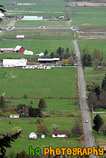
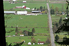
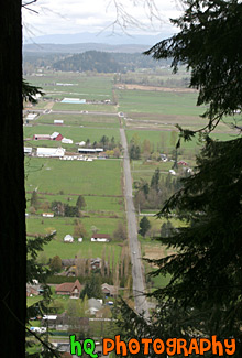
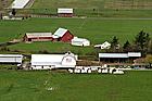
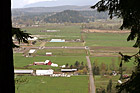
#1009 — An aerial picture taken of some farmland and the small town of Enumclaw located in the background. This picture was taken from a trail on Mt. Peak which is a place where many locals go for a great hike/workout.
View of Farms & Enumclaw
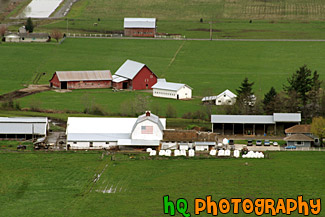
#1005 — A scenic aerial picture of a farm located in the countryside of Enumclaw, Washington. This picture was taken from up the trail at Mt. Peak. Mt. Peak is a popular hike the locals take for a great workout. In this picture you can see a couple farms located on green grass fields.
Aerial View of Farm
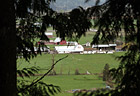
#80 — A scenic picture looking down at a farm through evergreen trees from high up on the trail of Mt. Peak located in Enumclaw, Washington.
Farm Through Trees
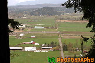
#1017 — A scenic picture taken looking down at a couple farms and country land located in the small town of Enumclaw, Washington. This photo was taken from one of the popular hiking trails of Mt. Peak.
View of Country Land
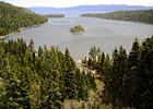
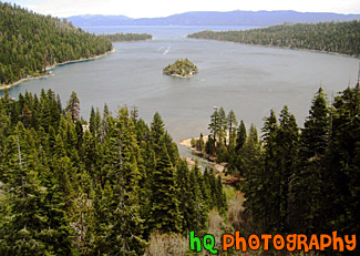
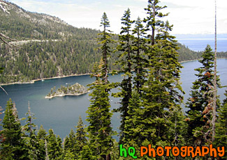
#19 — View of Lake Tahoe from high in the mountains looking over Emerald Bay. Lake Tahoe is the second deepest lake in the United States and the tenth deepest in the world. The Lake Tahoe Basin was formed by geologic block (normal) faulting about 2 to 3 million years ago. Snow, rain, and streams filled the southern and lowest part of the basin, forming the ancestral Lake Tahoe. Modern Lake Tahoe was shaped and landscaped by the scouring glaciers during the Ice Age. Many streams flow into Lake Tahoe, but the lake is drained only by the Truckee River, which flows northeast through Reno and into Pyramid Lake in Nevada.
Lake Tahoe and Emerald Bay
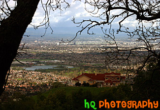
#319 — A scenic picture taken a top a hill in East San Jose overlooking the entire city. This picture shows a scenic house amongst the view of the city. From this aerial photo you can see the buildings of San Jose, the airport, and the amazing view that this multi-million dollar home also sees.
Scenic View of San Jose From A Hill
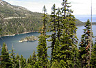
#22 — A photo up high in the Mountains of Lake Tahoe overlooking the Lake Tahoe and Emerald Bay. Green trees can be see in the foreground and the sky looks to be overcast.
Mountains of Lake Tahoe
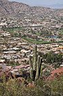
#2278 — A scenic vertical picture taken of a view from the lower part of hiking Camelback Mountain in Arizona and a cactus tree and Scottsdale.
Camelback Mountain, Cactus, & Scottsdale
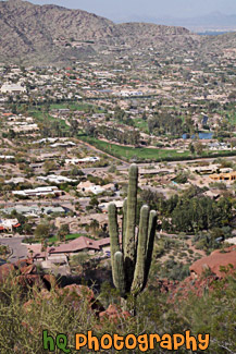
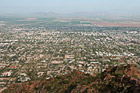
#2275 — A scenic vertical picture taken of a view of the city of Scottsdale, Arizona from on top of Camelback Mountain.
Scottsdale from Camelback Mountain
#2274 — A scenic picture taken of the view of Scottsdale, Arizona from the top of Camelback Mountain which is near Phoenix, Arizona.
Scottsdale View from Camelback Mountain
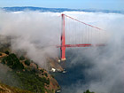
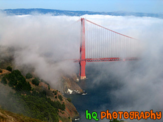
#215 — A scenic photo of fog covering the Golden Gate Bridge located in San Francisco, California. This picture was taken during the summer months when the fog really covers the Golden Gate Bridge. The real "Golden Gate" is the strait that the bridge spans. It was first named "Chrysopylae," meaning "golden gate," by Captain John C. Fremont in 1846. This photo was taken from the top of Hawk Hill which is located just north of San Francisco in the Marin Headlands. Total length of the bridge is 1.7 miles and the clearance above the high water is 220 feet.
Golden Gate Bridge Covered in Fog
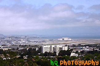
#556 — A scenic picture taken of the San Francisco International Airport seen from atop a hill in Burlingame, California. The San Francisco International Airport commits itself to being recognized as the world leader in setting the standard for: safety and security, customer service and satisfaction, community relations, environmental commitment, quality of facilities, and financial and economic vitality.
San Francisco Airport from Hill
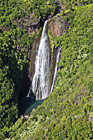
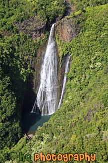
#2375 — A scenic vertical picture taken of the waterfall seen in the movie Jurassic Park located on the island of Kauai, Hawaii. This photo was taken from the air in a helicopter. The actual name of this waterfall is Manawaiopuna Falls, but it is more commonly known as Jurassic Falls because of the movie.
Jurassic Falls, Kauai
#2376 — A scenic picture taken of the island of Kauai, Hawaii from the air in a helicopter.
Kauai Aerial View
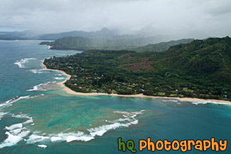
#2374 — A scenic picture taken of the Kauai Coast from a helicopter. Clouds are covering the island in this photo.
Kauai Coast From Air
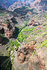
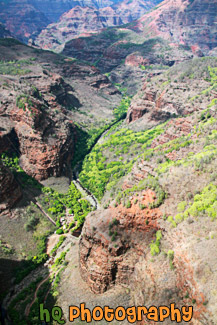
#2369 — Waimea canyon is located on the island of Kauai, Hawaii. This is an aerial picture taken of the canyon from a helicopter.
Waimea Canyon View
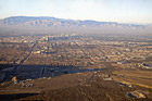
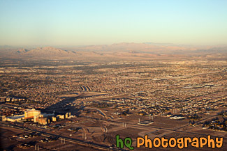
#1868 — A scenic picture taken of an aerial view of Las Vegas, NV from an airplane.
Las Vegas from the Sky
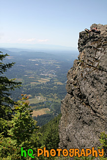
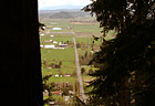
#2013 — A view of the Seattle area and a rock cliff with a person laying on it from the top of Mt. Si which is located in North Bend, Washington.
Rock Cliff & View at top of Mt. Si