Photos of Rock (163)
There are (163) photos of the keyword, Rock, available on our website. They are pictured below.The pictures are organized by category.
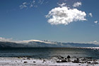
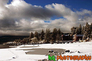
#285 — Beautiful scenic view of lake tahoe taken right after a snow storm. This photo is gorgeous because of the blue skies contrasting the freshly fallen snow covereing the shore and beach.
Beautiful Lake Tahoe Snow View
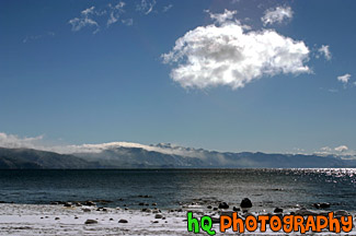
#284 — A scenic picture taken of Lake Tahoe right after a huge snow storm. Interesting and dramatic clouds are hovering in the skies above Lake Tahoe along with snow covering the rocks on the shore. On this particular day there was about a foot of snow that dropped down from the skies. A beautiful picture of what it is like in the winters at Lake Tahoe.
Lake Tahoe Clouds and Snow
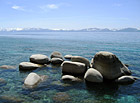
#17 — A pretty view of a some big rocks in Lake Tahoe. Lake Tahoe is the second deepest lake in the United States and the tenth deepest in the world, with a maximum depth measured at 1,645 ft (501 m), average depth of 1,000 ft (305 m). The Lake Tahoe Basin was formed by geologic block (normal) faulting about 2 to 3 million years ago. Snow, rain, and streams filled the southern and lowest part of the basin, forming the ancestral Lake Tahoe. Modern Lake Tahoe was shaped and landscaped by the scouring glaciers during the Ice Age. Many streams flow into Lake Tahoe, but the lake is drained only by the Truckee River, which flows northeast through Reno and into Pyramid Lake in Nevada.
Lake Tahoe Rocks
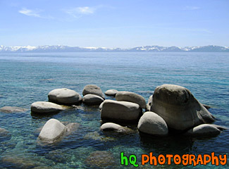
#18 — A pretty view of Lake Tahoe during Spring 2003. Lake Tahoe is the second deepest lake in the United States and the tenth deepest in the world, with a maximum depth measured at 1,645 ft (501 m). In this photo you can see a big rock on the right and the see through water of the lake. Mountains are also visible that surround the lake.
Lake Tahoe Waters
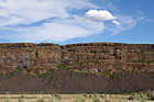
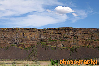
#1978 — A scenic picture taken of a rock cliff next to the freeway with an interesting puffy cloud and blue sky seen above. This photo was taken in Eastern Washington near Steamboat Rock State Park.
Rock Cliff and Puffy Cloud
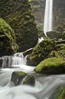
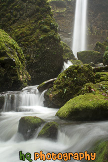
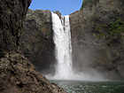
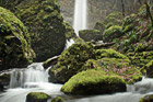
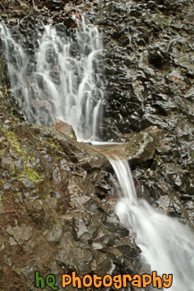
#2203 — A scenic vertical picture taken of Elowah Falls and moss covered rocks in the foreground. At Elowah Falls you get a sense of seclusion even though it is about 1-2 miles from the freeway. This photo was taken with a slow shutter speed to get the silky streaming water effect.
Elowah Falls & Rocks
#23 — A scenic vertical picture taken of the Lower Eagle Falls located in the mountains of Lake Tahoe near Emerald Bay. The Lake Tahoe Basin was formed by geologic block (normal) faulting about 2 to 3 million years ago. In this photo the water is flowing through trees and rocks.
Lower Eagle Falls at Lake Tahoe
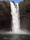
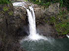
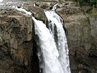
#84 — A fantastic photo of the Snoqualmie Falls. This waterfall is an historic site in the state of Washington. Snoqualmie Falls is one of Washington state's most popular scenic attractions. More than 1.5 million visitors come to the Falls every year. Blue sky is seen above the waterfall in this photo.
Snoqualmie Falls & Rock
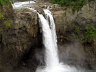
#111 — A fantastic photo of the Snoqualmie Falls, which is located in Snoqualmie, Washington. This waterfall is an historic site in the state of Washington. Snoqualmie Falls is one of Washington state's most popular scenic attractions. More than 1.5 million visitors come to the Falls every year. In this photo blue sky is seen above the falls.
Snoqualmie Falls Waterfall
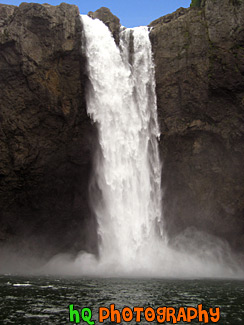
#112 — A fantastic vertical photo of the Snoqualmie Falls, which is located in Snoqualmie, Washington. This is about 30 minutes from Seattle. This waterfall is an historic site in the state of Washington. Snoqualmie Falls is one of Washington state's most popular scenic attractions. More than 1.5 million visitors come to the Falls every year.
Tall Snoqualmie Falls in Washington
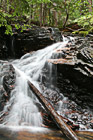
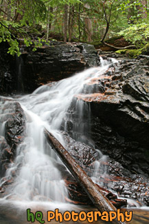
#1798 — A scenic vertical picture taken of a silky waterfall with a log laying in it. This waterfall is seen with the "cotton candy" effect which uses a slow shutter speed.
Waterfall & Log
#1989 — A scenic close up vertical picture taken of Deception Falls which is located right under the road while driving on Highway 2 or Stevens Pass in Washington State.
Deception Falls Under Stevens Pass
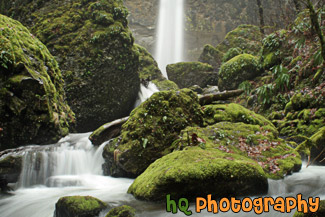
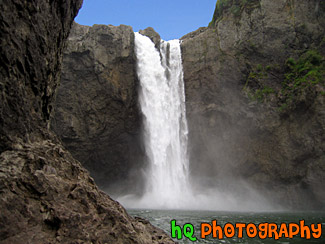
#2204 — A scenic picture taken of Elowah Falls and moss covered rocks seen in the foreground. At Elowah Falls you get a sense of seclusion even though it is about 1-2 miles from the freeway. This photo was taken with a slow shutter speed to get the silky streaming water effect.
Elowah Falls
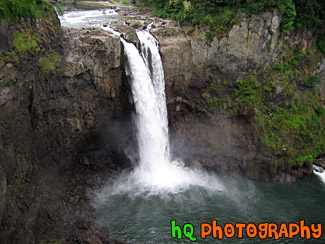
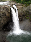
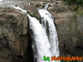
#158 — A fantastic photo of the Snoqualmie Falls, which is located in Snoqualmie, Washington. This waterfall is an historic site in the state of Washington. Snoqualmie Falls is one of Washington state's most popular scenic attractions. More than 1.5 million visitors come to the Falls every year. At the Falls, you will find a two-acre park, observation deck, gift shop, the Salish Lodge and the famous 270 foot waterfall.
Overlooking Snoqualmie Falls
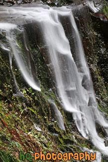
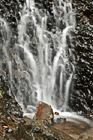
#2198 — A scenic vertical picture taken of a small waterfall on a rock wall at a slow shutter speed as you can see the water streaming silky-like.
Small Waterfall on Rock Wall
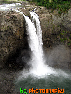
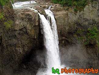
#92 — A fantastic photo of the Snoqualmie Falls, which is located in Snoqualmie, Washington. This waterfall is an historic site in the state of Washington. Snoqualmie Falls is one of Washington state's most popular scenic attractions. More than 1.5 million visitors come to the Falls every year. At the Falls, you will find a two-acre park, observation deck, gift shop, the Salish Lodge and the famous 270 foot waterfall.
Snoqualmie Falls Close Up
#83 — A fantastic photo of the Snoqualmie Falls, which is located in Snoqualmie, Washington. This waterfall is an historic site in the state of Washington. Snoqualmie Falls is one of Washington state's most popular scenic attractions. More than 1.5 million visitors come to the Falls every year. At the Falls, you will find a two-acre park, observation deck, gift shop, the Salish Lodge and the famous 270 foot waterfall.
Snoqualmie Falls, Wa
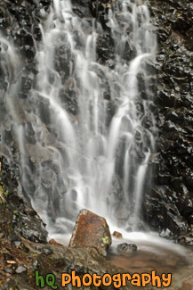
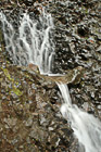
#2199 — A scenic vertical picture taken of a small waterfall close up against a rock wall. A lone rock is seen sitting at the bottom of the waterfall.
Waterfall & Rock Close Up
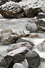
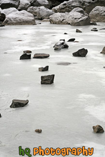
#2170 — A scenic vertical photo taken of some frozen rocks seen at the base of Snoqualmie Falls located in Washington State during the December 2009 freeze.
Frozen Rocks
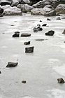
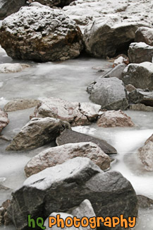
#2172 — A scenic vertical picture taken of small frozen rocks sitting on top of iced over frozen water. This photo was taken at the base of Snoqualmie Falls during the Washington State December 2009 freeze.
Frozen Rocks on Icy Water
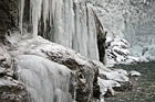
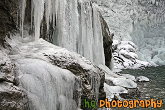
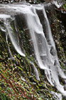
#2182 — A scenic picture taken of a bunch of thick icicles that have formed along the rocks and wall located at Snoqualmie Falls in Washington State during the December 2009 winter freeze. Temperatures got as low as the teens during about a week of freezing weather.
Icicles on Rocks
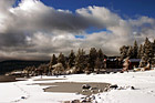
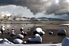
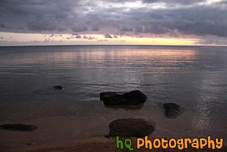
#198 — A pretty view at Lake Tahoe during a November snow storm in 2004. The Lake Tahoe Basin was formed by geologic block (normal) faulting about 2 to 3 million years ago. A geologic block fault is a fracture in the Earth's crust causing blocks of land to move up or down. Snow, rain, and streams filled the southern and lowest part of the basin, forming the ancestral Lake Tahoe.
Lake Tahoe Snow, Clouds, & Beach
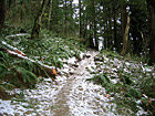
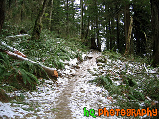
#51 — "Mt. Peak" as the locals call this small mountain located in Enumclaw, Washington, is one known throughout the whole city of one of the major places to get a great workout. The trail goes a mile up and can be challenging. This photo was taken in the winter time after a snow storm of the icy trail of Mt. Peak.
Mt. Peak Icy Trail
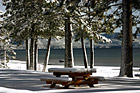
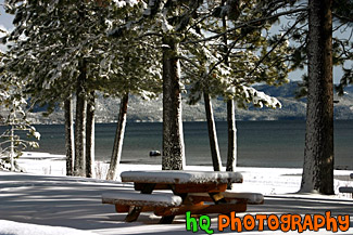
#286 — A pretty view of a snow covered picnic table at Lake Tahoe during a November snow storm. Lake Tahoe is the second deepest lake in the United States and the tenth deepest in the world, with a maximum depth measured at 1,645 ft (501 m), average depth of 1,000 ft (305 m).
Picnic Table & Lake Tahoe Snow
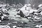
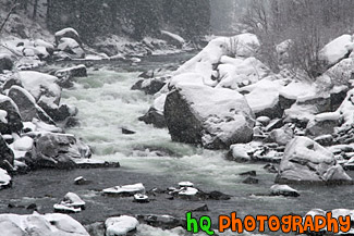
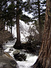
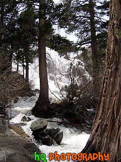
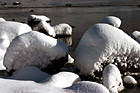
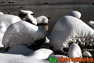
#1877 — A scenic picture taken of a river during the winter season while it is snowing outside and snow is piling up on the rocks around the river.
River & Snowy Rocks
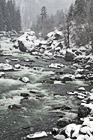
#2071 — A scenic vertical picture taken of a river flowing through snow falling from the sky and snow covering the rocks surrounding the river. This river was located along Highway 2 in Washington State just near Leavenworth.
River Flowing Through Snow
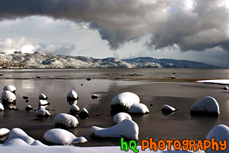
#283 — A scenic photo taken of rocks covered in snow right on the beach at Lake Tahoe. This photo was taken right after a huge snow storm at the end of November in 2004.
Snow Covered Rocks in Lake Tahoe
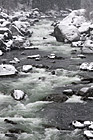
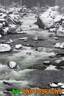
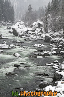
#1876 — A scenic vertical picture taken of a snowy river located along Highway 2 just as you leave Leavenworth in Washington State. It was snowing quite a big this day as the snow is covering the rocks along the river.
Snowy River Along Highway 2


#974 — A close up picture taken of railroad tracks with rocks surrounding the tracks.
Close up of Railroad Tracks


#979 — A vertical picture taken close up of some railroad tracks located in Washington State.
Railroad Tracks
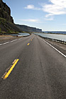
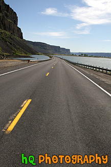
#1979 — A scenic vertical picture taken of a road located in Eastern Washington between a lake and a rock cliff wall.
Road Between Lake and Cliff
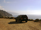
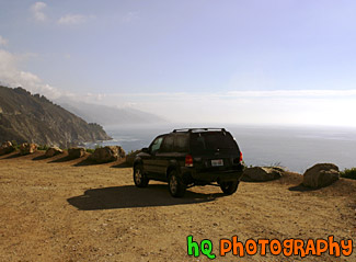
#431 — A scenic picture taken of a 2003 Ford Escape located on a dirt road close to the cliff by the coast of the Pacific Ocean on California's coast.
Ford Escape on Dirt Road Ocean View
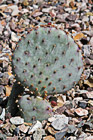
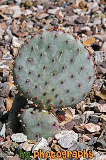
#2238 — A scenic close up vertical picture taken of a baby prickly pear cactus plant located outside of a homeowner's yard in Arizona. Small rocks surround the cactus plant.
Baby Prickly Pear Cactus

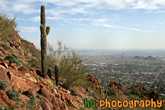
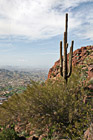
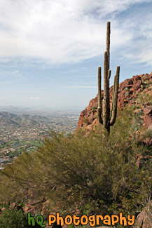
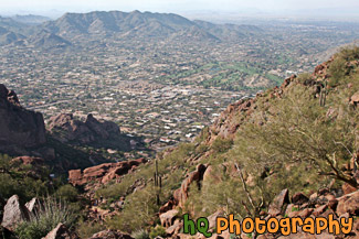
#2272 — A scenic picture taken of a pretty view from the hike on Camelback Mountain near Phoenix, Arizona. You can see a cactus tree in the foreground.
Cactus & Camelback Mountain View
#2279 — A scenic vertical picture taken of a Camelback Mountain view and a cactus tree in the foreground in Arizona State.
Camelback Mountain & Cactus
#2276 — A scenic vertical picture taken of a trail and hills of camelback mountain located in Arizona State near Scottsdale and Phoenix.
Camelback Mountain Trail
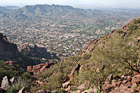
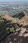
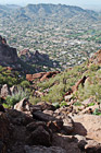
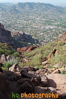
#2273 — A scenic picture taken of the view looking down from almost the top of Camelback Mountain located near Phoenix, Arizona.
Camelback Mountain View
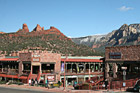
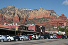
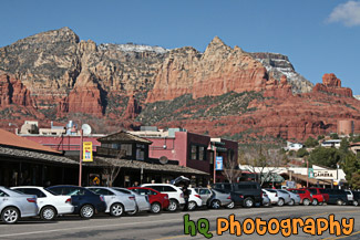
#2241 — A scenic picture taken of the downtown Sedona area in Arizona with red rocks seen in the background. This photo was taken on a sunny day with blue sky seen in the background. People are out on the streets enjoying the downtown.
Downtown Sedona & Red Rocks
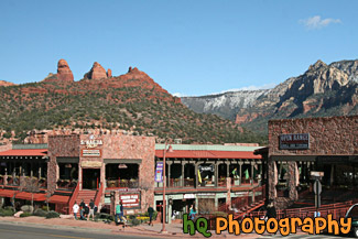
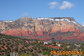
#2240 — A scenic picture taken of the downtown area of Sedona, which is located in Arizona State. The famous red rock of Sedona is seen in the backround which surrounds the entire city of Sedona. Blue sky is seen in the background too.
Downtown Sedona, Arizona
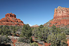
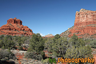
#2239 — A scenic picture taken of some of the Red Rock hills seen in Sedona Arizona State. This photo was taken with blue sky seen in the background. The rocks surrounding Sedona are red because of iron. Sandstone is porous, and when water carrying dissolved iron drains through the sandstone, some of the iron is left behind, and it is this iron in the form of iron oxide, which is red, that coats the grains of quartz and gives it color.
Red Rock in Sedona
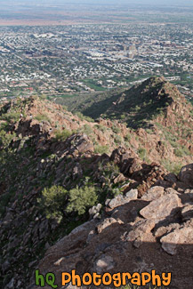
#2277 — A scenic vertical picture taken looking down on the trail at Camelback Mountain in Arizona State. You can see hills in the distance and the big rocks on the trail that you have to climb over.
Rocks & Trail on Camelback Mountain
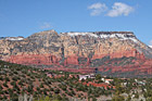
#2284 — A scenic picture taken in Sedona, Arizona of the red rock hills and some houses on a hill. Some snow is visible on top of the red rock hill.
Sedona Red Rock & Houses on Hill
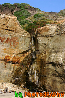
#512 — A scenic picture taken of a big rock cliff with water streaming down located on the beach in Marin County, California. This picture was taken at Kehoe Beach.
Big Rock Cliff
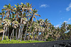
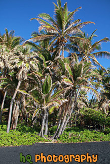
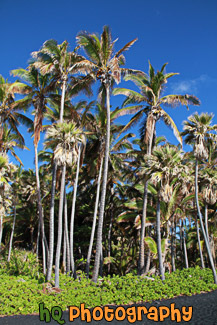
#2387 — A scenic picture taken of the black sand and palm trees located on the Big Island of Hawaii. Beautiful blue sky is seen in the background. This black sand beach is located at Punaluu Black Sand Beach. The sand is black because of the constant volcanic activity on the island.
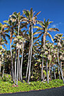
Black Sand Beach & Palm Trees
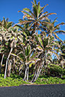
#2389 — A scenic vertical picture taken of Punaluu Black Sand Beach which green palm trees and blue sky. You can see the black sand in the foreground.
Black Sand Beach at Punaluu, Big Island
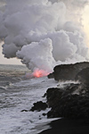
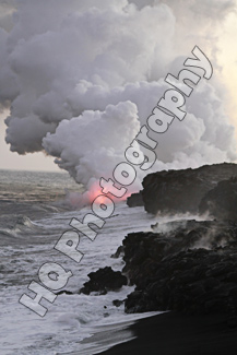
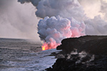
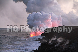
#2403 — A scenic vertical picture taken of lava entering the Pacific Ocean off the rocky coast of the Big Island, Hawaii.
Lava, Smoke, Rocky Shore
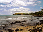
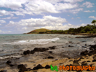
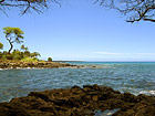
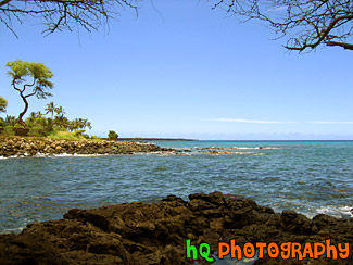
#180 — A scenic photo of the view on the coast of the Pacific Ocean off the coast of Maui, Hawaii. The water during this time in the summer is close to 80 degrees and a joy to swim or snorkel in!
Pacific Ocean, Maui
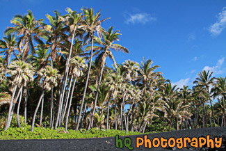
#2388 — A scenic vertical taken taken of the bland sand and palm trees at Punaluu Black Sand Beach located on the Big Island of Hawaii. Bright blue sky is seen in the background.
Punaluu Black Sand Beach
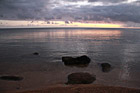
#2357 — A scenic picture taken of the sun rising at Secret Beach in Kauai, Hawaii near Princeville. In this photo you can see the pink and purple skies of the sunrise reflecting onto the Pacific Ocean. Rocks are also visible in the foreground.
Secret Beach, Kauai Surise
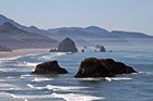
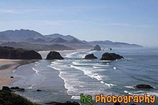
#2002 — A scenic coastal picture taken in Oregon State at Cannon Beach. In this picture you can see sea stack rocks and the well-known Haystack Rock in the distance.
Cannon Beach & Ocean Rocks
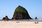
#2020 — A scenic picture taken of the popular Cannon Beach landmark, Haystack Rock. This photo was taken from a hill looking slightly down at the rock. You can see all of the people below observing Haystack Rock.
Haystack Rock From a Hill
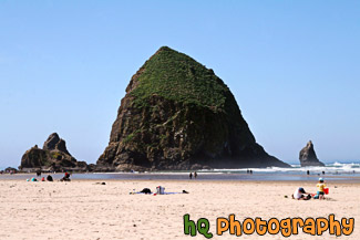
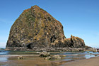
#2016 — A scenic picture taken of Haystack Rock which is located along the shore at Cannon Beach, Oregon. Haystack Rock is a popular tourist location in Oregon State.
Haystack Rock on Cannon Beach
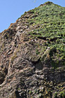
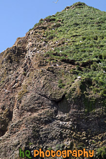
#1964 — A scenic close up picture taken of Haystack Rock which is located along the coast in Cannon Beach, Oregon. You can see the birds landing on the rock as it is their home.
Haystack Rock up Close
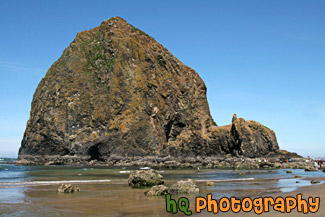
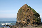
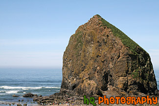
#1962 — A scenic picture taken of Haystack Rock located along the coastal shore in Cannon Beach, Oregon. Haystack Rock is a dedicated and protected Marine Garden. It rises 235 feet and is abundant with sea life. Haystack Rock is home to many birds such as tufted puffins, gulls, and cormorants.
Haystack Rock, Cannon Beach
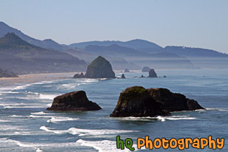
#2332 — A scenic coastal picture taken along the cast in Oregon State at Cannon Beach. In this picture you can see a lot of sea stack rocks and the well-known Haystack Rock in the distance. Blue sky is seen above the Pacific Ocean.
Pacific Ocean at Cannon Beach
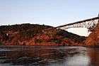
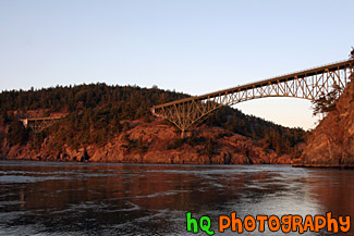
#1788 — A scenic picture taken of the Deception Pass bridge during sunset. The bridge, water, and rocks are turning red from the sunset in this photo.
Deception Pass During Sunset
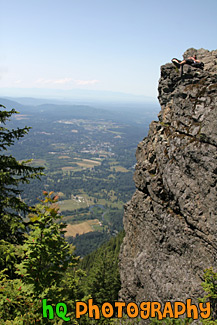
#2013 — A view of the Seattle area and a rock cliff with a person laying on it from the top of Mt. Si which is located in North Bend, Washington.
Rock Cliff & View at top of Mt. Si
#1445 — A scenic vertical picture taken of the city of Seattle, the Puget Sound, waves and rocks from Alki Beach. This photo was taken on a sunny day.
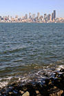
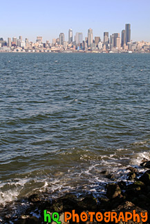
Seattle & Alki Beach Rocks
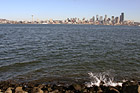
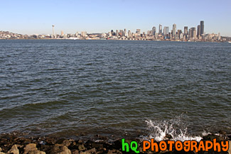
#129 — A scenic photo taken from across the Puget Sound on Alki Beach looking at Seattle, Washington with waves splashing on the rocks. Alki Beach is a popular attraction spot for locals to enjoy a beautiful view of Seattle and to play on the beach. This photo was taken on a sunny winter day in Washington.
Seattle From Alki Beach
