Photos of Ash (429)
There are (429) photos of the keyword, Ash, available on our website. They are pictured below.The pictures are organized by category.
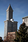
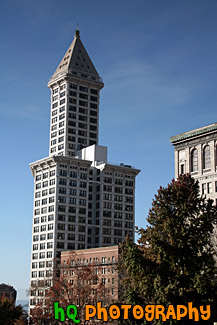
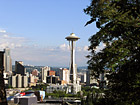
#1205 — A scenic picture of a tall building in Seattle, Washington on a beautiful sunny, winter day.
Scenic Building in Seattle
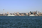
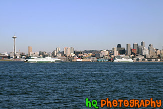
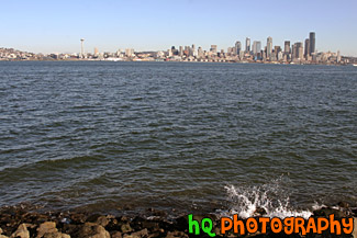
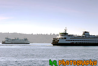
#1423 — A scenic picture taken of the city of Seattle from across the sound at Alki Beach. In this photo you can see the Space Needle, downtown Seattle buildings, and two ferry boats in the sound leaving shore.
Seattle & Two Ferry Boats
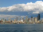
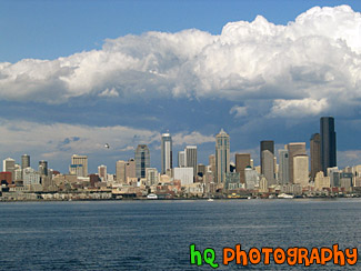
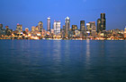
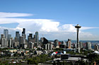
#154 — A scenic view of Seattle, Washington from Alki Beach with some clouds hovering over the city. From this view you can see all the tall buildings of Seattle with the waterfront. Dramatic clouds are seen above the city.
Seattle and Clouds
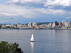
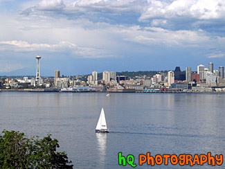
#155 — A scenic photo of a view of a sailboat and most of Seattle from across the puget sound.
Seattle and Sailboat
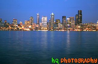
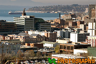
#1116 — A scenic night-time picture taken of the city of Seattle on a beautiful clear sky late summer night. In this photo you can see the buildings of Seattle all lit up with the Puget Sound in the forground. This photo was taken across the sound at Alki Beach.
Seattle at Night from Alki Beach
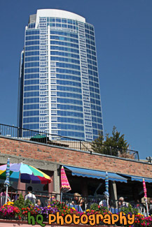
#2319 — A scenic vertical picture taken of a big Seattle business building in the background and a restaurant patio with umbrellas and tables in the foreground. Photo was taken against a blue sky.
Seattle Building & Restaurant Patio
#842 — A scenic picture taken of some downtown Seattle, Washington buildings looking near the Chinatown area. In this picture you can also see the Puget Sound along with part of the Olympic Mountains in the background.
Seattle Buildings Near Chinatown
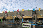
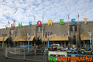
#1929 — A scenic picture taken of the Fun Forest located at the Seattle Center in downtown Seattle. Fun Forest Amusement Park, with games and 19 rides for kids and thrill seekers alike, is a playground for all ages. The Fun Forest has a roller coaster, carousel, and prize winning games. The Fun Forest also features the Entertainment Pavilion, open daily year-round with three rides, laser tag, mini-golf, prize games and a full video arcade.
Seattle Center Fun Forest
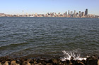
#129 — A scenic photo taken from across the Puget Sound on Alki Beach looking at Seattle, Washington with waves splashing on the rocks. Alki Beach is a popular attraction spot for locals to enjoy a beautiful view of Seattle and to play on the beach. This photo was taken on a sunny winter day in Washington.
Seattle From Alki Beach
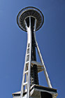
#2318 — A close up, scenic vertical picture taken of the Seattle Space Needle against blue sky.
Seattle Space Needle Against a Blue Sky
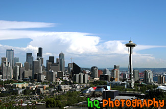
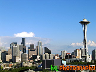
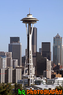
#607 — A scenic picture taken of the city of Seattle Washington. In this pictures you can see the tall buildings of Seattle along with the Space Needle. The City of Seattle is located in the State of Washington on Puget Sound which is 113 miles (182 km) south of the U.S.-Canadian border. The city is located at sea level. The highest hill elevation in the city is 520 feet. Greater Seattle excels in livability with a mild climate, affordable housing, a full range of arts, cultural and sporting events, an abundance of shops and restaurants, and easy access to outdoor recreational activities throughout the year.
Seattle, Washington
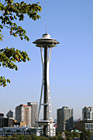
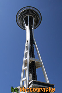
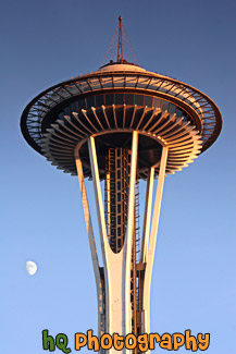
#7 — The Space Needle on a beautiful, sunny day in Seattle, Washington. The 605 foot (184 meter) Space Needle was designed by Edward E. Carlson for the 1962 World's Fair in Seattle. The futuristic structure has become a symbol for the city, and is home to festive events such as the annual New Year's Eve fireworks display.
Space Needle
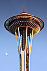
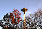
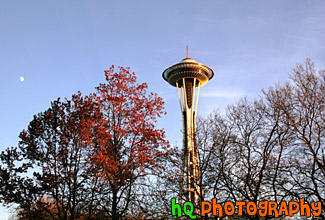
#819 — A close up picture taken of the Space Needle at dusk with a three quarters full moon in the background. This picture was taken in December as you can see the Christmas lights getting brighter on top of the Space Needle. The Space Needle has become the symbol for the city of Seattle.
Space Needle & Moon
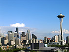
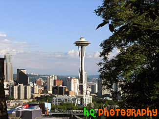
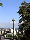
#124 — A scenic view of the Space Needle and Seattle, Washington from a hill near Seattle. Blue sky is seen above and the tall buildings of Seattle are to the left.
Space Needle & Seattle
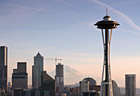
#1295 — A scenic picture taken of the Space Needle at dusk in Seattle, Washington. Blue sky and the moon are seen in the background.
Space Needle at Dusk
#123 — A view of the Space Needle located in Seattle, Washingon on this beautiful sunny day. The 605 foot (184 meter) Space Needle was designed by Edward E. Carlson for the 1962 World's Fair in Seattle. The Space Needle has become a symbol for the city, and is home to festive events such as the annual New Year's Eve fireworks display. The Space Needle was completed in December 1961, and officially opened four months later on the first day of the World's Fair, April 21, 1962.
Space Needle View
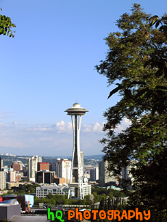
#125 — A view of the Space Needle and Seattle, Washington from a hill near Seattle. The futuristic structure has become a symbol for the city, and is home to festive events such as the annual New Year's Eve fireworks display. Blue sky is seen above and a tree is to the right.
Space Needle, Seattle
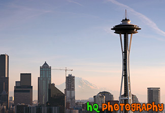
#811 — A scenic picture taken of the Space Needle, skyscrapers of the city of Seattle, and the famous landmark of Washington State - Mount Rainier in the background. This picture was taken on a sunny day as the sun is getting ready to set.
Space Needle, Seattle, & Mt. Rainier
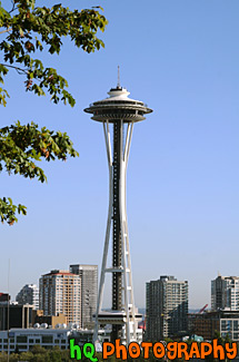
#152 — A view of the Space Needle from a hill near Seattle. The 605 foot (184 meter) Space Needle was designed by Edward E. Carlson for the 1962 World's Fair in Seattle. The futuristic structure has become a symbol for the city, and is home to festive events such as the annual New Year's Eve fireworks display. The Space Needle was completed in December 1961, and officially opened four months later on the first day of the World's Fair, April 21, 1962.
Tree & Space Needle
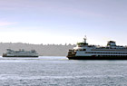
#821 — A close up scenic picture taken of two Seattle ferry boats in the Puget Sound. One ferry boat is leaving short while the other is on its way in. Washington State Ferries operates the largest ferry fleet in the United States. Twenty-eight ferries cross Puget Sound and its inland waterways, carrying over 26 million passengers to 20 different ports of call. From Tacoma, Washington, to Sidney, British Columbia, they travel up and down the Sound, acting as a marine highway for commercial users, tourists and daily commuters alike.
Two Seattle Ferry Boats
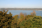
#1331 — A scenic picture taken of Commencement Bay in Tacoma, Washington with the trees changing color in the foreground due to the Fall season.
Commencement Bay in Autumn
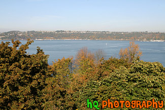
#1333 — A scenic picture taken of the Commencement Bay sound located in Tacoma, Washington. This photo was taken during the autumn season as you can see from the changing colors of the trees in the background.
Commencement Bay in Fall
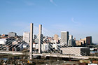
#932 — A scenic picture taken of downtown Tacoma, Washington on a beautiful sunny day with blue skies seen over the city. Tacoma serves as a gateway to some of the most magnificent natural wonders in the world such as Puget Sound, Mount Rainier National Park and the Olympic Peninsula.
Downtown Tacoma on Sunny Day
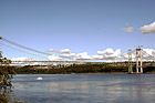
#1087 — A scenic picture taken of the Narrows Bridge project in process as the new bridge is being built right beside the old bridge of 1950. The new bridge opens to traffic in summer 2007, but renovations on the 1950 bridge go on for another 11 months after that. In summer 2008, when the new and existing bridges open in their final form, the 1950 span will take drivers westbound on two general purpose lanes and one carpool lane. The new bridge will carry eastbound traffic on two general purpose lanes, one carpool lane and a fourth "drop" lane.
Narrows Bridge Project, Tacoma
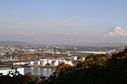
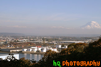
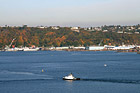
#1337 — A scenic view of the Port of Tacoma on a sunny day with Mt. Rainier seen in the background.
Port of Tacoma View
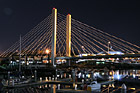
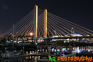
#1746 — A scenic picture taken of downtown Tacoma, Washington at night with a bridge seen in the foreground and the Tacoma dome seen in the background.
Tacoma Bridge at Night
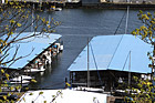
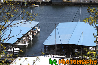
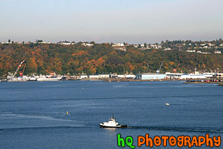
#1046 — A close up picture taken of boats under shelter located in Commencement Bay in Tacoma, Washington.
Tacoma Commencement Bay Boats
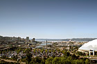
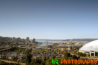
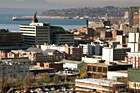
#1103 — A scenic view of Tacoma, Washington taken from a hill. In this photo you can see part of the Tacoma Dome, the buildings of downtown Tacoma, and Commencement Bay.
Tacoma From a Hill
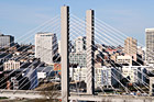
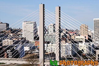
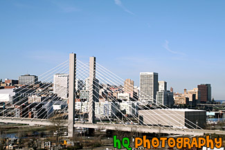
#933 — A close up scenic picture taken of downtown Tacoma and the scenic bridge where you can see the buildings of Tacoma through it. Tacoma, Washington, is located on the West Coast nestling between Commencement Bay and the Puget Sound. It is about 36 miles south of Seattle and 28 miles north of the capital of Washington, Olympia. Tacoma's historic and innovative downtown has expanded down the hillside to absorb and include its Puget Sound waterfront. With new condos, retail and the International Museum of Glass. Tacoma's Waterfront Downtown is reborn.
Tacoma, Washington Downtown
