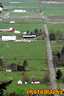
Aerial Farmland View Photo

A scenic aerial picture taken of a couple farms and farmland located in the small town of Enumclaw, Washington. This picture was taken from up Mt. Peak which is a popular local hike that people do for a great workout.
Related Photos
country land, aerial farms, country farmland enumclaw washington, view from mt. peak, from mt. peak, green farmland, enumclaw farmland looking down, scenic farmland
Camera Settings (EXIF Data)
country land, aerial farms, country farmland enumclaw washington, view from mt. peak, from mt. peak, green farmland, enumclaw farmland looking down, scenic farmland
Camera Settings (EXIF Data)
- Shutter Speed: 1/200 seconds
- Lens Aperture: F/8
- Focal Length: 108 mm
- Image Resolution: 2336 x 3504 pixels
- Image Size: 4.45 MB (JPG), 23.4 MB (TIF)
- Date Photo Taken: April 9, 2006 10:58 AM
- File Name: 1006_enumclaw.jpg
- Image ID: # 1006
- Date added to website: 12-Apr-2006
