Photos of Mount St. Helens Volcano (10)
There are (10) photos of the keyword, Mount St. Helens Volcano, available on our website. They are pictured below.The pictures are organized by category.
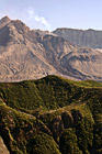
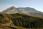
#541 — A close up picture taken of Mount St. Helens with a green hill in front and steam coming out of the dome. This picture was taken 25 years after the 1980 eruption and as you can see from the green hill there is re-growth from the destruction. Mount St. Helens is located in Gifford Pinchot National Forest and is a popular landmark of Washington State.
Mount St. Helens Close Up
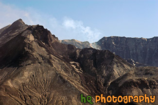
#899 — A scenic close up picture takne of the tip of Mount St. Helens with a blue sky background and some steam coming out. This picture was taken at the Windy Ridge view point. Hence the name, it is really windy here. Mount St. Helens is located in Gifford Pinchot National Forest and is a popular landmark of Washington State.
Close up of Mount St. Helens & Steam
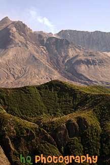
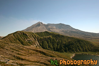
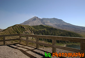
#903 — A scenic picture taken of Mount St. Helens on a sunny day with a blue sky background. This picture was taken 25 years after the 1980 eruption and as you can see from the green hills there is re-growth starting to appear from the destruction. Mount St. Helens is located in Gifford Pinchot National Forest in Washington State.
Mount St. Helens & Blue Sky
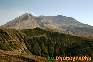
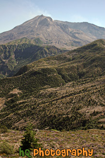
#528 — A scenic picture taken of Mount St. Helens National Volcanic Monument on a sunny day. In this picture you can see the volcano is active and letting out some steam. On this day there was a warning of 2 out of 3 and later this evening there was a 3.2 earthquake which the volcano let out even more steam. The last time Mount St. Helens really erupted was at 8:32 Sunday morning, May 18, 1980. Today, 25 years later, you can still see the destruction left from that blast, but you can also see a lot more green as things are starting to grow back. Back on May 18, 1980, Mount St. Helens was shaken by an earthquake measuring 5.1 on the Richter scale. Nearly 230 square miles of forest was blown over or left dead and standing. The eruption lasted 9 hours, but Mount St. Helens and the surrounding landscape were dramatically changed within moments.
Mount St. Helens & Steam
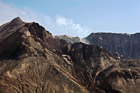
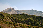
#539 — A scenic picture taken of Mount St. Helens from Windy Ridge, which is the closest spectators can get to the volcano. In this picture you can see some steam flowing out of the dome of the mountain as it has a waring level 2 out of 3 on this particular day. The last major eruption of Mount St. Helens was on May 18, 1980.
Mount St. Helens at Windy Ridge
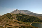
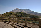
#1277 — A scenic picture taken of Mt. Saint Helens and part of Spirit Lake seen in the foreground.
Mt. St. Helens & Spirit Lake
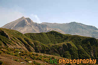
#1307 — A scenic picture taken of Mount St. Helens from Windy Ridge, which is the closest spectators can get to the volcano. In this picture you can see some steam coming out of the dome of the mountain as it has a waring level 2 out of 3 on this particular day.
Mt. St. Helens at Windy Ridge
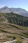
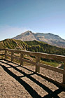
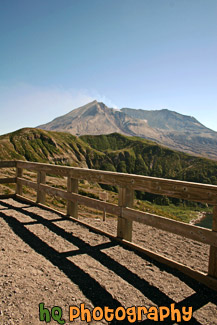
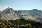
#1279 — A scenic vertical photo of Mt. Saint Helens volcano taken on a sunny day with blue sky seen above.
Mt. St. Helens Vertical
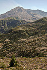
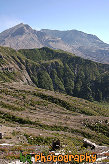
#1284 — A scenic vertical picture taken of the new growth in the foreground 25 years after the eruption of Mt. Saint Helens in 1980. Mt. Saint Helens is seen in the background with some steam coming out.
New Growth & Mt. Saint Helens
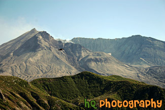
#554 — A scenic close up picture taken of Mount St. Helens volcano with a bird flying in front. This picture was taken at the Windy Ridge view point. Hence the name, it is really windy here and this bird was taking advantage as he was gliding through the air effortlessly. Mount St. Helens is located in Gifford Pinchot National Forest and is a popular landmark of Washington State.
Mount St. Helens & Bird
