Photos of Hill (208)
There are (208) photos of the keyword, Hill, available on our website. They are pictured below.The pictures are organized by category.
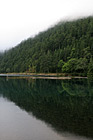
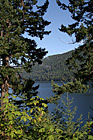
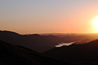
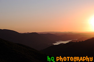
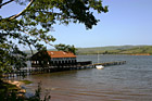
#1704 — A scenic vertical picture taken of a hill and its' reflection seen in Lake Cresent, located in the Olympic National Park.
Hill Reflection in Lake
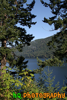
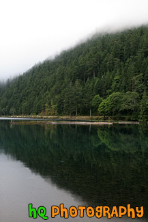
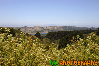
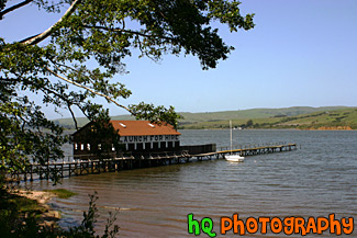
#1703 — A scenic vertical picture taken of Lake Cresent in the background seen through some green trees in the foreground. This photo was taken on a sunny day in the Olympic Mountains.
Lake Cresent and Trees
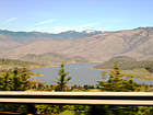
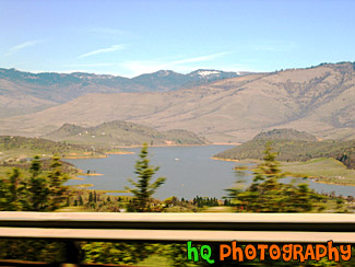
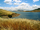
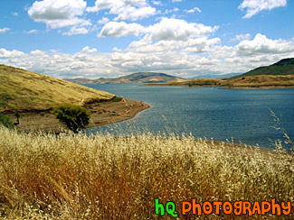
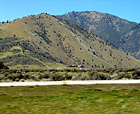
#67 — A view of Lake Shasta, California while driving North on I5. You can tell this photo was taken while the car was moving because the trees in the foreground are blurry but the lake itself is in focus.
Lake Shasta from I5
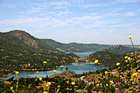
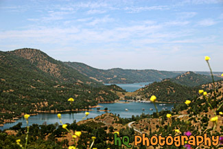
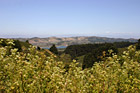
#44 — A landscape scene in Northern California near Gilroy of a lake and puffy clouds on a sunny day.
Landscape Lake Scene
#650 — Moccasin Point Marina can be seen on your drive to Yosemite National Park if you take Highway 120 (Yosemite Highway). Moccasin, California is situated in the foothills of California's beautiful Sierra Nevada Mountains. Moccasin Point Marina and recreation area is 60 miles west of the Yosemite National Park and 2 1/2 hours east of San Francisco.
Moccasin Point Marina, California
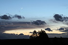
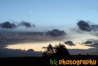
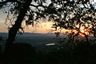
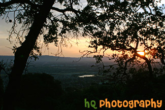
#913 — A very beautiful, scenic picture taken at sunset of a crescent moon with blue sky surrounding it along with a sunset near the horizon. Colorful and interesting shaped clouds and a silhouette of the hill and trees also make for a pretty picture. This photo was taken looking towards the west from Bonney Lake, Washington.
Crescent Moon, Sunset, & Hill Silhouette
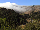
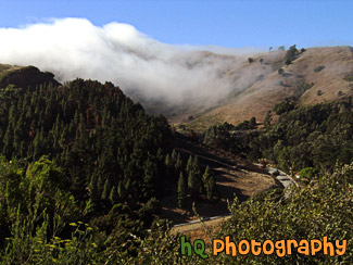
#262 — This photo was taken near the hills of the Golden Gate Bridge in San Francisco on a foggy, but sunny day. On this particular day the fog was just rolling over the hills from the Pacific Ocean as fast as it could and it was a site to see.
Fog Rolling over Road in San Francisco
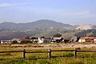
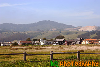
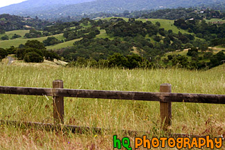
#955 — A scenic picture taken of a beautiful landscape scene located along the coast in California at Half Moon Bay. In this picture you see an old wooden fence in the foreground with a grass field that leads to some houses and green hills in the background. Half Moon Bay is located about 30 miles south of San Francisco, and only an hour's drive from pretty much anywhere in the Bay Area. Half Moon Bays' community offers numerous Bed and Breakfasts, several motels and some world-renowned hotels. Activities include surfing, whale watching, horseback riding on the beach, a historical Main Street with unique shops, two wineries, bird refuges, hiking and two lighthouses.
Half Moon Bay Hills & Houses
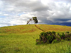
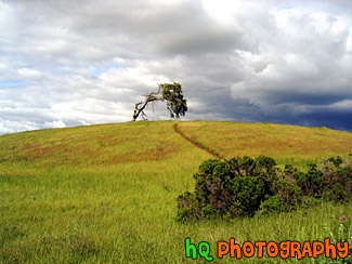
#4 — A photo of a lonely tree with a storm approaching on the golden hills of the California Bay Area. This photo was taken during Spring 2003 in Palo Alto area in CA.
Lonely Tree & Storm
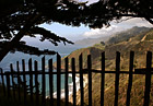
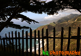
#295 — This is a scenic photo that was taken along the coast of the Pacific Ocean along Highway 1 in California. This photo looks through a fence down at the coast and Pacific Ocean. Highway 1 is a coastal highway running down the coast of California.
Pacific Ocean View Through Fence
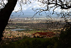
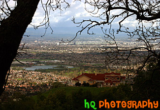
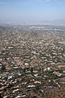
#319 — A scenic picture taken a top a hill in East San Jose overlooking the entire city. This picture shows a scenic house amongst the view of the city. From this aerial photo you can see the buildings of San Jose, the airport, and the amazing view that this multi-million dollar home also sees.
Scenic View of San Jose From A Hill
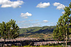
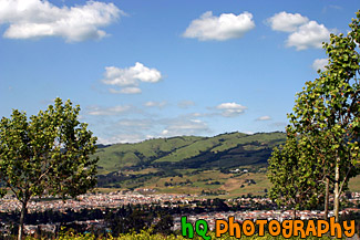
#956 — A scenic photo taken of the wesstern Bay Area in California looking towards the 280 freeway which runs near Half Moon Bay, Stanford, Los Altos, and Palo Alto. In this picture you can see the golden hills which surround the Bay Area and a small lake in the middle of the photo. This photo was taken on a sunny day.
Bay Area Landscape Scene
#329 — This is a scenic beautiful picture taken of a bright green grass field following a cury wooden fence in the hills of Palo Alto, California. This picture was taken up a trail behind the campus of Stanford University. The grass is especially green right now because of the tremendous rainfall the bay area has been having during this time period. Usually these fields are a golden yellow color because of the sunshine and lack of rainfall, hence the name "Golden Hills" of California. This hills can no longer live up to that name since they are all green! But they are so beautiful!
Bright Green Grass & Fence in Palo Alto
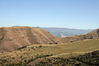
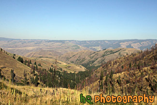
#2159 — A scenic picture taken of a landscape of some brown hills with a hint of green located in the state of Idaho. This was taken on a sunny day with blue skies seen above.
Brown Hills
#785 — A scenic picture taken close up of some golden and green hills located on the path towards Half Moon Bay, California. During late spring and the summer months in California, these golden hills are a very common site.
Close up of Golden Green Hills
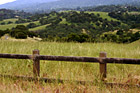
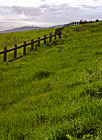
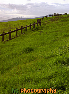
#887 — A scenic picture taken in the country side of the Los Altos Hills in the Bay Area of California. In this picture an old wooden fence lines the foreground and the country green fields and hills can be seen in the background.
Country Fence & Green Fields
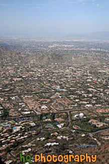
#373 — A scenic picture taken a top a hill in East San Jose overlooking the entire city and bay area. This picture shows a scenic house amongst the view of the city during a spectacular sunset.
East San Jose Hill Sunset
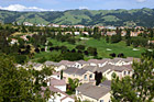
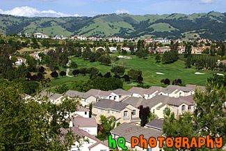
#888 — A scenic picture taken of the East San Jose landscape, green hills, blue sky, and houses in the area. This photo was taken in the Evergreen area.
East San Jose Landscape & Houses
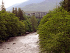
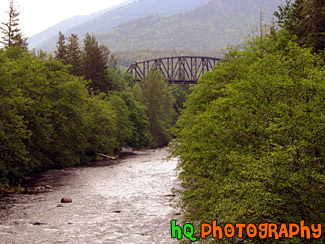
#91 — A river with an old bridge in the background. This photo was taken on a bridge looking out at the Green River located in Washington State. In this photo you can see the bunches of Evergreen trees.
Green River & Old Bridge
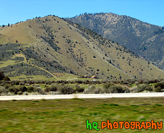
#68 — A scenic view of a little house off the I5 freeway heading towards California. You can tell this photo was taken while the car was moving because the grass in the foreground is blurry while the house and mountain in the distance are in focus.
House off the Freeway
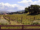
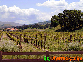
#21 — A photo of a farm in the countryside of Northern California. This farm was located out near Sacramento but not quite in the city. A fence and a wine field can be seen in the picture.
Out in the Country
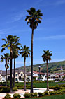
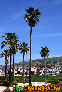
#750 — A scenic picture taken of some tall palm trees which are located at a park in the center of a housing development in East San Jose, California (the Evergreen area). This picture was taken on a sunny day with blue skies in the background.
Palm Trees in Housing Development
#357 — A scenic picture taken of the Silver Creek Valley area in East San Jose. From all the rain this area has been having during 2005, you can see the very green hills in the background.
Silver Creek Valley, San Jose
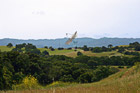
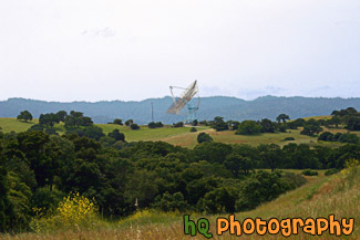
#1866 — A scenic picture taken of The Dish located in the Stanford Foothills. The Dish is a popular hike for the locals. It is 4 mile walk round trip with paved road. It's great for runner and walkers. The first part of The Dish is an incline for about a quarter of a mile.
The Dish at Stanford Foothills
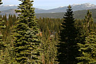
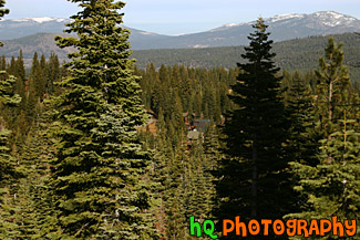
#200 — A view of the trees in the mountains of Lake Tahoe. Lake Tahoe is the second deepest lake in the United States and the tenth deepest in the world, with a maximum depth measured at 1,645 ft (501 m), average depth of 1,000 ft (305 m). The Lake Tahoe Basin was formed by geologic block (normal) faulting about 2 to 3 million years ago. A geologic block fault is a fracture in the Earth's crust causing blocks of land to move up or down. Snow, rain, and streams filled the southern and lowest part of the basin, forming the ancestral Lake Tahoe. Modern Lake Tahoe was shaped and landscaped by the scouring glaciers during the Ice Age. Many streams flow into Lake Tahoe, but the lake is drained only by the Truckee River, which flows northeast through Reno and into Pyramid Lake in Nevada.
Trees in the Mountains of Lake Tahoe
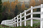
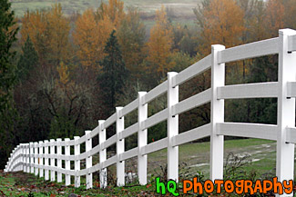
#1162 — A scenic picture taken of a white fence heading downhill surrounded by a bunch of trees changing color during the fall season. This picture was taken in Washington State.
White Fence & Trees
#515 — A scenic picture taken of the hills and mountains surrounding Yosemite National Park in California during sunset. The picture was taken near the entrence to Yosemite National Park just a couple miles west of Groveland and Big Oak Flat. Yosemite is located in east-central California and lies 105 miles north of Fresno, 195 miles east of San Francisco, 313 miles north of Los Angeles and 350 miles northwest of Las Vegas.
Yosemite Hills Sunset
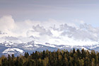
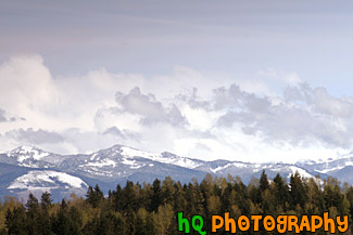
#1029 — A scenic picture taken of the Cascade Foothills located in Washington State near Mt. Rainier. In this photo you can see snow on the foothills, green evergreen trees in the foreground and some low clouds hovering over the mountains.
Cascade Foothills & Clouds
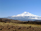
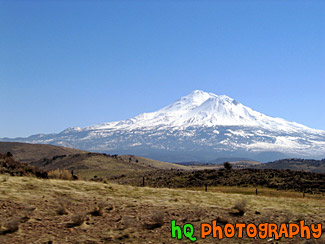
#66 — Mt. Shasta located in Northern California on the Cascade Range. Mount Shasta stands 14,162 feet high. Avalanche Gulch route is one of the most popular and climbed routes in the United States with an estimated 15,000 climbers that attempt the summit annually. With 17 established routes, each with variations, there is climbing available for beginners as well as advanced mountaineers. The terrain consists of loose volcanic talus, rock & ice, and glaciers. This photo was taken on a sunny day.
Mount Shasta
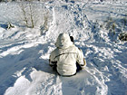
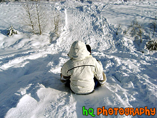
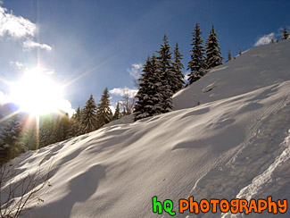
#41 — This picture captured a sledder making their way down a steep hill on an inner tube at Snoqualmie, Washington. This day there was a huge snow storm at Snoqualmie accumulating probably over a foot of snow. This sledder and friends hiked into the wilderness at Snoqualmie and built their own sledding hill to make it more thrilling!
Sledding
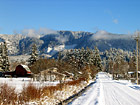
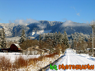
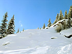
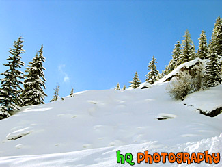
#30 — A scenic photo of a beautiful snowy winter scene in the foothills of the Cascade Mountains in Washington. This photo was taken in the Enumclaw area which is located about 30 miles from Mt. Rainier. Washington had a snow blast in January of 2004. Enumclaw is a small town in Washington State that has a lot of farms and land. From this city you can see some spectacular views of Mt. Rainier and other landscapes.
Winter Snow Landscape
#55 — Bright blue sky among the snow in Snoqualmie, Washington. Snoqualmie is a popular place in the winter to go skiing among many people.
Blue Sky & Snow
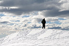
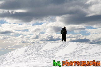
#1508 — A scenic photo of a man looking over a ledge/cliff on a snowshoeing trail at Paradise which is located in Mt. Rainier National Park.
Man Looking Over Ledge
#56 — Sun shining down on the snow after a snow storm at Snoqualmie, Washington. Snoqualmie is a popular place for people to come in the winter to go skiing, sledding, or just to play in the snow.
Snow and Sun
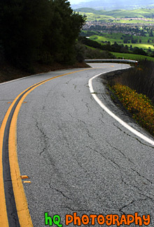
#326 — A scenic picture taken of a curvy road going down the hills of East San Jose. In this photo you can see the bright green hills in the distance from all the rain the bay area has been having during this time.
Road Leading to Green San Jose Hills
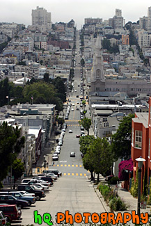
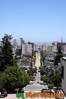
#384 — A scenic picture taken of a road in San Francisco, California from one end of the city going down a hill and back up another to the other end of the city. From this picture you can also see the scenic San Francisco buildings and houses.
San Francisco Road
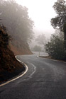
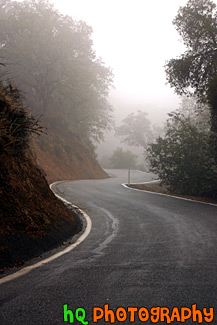
#242 — A scenic picture taken of a curvy road with fog in the distance. This picture was taken in the hills of East San Jose during a really foggy day.
Curvy Road with Fog

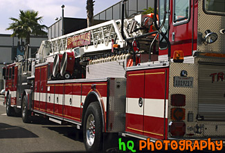
#396 — A scenic picture taken of a Fire Truck in downtown Beverly Hills, California. The fire truck says "Beverly Hills" on the sign on the ladder of the truck.
Beverly Hills Fire Truck
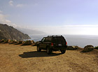
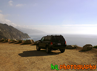
#431 — A scenic picture taken of a 2003 Ford Escape located on a dirt road close to the cliff by the coast of the Pacific Ocean on California's coast.
Ford Escape on Dirt Road Ocean View
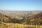
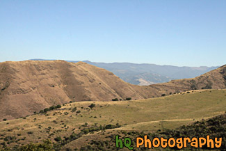
#2157 — A scenic picture taken of some hills located in the State of Idaho just near Hells Canyon.
Idaho Hills
#287 — Scenic photo of a Lake Tahoe ski resort. Looking through the Evergreen trees you can see the buildings of the resort surrounded by the trees. Every winter tons of people migrate to Lake Tahoe to take advantage of the great skiing.
Tahoe Ski Resort View

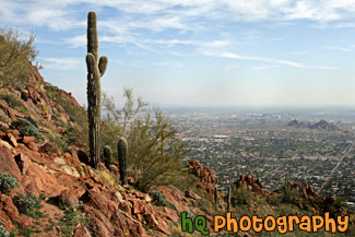
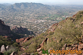
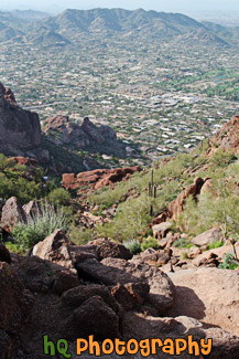
#2272 — A scenic picture taken of a pretty view from the hike on Camelback Mountain near Phoenix, Arizona. You can see a cactus tree in the foreground.
Cactus & Camelback Mountain View
#2276 — A scenic vertical picture taken of a trail and hills of camelback mountain located in Arizona State near Scottsdale and Phoenix.
Camelback Mountain Trail
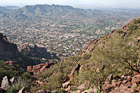
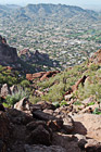
#2273 — A scenic picture taken of the view looking down from almost the top of Camelback Mountain located near Phoenix, Arizona.
Camelback Mountain View
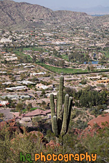
#2278 — A scenic vertical picture taken of a view from the lower part of hiking Camelback Mountain in Arizona and a cactus tree and Scottsdale.
Camelback Mountain, Cactus, & Scottsdale
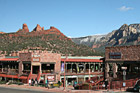
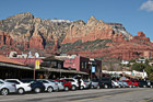
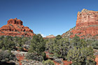
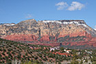
#2241 — A scenic picture taken of the downtown Sedona area in Arizona with red rocks seen in the background. This photo was taken on a sunny day with blue sky seen in the background. People are out on the streets enjoying the downtown.
Downtown Sedona & Red Rocks
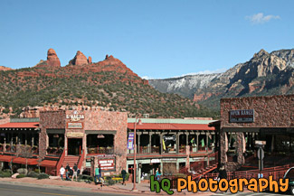
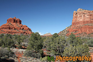
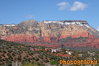
#2240 — A scenic picture taken of the downtown area of Sedona, which is located in Arizona State. The famous red rock of Sedona is seen in the backround which surrounds the entire city of Sedona. Blue sky is seen in the background too.
Downtown Sedona, Arizona
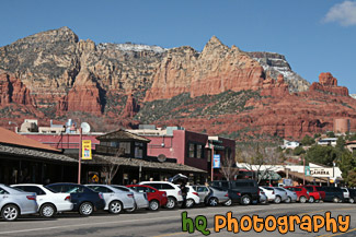
#2239 — A scenic picture taken of some of the Red Rock hills seen in Sedona Arizona State. This photo was taken with blue sky seen in the background. The rocks surrounding Sedona are red because of iron. Sandstone is porous, and when water carrying dissolved iron drains through the sandstone, some of the iron is left behind, and it is this iron in the form of iron oxide, which is red, that coats the grains of quartz and gives it color.
Red Rock in Sedona
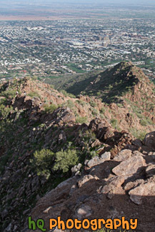
#2277 — A scenic vertical picture taken looking down on the trail at Camelback Mountain in Arizona State. You can see hills in the distance and the big rocks on the trail that you have to climb over.
Rocks & Trail on Camelback Mountain
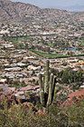
#2275 — A scenic vertical picture taken of a view of the city of Scottsdale, Arizona from on top of Camelback Mountain.
Scottsdale from Camelback Mountain
#2284 — A scenic picture taken in Sedona, Arizona of the red rock hills and some houses on a hill. Some snow is visible on top of the red rock hill.
Sedona Red Rock & Houses on Hill
#803 — A scenic picture taken of the Tomales Bay near Point Reyes in Marin County, California. In this picture you can see the hills in the background of marin county and a sail boat parked by this boat launch in the foreground. Tomales bay is a coastal estuary located on the central California coast approximately 40 miles northwest of San Francisco.
Marin County Boat Launch
#806 — A scenic picture of a beautiful hiking trail located by the coast in Marin County, California at Kehoe Beach. Marin County is a county located in California's San Francisco Bay Area across the Golden Gate Bridge fom San Franicsco. In this picture you can see Marin county's beautiful green hills along with the yellow falselupine wildflowers.
Marin County Coastal Trail
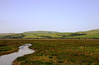
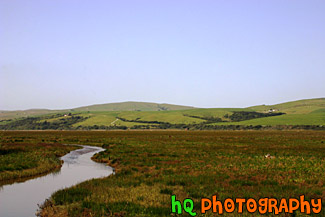
#948 — A scenic picture taken of the grasslands and hills in Marin County, California. This photo was taken near Point Reyes. In the photo you can see a stream of water along with the green hills in the background and green grassy field in the foreground. This photo was taken on a beautiful sunny day with blue sky seen all around.
Marin County Fieldland and Hills
#365 — A scenic picture taken in Point Reyes, California in Marin County. Point Reyes is home to many native land mammals which number about 37 species. Marine mammals also add to this total by another 12 species. The biological diversity stems from a favorable location in the middle of California and the natural occurrence of many distinct habitats which makes Point Reyes a fun place to visit.
Point Reyes Landscape Scene
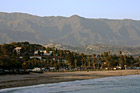
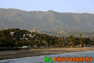
#752 — A scenic picture taken of Santa Barbara, California along the beach with a view of the many palm trees along the coast and the mountains in the background on a sunny day. In front of the mountain you can see the little hills filled with houses of the rich and famous.
Santa Barbara Beach & Mountains
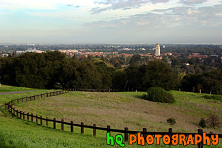
#331 — A scenic view of Stanford University taken from a hill up high just behind the campus. From this picture you can see Hoover Tower amongst all the other scenic buildings of Stanford University. In the foreground there is a wooden fence that curves along the trail.
Stanford University Hill Scene
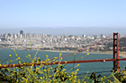
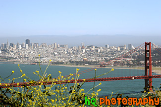
#656 — A scenic picture taken of the Golden Gate Bridge with some yellow wildflowers in the foreground near Hawk Hill in San Francisco, California. Hawk Hill is located just north of San Francisco, California in the Marin Headlands. From this position you are actually above the Golden Gate Bridge looking down at it and the city. In this picture you can see the Transamerica Building along with the Palace of Fine Arts.
Golden Gate Bridge & Yellow Flowers
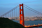
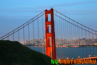
#362 — A scenic picture of the Golden Gate Bridge in San Francisco at night with a view of San Francisco city in the background. In the distance you can see the lights of the city lit up as well as the lights of the bridge. The Golden Gate Bridge seems to be "glowing" in this picture from the effect of night-fall approaching and city lights beginning to come on. This picture was taken from the Marin Headlands (north side) of the bridge from a place called Battery Spencer just slightly after dusk.
Golden Gate Bridge at Night & San Francisco City
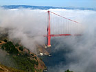
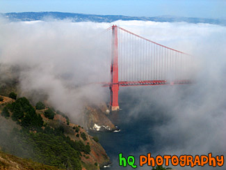
#215 — A scenic photo of fog covering the Golden Gate Bridge located in San Francisco, California. This picture was taken during the summer months when the fog really covers the Golden Gate Bridge. The real "Golden Gate" is the strait that the bridge spans. It was first named "Chrysopylae," meaning "golden gate," by Captain John C. Fremont in 1846. This photo was taken from the top of Hawk Hill which is located just north of San Francisco in the Marin Headlands. Total length of the bridge is 1.7 miles and the clearance above the high water is 220 feet.
Golden Gate Bridge Covered in Fog
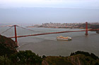
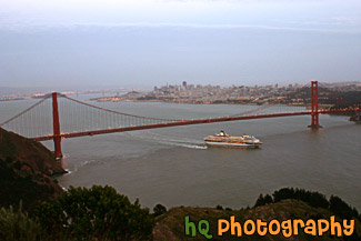
#363 — A scenic picture taken of the entire Golden Gate Bridge in San Francisco with a view of the city behind and a big cruise ship leaving the bay area underneath. This picture was taken at dusk from the top of Hawk Hill which is located just north of San Francisco in the Marin Headlands.
Cruise Ship Under Golden Gate Bridge
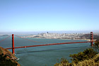
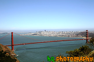
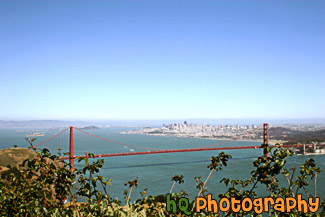
#580 — A scenic picture taken of the entire Golden Gate Bridge from Hawk Hill near San Francisco. Hawk Hill is located just north of San Francisco, California in the Marin Headlands. From this position you are actually above the Golden Gate Bridge looking down at it and the city.
Entire Golden Gate Bridge View
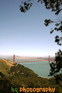
#733 — A scenic picture taken of the Golden Gate Bridge which is located in San Francisco, California. In this picture you can see the tall buildings of San Francisco in the distance. This picture was taken near Hawk Hill in San Francisco. Hawk Hill is located just north of San Francisco, California in the Marin Headlands. From this position you are actually above the Golden Gate Bridge looking down at it and the city.
Golden Gate Bridge framed by Tree
#581 — A scenic picture taken of the Golden Gate Bridge with some green shrubs in the foreground. In this picture you can see the entire view of the Golden Gate Bridge along with the city of San Francisco in the background and Alcatraz Island off to the left. This picture was taken from Hawk Hill which is located just north of San Francisco in the Marin Headlands.
Golden Gate Bridge from Hawk Hill
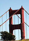
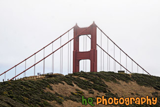
#591 — A scenic vertical picture taken of a close up of the tip of the famous Golden Gate Bridge located in San Francisco, California on a sunny blue sky day. The Golden Gate Bridge is a historic symbol that represents the city of San Francisco. If you look closely in this picture you can see two people standing on the hill just before the bridge. You can seen how tiny these people look in comparison to the great big bridge.
Tip of Golden Gate Bridge
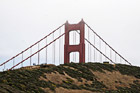
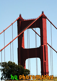
#2066 — A scenic picture taken of the tip of the Golden Gate Bridge behind a hill. You can see people walking on the hill and how large the bridge is in comparison. This picture was taken on a cloudy day.
Tip of Golden Gate Bridge Behind Hill
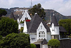
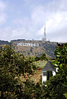
#388 — A scenic picture of the famous Los Angeles landmark, the Hollywood sign. This sign is located on the hills just north of the Hollywood strip and was taking with a scenic white, pointy house in the foreground. The Hollywood Sign originally said "Hollywoodland" in 1923 before it was shortened in 1945. The Hollywood Sign is the most famous sign in the world. It is located on Mount Lee in Griffith Park overlooking the city of Hollywood. It's illegal to hike to the Hollywood Sign, but there are many good vantage points from the streets of Hollywood. The Sign is a trademark of the Hollywood Chamber of Commerce. The Sign was declared Los Angeles Cultural-Historical Monument #111 in 1973 by the Cultural Heritage Board of the City of Los Angeles.
Hollywood Sign & Scenic House
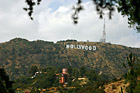
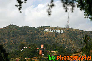
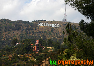
#390 — This is a picture taken of the famous Los Angeles landmark, The "Hollywood" sign. The Hollywood Sign originally said "Hollywoodland" in 1923 before it was shortened in 1945. The Hollywood Sign is the most famous sign in the world. It is located on Mount Lee in Griffith Park overlooking the city of Hollywood. It's illegal to hike to the Hollywood Sign, but there are many good vantage points from the streets of Hollywood. The Sign is a trademark of the Hollywood Chamber of Commerce. The Sign was declared Los Angeles Cultural-Historical Monument #111 in 1973 by the Cultural Heritage Board of the City of Los Angeles.
Hollywood Sign on Hill
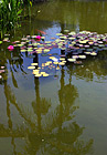
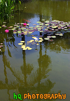
#389 — A scenic picture of a flower, water lillies, and reflection of a palm tree taken at Rogers Memorial Park in Beverly Hills, California. The Will Rogers Memorial Park was the first municipal park in Beverly Hills, originally opened under the name of Sunset Park in 1915. The park was renamed in 1952 to honor the entertainer and honorary mayor of Beverly Hills, Will Rogers.
Lilly, Pond & Palm Tree Reflection
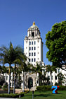
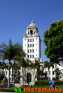
#393 — A scenic picture of the Beverly Hills, California City Hall located in downtown Beveryly Hills on the outskirt of Los Angeles. The Beverly Hills City Hall has gracefully presided over the city's civic life since 1932. Architect Willliam Gage created the Spanish Renaissance building in typical government style of that era. The beauty of the building, with its tiled dome and gilded cupola, soon transcended the typical government building and has become a beloved local landmark of Beverly Hills. The city of Beverly Hills was wealthy and famous long before it was discovered by the movie industry. At the beginning Beverly Hills was blessed with a commodity more precious in Southern California than jewels: water.
Beverly Hills City Hall
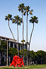
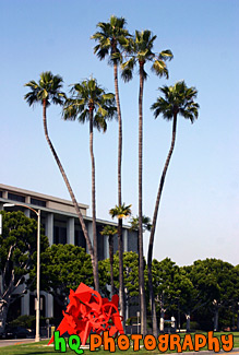
#398 — A scenic picture taken of downtown Beverly Hills, California of some interesting shaped palm trees and a red structure. The city of Beverly Hills was wealthy and famous long before it was discovered by the movie industry. At the beginning Beverly Hills was blessed with a commodity more precious in Southern California than jewels: water.
Downtown Beverly Hills, California Palm Trees
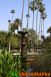
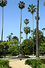
#1403 — A scenic vertical picture taken of the fountain at Will Rogers Memorial Park located in the Beverly Hills area of Los Angeles, California. Blue sky and palm trees are seen surrounding this fountain.
Fountain at Will Rogers Memorial Park
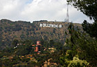
#1771 — A scenic vertical picture taken of the Hollywood Sign on the hill in Los Angeles, California. Partly cloudy, blue sky is seen above.
Hollywood Sign
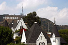
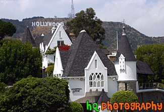
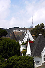
#1394 — A scenic picture taken of a white house with the famous Hollywood sign seen in the background on a hill.
Hollywood Sign & White House
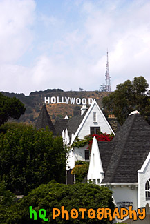
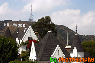
#1411 — A scenic vertical picture taken of the famous Hollywood sign sitting on a hill behind this white house in Los Angeles, California.
Hollywood Sign Behind House
#464 — A scenic picture taken of the Hollywood Sign and palm trees from Babylon Court at Hollywood and Highland Ave.
Hollywood Sign from Babylon Court
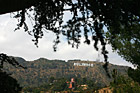
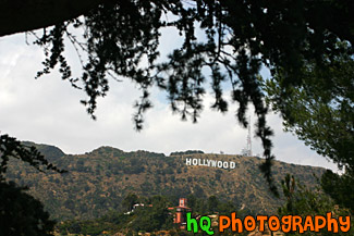
#1402 — A scenic picture taken of the famous Hollywood sign seen on the hill in the distance. In the foreground are tree branches framing the Holloywood sign.
Hollywood Sign in Distance
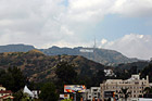
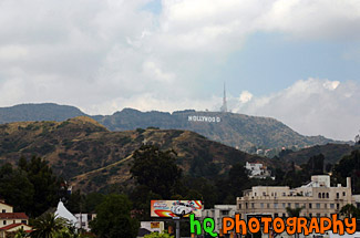
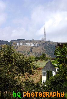
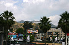
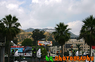
#1924 — A scenic picture taken of the famous Hollywood Sign sitting on the hill in the distance taken from dowtown Hollywood, California. This picture was taken on a partly cloudy day. Some buildings can be seen in the foreground.
Hollywood Sign on Hill in Distance
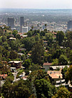
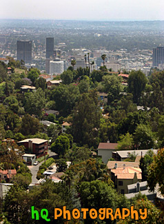
#1915 — A scenic vertical picture taken of Los Angeles from on top of a hill. In this picture you can see the Capital Records building which is located in downtown Hollywood.
Hollywood View from a Hill
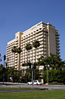
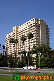
#953 — A scenic picture taken of a hotel located in downtown Beverly Hills, California. A limousine is driving in front of the hotel on this beautiful sunny day.
Hotel in Downtown Beverly Hills
#1860 — A scenic picture taken of the famous Los Angeles Hollywood Sign sitting on the hill.
Los Angeles Hollywood Sign
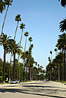
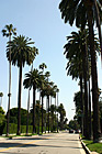
#723 — A scenic picture taken of many palm trees alternating between tall and short along a road perpendicular to Sunset Blvd. in Beverly Hills, California.
Palm Trees Along Beverly Hills Road
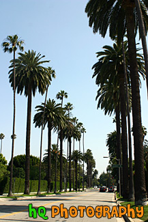
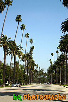
#751 — A scenic picture taken of the hundreds of palm trees located in Beverly Hills while approaching the famous Sunset Boulevard street. This picture was taken on a sunny day with blue sky above the palm trees. Sunset Boulevard is one of the world's most famous streets. Sunset Boulevard passes through Hollywood, then becomes the Sunset Strip as it passes through West Hollywood, weaves its way through Beverly Hills and Bel-Air, and finally winds its way through the rustic foothills of the Santa Monica mountains, to finally end at the Pacific Ocean near Malibu.
Palm Trees Leading to Sunset Blvd.
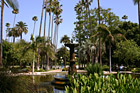
#720 — A scenic picture taken of the tall palm trees surrounding the beautiful Rogers Memorial Park located in Beverly Hills, California. The Will Rogers Memorial Park was the first municipal park in Beverly Hills, originally opened under the name of Sunset Park in 1915. The park was renamed in 1952 to honor the entertainer and honorary mayor of Beverly Hills, Will Rogers.
Palms of Rogers Memorial Park
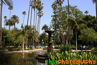
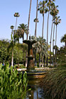
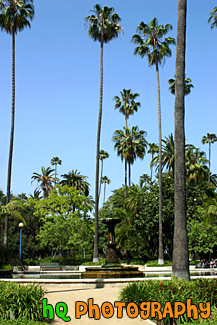
#892 — A scenic picture taken of the water fountain in the middle of Will Rogers Memorial Park located in downtown Beverly Hills, California. There are many pretty palm trees surrounding this beautiful park as you can tell in the picture. The Will Rogers Memorial Park was the first municipal park in Beverly Hills, originally opened under the name of Sunset Park in 1915. The park was renamed in 1952 to honor the entertainer and honorary mayor of Beverly Hills, Will Rogers.
Will Rogers Memorial Park Fountain
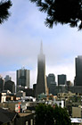
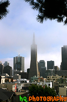
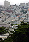
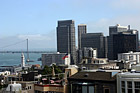
#601 — A scenic picture taken of downtown San Francisco, California from Telegraph Hill. In this picture you can see the Transamerica Pyramid with fog covering the tip of it. The Transamerica building was completed in 1972 and was the tallest building in the United States west of the Mississippi River from 1972-1974; surpassed by the Aon Center in Los Angeles. The Pyramid is no longer the company headquarters, but it serves as Transamerica's corporate logo and is strongly identified with the corporation. Today it is a world-class office tower and home to more than 50 high-profile firms employing about 1,500 people.
San Francisco & Transamerica Pyramid
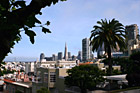
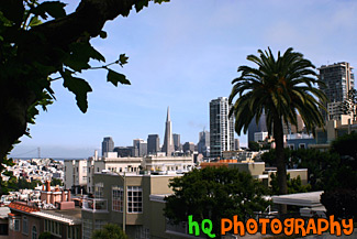
#602 — A pretty picture taken of downtown San Francisco, California from Telegraph Hill. In this picture you can see the tall buildings of San Francisco such as the Transamerica Pyramid, a pretty palm tree in the foreground, and the Bay Bridge in the distance.
Scenic Downtown San Francisco
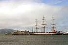
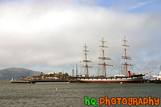
#32 — A scenic picture taken of the big Balclutha boat sitting in front of Alcatraz Island on this beautiful day in San Francisco. Alcatraz is a popular tourist attraction in this area as it was once used as a prison facility to hold inmates.
Alcatraz & Balclutha Boat
#488 — A scenic picture taken of the Bay Bridge and the Ferry Building from Coit Tower on top of Telegraph Hill. San Francisco is a city full of things to do. San Francisco offers a wide arrange of activities from climbing to the top of Coit Tower, admiring the grandeur of the Golden Gate Bridge, or even exploring the infamous Alcatraz prison! And don't forget about the Golden Gate Park, the Japanese Tea Garden the Botanical Garden plus so much more!
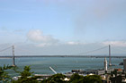
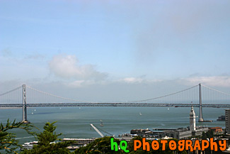
Bay Bridge & Ferry Building
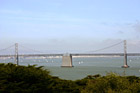

#567 — A scenic picture taken of the Bay Bridge from atop Telegraph Hill where Coit Tower is located. In this picture you can see the many sailboats sailing near and around the Bay Bridge on sunny day in May.
Bay Bridge from Coit Tower
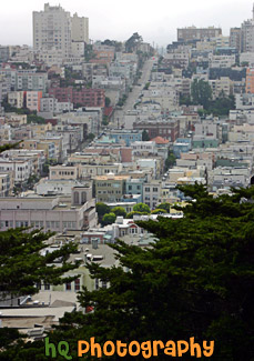
#563 — A scenic picture taken of a view of the interesting building architecture of the city of San Francisco. This picture was taken from Telegraph Hill looking in the north-west direction.
Buildings of San Francisco
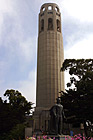
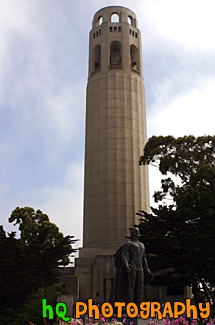
#441 — A close up picture of Coit Tower located on Telegraph Hill in San Francisco, California. Coit Tower on Telegraph hill in San Francisco has provided visitors, and locals, with impressive views of The City since its completion in 1933. Coit Tower was built due to admiration for the fire fighters who fought the 1906 earthquake fires. Many believe the tower was designed in the shape of a fire hose nozzle in relation to that admiration.
Coit Tower
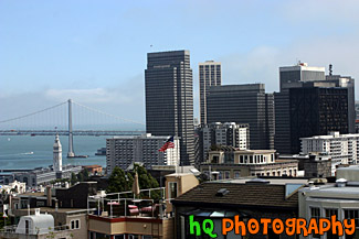
#486 — A scenic picture taken of the tall buildings of downtown San Francisco, California and the Bay Bridge from Coit Tower on Telegraph Hill. In this picture you can also see the Ferry Building in front of the Bay Bridge. San Francisco is a city full of things to do. San Francisco offers a wide arrange of activities from climbing to the top of Coit Tower, admiring the grandeur of the Golden Gate Bridge, or even exploring the infamous Alcatraz prison! And don't forget about the Golden Gate Park, the Japanese Tea Garden the Botanical Garden plus so much more!
Downtown San Francisco from Telegraph Hill
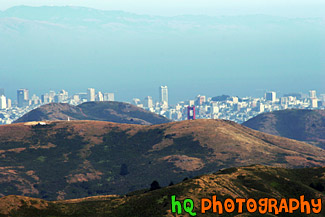
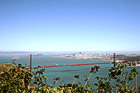
#1775 — A scenic picture taken close up of golden hills and the tip of the golden gate bridge in San Francisco. This photo was taken from Mt. Tamalpais in Marin County, California. The city of San Francisco is seen in the background.
Hills & Golden Gate Bridge
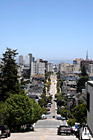
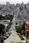
#993 — A scenic picture taken of a long downhill road in San Francisco, California. This picture was taken on a beautiful sunny blue sky day.
Long Street in Downtown San Francisco
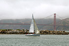
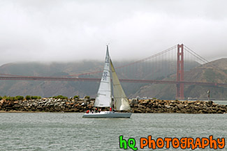
#1569 — A scenic picture taken of a sail boat floating off shore in front of the Golden Gate Bridge seen in the bay in San Francisco, California. Fog is seen over the hill just beyond the bridge.
Sail Boat & Golden Gate Bridge
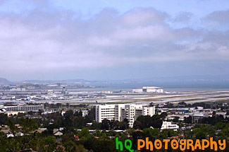
#556 — A scenic picture taken of the San Francisco International Airport seen from atop a hill in Burlingame, California. The San Francisco International Airport commits itself to being recognized as the world leader in setting the standard for: safety and security, customer service and satisfaction, community relations, environmental commitment, quality of facilities, and financial and economic vitality.
San Francisco Airport from Hill
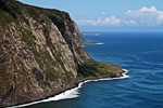
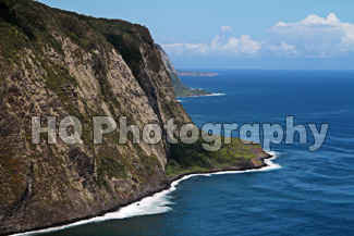
#2411 — A scenic picture taken with blue skies of the Waipio Valley located on the Big Island in Hawaii.
Waipio Valley, Hawaii