Photos of Cloud (229)
There are (229) photos of the keyword, Cloud, available on our website. They are pictured below.The pictures are organized by category.
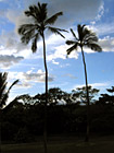
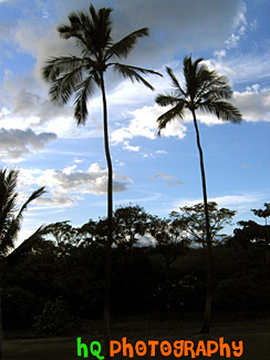
#169 — A scenic silhouette of two palm trees located in Maui, Hawaii with a beautiful sky behind them as the sun is getting ready to set on this beautiful island.
Two Palm Trees of Maui
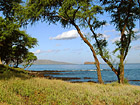
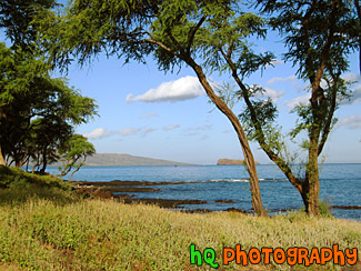
#217 — A scenic picture taken of Maui and the Pacific Ocean off the coast of Makena, Hawaii, which is on the island of Maui.
View of Maui & Ocean
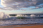
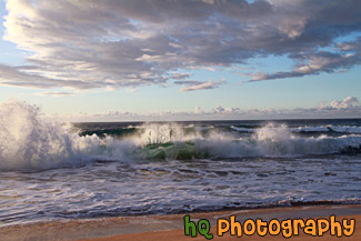
#2379 — A scenic picture taken of the Pacific Ocean waves crashing on the the beach at Polihale State Park in Kauai, Hawaii. This photo was taken at dusk as you can see the pink colors of the sky starting to set in.
Waves Crashing on Polihale Beach
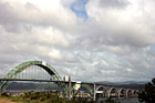
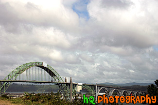
#777 — A scenic picture taken of the Yaquina Bay Bridge located near the Yaquina Head Lighthouse along the coast in Oregon State. This picture was taken on a day with interesting puffy clouds which filled the sky. This bridge is composed of five concrete support decks that lead to a dramatic, high-soaring steel arch. Each end of the structure has a pedestrian plaza with winding stairways that lead to lookout spots. Newport today is a bustling coastal community of over 9,000. It's heart is along a working waterfront on Yaquina Bay where fishing fleets and fresh seafood markets coexist with galleries, gift shops, restaurants and family attractions. Across the bay is the acclaimed Oregon Coast Aquarium and the Hatfield Marine Science Center. Historic Nye Beach, 2 lighthouses, museums and wide sandy beaches provide activity for people of all ages.
Newport, Oregon - Yaquina Bay Bridge
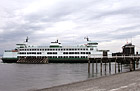
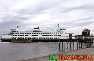
#1546 — A scenic picture taken of a Mukilteo ferry boat loading up cars at the shore.
Mukilteo Ferry
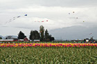
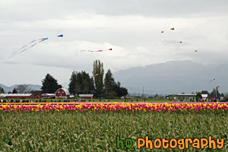
#2307 — A scenic picture taken of the Skagit Valley Tulip Festival with rows of colorful tulips, kites flying above, and lots of people exploring the tulips. This festival is located north of Seattle, Washington in Mount Vernon.
Skagit Valley Tulip Festival
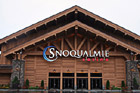
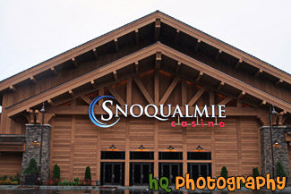
#2148 — A close up photo taken of part of the new Snoqualmie Casino building located in Snoqualmie, Washington State.
Snoqualmie Casino
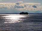
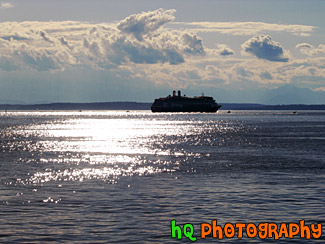
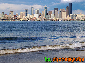
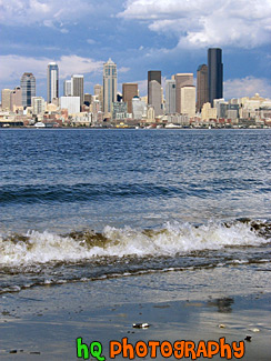
#153 — A scenic view of the port in Seattle with the sun shining down on it. This photo was taken in dowtown Seattle by the shore.
View of Water and Ferry
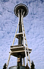

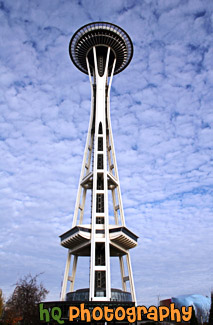
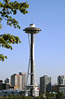
#826 — A scenic picture looking up at the Seattle Space Needle with an interesting clouds and blue sky background. The space needle has become the symbol of Seattle as well as one of the symbols of Washington State. The Space Needle is 605 feet tall (184 meter) and was designed by Edward E. Carlson for the 1962 World's Fair in Seattle.
Looking up at Space Needle
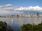
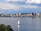
#122 — A view of all of Seattle, Washington from across the water near Alki Beach. In this photo you can see a sail boat passing by Seattle.
Sailboat & Seattle View
#121 — A scenic picture taken from across the water on Alki Beach looking the tall buildings of Seattle, Washington.
Seattle Buildings from Alki Beach
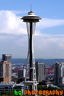
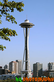
#412 — A scenic picture taken of the Seattle Space Needle in downtown Seattle, Washington. This photo was taken from Queen Anne Hill overlooking the city. The 605 foot (184 meter) Space Needle was designed by Edward E. Carlson for the 1962 World's Fair in Seattle. The futuristic structure has become a symbol for the city, and is home to festive events such as the annual New Year's Eve fireworks display.
Seattle Space Needle, Washington
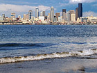
#120 — A scenic picture taken across the water on the shore of Alki Beach looking at Seattle, Washington. Waves from the Puget Sound are in the foreground.
A View of Seattle from Alki
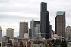
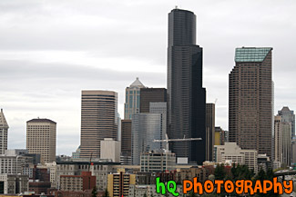
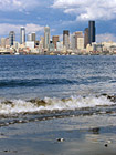
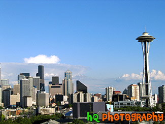
#1194 — A scenic picture taken of the tall buildings of downtown Seattle, Washington on a cloudy, overcast day. This is what the typical weather is like in Seattle.
Downtown Seattle Buildings on Cloudy Day
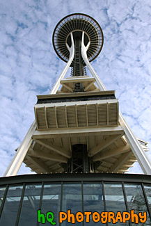
#845 — A scenic picture taken looking towards the front or entrence to the Seattle Space Needle. The Space Needle is located at the Seattle Center right across the street from the KOMO News 4 building. This picture was taken with a beautiful sky background with blue sky and patchy clouds.
Front of Seattle Space Needle
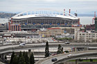
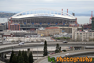
#2074 — A scenic picture taken of Qwest Field and the Puget Sound with a freeway seen in the foreground.
Qwest Field & Freeway
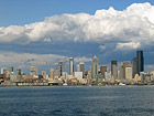
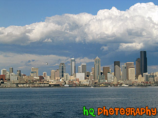
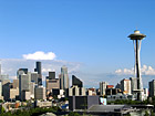
#154 — A scenic view of Seattle, Washington from Alki Beach with some clouds hovering over the city. From this view you can see all the tall buildings of Seattle with the waterfront. Dramatic clouds are seen above the city.
Seattle and Clouds
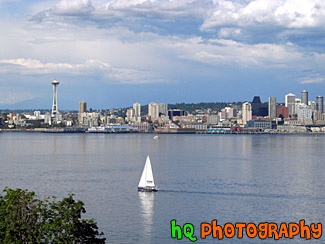
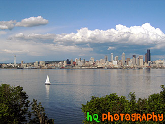
#155 — A scenic photo of a view of a sailboat and most of Seattle from across the puget sound.
Seattle and Sailboat
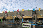
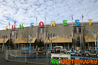
#1929 — A scenic picture taken of the Fun Forest located at the Seattle Center in downtown Seattle. Fun Forest Amusement Park, with games and 19 rides for kids and thrill seekers alike, is a playground for all ages. The Fun Forest has a roller coaster, carousel, and prize winning games. The Fun Forest also features the Entertainment Pavilion, open daily year-round with three rides, laser tag, mini-golf, prize games and a full video arcade.
Seattle Center Fun Forest
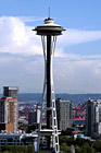
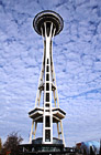
#7 — The Space Needle on a beautiful, sunny day in Seattle, Washington. The 605 foot (184 meter) Space Needle was designed by Edward E. Carlson for the 1962 World's Fair in Seattle. The futuristic structure has become a symbol for the city, and is home to festive events such as the annual New Year's Eve fireworks display.
Space Needle
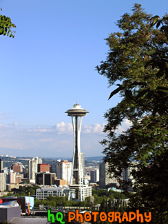
#124 — A scenic view of the Space Needle and Seattle, Washington from a hill near Seattle. Blue sky is seen above and the tall buildings of Seattle are to the left.
Space Needle & Seattle
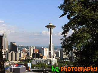
#125 — A view of the Space Needle and Seattle, Washington from a hill near Seattle. The futuristic structure has become a symbol for the city, and is home to festive events such as the annual New Year's Eve fireworks display. Blue sky is seen above and a tree is to the right.
Space Needle, Seattle
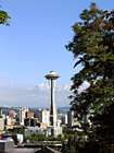
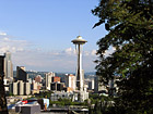
#152 — A view of the Space Needle from a hill near Seattle. The 605 foot (184 meter) Space Needle was designed by Edward E. Carlson for the 1962 World's Fair in Seattle. The futuristic structure has become a symbol for the city, and is home to festive events such as the annual New Year's Eve fireworks display. The Space Needle was completed in December 1961, and officially opened four months later on the first day of the World's Fair, April 21, 1962.
Tree & Space Needle
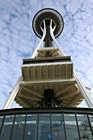
#844 — An interesting picture taken of the Seattle Space Needle from practically standing underneath it. This picture was taken with a scenic patchy cloudy and sunny sky.
Under the Space Needle
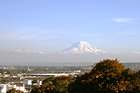
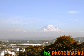
#1332 — A scenic picture taken of Mt. Rainier appearing like it is sitting on clouds with blue sky above. This picture was taken from Tacoma.
Mt. Rainier From Tacoma
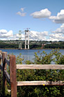
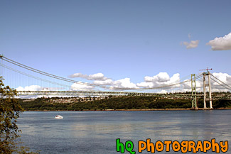
#1086 — A scenic picture taken of a wooden fence in the foreground of the "double" Narrows Bridge. Being built next to the old Narrows Bridge built in 1950 is the new bridge which is nearly 80 percent complete. The new bridge opens to traffic in summer 2007, but renovations on the 1950 bridge go on for another 11 months after that. In summer 2008, when the new and existing bridges open in their final form, the 1950 span will take drivers westbound on two general purpose lanes and one carpool lane. The new bridge will carry eastbound traffic on two general purpose lanes, one carpool lane and a fourth "drop" lane.
Narrows Bridge Construction & Fence
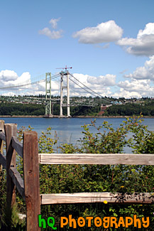
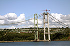
#1087 — A scenic picture taken of the Narrows Bridge project in process as the new bridge is being built right beside the old bridge of 1950. The new bridge opens to traffic in summer 2007, but renovations on the 1950 bridge go on for another 11 months after that. In summer 2008, when the new and existing bridges open in their final form, the 1950 span will take drivers westbound on two general purpose lanes and one carpool lane. The new bridge will carry eastbound traffic on two general purpose lanes, one carpool lane and a fourth "drop" lane.
Narrows Bridge Project, Tacoma
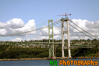
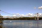
#1095 — A scenic picture taken of a close up of the "double" Narrows Bridge. Being built next to the old Narrows Bridge built in 1950 is the new bridge which is nearly 80 percent complete. The new bridge opens to traffic in summer 2007, but renovations on the 1950 bridge go on for another 11 months after that. In summer 2008, when the new and existing bridges open in their final form, the 1950 span will take drivers westbound on two general purpose lanes and one carpool lane. The new bridge will carry eastbound traffic on two general purpose lanes, one carpool lane and a fourth "drop" lane.
Narrows Bridge up Close
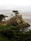
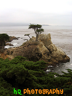
#256 — A scenic photo of the Lone Cypress located in Pebble Beach, California. As one of Californias most enduring landmarks, The Lone Cypress has prevailed on its rocky perch for over 250 years. This icon of fortitude has inspired many and is revered as the eternal symbol of Pebble Beach Company.
The Lone Cypress in Pebble Beach
