Photos of Cloud (229)
There are (229) photos of the keyword, Cloud, available on our website. They are pictured below.The pictures are organized by category.
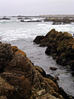
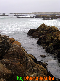
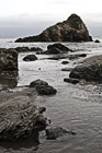
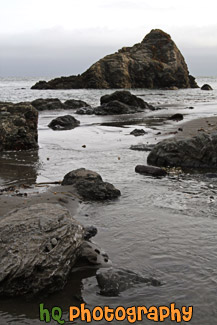
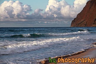
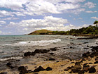
#128 — A picture taken of the beach of the Pacific Ocean off the coast of Pebble Beach, California. This picture was taken on the 17 mile scenic route along Highway 1.
Pebble Beach 17 Mile Scenic Route
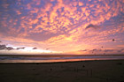
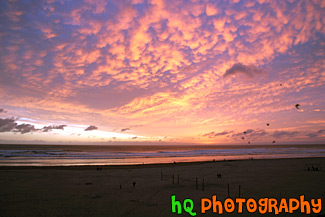
#791 — A scenic picture taken of a beautiful pink and purple sunset sky at the beach in Seaside, Oregon. In this picture you can see people on the beach and some birds flying in the sky. Seaside contains 3 miles of powder-soft beach and 2 miles of manicured, ocean front boardwalk which make Seaside a popular tourist town. A pleasant 90 minute drive from Portland, Seaside is a first choice destination for north and southbound travelers. In Seaside you'll find dozens of delightful mini-malls, specialty boutiques, antique shops, art galleries, museums, arcades and cinemas.
Seaside Oregon Beach Sunset
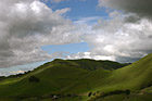
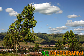
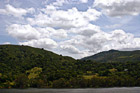
#318 — Scenic picture of the green hills of San Jose during February of 2005. This picture was taken at a spot on the east San Jose hills just north of the Evergreen area. The hills are especially green right now in February because of the tremendous rainfall the bay area has experienced this season. The rain has made for a some beautiful green hills surrounding San Jose, California.
Green Hills of San Jose
#6 — Rolling hills of Palo Alto, California on a sunny day. This photo was taken on the eastern hills between Palo Alto and Los Altos in the Bay Area.
Rolling Hills in California
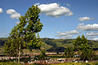
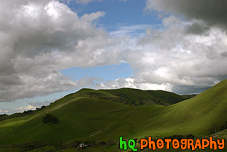
#950 — A scenic picture taken of a landscape scene in the East San Jose area near Evergreen Village. This picture was taken on a beautiful day with scattered clouds and blue sky. You can see the green hills from much rain this year in the background with shadows from the clouds over them.
Blue Sky, Green Hills, & Trees in San Jose
#350 — A scenic picture and contrast between a very green hill and partly cloudy blue skies. This picture was taken in San Jose of the very green hills (which are starting to turn brown) from the tremendous early 2005 rainfall.
Green Hill & Scenic Sky Scene
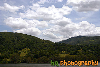
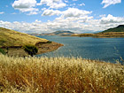
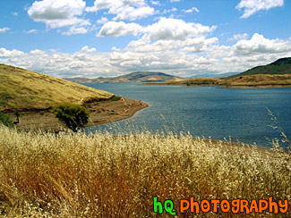
#885 — A scenic picture taken of a lake in the foreground, green rolling hills in the mid-ground, and interesting puffy white clouds and blue sky in the sky. This photo was taken near the Santa Cruz Mountains on the way to Santa Cruz, California near Highway 17.
Green Hill, Lake, & Puffy Clouds
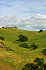
#473 — A scenic picture taken of some green hills with the shadows of the clouds on the hills from the partly cloudy sky. This picture was taken in South/East San Jose near the Silver Creek Valley area.
Green Hills & Partly Cloudy Sky

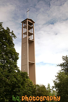
#1078 — A scenic picture taken of the cross on top of the Trinity Lutheran Church building located at Pacific Lutheran University in Tacoma, Washington.
Cross at Trinity Lutheran Church, PLU

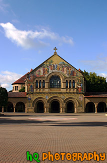
#799 — A scenic vertical picture taken of the Stanford Memorial Church located on the Stanford University campus. Stanford Memorial Church stands at the center of the campus, and was one of the earliest and is still among the most prominent interdenominational churches in the West. Memorial Church is open to all religions and is non-denominational.
Stanford Memorial Church
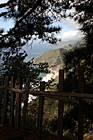
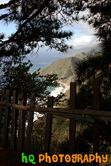
#1774 — A scenic vertical picture taken along the Highway 1 coast in California. This picture was taken looking down at the Pacific Ocean through a fence and trees on a hill. Hills along the coast are seen in the background.
Highway 1 Coast
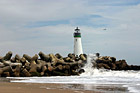
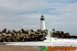
#386 — A scenic close up picture taken of the Walton Lighthouse in green on the beach at Santa Cruz, California. In this picture you can see the waves of the ocean crashing onto the rocks surrounding the lighthouse.
Santa Cruz Lighthouse (Walton)
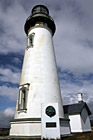
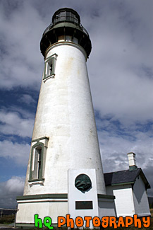
#583 — A close up scenic picture taken of the Yaquina Head Lighthouse which is located along the coast of Oregon State and the Pacific Ocean. This picture was taken on a partly cloudy day. This historic lighthouse is 93 (28 m) feet tall and was built in 1872-73. Its light towers are 162 feet (49 m) above the sea, and can be seen about 19 miles (32 km) out to sea. This lighhouse was automated in 1966 in which the light flashes two seconds on, two off, two on, 14 off, then repeats. Each light has its own pattern so it will not be confused with other lights.
Yaquina Head Lighthouse
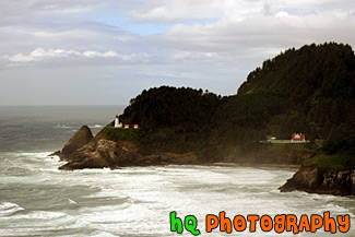
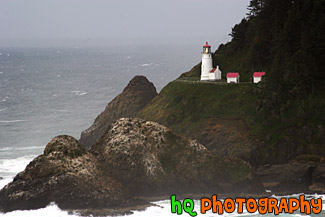
#457 — A scenic picture taken of the Heceta Head Lighhouse located on the Oregon coast, just after the famous Sea Lion Caves. The lighthouse is a working lighthouse and has a height of 205 feet above the Pacific Ocean. To the right of the lighthouse is the Keeper's house. There are some spectacular view seen from the front porch of the Keeper's house. Whales sometimes stop by at high tide and use the shallow rocks to scratch the barnacles off their sides. Up by the light house is some of the best whale watching one can do from dry land. Heceta Head Lighthouse is one of the most visited lighthouses in the United States drawing thousands of visitors each year to sense its history, romantic aura, and spectacular view. The Heceta (pronounced he-SEE-tuh) Head Lighthouse, constructed in 1874, was named for Spanish explorer Don Bruno De Heceta. Its light is the most powerful beacon on the Oregon coast, visible 21 miles out to sea.
Heceta Head Lighthouse, Oregon Coast
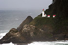
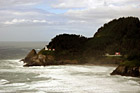
#1736 — A scenic picture taken of the Heceta Head Lighthouse with clouds in the sky. This light house is located off the coast in Oregon State.
Heceta Light House & Clouds
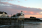
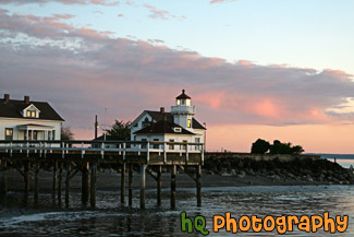
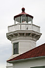
#2297 — A scenic picture taken of the Mukilteo Lighthouse during sunset in Washington State. You can see the sky colors start to change to pink/purple with blue sky and clouds in the photo.
Mukilteo Lighthouse at Sunset
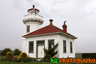
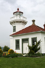
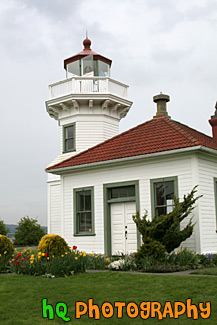
#1541 — A scenic picture taken of the Mukilteo Lighthouse during the Spring season with tulip flowers seen in front. The Mukilteo Lighthouse guides ships on their way to Everett, Washington.
Mukilteo Lighthouse
#1547 — A scenic vertical picture taken of the Mukilteo Lighthouse which is located in Wasington State. The Mukilteo Lighthouse guides ships on their way to Everett, Washington.
Mukilteo Lighthouse & Clouds
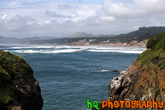
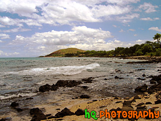
#778 — A scenic picture taken of the beautiful coast and Pacific Ocean along the shore of Newport, Oregon. This picture was taken near the Yaquina Head Lighthouse looking toward the shore. The puffy clouds and blue sky add character to this picture. Newport today is a bustling coastal community of over 9,000. It's heart is along a working waterfront on Yaquina Bay where fishing fleets and fresh seafood markets coexist with galleries, gift shops, restaurants and family attractions. Across the bay is the acclaimed Oregon Coast Aquarium and the Hatfield Marine Science Center. Historic Nye Beach, 2 lighthouses, museums and wide sandy beaches provide activity for people of all ages.
Newport, Oregon Coastal Scene
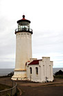
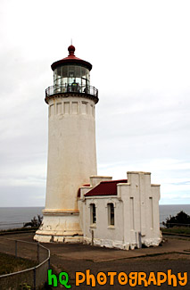
#995 — A scenic picture taken of the North Head Lighthouse located along the coast in Washington State. This lighthouse has a red tip. The North Head is the windiest lighthouse area on the West Coast and the third windiest in the nation. Winds of 120 miles per hour have been recorded at the site.
North Head Lighthouse in Washington
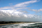
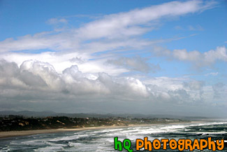
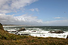
#872 — A beautiful picture taken of the Pacific Ocean along the coast near Newport, Oregon. This picture portrays an interesting blye sky sky and clouds along with the waves of the ocean.
Ocean & Coast Near Newport
#2109 — A scenic vertical picture taken of some big ocean rocks located along the shore at Muir Beach in California.
Ocean Rocks Along Beach
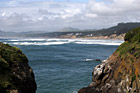
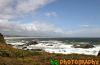
#668 — A scenic picture of the Oregon coast and Pacific Ocean looking to the North from Yaquina Head Lighthouse which is near Newport and Depoe Bay. In this picture the sky is thick with low puffy clouds that are about to be burned off.
Oregon Coast
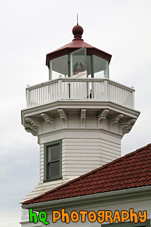
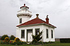
#1917 — A scenic close up picture taken of the tip of the Mukilteo Lighthouse located in Washington state on a cloudy day.
Tip of Mukilteo Lighthouse
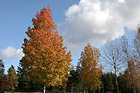
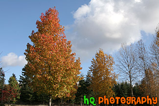
#1374 — A scenic picture taken of colorful trees changing color during the autumn season with a partly cloudy sky in the background.
Fall Trees & Blue Sky
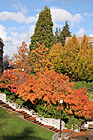
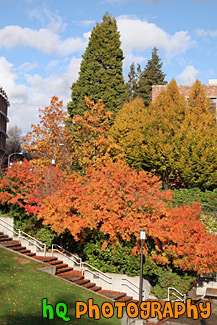
#1783 — A scenic picture taken of the fall colors seen on trees located on campus at the University of Washington. In this picture you can see the colors red, orange, green, yellow, and blue (in the sky). Leaves are also seen on the ground below the trees.
Scenic Colors of Fall
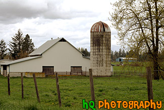
#1013 — A scenic picture taken of a blue silo located on a farm in Enumclaw, Washington. This picture was taken on a cloudy day with texturous clouds.
Blue Silo
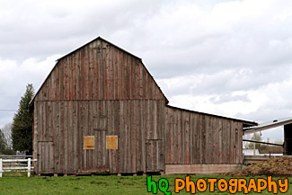
#1002 — A scenic picture taken of a brown barn on a cloudy day with green grass in the foreground. This barn was located in Washington State.
Brown Barn & Clouds
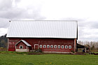
#1003 — A scenic picture taken at an agle of a red barn located on a farm in Enumclaw, Washington. This picture was taken on a cloudy day and you can see the right side of Mt. Peak in the background.
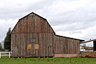
Red Barn on Farm
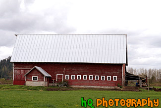
#1004 — A scenic picture taken of the side of a red barn located on a farm in Enumclaw, Washington. This photograph was taken on a cloudy day.
Side of Red Barn
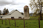
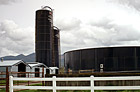
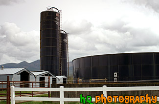
#1015 — A scenic picture taken of a white barn, dirty silo, fence and a tree located on a farm in Enumclaw, Washington. This photo was taken on a cloudy day.
White Barn, Silo & Tree
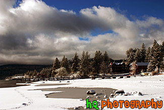
#285 — Beautiful scenic view of lake tahoe taken right after a snow storm. This photo is gorgeous because of the blue skies contrasting the freshly fallen snow covereing the shore and beach.
Beautiful Lake Tahoe Snow View
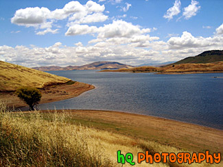
#45 — A scenic photo of a lake scene taken in Northern California on a partly cloudy day.
California Lake Scene
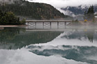
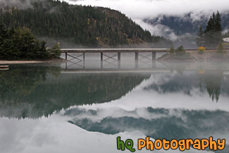
#2050 — A scenic picture taken of Diablo Lake and the surrounding northern cascade mountains in the background which are reflecting in the lake. You can see some fog in the reflection and surrounding the lake.
Lake & Mountain Reflection
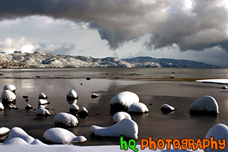
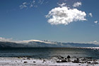
#284 — A scenic picture taken of Lake Tahoe right after a huge snow storm. Interesting and dramatic clouds are hovering in the skies above Lake Tahoe along with snow covering the rocks on the shore. On this particular day there was about a foot of snow that dropped down from the skies. A beautiful picture of what it is like in the winters at Lake Tahoe.
Lake Tahoe Clouds and Snow
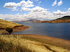
#44 — A landscape scene in Northern California near Gilroy of a lake and puffy clouds on a sunny day.
Landscape Lake Scene
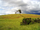
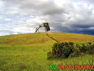
#4 — A photo of a lonely tree with a storm approaching on the golden hills of the California Bay Area. This photo was taken during Spring 2003 in Palo Alto area in CA.
Lonely Tree & Storm
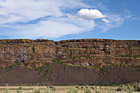
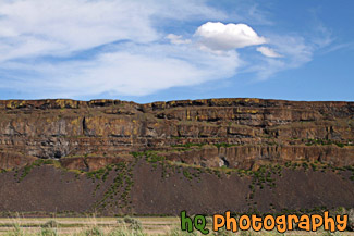
#1978 — A scenic picture taken of a rock cliff next to the freeway with an interesting puffy cloud and blue sky seen above. This photo was taken in Eastern Washington near Steamboat Rock State Park.
Rock Cliff and Puffy Cloud
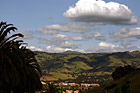
#373 — A scenic picture taken a top a hill in East San Jose overlooking the entire city and bay area. This picture shows a scenic house amongst the view of the city during a spectacular sunset.
East San Jose Hill Sunset
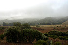
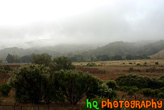
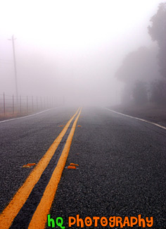
#251 — A scenic view of a foggy landscape area located in the country side of East San Jose, California. This photo was taken in the end of 2004 during winter season.
Foggy Landscape Scene
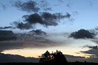
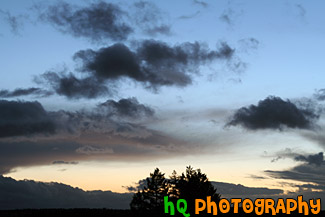
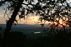
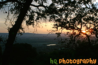
#914 — A beautiful night picture taken of a scenic sunset, clouds, and sky along with a silhouette of the trees in the middle of the photo. High in the sky blue sky is still visible, but as you get closer to the horizon you can see the sunset starting to take place with the pink-ish sky. This photo was taken looking towards the west from Bonney Lake, Washington.
Night Sunset & Landscape Silhouette
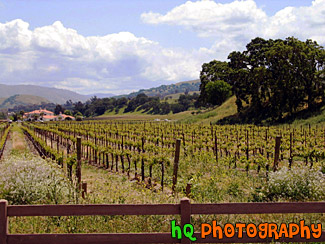
#21 — A photo of a farm in the countryside of Northern California. This farm was located out near Sacramento but not quite in the city. A fence and a wine field can be seen in the picture.
Out in the Country
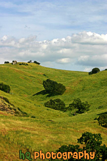
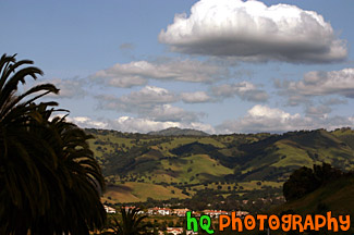
#357 — A scenic picture taken of the Silver Creek Valley area in East San Jose. From all the rain this area has been having during 2005, you can see the very green hills in the background.
Silver Creek Valley, San Jose
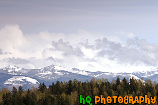
#1029 — A scenic picture taken of the Cascade Foothills located in Washington State near Mt. Rainier. In this photo you can see snow on the foothills, green evergreen trees in the foreground and some low clouds hovering over the mountains.
Cascade Foothills & Clouds
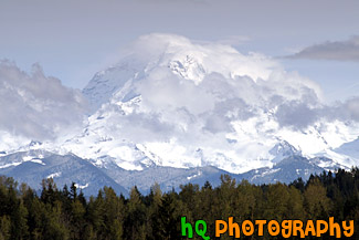
#1028 — A scenic picture taken of Mount Rainier on a partly cloudy day as you can see the blue sky above the mountain and clouds hovering around it. This picture was taken looking toward the north side of Mount Rainier from Bonney Lake, Washington.
Clouds, Blue Sky & Mt. Rainier
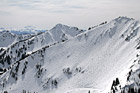
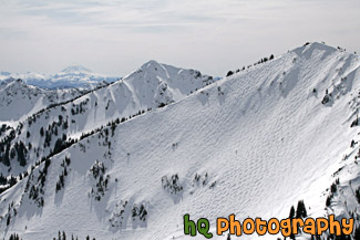
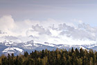
#2329 — A scenic picture taken at Crystal Mountain Summit, Washington during the winter season. In the background you can see Mt. Adams.
Crystal Moutntain View of Mt. Adams
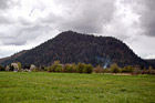
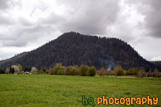
#1008 — A scenic picture taken of the local small mountain in which people of the area hike up to receive and excellent workout. This picture was taken on a cloudy day in Enumclaw, Washington. A green grass field is seen in the foreground and a little bit of smoke is seen just before the mountain.
Mt. Peak, Enumclaw
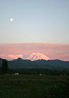
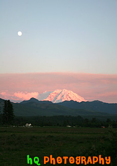
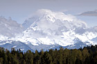
#417 — A scenic picture of Mt. Rainier taken at sunset with a full moon in the sky. This picture was taken in Enumclaw, Washington. Mount Rainier dominates the Seattle - Tacoma skyline, towering over the metropolis in breathtaking beauty. Mount Rainiers highest elevation is 14,410 feet which is located at the summit, also called Columbia Crest.
Mt. Rainier at Sunset & Full Moon
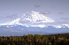
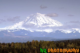
#1055 — A scenic picture taken of Mt. Rainier on a beautiful blue sky, sunny day in Washington State. This photo was taken from the Sky Island housing development area in Bonney Lake.
Mt. Rainier, Blue Sky & Scattered Clouds
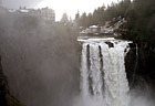
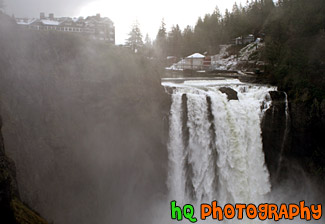
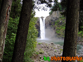
#82 — A fantastic photo of the Snoqualmie Falls, which is located in Snoqualmie, Washington. In this picture you can see steam from the waterfall floating up in the air from how much water is dumping over the falls. This photo was taken during the winter season when Washington had a astonishing 28 days of rainfall out of the 31 days in January. This waterfall is an historic site in the state of Washington. Snoqualmie Falls is one of Washington state's most popular scenic attractions. More than 1.5 million visitors come to the Falls every year. At the Falls, you will find a two-acre park, observation deck, gift shop, the Salish Lodge and the famous 270 foot waterfall.
Snoqualmie Falls & Lodge
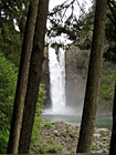
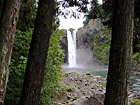
#159 — A scenic picture taken of Snoqualmie Falls seen between two trees. This waterfall is located in Washington State.
Snoqualmie Falls Between Trees
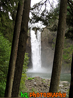
#88 — A fantastic photo of the Snoqualmie Falls, which is located in Snoqualmie, Washington. You can see Snoqualmie Falls in the distance between two trees.
Snoqualmie Falls in Distance
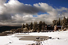
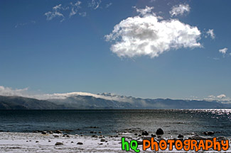
#198 — A pretty view at Lake Tahoe during a November snow storm in 2004. The Lake Tahoe Basin was formed by geologic block (normal) faulting about 2 to 3 million years ago. A geologic block fault is a fracture in the Earth's crust causing blocks of land to move up or down. Snow, rain, and streams filled the southern and lowest part of the basin, forming the ancestral Lake Tahoe.
Lake Tahoe Snow, Clouds, & Beach
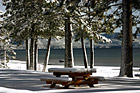
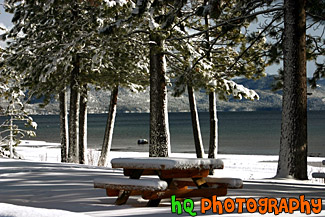
#286 — A pretty view of a snow covered picnic table at Lake Tahoe during a November snow storm. Lake Tahoe is the second deepest lake in the United States and the tenth deepest in the world, with a maximum depth measured at 1,645 ft (501 m), average depth of 1,000 ft (305 m).
Picnic Table & Lake Tahoe Snow
#56 — Sun shining down on the snow after a snow storm at Snoqualmie, Washington. Snoqualmie is a popular place for people to come in the winter to go skiing, sledding, or just to play in the snow.
Snow and Sun
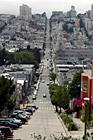
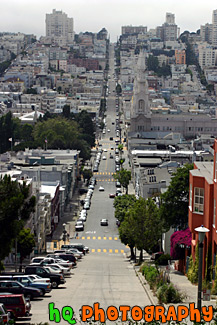
#384 — A scenic picture taken of a road in San Francisco, California from one end of the city going down a hill and back up another to the other end of the city. From this picture you can also see the scenic San Francisco buildings and houses.
San Francisco Road

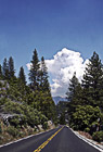
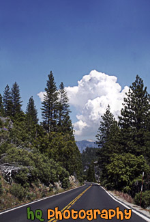
#617 — A scenic picture taken of a road located in Yosemite National Park which is located in California. This road was leading towards to only cloud in the sky which was a big puffy one.
Road in Yosemite National Park

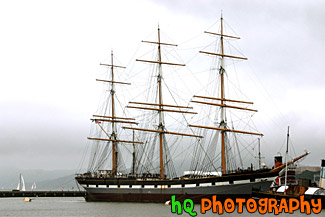
#341 — A scenic picture taken of a The Balclutha beautiful boat located in the San Francisco bay. This was taken on a cloudy day in the bay. The overall length of The Balclutha is 301 feet, length of deck is 256.5 feet, the beam is 38.6 feet, the depth is 22.7 feet, the gross tonnage is 1689, and the height of teh mainmast is 145 feet.
In 1954 the San Francisco Maritime Museum purchased Pacific Queen (The Balclutha was renamed this when Frank Kissinger purchased it in 1933) for $25,000. Assisted by donations of cash, materials and labor from the local community, the Museum restored the vessel and returned her original name. The ship was transferred to the National Park Service in 1978, and Balclutha was designated a National Historic Landmark in 1985.
Balclutha Boat in San Francisco Bay

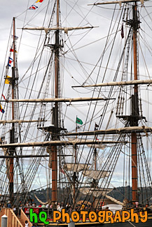
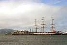
#1656 — A scenic vertical picture taken close up of a Tall Ship located in Tacoma, Washington during the 4th of July Tall Ships Festival.
Close up of a Tall Ship
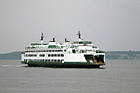
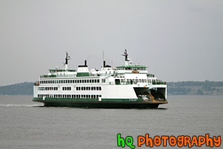
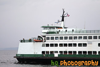
#1543 — A scenic picture taken of a Mukilteo, Washington ferry boat on a cloudy day.
Ferry Boat & Cloudy Day
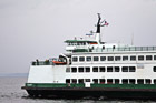
#2291 — A close up picture taken of a ferry boat in the Puget Sound area of Washington State. This photo was taken on an overcast, cloudy day.
Ferry Boat Close Up
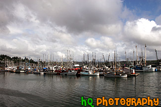
#585 — A scenic picture taken of a bunch of sailboats located in the water along the coast at Newport, Oregon. In this picture you can see the partly cloudy skies with the big puffy clouds. Newport was etablished in 1882 and is now a bustling coastal community of over 9,000 people. It's heart is along a working waterfront on Yaquina Bay where fishing fleets and fresh seafood markets coexist with galleries, gift shops, restaurants and family attractions.
Sailboats of Newport, Oregon


#1016 — A scenic picture taken of the side of a train with scenic clouds in the sky.
Side of Train & Clouds
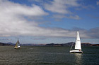
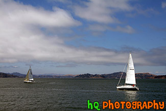
#1848 — A scenic picture taken of two sailboats sailing in the bay area waters of San Francisco. This picture was taken on a partly cloudy sky with blue sky seen.
Two Sailboats in San Francisco Bay
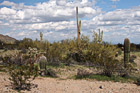
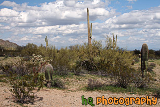
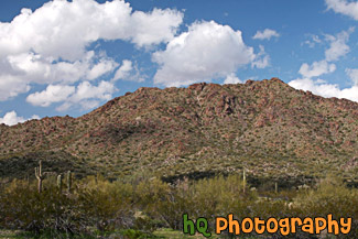
#2281 — A scenic picture taken of an Arizona landscape scene with lots of cacti and puffy clouds in the sky. This photo was taken in the desert at San Tan Mountain Regional Park.
Arizona Cacti & Clouds
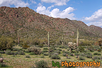
#2322 — A scenic picture taken of an Arizona landscape located at the San Tan Mountain Regional Park. The mountain can been seen in the background behind some cacti trees. Partly cloudy sky is above.
Arizona Landscape
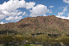
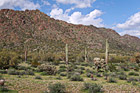
#2283 — A scenic picture taken of the Arizona desert landscape seen at San Tan Mountain Regional Park. You can see some puffy clouds above the mountain and some cacti trees in the foreground.
Arizona Landscape at San Tan Mountain

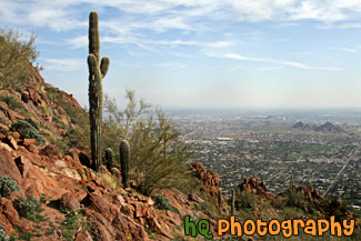
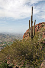
#2272 — A scenic picture taken of a pretty view from the hike on Camelback Mountain near Phoenix, Arizona. You can see a cactus tree in the foreground.
Cactus & Camelback Mountain View
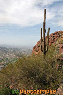
#2279 — A scenic vertical picture taken of a Camelback Mountain view and a cactus tree in the foreground in Arizona State.
Camelback Mountain & Cactus
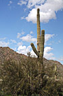
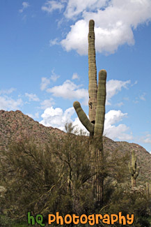
#2323 — A scenic vertical picture taken of a tall Saguaro cactus tree located in the San Tan Mountain Regional Park in Arizona. The photo was taken on a partly cloudy day.
Saguaro Cactus
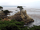
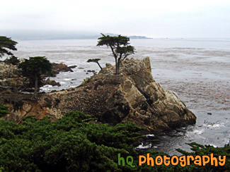
#261 — A scenic photo of the Lone Cypress located in Pebble Beach, California. As one of California's most enduring landmarks, The Lone Cypress has prevailed on its rocky perch for over 250 years. This icon of fortitude has inspired many and is revered as the eternal symbol of Pebble Beach Company.
Lone Cypress in Pebble Beach
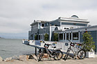
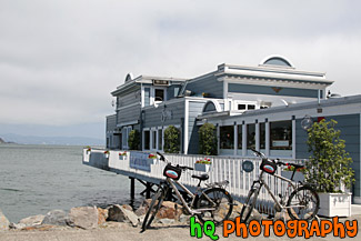
#1582 — A scenic picture taken of a restaurant called Scomas located along the waterfront in Sausalito, California which is right across the Golden Gate Bridge on the Marin County side from San Francisco.
Scomas Restaurant
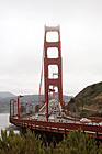
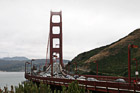
#1580 — A scenic vertical picture taken of the Golden Gate Bridge from the lookout point on the Marin County side. This photo was taken with clouds seen above the bridge.
Golden Gate Bridge - Vertical

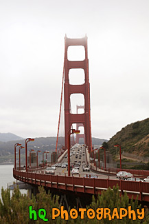
#2067 — A scenic picture taken of the Golden Gate Bridge on a cloudy day. This photo is taken from the Marin County side of the bridge.
Golden Gate Bridge on Cloudy Day
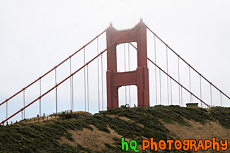
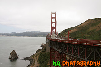
#1583 — A scenic close up picture taken of the tip of the Golden Gate Bridge which is seen very close to the clouds. You can see how big the bridge is compared to people standing on the hill in which case they look tiny.
Golden Gate Bridge Tip in Clouds
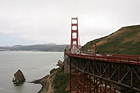
#1579 — A scenic picture taken of the Golden Gate Bridge in San Francisco, California from the lookout point on the Marin County side of the bridge. This photo was taken with clouds above the bridge.
Golen Gate Bridge & Clouds
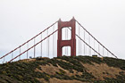
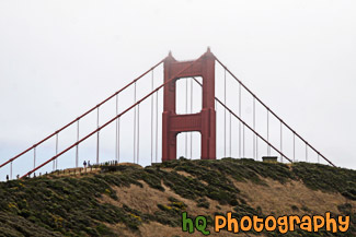
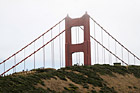
#2066 — A scenic picture taken of the tip of the Golden Gate Bridge behind a hill. You can see people walking on the hill and how large the bridge is in comparison. This picture was taken on a cloudy day.
Tip of Golden Gate Bridge Behind Hill
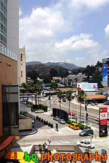
#392 — A scenic picture of the famous "Hollywood Sign" looking north along Highland Ave. at Hollywood & Highland. This picture is taken near the Kodak Theatre. The Hollywood & Highland center is located in the heart of Hollywood, California and contains the Babylon Court. The new Hollywood & Highland center is the same center that contains the Kodak Theatre.
Hollywood View from Babylon Court

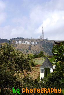
#1771 — A scenic vertical picture taken of the Hollywood Sign on the hill in Los Angeles, California. Partly cloudy, blue sky is seen above.
Hollywood Sign

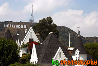
#1394 — A scenic picture taken of a white house with the famous Hollywood sign seen in the background on a hill.
Hollywood Sign & White House
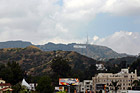
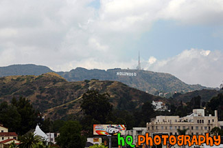
#1924 — A scenic picture taken of the famous Hollywood Sign sitting on the hill in the distance taken from dowtown Hollywood, California. This picture was taken on a partly cloudy day. Some buildings can be seen in the foreground.
Hollywood Sign on Hill in Distance

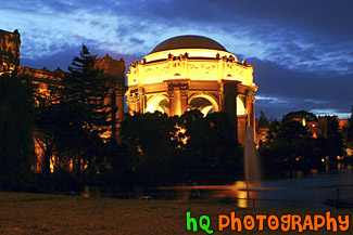
#368 — A scenic picture taken of the Palace of Fine Arts building at night in downtown San Francisco. With this picture taken at night you can see the palace lit up and the water fountain streaming. The task of creating a Palace of Fine Arts for the 1915 Panama-Pacific International Exposition fell to the architect Bernard R. Maybeck, then fifty years old and known for his innovative ideas. Setting to work on this new project, he chose as his theme a Roman ruin, mutilated and overgrown, in the mood of a Piranesi engraving. The Palace of Fine Arts was meant to give delight by its exterior beauty, but its purpose was also to offer all visitors a stimulating experience within doors
Palace of Fine Arts Exploratorium at Night
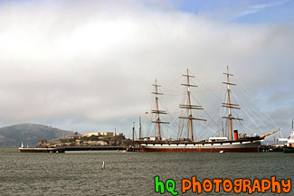
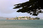
#32 — A scenic picture taken of the big Balclutha boat sitting in front of Alcatraz Island on this beautiful day in San Francisco. Alcatraz is a popular tourist attraction in this area as it was once used as a prison facility to hold inmates.
Alcatraz & Balclutha Boat
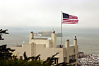
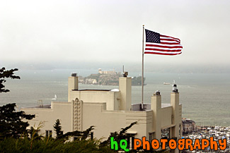
#383 — A scenic picture taken of Alactraz Island and a flag in the foreground in San Francisco. This picture was taken from the Coit Tower.
Alcatraz & Flag
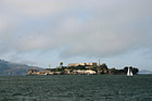
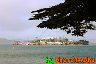
#491 — A scenic picture taken of Alcatraz Island located in San Francisco, California. Alcatraz Island served as a military fortification in the 1850s, an incarceration facility for Spanish-American War prisoners, and a federal maximum-security prison from 1934 to 1963. Alcatraz Island is now one of Golden Gate National Recreation Area's most popular destinations, offering a close-up look at a historic and infamous federal prison long off-limits to the public. Alcatraz Island is also commonly known as the "Rock."
Alcatraz Island & Prison
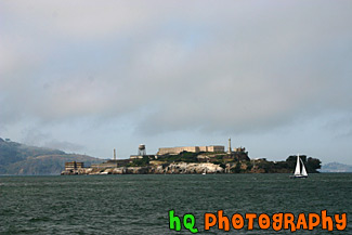
#566 — A scenic picture taken of Alcatraz Island with a tree branch in view from atop a hill in San Francisco, California.
Alcatraz with Tree Branch

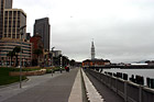
#334 — A scenic picture taken of downtown San Francisco on a cloudy day. From this picture you can see the tall buildings of San Francisco and the symbolic anchor that is displayed by the waterfront.
Downtown San Francisco
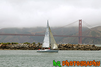
#1569 — A scenic picture taken of a sail boat floating off shore in front of the Golden Gate Bridge seen in the bay in San Francisco, California. Fog is seen over the hill just beyond the bridge.
Sail Boat & Golden Gate Bridge
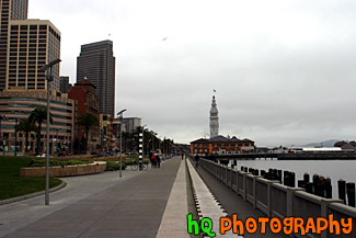
#340 — A scenic picture taken of San Francisco, California looking towards the piers and wharf of San Francisco. This part of San Francisco is a popular tourist spot and you can see many people walking along the wharf year round.
San Francisco Piers & Wharf

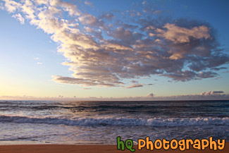
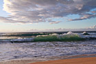
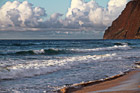
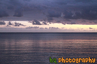
#2380 — A scenic picture taken of the Pacific Ocean and clouds at dusk as the pink sky starts to set in. This photo was taken on the island of Kauai, Hawaii.
Clouds and Waves at Polihale State Park
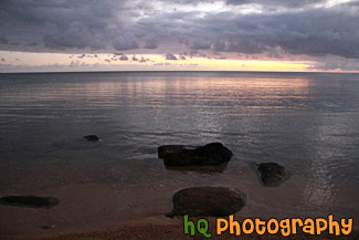
#2378 — A scenic picture taken of the sun about to set over the pacific ocean on the island of Kauai, Hawaii. This photo was taken at Polihale State Park.
Dusk at Polihale Park, Kauai

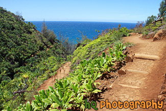
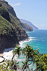
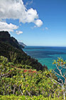
#2385 — A scenic picture taken of part of the Kalalau Trail located on the island of Kauai, Hawaii along the rugged Na Pali Coast.
Kalalau Trail on Na Pali Coast
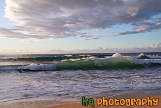
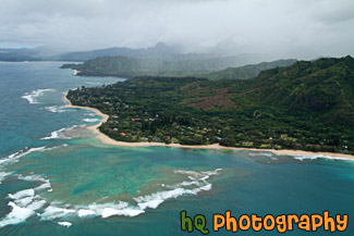
#2377 — A scenic picture taken of the beach shore at Polihale Park located on the island of Kauai, Hawaii. Puffy clouds and part of the Na Pali coast are seen in this photo. Beautiful waves from the Pacific Ocean are also seen as the sun is getting ready to set.
Kauai at Polihale Beach Park
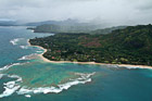
#2374 — A scenic picture taken of the Kauai Coast from a helicopter. Clouds are covering the island in this photo.
Kauai Coast From Air

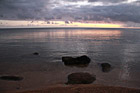
#2356 — A scenic beautiful picture taken of a Kauai, Hawaii sunrise with pink and purple skies reflected onto the Pacific Ocean. This photo was taken at Secret Beach near Princeville.
Kauai, Hawaii Sunrise
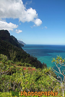
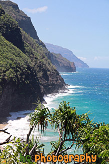
#2365 — A scenic vertical picture taken of the Na Pali coastline seen from hiking the Kalalau Trail in Kauai, Hawaii. Clouds and blue sky are seen above.
Na Pali Coast From Kalalau Trail