Home > National Parks > Gifford Pinchot National Forest (Digital Paintings)
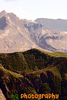
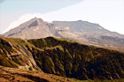
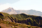
A close up picture taken of Mount St. Helens with a green hill in front and steam coming out of the dome. This picture was taken 25 years after the 1980 eruption and as you can see from the green hill there is re-growth from the destruction. Mount St. Helens is located in Gifford Pinchot National Forest and is a popular landmark of Washington State.
Image #541 | 2336 x 3504 pixels | 4.55 MB (jpg) | 23.4 MB (tif)
Mount St. Helens Close Up
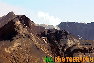
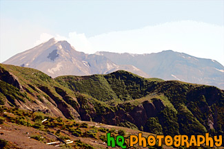
A scenic close up picture takne of the tip of Mount St. Helens with a blue sky background and some steam coming out. This picture was taken at the Windy Ridge view point. Hence the name, it is really windy here. Mount St. Helens is located in Gifford Pinchot National Forest and is a popular landmark of Washington State.
Image #899 | 3504 x 2336 pixels | 4.63 MB (jpg) | 23.4 MB (tif)
Close up of Mount St. Helens & Steam
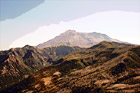
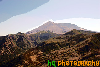
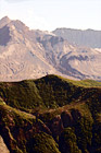
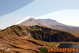
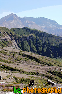
A scenic picture taken on a blue sky sunny day of Mount St. Helens and the devastation seen in the foreground still 25+ years after the eruption of May 1980. Things are starting to get green again, but there are still no trees and hardly any plants growing. Mount St. Helens is located in Gifford Pinchot National Forest and is a popular landmark of Washington State.
Image #901 | 3504 x 2336 pixels | 4.07 MB (jpg) | 23.4 MB (tif)
Devastation & Mount St. Helens
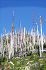
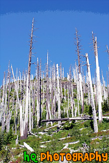
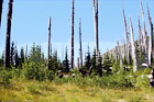
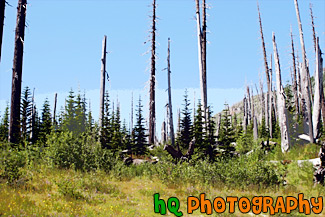
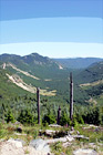
A vertical picture taken of the devastation of trees resulting from the eruption of Mt. St. Helens in 1980.
Image #1270 | 2336 x 3504 pixels | 6.09 MB (jpg) | 23.4 MB (tif)
Devastation of Trees
A vertical picture taken of the forest of Gifford Pinchot National Forest. In the far distance Mt. Baker can be seen in this photo.
Image #1274 | 2336 x 3504 pixels | 6.12 MB (jpg) | 23.4 MB (tif)
Forest & Mt. Baker in Distance
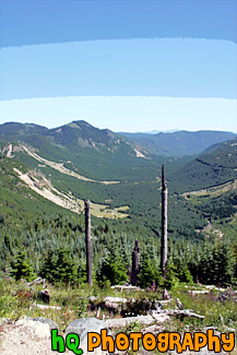
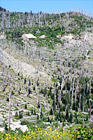
A scenic picture taken of the new forest being grown after the destruction from the eruption of Mt. St. Helen's in 1980.
Image #1271 | 3504 x 2336 pixels | 6.44 MB (jpg) | 23.4 MB (tif)
Forest Near Mt. St. Helens
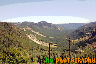
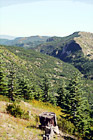
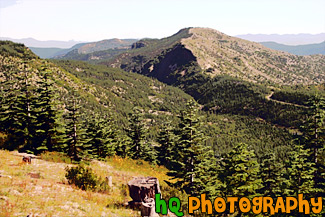
A scenic picture taken of the trees and landscape at Gifford Pinchot National Forest which is the Forest in which Mount St. Helens National Volcanic Monument lies. In this picture to the left you can see the tip of Mt. Rainier sticking over the top of the hill. The Gifford Pinchot National Forest is located in southwest Washington State. The Forest provides a wide variety of recreation opportunities. This forest was formerly known as the Columbia National Forest, but in 1949 it was renamed for Gifford Pinchot, an active conservationist and visionary environmentalist who became the first Chief of the Forest Service.
Image #533 | 3504 x 2336 pixels | 5.52 MB (jpg) | 23.4 MB (tif)
Gifford Pinchot National Forest
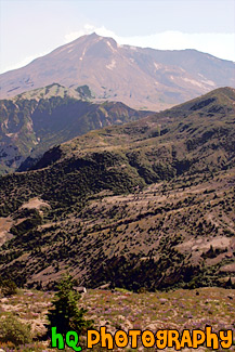
A scenic picture taken of Mount St. Helens on a sunny day with a blue sky background. This picture was taken 25 years after the 1980 eruption and as you can see from the green hills there is re-growth starting to appear from the destruction. Mount St. Helens is located in Gifford Pinchot National Forest in Washington State.
Image #903 | 3504 x 2336 pixels | 4.19 MB (jpg) | 23.4 MB (tif)
Mount St. Helens & Blue Sky
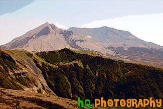
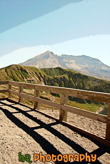
A scenic picture taken of Mount St. Helens National Volcanic Monument on a sunny day. In this picture you can see the volcano is active and letting out some steam. On this day there was a warning of 2 out of 3 and later this evening there was a 3.2 earthquake which the volcano let out even more steam. The last time Mount St. Helens really erupted was at 8:32 Sunday morning, May 18, 1980. Today, 25 years later, you can still see the destruction left from that blast, but you can also see a lot more green as things are starting to grow back. Back on May 18, 1980, Mount St. Helens was shaken by an earthquake measuring 5.1 on the Richter scale. Nearly 230 square miles of forest was blown over or left dead and standing. The eruption lasted 9 hours, but Mount St. Helens and the surrounding landscape were dramatically changed within moments.
Image #528 | 3504 x 2336 pixels | 4.30 MB (jpg) | 23.4 MB (tif)
Mount St. Helens & Steam
A scenic picture taken of Mount St. Helens from Windy Ridge, which is the closest spectators can get to the volcano. In this picture you can see some steam flowing out of the dome of the mountain as it has a waring level 2 out of 3 on this particular day. The last major eruption of Mount St. Helens was on May 18, 1980.
Image #539 | 2336 x 3504 pixels | 4.86 MB (jpg) | 23.4 MB (tif)
Mount St. Helens at Windy Ridge
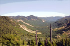
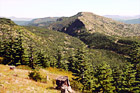
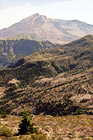
A scenic picture taken of the surrounding mountains and new growth of Gifford Pinchot National Forest after the erruption of Mt. St. Helens.
Image #1267 | 2336 x 3504 pixels | 5.30 MB (jpg) | 23.4 MB (tif)
Mountains and New Growth of Gifford Pinchot
A scenic picture taken of the Gifford Pinchot National Forest with Mt. Baker seen in the background. In this picture you can see the new growth and trees in which the original forest was destroyed after the Mount St. Helens volcanic erruption in May of 1980.
Image #771 | 3504 x 2336 pixels | 6.44 MB (jpg) | 23.4 MB (tif)
Mt. Baker & Gifford Pinchot National Forest
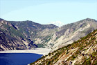
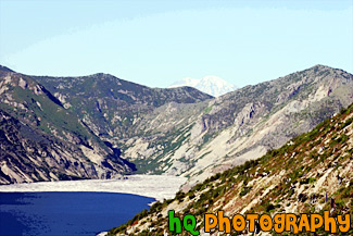
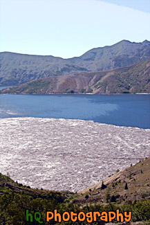
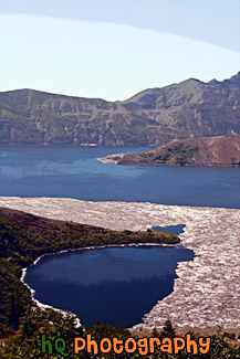
A scenic picture taken of Spirit Lake and the tip of Mt. Rainier seen over the hill on a blue sky sunny day in Washington State. Spirit Lake is located right by Mount St. Helens which is in Gifford Pinchot National Forest, Washington. Spirit Lake is situated across the blast path of Mount St. Helens and is one of the enduring features of the devastation of the 1980 Mount St. Helens eruption. Floating over the surface of the water is a forest of destroyed trees.
Image #902 | 3504 x 2336 pixels | 5.30 MB (jpg) | 23.4 MB (tif)
Mt. Rainier & Spirit Lake
A scenic vertical picture taken of Gifford Pinchot National Forest and Mt. Saint Helen's seen in the distance on a sunny day. You can see the new growth of the forest in the foreground.
Image #1280 | 2336 x 3504 pixels | 5.43 MB (jpg) | 23.4 MB (tif)
Mt. Saint Helens in Distance
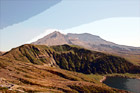
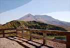
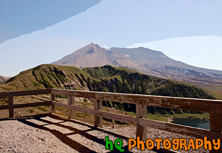
A scenic picture taken of Mt. Saint Helens and part of Spirit Lake seen in the foreground.
Image #1277 | 3504 x 2336 pixels | 4.03 MB (jpg) | 23.4 MB (tif)
Mt. St. Helens & Spirit Lake
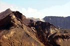
A scenic picture taken of Mount St. Helens from Windy Ridge, which is the closest spectators can get to the volcano. In this picture you can see some steam coming out of the dome of the mountain as it has a waring level 2 out of 3 on this particular day.
Image #1307 | 3393 x 2336 pixels | 4.09 MB (jpg) | 22.7 MB (tif)
Mt. St. Helens at Windy Ridge
A scenic vertical photo of Mt. Saint Helens volcano taken on a sunny day with blue sky seen above.
Image #1279 | 2336 x 3504 pixels | 5.12 MB (jpg) | 23.4 MB (tif)
Mt. St. Helens Vertical
A scenic vertical picture taken of the new growth in the foreground 25 years after the eruption of Mt. Saint Helens in 1980. Mt. Saint Helens is seen in the background with some steam coming out.
Image #1284 | 2336 x 3504 pixels | 5.13 MB (jpg) | 23.4 MB (tif)
New Growth & Mt. Saint Helens
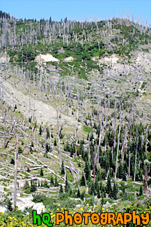
A vertical scenic picture taken of the old and new growth of Gifford Pinchot National Forest near Mt. Saint Helens 25 years after the eruption in 1980.
Image #1272 | 2336 x 3504 pixels | 7.21 MB (jpg) | 23.4 MB (tif)
Old & New Growth
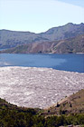
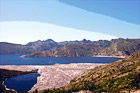
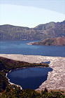
A scenic vertical picture taken of Spirt Lake in Gifford Pinchot National Forest. In the foreground you can still see the logs that flooded the lake after the eruption of Mt. Saint Helens in 1980.
Image #1281 | 2336 x 3504 pixels | 5.45 MB (jpg) | 23.4 MB (tif)
Spirit Lake & Logs
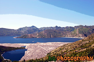
A scenic picture taken of Spirit Lake with logs floating on top. Spirit Lake is located right by Mount St. Helens which is in Gifford Pinchot National Forest, Washington. Spirit Lake is situated across the blast path of Mount St Helens and is one of the enduring features of the devastation of the 1980 Mount St. Helens eruption. Floating over the surface of the water is a forest of destroyed trees. Just over two decades after the eruption, Spirit Lake has seen drastic changes. Once, it used to be a recreational outpost for children and adults of all ages. Now, due to the floating forest and other factors, the lake has become a tourist attraction that remains evidence of the Mount St. Helens eruption. Spirit Lake was once part of an ideal picture-postcard setting, with Spirit Lake in foreground and snowcapped Mt. Saint Helens as a backdrop. The scene at Spirit Lake changed dramatically on May 18, 1980, when the Mt. Saint Helens volcano erupted after being dormant for 123 years, sending a deep blanket of ash upon the lake and destroying the beautiful scene.
Image #548 | 3504 x 2336 pixels | 4.87 MB (jpg) | 23.4 MB (tif)
Spirit Lake, Washington
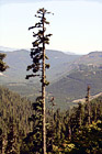
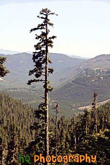
A scenic picture taken of a tall evergreen tree and surrounding evergreens of Gifford Pinchot National Forest on a sunny blue sky day.
Image #1268 | 2336 x 3504 pixels | 4.79 MB (jpg) | 23.4 MB (tif)
Tall Evergreen of Gifford Pinchot National Forest
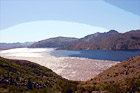
A scenic vertical picture taken of Spirit Lake on a sunny day which is located right next to the Mount Saint Helens volcano in Washington State.
Image #1283 | 2336 x 3504 pixels | 4.65 MB (jpg) | 23.4 MB (tif)
Vertical View of Spirit Lake
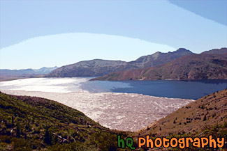
A scenic view of Spirit Lake with the sun shining on it. Spirit Lake is located right next to Mt. Saint Helens.
Image #1282 | 3504 x 2336 pixels | 4.36 MB (jpg) | 23.4 MB (tif)
View of Spirit Lake
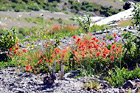
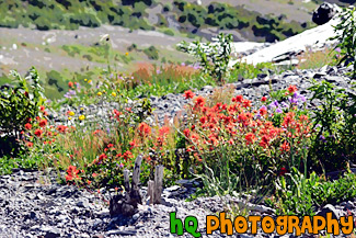
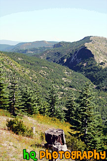
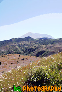
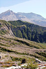
A scenic picture of some wildflowers, logs, and new growth in Gifford Pinchot National Forest near Mount St. Helens at the Windy Ridge viewing area.
Image #664 | 3504 x 2336 pixels | 5.66 MB (jpg) | 23.4 MB (tif)
Wildflowers near Mount St. Helens
