Photos of National Parks (27)
There are (27) photos of the keyword, National Parks, available on our website. They are pictured below.The pictures are organized by category.
Categories Search Results
- National Parks
- National Parks:Crater Lake
- National Parks:Gifford Pinchot National Forest
- National Parks:Grand Canyon
- National Parks:Mt Rainier National Park
- National Parks:North Cascades National Park
- National Parks:Olympic National Park
- National Parks:Yosemite National Park
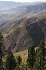
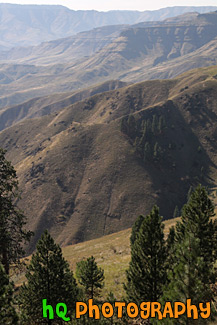
#2046 — A scenic vertical picture taken of some hills of Hells Canyon National Recreation Area located in the northeastern Oregon and western Idaho areas.
Hells Canyon Hills
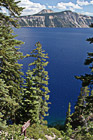
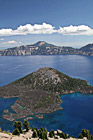
#2352 — A scenic picture taken of Crater Lake National Park located in Oregon State. In this picture you can see the super blue waters of the lake.
Crater Lake Through Trees
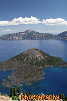
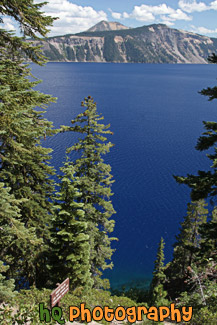
#2349 — A scenic vertical picture taken of Crater Lake and Wizard Island seen in the middle of it. This photo was taken on a pretty blue sky day during the summer month of August.
Wizard Island in Crater Lake
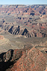
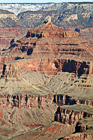
#2325 — A scenic vertical picture taken of the rocky grand canyon located in Arizona State. In this photo you can see peaks of the rock formations and blue sky above. This photo was taken on the south rim of the national park.
Grand Canyon Rocks
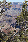
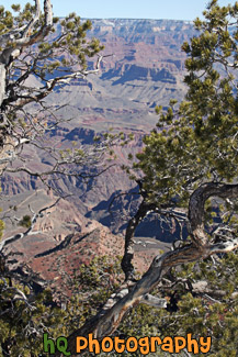
#2289 — A scenic vertical picture taken of the Grand Canyon National Park seen through some tree branches in the foreground on this sunny day. This photo was taken from the south side of the park.
Grand Canyon Through Trees
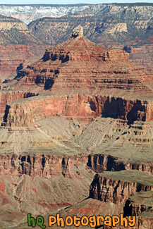
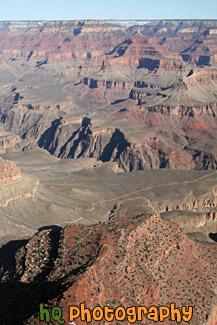
#882 — A scenic vertical close up picture taken of rocks of the Grand Canyon from the South Rim.
Rocks of the Grand Canyon
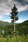
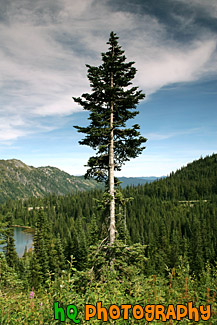
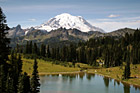
#654 — A scenic picture taken of a single evergreen tree on the hill above a lake in the Louise Lake in the Mount Rainier National Park. You can see part of the Louise Lake to the left and the hills in the national park in the background.
Evergreen Tree in Forest
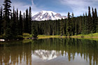
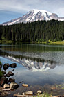
#639 — A beautiful picture taken of Mt. Rainier and reflections of evergreen trees and the mountain in Reflection Lakes. Reflection Lakes is located in Mount Rainier National Park in Wasington State. This is a beautiful spot to go hiking or get a tremendous view of Mt. Rainier.
Mount Rainier & Reflections in Reflection Lake
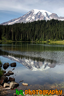
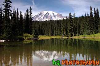
#628 — A scenic picture taken of Mt. Rainier and its' reflection sourounded by some rocks in Reflection Lakes which is located in Mt. Rainier's National Park. As an active volcano Mount Rainier stands as a reminder of the beauty and power of nature. Mt. Rainier formed about 500,000 years ago and has the potential to erupt again at some unknown time. Mount Rainier National Park was established in 1899.
Mt. Rainier Reflection & Rocks in Reflection Lakes
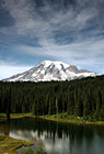
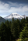
#703 — A scenic picture taken of Mount Rainier, an interesting sky, evergreen trees, and reflection lake located in Mount Rainier National Park. In this picture you can see the evergreen trees along with some of Mt. Rainier reflecting in the lake. Mt. Rainier does not have much snow on it in this picture as it was taken in the summertime.
Mount Rainier & Reflection Lake
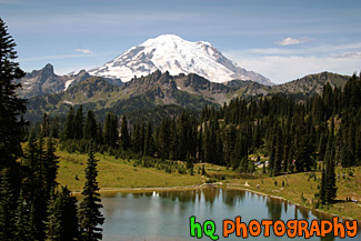
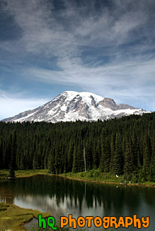
#638 — A scenic summer picture taken of Mt. Rainier and Tipsoo Lake which is located in Mount Rainier's National Forest in Washington State. When locals mention "The Mountain," there is no mistaking which peak they are referring to. At 14,411 feet, Mount Rainier towers 8,000 feet above surrounding Cascades peaks, and is such a behemoth that it creates its own weather.
Mount Rainier & Tipsoo Lake in Summer
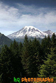
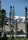
#680 — A scenic picture taken of Mt. Rainier with evergreen trees in the foreground and an interesting cloud formation in the sky. This picture was taken during the summer in Mount Rainier National Park. Mount Rainier National Park lies in the Cascade chain of mountains 68 miles south-southeast of Seattle and 95 miles north-northeast of Portland, Oregon. The park is open year round, but visitation to most regions is limited to late June to early October, depending on snowfall.
Mount Rainier Behind Evergreen Trees
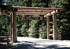
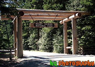
#634 — A picture of a wooden entrence and sign to the Mount Rainier National Park coming from highway 410 past Crystal Mountain. Mount Rainier National Park was established in 1899 and contains 235,625 acres (97% is designated Wilderness). The national park includes Mount Rainier (14,410 feet high), an active volcano encased in over 35 square miles of snow and ice and outstanding examples of old growth forests and subalpine meadows. Nearly two million people come to enjoy hiking, climbing, snowshoeing, cross-country skiing, camping, photographing, or admiring the views of Mount Rainier each year.
Mount Rainier National Park Entrence
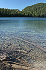
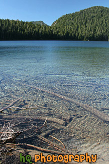
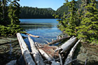
#2315 — A scenic vertical picture taken of Mowich Lake located in the Mount Rainier National Park. This lake is full of extremely clear water as you can see the logs and the bottom of the lake through the water.
Mowich Lake & Clear Water
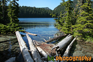
#2314 — A scenic picture taken of Mowich Lake located in Mt. Rainier National Park. Logs are seen in the foreground floating on the lake and green trees surround the lake. Mowich Lake is the largest and deepest lake in Mount Rainier National Park. The road is unpaved after the first three miles and may be rough. You can get to the lake through the Carbon River Entrance to the park. It is generally open mid-July to mid-October.
Mowich Lake & Logs
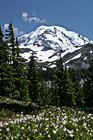
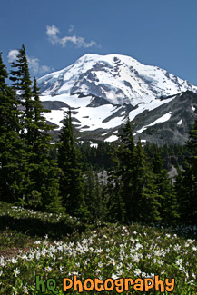
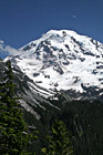
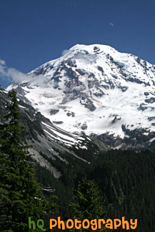
#2311 — A scenic vertical picture taken of Mt. Rainier from Spray Park which is located about 3 miles down a hiking trail starting at Mowich Lake at the Carbon River Entrance to Mt. Rainier National Park. In this photo you can see some white wild flowers in the foreground during this summer season.
Mt. Rainier at Spray Park
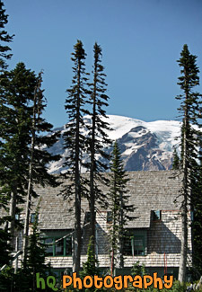
#726 — A scenic picture taken of Mount Rainier seen behind part of the Paradise Inn building which is located in the Mount Rainier National Park. This picture was taken on a sunny day during the summertime.
Mt. Rainier Behind Paradise Inn
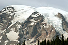
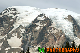
#747 — A super close up taken of Mount Rainier. This picture was taken near Reflection Lake in Mount Rainier's National Park.
Mt. Rainier Really Close Up
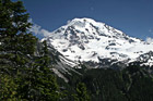
#2312 — A scenic vertical picture taken of Mt. Rainier with the moon seen faintly above on a blue sky sunny day. This photo was taken from the Spray Park trail which starts at Mowich Lake from the Carbon River Entrance to the park. A few clouds can be seen in front of the mountain.
Mt. Rainier With Moon Faintly Above
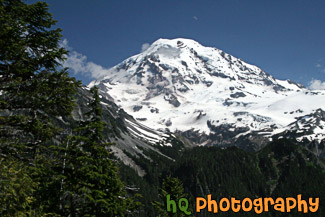
#2313 — A scenic picture taken of Mt. Rainier with the moon seen faintly above on a blue sky day. This photo was taken from the Spray Park trail which starts at Mowich Lake from the Carbon River Entrance to the park. A few scattered clouds can be seen in front of the mountain.
Mt. Rainier, Faint Moon & Blue Sky
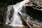
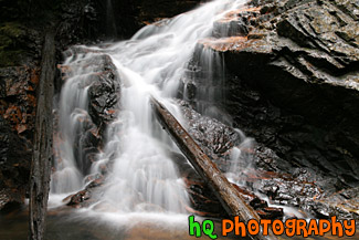
#1847 — A scenic picture taken close up of a waterfall located in the North Cascades National Park in Washington State. A couple logs are seen laying in the waterfall.
Waterfall and Logs Up Close
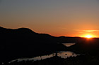
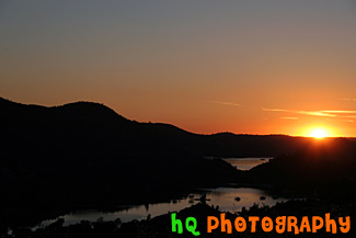
#405 — This picture was taken of a beautiful sunset near the entrence to Yosemite National Park just a couple miles west of Groveland and Big Oak Flat. You can see part of the reservoir to Don Pedro Lake in between the hills. Yosemite is located in east-central California and lies 105 miles north of Fresno, 195 miles east of San Francisco, 313 miles north of Los Angeles and 350 miles northwest of Las Vegas. The gross area acres for the national park is Gross Area Acres for 761,266 and receives about 3,300 total recreational visits per year. The elevation in the park ranges from from 2000 feet to over 13,000 feet. The cliffs, waterfalls, steep mountains and deep lakes of Yosemite National Park were all formed over millions of years by earthquakes, glaciers and numerous other forces of nature.
Sunset at Hills near Yosemite
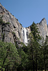

#682 — A scenic picture taken of Bridalveil Fall located in Yosemite National Park, California. Although Bridalveil Fall appears small when viewd against the surrounding canyon walls, it actually has a 620 foot drop, the height of a 62 story building. Bridalveil Fall is one of the most prominent waterfalls in the Yosemite Valley in California, seen yearly by millions of visitors to Yosemite National Park. When the wind blows briskly, the waterfall will appear to be falling sideways.
Bridalveil Fall
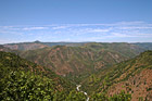
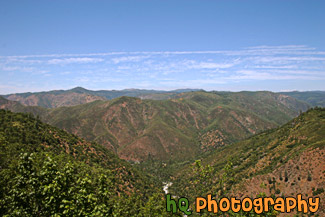
#456 — A scenic picture of the mountains and hills surrounding Yosemite National Park and the Tuolumne River flowing below. The Tuolumne River was designated Wild and Scenic in 1984 by the United State Congress. The Wild and Scenic Act provieds that rivers possessing extraordinary scenic, recreational, fishery, or wildlife values shall be preserved for the benefit and enjoyment of Forest visitors. It also limits land development surrounding these rivers and water diversion from them. The Tuolumne River begins as small rivulets trickling from Mount Dana and Mount Lyell in Yosemite National Park high in the Sierra Nevada. It ends at the San Joaquin River.
Yosemite & Tuolumne River View
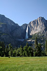
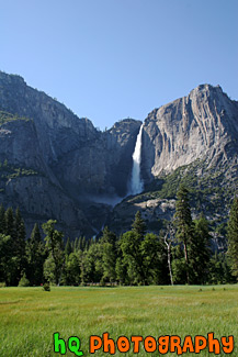
#621 — A scenic picture taken of the tall Yosemite Falls with a big grass field in the foreground. Yosemite Falls is located in Yosemite National Park in California. Yosemite Falls is the world's 5th tallest waterfall, but North America's largest and most popular waterfall in Yosemite's National Park. This waterfall is actually composed of three falls: Upper, Middle Cascades, and the Lower fall. Together they have a combined height of 2,425 feet which is more than 9 times the height of Niagara Falls. Perhaps the easiest place to view the falls is the Yosemite Falls Parking Area across from Yosemite Lodge.
Yosemite Falls & Grass Field
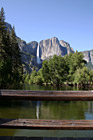
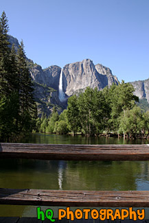
#705 — A scenic picture taken of Yosemite Falls in the distance with a wood railing overlooking some water in the foreground. Yosemite Falls is located in Yosemite National Park which is located in east-central California and lies 105 miles north of Fresno, 195 miles east of San Francisco, 313 miles north of Los Angeles and 350 miles northwest of Las Vegas. The Yosemite waterfall is actually composed of three falls: Upper, Middle Cascades, and the Lower fall. Together they have a combined height of 2,425 feet which is more than 9 times the height of Niagara Falls. Perhaps the easiest place to view the falls is the Yosemite Falls Parking Area across from Yosemite Lodge.
Yosemite Falls & Wood Railing