Photos of Hills And Trees (23)
There are (23) photos of the keyword, Hills And Trees, available on our website. They are pictured below.The pictures are organized by category.
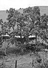
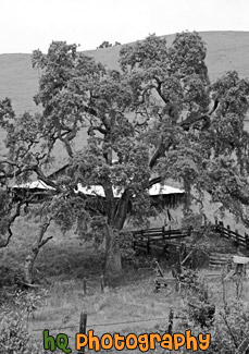
#679 — A scenic picture of a black and white tree and barn behind on a hill located in the hill of East San Jose, California.
Black & White Scenic Tree
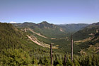
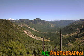
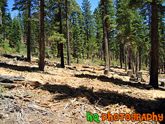
#533 — A scenic picture taken of the trees and landscape at Gifford Pinchot National Forest which is the Forest in which Mount St. Helens National Volcanic Monument lies. In this picture to the left you can see the tip of Mt. Rainier sticking over the top of the hill. The Gifford Pinchot National Forest is located in southwest Washington State. The Forest provides a wide variety of recreation opportunities. This forest was formerly known as the Columbia National Forest, but in 1949 it was renamed for Gifford Pinchot, an active conservationist and visionary environmentalist who became the first Chief of the Forest Service.
Gifford Pinchot National Forest
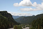
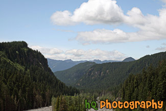
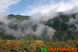
#1643 — A scenic picture taken of blue sky, clouds, and hills located in Mt. Rainier National Park. Tons of evergreen trees can be seen in this photo.
Hills & Clouds in Mt Rainier Park
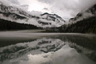
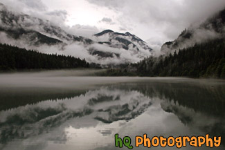
#1828 — A scenic picture taken of a dramatic Diablo Lake clouds, fog, and reflection seen on this autumn morning. You can see the mountains, hills, trees, fog, clouds, and sky reflecting into the lake.
Diablo Lake Dramatic Clouds, Fog, and Reflection
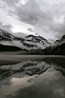
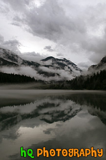
#1832 — A scenic vertical picture taken of a dramatic Diablo Lake clouds, fog, and reflection seen on this autumn morning. You can see the mountains, hills, trees, fog, clouds, and sky reflecting into the lake.
Vertical Diablo Lake Dramatic Clouds, Fog, and Reflection
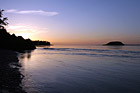
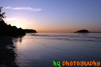
#1827 — A scenic blue, pink, and purple sunset seen on the shore of the Pacific Ocean at Deception Pass which is located in Washington State. Silhouettes of the hills are seen.
Pacific Ocean Sunset by Deception Pass
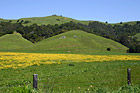
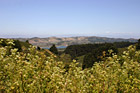
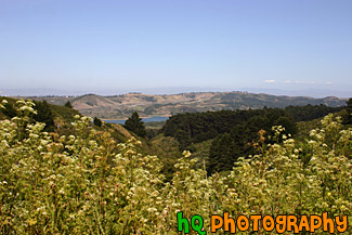
#364 — A scenic photo taken of a beautiful landscape scene with green grass, blue sky, and yellow flowers in Marin County, California. Marin County is just north of San Francisco. From 1850 to 1950 the population of Marin increased by 85,000 people. Twenty years later there were an additional 123,000 residents. Population growth has slowed since then and is now about 245,000. In 1972 the Golden Gate National Recreational Area was created which encompasses the Marin Headlands, Muir Woods and thousands of acres along the Pacific Coast.
Marin County Landscape of Hills
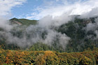
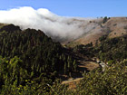
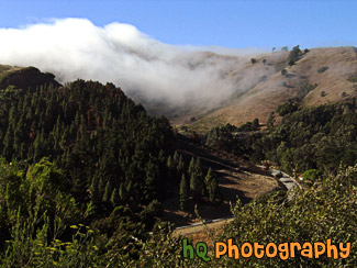
#1850 — A scenic picture taken of foggy hills near the entrance to the North Cascades National Park located in Washington State. In this picture you can see the fall colors starting to change on the trees and blue sky seen above.
Foggy Hills & Blue Sky
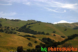
#350 — A scenic picture and contrast between a very green hill and partly cloudy blue skies. This picture was taken in San Jose of the very green hills (which are starting to turn brown) from the tremendous early 2005 rainfall.
Green Hill & Scenic Sky Scene
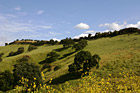

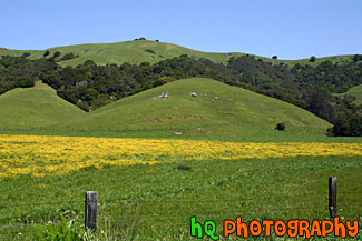
#765 — A scenic picture taken of a green hill, green trees, and yellow wildflowers blooming during spring in Northern California. This picture was taken in the East San Jose area.
Green Hill & Yellow Wildflowers
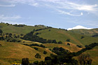
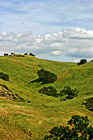
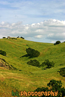
#884 — A scenic picture taken close up of one of the many rolling hills located in the San Jose Bay Area in California. In this picture you can see green hills with trees scattered over them on a sunny day.
Green Hill, Trees, & Blue Sky
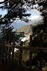
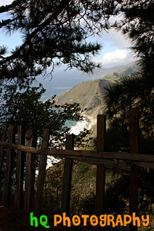
#1774 — A scenic vertical picture taken along the Highway 1 coast in California. This picture was taken looking down at the Pacific Ocean through a fence and trees on a hill. Hills along the coast are seen in the background.
Highway 1 Coast
#262 — This photo was taken near the hills of the Golden Gate Bridge in San Francisco on a foggy, but sunny day. On this particular day the fog was just rolling over the hills from the Pacific Ocean as fast as it could and it was a site to see.
Fog Rolling over Road in San Francisco
#956 — A scenic photo taken of the wesstern Bay Area in California looking towards the 280 freeway which runs near Half Moon Bay, Stanford, Los Altos, and Palo Alto. In this picture you can see the golden hills which surround the Bay Area and a small lake in the middle of the photo. This photo was taken on a sunny day.
Bay Area Landscape Scene
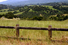
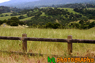
#887 — A scenic picture taken in the country side of the Los Altos Hills in the Bay Area of California. In this picture an old wooden fence lines the foreground and the country green fields and hills can be seen in the background.
Country Fence & Green Fields
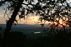
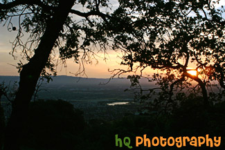
#373 — A scenic picture taken a top a hill in East San Jose overlooking the entire city and bay area. This picture shows a scenic house amongst the view of the city during a spectacular sunset.
East San Jose Hill Sunset
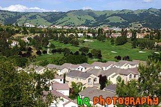
#357 — A scenic picture taken of the Silver Creek Valley area in East San Jose. From all the rain this area has been having during 2005, you can see the very green hills in the background.
Silver Creek Valley, San Jose
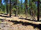
#200 — A view of the trees in the mountains of Lake Tahoe. Lake Tahoe is the second deepest lake in the United States and the tenth deepest in the world, with a maximum depth measured at 1,645 ft (501 m), average depth of 1,000 ft (305 m). The Lake Tahoe Basin was formed by geologic block (normal) faulting about 2 to 3 million years ago. A geologic block fault is a fracture in the Earth's crust causing blocks of land to move up or down. Snow, rain, and streams filled the southern and lowest part of the basin, forming the ancestral Lake Tahoe. Modern Lake Tahoe was shaped and landscaped by the scouring glaciers during the Ice Age. Many streams flow into Lake Tahoe, but the lake is drained only by the Truckee River, which flows northeast through Reno and into Pyramid Lake in Nevada.
Trees in the Mountains of Lake Tahoe
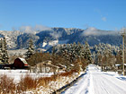
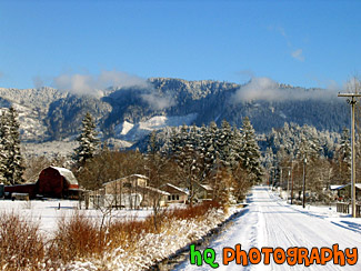
#30 — A scenic photo of a beautiful snowy winter scene in the foothills of the Cascade Mountains in Washington. This photo was taken in the Enumclaw area which is located about 30 miles from Mt. Rainier. Washington had a snow blast in January of 2004. Enumclaw is a small town in Washington State that has a lot of farms and land. From this city you can see some spectacular views of Mt. Rainier and other landscapes.
Winter Snow Landscape
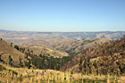
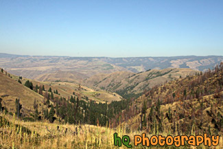
#2157 — A scenic picture taken of some hills located in the State of Idaho just near Hells Canyon.
Idaho Hills
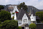
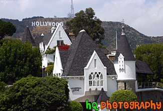
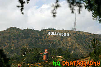
#388 — A scenic picture of the famous Los Angeles landmark, the Hollywood sign. This sign is located on the hills just north of the Hollywood strip and was taking with a scenic white, pointy house in the foreground. The Hollywood Sign originally said "Hollywoodland" in 1923 before it was shortened in 1945. The Hollywood Sign is the most famous sign in the world. It is located on Mount Lee in Griffith Park overlooking the city of Hollywood. It's illegal to hike to the Hollywood Sign, but there are many good vantage points from the streets of Hollywood. The Sign is a trademark of the Hollywood Chamber of Commerce. The Sign was declared Los Angeles Cultural-Historical Monument #111 in 1973 by the Cultural Heritage Board of the City of Los Angeles.
Hollywood Sign & Scenic House
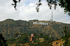
#390 — This is a picture taken of the famous Los Angeles landmark, The "Hollywood" sign. The Hollywood Sign originally said "Hollywoodland" in 1923 before it was shortened in 1945. The Hollywood Sign is the most famous sign in the world. It is located on Mount Lee in Griffith Park overlooking the city of Hollywood. It's illegal to hike to the Hollywood Sign, but there are many good vantage points from the streets of Hollywood. The Sign is a trademark of the Hollywood Chamber of Commerce. The Sign was declared Los Angeles Cultural-Historical Monument #111 in 1973 by the Cultural Heritage Board of the City of Los Angeles.
Hollywood Sign on Hill