Photos of Hills And Lake (9)
There are (9) photos of the keyword, Hills And Lake, available on our website. They are pictured below.The pictures are organized by category.
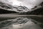
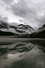
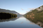
#1828 — A scenic picture taken of a dramatic Diablo Lake clouds, fog, and reflection seen on this autumn morning. You can see the mountains, hills, trees, fog, clouds, and sky reflecting into the lake.
Diablo Lake Dramatic Clouds, Fog, and Reflection
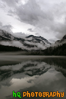
#1832 — A scenic vertical picture taken of a dramatic Diablo Lake clouds, fog, and reflection seen on this autumn morning. You can see the mountains, hills, trees, fog, clouds, and sky reflecting into the lake.
Vertical Diablo Lake Dramatic Clouds, Fog, and Reflection
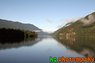
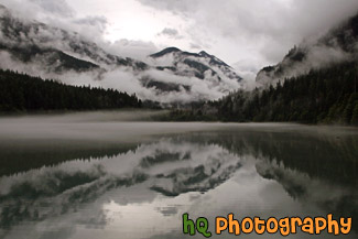
#1679 — A scenic picture taken of Lake Cresent and the hills and mountains surrounding it reflecting in the lake. Some fog that is burning off is also seen in the photo.
Lake Cresent Reflections
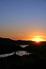
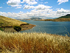
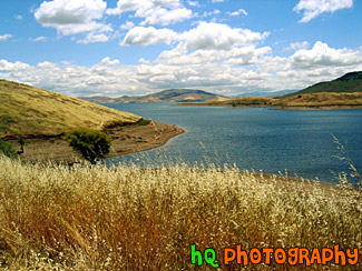
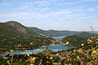
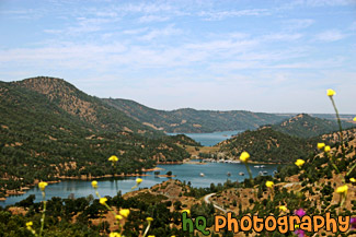
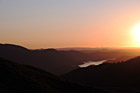
#665 — A scenic picture taken of a sunset behind the reservoir to Don Pedro Lake in between the hills and mountains surrounding Yosemite National Park in California. The picture was taken near the entrence to Yosemite National Park just a couple miles west of Groveland and Big Oak Flat. Yosemite is located in east-central California and lies 105 miles north of Fresno, 195 miles east of San Francisco, 313 miles north of Los Angeles and 350 miles northwest of Las Vegas.
Sunset Behind Don Pedro Lake
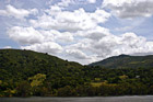
#885 — A scenic picture taken of a lake in the foreground, green rolling hills in the mid-ground, and interesting puffy white clouds and blue sky in the sky. This photo was taken near the Santa Cruz Mountains on the way to Santa Cruz, California near Highway 17.
Green Hill, Lake, & Puffy Clouds
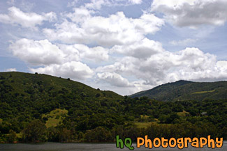
#44 — A landscape scene in Northern California near Gilroy of a lake and puffy clouds on a sunny day.
Landscape Lake Scene
#650 — Moccasin Point Marina can be seen on your drive to Yosemite National Park if you take Highway 120 (Yosemite Highway). Moccasin, California is situated in the foothills of California's beautiful Sierra Nevada Mountains. Moccasin Point Marina and recreation area is 60 miles west of the Yosemite National Park and 2 1/2 hours east of San Francisco.
Moccasin Point Marina, California
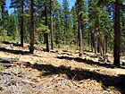
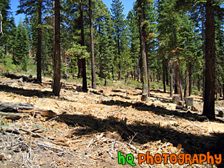
#200 — A view of the trees in the mountains of Lake Tahoe. Lake Tahoe is the second deepest lake in the United States and the tenth deepest in the world, with a maximum depth measured at 1,645 ft (501 m), average depth of 1,000 ft (305 m). The Lake Tahoe Basin was formed by geologic block (normal) faulting about 2 to 3 million years ago. A geologic block fault is a fracture in the Earth's crust causing blocks of land to move up or down. Snow, rain, and streams filled the southern and lowest part of the basin, forming the ancestral Lake Tahoe. Modern Lake Tahoe was shaped and landscaped by the scouring glaciers during the Ice Age. Many streams flow into Lake Tahoe, but the lake is drained only by the Truckee River, which flows northeast through Reno and into Pyramid Lake in Nevada.
Trees in the Mountains of Lake Tahoe
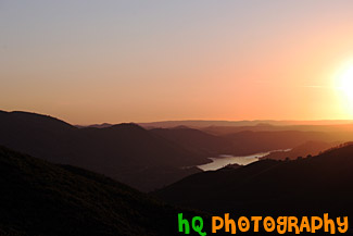
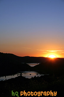
#515 — A scenic picture taken of the hills and mountains surrounding Yosemite National Park in California during sunset. The picture was taken near the entrence to Yosemite National Park just a couple miles west of Groveland and Big Oak Flat. Yosemite is located in east-central California and lies 105 miles north of Fresno, 195 miles east of San Francisco, 313 miles north of Los Angeles and 350 miles northwest of Las Vegas.
Yosemite Hills Sunset
