Photos of Hill (208)
There are (208) photos of the keyword, Hill, available on our website. They are pictured below.The pictures are organized by category.
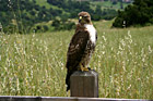
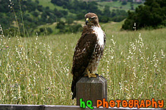
#382 — A scenic picture taken of a still hawk on a post in the hills of Palo Alto, California. This hawk is looking at me as I get closer and is deciding whether to fly away or not!
Hawk on Post
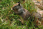

#385 — A picture of a squirrel eating something in the grass on the hills of Palo Alto, California.
Close up of a Squirrel
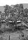
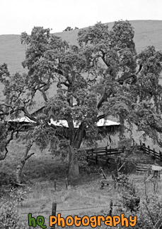
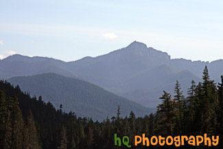
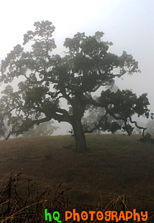
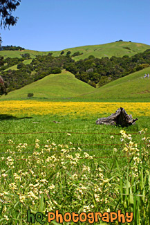
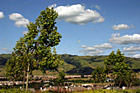
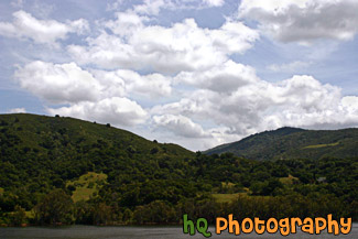
#679 — A scenic picture of a black and white tree and barn behind on a hill located in the hill of East San Jose, California.
Black & White Scenic Tree
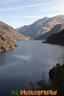
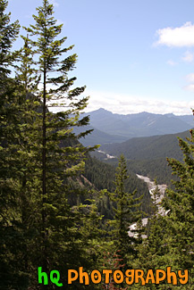
#2154 — A scenic vertical picture taken of Hells Canyon and the Snake River running through it on a sunny day. This picture was taken on the Idaho side of the canyon. Hells Canyon runs along the North East border of Oregon State and western Idaho. Hells Canyon is a National Recreation Area and is the deepest river gorge in North America.
Hells Canyon & Snake River
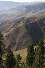
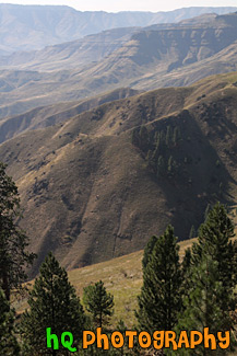
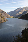
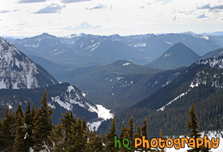
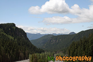
#2046 — A scenic vertical picture taken of some hills of Hells Canyon National Recreation Area located in the northeastern Oregon and western Idaho areas.
Hells Canyon Hills
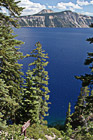
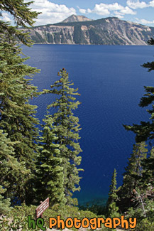
#2352 — A scenic picture taken of Crater Lake National Park located in Oregon State. In this picture you can see the super blue waters of the lake.
Crater Lake Through Trees
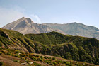
#541 — A close up picture taken of Mount St. Helens with a green hill in front and steam coming out of the dome. This picture was taken 25 years after the 1980 eruption and as you can see from the green hill there is re-growth from the destruction. Mount St. Helens is located in Gifford Pinchot National Forest and is a popular landmark of Washington State.
Mount St. Helens Close Up
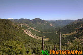
#533 — A scenic picture taken of the trees and landscape at Gifford Pinchot National Forest which is the Forest in which Mount St. Helens National Volcanic Monument lies. In this picture to the left you can see the tip of Mt. Rainier sticking over the top of the hill. The Gifford Pinchot National Forest is located in southwest Washington State. The Forest provides a wide variety of recreation opportunities. This forest was formerly known as the Columbia National Forest, but in 1949 it was renamed for Gifford Pinchot, an active conservationist and visionary environmentalist who became the first Chief of the Forest Service.
Gifford Pinchot National Forest
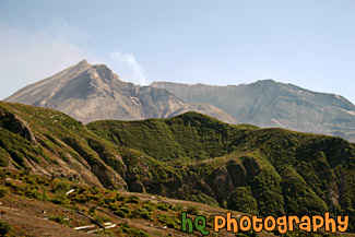
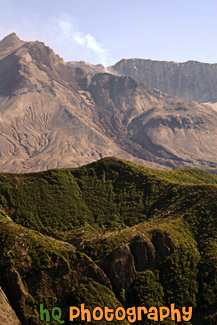
#528 — A scenic picture taken of Mount St. Helens National Volcanic Monument on a sunny day. In this picture you can see the volcano is active and letting out some steam. On this day there was a warning of 2 out of 3 and later this evening there was a 3.2 earthquake which the volcano let out even more steam. The last time Mount St. Helens really erupted was at 8:32 Sunday morning, May 18, 1980. Today, 25 years later, you can still see the destruction left from that blast, but you can also see a lot more green as things are starting to grow back. Back on May 18, 1980, Mount St. Helens was shaken by an earthquake measuring 5.1 on the Richter scale. Nearly 230 square miles of forest was blown over or left dead and standing. The eruption lasted 9 hours, but Mount St. Helens and the surrounding landscape were dramatically changed within moments.
Mount St. Helens & Steam
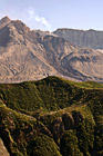
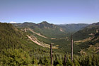
#1267 — A scenic picture taken of the surrounding mountains and new growth of Gifford Pinchot National Forest after the erruption of Mt. St. Helens.
Mountains and New Growth of Gifford Pinchot
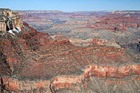
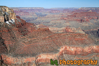
#2251 — A scenic picture taken of the Grand Canyon National Park from the South Rim. This photo was taken on a sunny day with blue skies seen above.
Grand Canyon National Park View
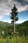
#654 — A scenic picture taken of a single evergreen tree on the hill above a lake in the Louise Lake in the Mount Rainier National Park. You can see part of the Louise Lake to the left and the hills in the national park in the background.
Evergreen Tree in Forest
#1645 — A scenic vertical picture taken evergreen trees and hills seen in the background located at Mt. Rainier National Park in Washington.
Evergreen Trees & Hills
#1506 — A scenic picture taken of evergreen trees seen in the foreground and snow-capped hills seen in the background of Mt. Rainier National Park. This picture was taken from the Paradise area of Mt. Rainier.
Evergreen Trees & Snowy Hills
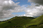
#1643 — A scenic picture taken of blue sky, clouds, and hills located in Mt. Rainier National Park. Tons of evergreen trees can be seen in this photo.
Hills & Clouds in Mt Rainier Park
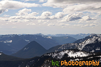
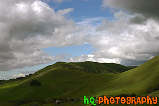
#649 — A beautiful picture taken of the hills of Mount Rainier's National Park and the Cascade Mountains. This picture was taken looking west at a lookout while approaching Paradise.
Hills of Mount Rainier National Park
#1640 — A scenic picture taken of many hills seen in Mt. Rainier National Park during the summer season.
Hills of Mt. Rainier National Park
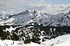
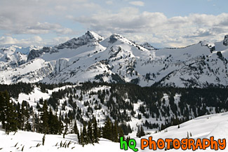
#1637 — A scenic vertical picture taken of some hills with snow on them which are located right next to Mt Rainier near the Sunrise entrance. This picture was taken from the Mount Fremont lookout.
Hills with Snow Near Mt. Rainier
#1629 — A scenic picture taken of the Mt. Rainier National Park from a view located up at Mount Fremont lookout which is near the Sunrise area.
Mount Fremont Lookout View
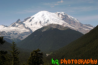
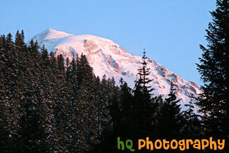
#142 — A beautiful picture of Mt. Rainier shot during August. This photo was taken near the White River Entrance in Mt. Rainier's National Forest. Blue sky is seen above the mountain with hills in the foreground.
Mt. Rainier Near White River Entrance
#1778 — A scenic picture taken of Mt. Rainier seen behind a hill during sunset as you can see a red tint on the mountain. This photo was taken at Lake Mowich near the Carbon River Entrance to the park.
Red Mt. Rainier
#1504 — A scenic picture overlooking the snow-capped hills of Mt. Rainier National Park. This picture was taken from a snowshoeing trail at Paradise on a partly cloudy day.
Snow Capped Hills from Paradise
#1505 — A scenic picture taken of snow covered hills located in Mt. Rainier National Park. This picture was taken from a trail in the Paradise area on a partly cloudy winter day.
Snowy Hills
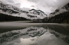
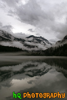
#1828 — A scenic picture taken of a dramatic Diablo Lake clouds, fog, and reflection seen on this autumn morning. You can see the mountains, hills, trees, fog, clouds, and sky reflecting into the lake.
Diablo Lake Dramatic Clouds, Fog, and Reflection
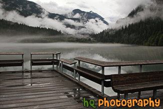
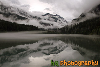
#1829 — A scenic picture taken of Diablo Lake and the dock, mountains, trees, dramatic sky and clouds, and fog. You can see reflections in the lake.
Diablo Lake Trees, Hills, & Dock
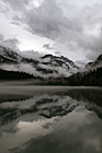
#1832 — A scenic vertical picture taken of a dramatic Diablo Lake clouds, fog, and reflection seen on this autumn morning. You can see the mountains, hills, trees, fog, clouds, and sky reflecting into the lake.
Vertical Diablo Lake Dramatic Clouds, Fog, and Reflection
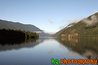
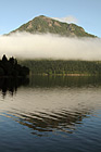
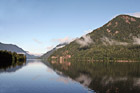
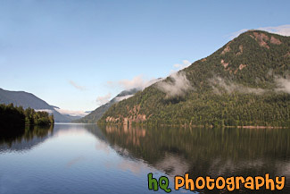
#1679 — A scenic picture taken of Lake Cresent and the hills and mountains surrounding it reflecting in the lake. Some fog that is burning off is also seen in the photo.
Lake Cresent Reflections
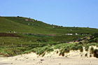
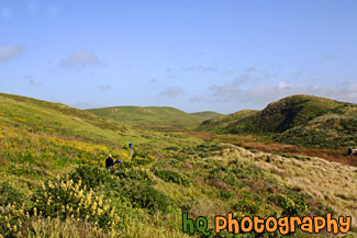
#1769 — A scenic picture taken of a hill located in the Olympic National Park. The hills is covered with dried up grass and there are people standing on the top of it (seen very small).
Hill in the Olympic Mountains
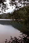
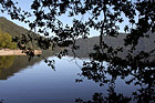
#1790 — A scenic vertical picture taken of a hill reflection and tree branches reflecting into Cresent Lake which is located in the Olympic National Park in Washington State.
Hill Reflection & Tree Branches
#1946 — A scenic picture taken of the hills and sky of the Olympic Mountains located along the coast in Western Washington State.
Hills of Olympic Mountains
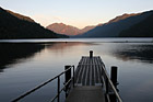
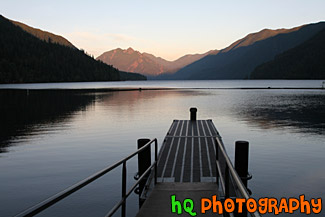
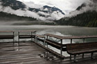
#1702 — A scenic picture taken of Lake Cresent during the dusk hours with a dock seen in the foreground. Lake Cresent is located in the Olympic National Park which is in Washington State.
Lake Cresent & Dock
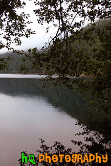
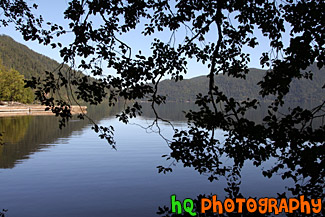
#1677 — A scenic vertical picture taken of Lake Cresent, fog, and the reflection of a hill and the fog in the lake.
Lake Cresent Fog & Reflection
#1678 — A scenic picture taken of hills reflecting in Lake Cresent and a tree and leaves silhouette in the foreground.
Lake Cresent Reflections & Silhouette
#1691 — A scenic picture taken of reflections of the hill, fog, and sky in Lake Cresent. Lake Cresent is located in the Olympic National Park which is near Port Angeles.
Lake Cresent Water Reflections
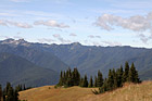
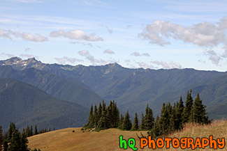
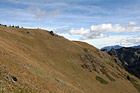
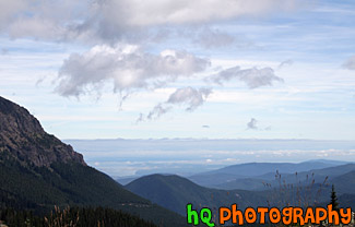
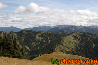
#1718 — A scenic picture taken of the hills and mountains of the Olympic National Park. This photo was taken from the Hurricane Ridge area on a sunny day.
Olympic Mountain Hills & Field
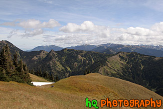
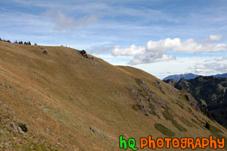
#1779 — A scenic picture taken of the hills of the Olympic Mountains during a nice late summer day. In this picture you can see two people in distance sitting on the ground enjoying their surroundings. This photo was taken near Hurricane Ridge.
Olympic Mountain Hills & Scenic Sky
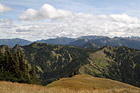
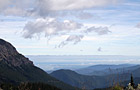
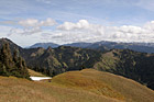
#2010 — A scenic picture taken of the Olympic Mountain Ranges on a partly cloudy sunny day. This photo was taken near Hurricane Ridge.
Olympic Mountain Ranges
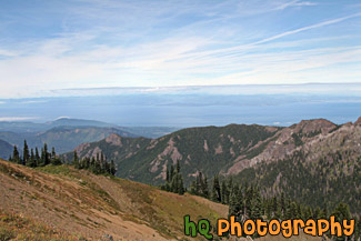
#1920 — A scenic view looking out towards the coast of the Strait of Juan de Fuca from a hike on top of a hill in the Olympic National Park.
Olympic National Park View
#1693 — A scenic picture taken of trees and mountains located around Lake Cresent in the Olympic National Park with partly cloudy skies.
Trees & Mountains Around Lake Cresent
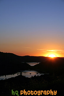
#405 — This picture was taken of a beautiful sunset near the entrence to Yosemite National Park just a couple miles west of Groveland and Big Oak Flat. You can see part of the reservoir to Don Pedro Lake in between the hills. Yosemite is located in east-central California and lies 105 miles north of Fresno, 195 miles east of San Francisco, 313 miles north of Los Angeles and 350 miles northwest of Las Vegas. The gross area acres for the national park is Gross Area Acres for 761,266 and receives about 3,300 total recreational visits per year. The elevation in the park ranges from from 2000 feet to over 13,000 feet. The cliffs, waterfalls, steep mountains and deep lakes of Yosemite National Park were all formed over millions of years by earthquakes, glaciers and numerous other forces of nature.
Sunset at Hills near Yosemite
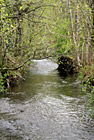
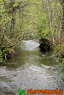
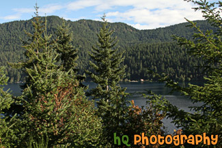
#36 — A photo of a small creek located near the Cascade Mountains foothills in Washington State. The Cascade Mountains are located close to Mt. Rainier.
Small Creek & Trees
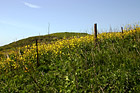
#374 — A scenic picture taken on of California Falselupine (Thermopsis Macrophylla) past Pt. Reyes near the California coast and Pacific Ocean in Marin County. This picture was taken on a sunny spring day in April.
California Yellow Wildflowers
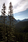
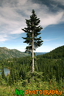
#161 — A scenic picture of two tall evergreen trees located in the middle of Mt. Rainier's National Park near Paradise and Mt. Rainier. This is a view looking west to the forest and some hills. This picture was taken during the summertime in August.
Two Tall Evergreen Trees
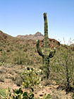
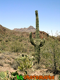
#148 — A scenic photo of a green catcus tree taken in the state of Arizona. This photo was taken on the desert land on a beautiful sunny day with blue sky overhead.
Cactus Tree
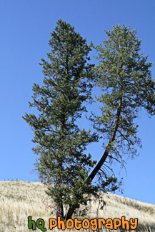
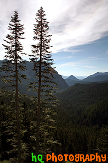
#2156 — A scenic vertical picture taken of a lone tree on a hill located in the state of Idaho.
Tree on Hill
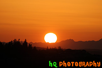
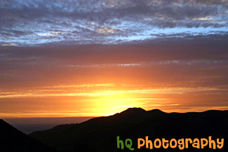
#270 — A beautiful close up picture taken of the big orange sun stetting over the Olympic Mountains located in Washington State. This picture was taken from Bonney Lake looking towards Tacoma and the Olympic Mountains. In the foreground you can see the silhouettes of some hills with houses on them.
Big Sun Setting Over Olympic Mountains
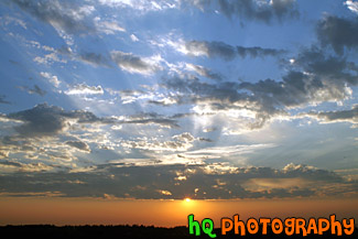
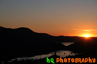
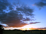
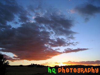
#1119 — A beautiful picture of an orange sunset with blue sky seen above, clouds, and the sun rays shining through. This photo was taken from Bonney Lake looking over the valley towards Tacoma, Washington.
Blue Sky, Clouds & Orange Sunset
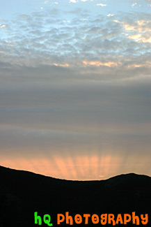
#372 — A scenic picture taken of a sunset over the hills of Mt. Tamalpais State Park near San Francisco. This picture was taken at the Golden Gate Bridge looking over towards the Pacific Ocean. You can see a silhouette of the hills in the foreground.
San Francisco Sunset
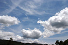
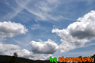
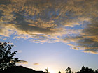
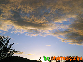
#379 — An interesting picture taken of some scenic puffy clouds and blue sky in the hills of the Santa Cruz Mountains in California.
Scenic Clouds & Blue Sky
#542 — A scenic picture taken of a bright orange, red, and blue sunset over the hills just behind the Golden Gate Bridge in San Francisco. The picture was taken on the Marin County side of the bridge looking towards the Pacific Ocean.
Sunset Over Hill at San Francisco

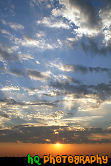
#1120 — A scenic vertical picture taken of blue sky, clouds, and an orange sunset over a hill. This picture was taken in Washington State looking towards Tacoma. In this photo you can see the sun rays shining through the clouds.
Interesting Sky With Clouds & Sunset
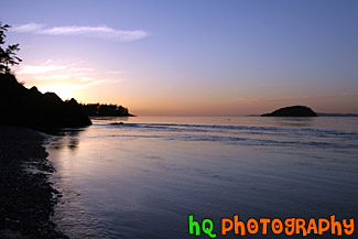
#1827 — A scenic blue, pink, and purple sunset seen on the shore of the Pacific Ocean at Deception Pass which is located in Washington State. Silhouettes of the hills are seen.
Pacific Ocean Sunset by Deception Pass
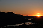
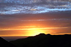
#26 — A pretty sunset while darkness is starting to set in. This photo was taken in the foothills of the Cascade Mountains in Washington State. Many sunsets like this one can be captured year round in this state.
Sunset & Silhouette
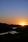
#665 — A scenic picture taken of a sunset behind the reservoir to Don Pedro Lake in between the hills and mountains surrounding Yosemite National Park in California. The picture was taken near the entrence to Yosemite National Park just a couple miles west of Groveland and Big Oak Flat. Yosemite is located in east-central California and lies 105 miles north of Fresno, 195 miles east of San Francisco, 313 miles north of Los Angeles and 350 miles northwest of Las Vegas.
Sunset Behind Don Pedro Lake
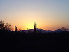
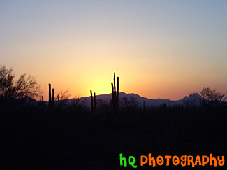
#151 — A scenic photograph of beautiful sunset taken in Arizona state. Silhouette of hills, trees, and cacti are seen.
Sunset in Arizona
#224 — A pretty sunset along the coast of Highway 101 in California just north of Santa Barbara.
Sunset on the 101


#1356 — A scenic vertical picture taken of a bunch of graves on a green grass hill during the early morning as frost can be seen on the ground. The grave in the center as American flags on both sides of it.
Graves on a Hill


#704 — A close up picture taken of a phillips screwdriver with a yellow and black handle and a white background.
Phillips Screwdriver
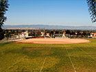
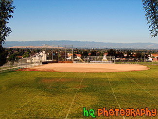
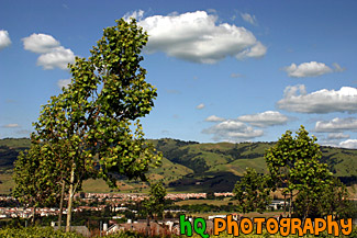
#218 — A scenic picture taken of a baseball field of a local high school located in the Evergreen San Jose, California area. This photo was taken of a baseball field through two trees on a beautiful sunny day. In the distance you can see the city of San Jose and the buildings.
High School Baseball Field
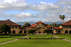
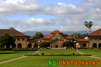
#358 — A scenic picture taken at the "Oval" at Stanford University in Palo Alto, California. The Oval is located down Palm Drive on the Stanford University campus. In this picture you can see the Stanford Memorial Church as well as the scenic green hills of Palo Alto behind the buildings in the distance.
Oval at Stanford University
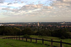
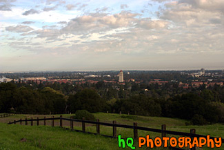
#330 — A scenic view of Stanford University taken from a hill up high just behind the campus. From this picture you can see Hoover Tower amongst all the other scenic buildings of Stanford University.
View of Stanford University from Hill
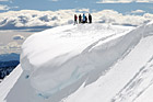
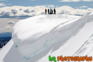
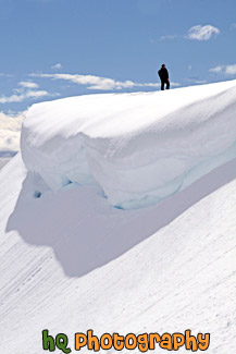
#1501 — A scenic, beautiful picture taken of people standing on top of a snow cliff near the edge of a snow overhang on a snowshoeing trail at Paradise which is located at the base of Mt. Rainier in Washington State. This picture was taken on a partly sunny day as you can see the sun shining on the snow.
People on Top of Snowy Hill for Snowshoe Trip
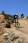
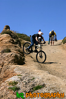
#754 — A scenic picture taken of a kid riding his bike down a hill located on the beach at Half Moon Bay, California on a sunny day.
Kid Riding Bike Down a Hill

#160 — A scenic picture taken of a man with a red stocking cap on snowshoeing up a hill near Snoqualmie Pass, Washington State.
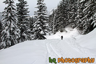
Man Snowshoeing Up Hill

#1507 — A scenic picture taken of a man standing on top of a snowy hill near a snow overhang on a sunny winter afternoon. This picture was taken on a snowshoeing trail at Paradise which is located in Mt. Rainier National Park.
Man Standing Near a Snow Overhang
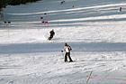
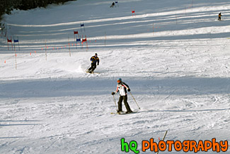
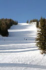
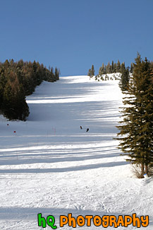
#1178 — A scenic picture taken of a ski slope at Big Mountain located in Montana State. This picture was taken on a beautiful day with blue sky seen.
Ski Slope at Big Mountain


#2270 — A scenic picture taken of a Southwest airplane about to take off at the Phoenix, Arizona airport.
Soutwest Airplane on Runway
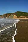
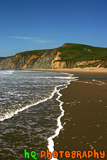
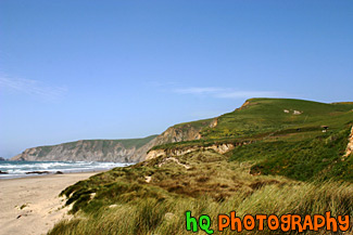
#369 — A scenic picture taken at Kehoe Beach in Marin County, California. In this picture you can see the white bubbles from the ocean wave coming to shore and making interesting lines towards the hill in the background.
Kehoe Beach Wave Lines
#1826 — A scenic vertical picture taken of the beach land at Muir Beach which is located near San Francisco in California. You can see seaweed on the beach and hills in the sand where the water is seen.
Beach Sand, Seaweed, & Water
#367 — A scenic photo taken of a beautiful landscape scene with green grass, blue sky, close up wild flowers, and yellow flowers in Marin County, California. Marin County is just north of San Francisco. From 1850 to 1950 the population of Marin increased by 85,000 people. Twenty years later there were an additional 123,000 residents. Population growth has slowed since then and is now about 245,000. In 1972 the Golden Gate National Recreational Area was created which encompasses the Marin Headlands, Muir Woods and thousands of acres along the Pacific Coast.
Beautiful Marin County Landscape
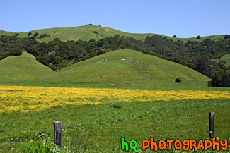
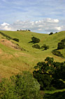
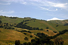
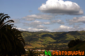
#318 — Scenic picture of the green hills of San Jose during February of 2005. This picture was taken at a spot on the east San Jose hills just north of the Evergreen area. The hills are especially green right now in February because of the tremendous rainfall the bay area has experienced this season. The rain has made for a some beautiful green hills surrounding San Jose, California.
Green Hills of San Jose
#364 — A scenic photo taken of a beautiful landscape scene with green grass, blue sky, and yellow flowers in Marin County, California. Marin County is just north of San Francisco. From 1850 to 1950 the population of Marin increased by 85,000 people. Twenty years later there were an additional 123,000 residents. Population growth has slowed since then and is now about 245,000. In 1972 the Golden Gate National Recreational Area was created which encompasses the Marin Headlands, Muir Woods and thousands of acres along the Pacific Coast.
Marin County Landscape of Hills
#6 — Rolling hills of Palo Alto, California on a sunny day. This photo was taken on the eastern hills between Palo Alto and Los Altos in the Bay Area.
Rolling Hills in California
#950 — A scenic picture taken of a landscape scene in the East San Jose area near Evergreen Village. This picture was taken on a beautiful day with scattered clouds and blue sky. You can see the green hills from much rain this year in the background with shadows from the clouds over them.
Blue Sky, Green Hills, & Trees in San Jose
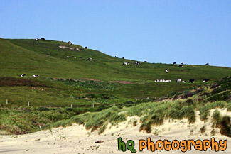
#764 — A scenic picture taken of a bunch of black and white spotted cows located on a big green hill along the coast at Kehoe Beach in Marin County California. In this picture you can see where the beach starts as the sand approaches the grass in the foreground.
Cows on Coastal Green Hill
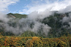
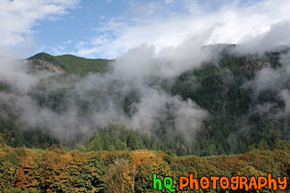
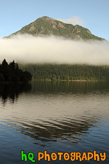
#1850 — A scenic picture taken of foggy hills near the entrance to the North Cascades National Park located in Washington State. In this picture you can see the fall colors starting to change on the trees and blue sky seen above.
Foggy Hills & Blue Sky
#350 — A scenic picture and contrast between a very green hill and partly cloudy blue skies. This picture was taken in San Jose of the very green hills (which are starting to turn brown) from the tremendous early 2005 rainfall.
Green Hill & Scenic Sky Scene
#766 — A scenic picture taken of a green hill filled with lots of green trees on a blue sky sunny day in East San Jose, California.
Green Hill & Trees
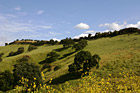

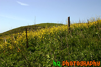
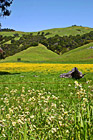
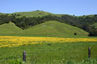
#765 — A scenic picture taken of a green hill, green trees, and yellow wildflowers blooming during spring in Northern California. This picture was taken in the East San Jose area.
Green Hill & Yellow Wildflowers
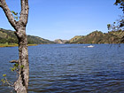
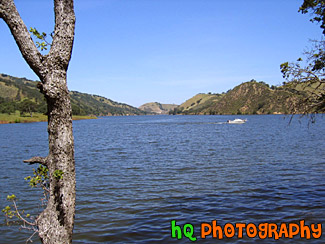
#885 — A scenic picture taken of a lake in the foreground, green rolling hills in the mid-ground, and interesting puffy white clouds and blue sky in the sky. This photo was taken near the Santa Cruz Mountains on the way to Santa Cruz, California near Highway 17.
Green Hill, Lake, & Puffy Clouds
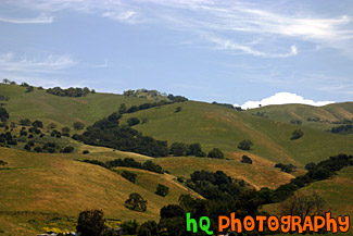
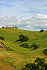
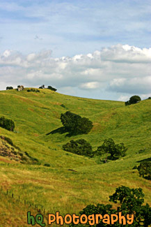
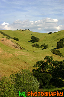
#884 — A scenic picture taken close up of one of the many rolling hills located in the San Jose Bay Area in California. In this picture you can see green hills with trees scattered over them on a sunny day.
Green Hill, Trees, & Blue Sky
#473 — A scenic picture taken of some green hills with the shadows of the clouds on the hills from the partly cloudy sky. This picture was taken in South/East San Jose near the Silver Creek Valley area.
Green Hills & Partly Cloudy Sky
#805 — A scenic picture of people hiking on a trail near the coast at Kehoe Beach which is located in Marin County California. This is a beautiful picture as you can see the green hills and wildflowers of marin county along with some patchy fog in the background with the blue sky.
People Hiking on Green Trail
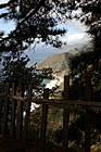
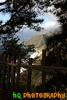
#1774 — A scenic vertical picture taken along the Highway 1 coast in California. This picture was taken looking down at the Pacific Ocean through a fence and trees on a hill. Hills along the coast are seen in the background.
Highway 1 Coast
#294 — A scenic photograph taken along the coast of Highway 1 going south towards Los Angeles in California. This photo displays the beautiful Pacific Ocean with the blue and sunny skies.
Pacific Ocean Along Highway 1, California
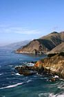
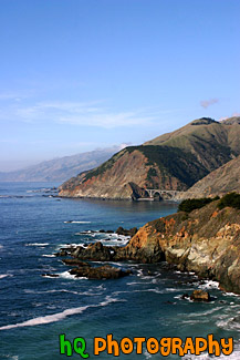
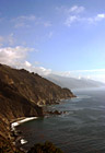
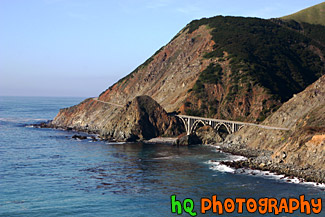
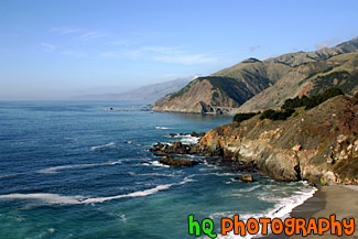
#793 — A scenic picture taken of the Pacific Ocean and the west coast in California in a beautiful sunny day. In this picture you can see many hills of the coast along with rocks and the scenic road and a beautiful bridge in the background.
Pacific Ocean Coast in California
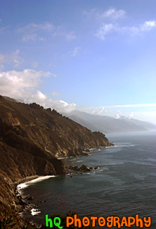
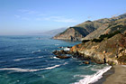
#346 — A scenic view of the Pacific Ocean driving down the coast view on Highway 1 in California. This picture was taken between the cities of Monterey and Santa Barabara by the coast. In this picture you can see the low clouds finishing up fading away from the raise of the sun which makes for a beautiful scene.
Pacific Ocean Scenic Coast
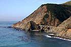
#1773 — A scenic picture taken along the west coast of the Pacific Ocean. In this picture you can see a bridge, the ocean, and the blue sky on this sunny day along the hills seen to the east.
Bridge Along West Coast
#296 — This is a scenic photo taken along the coast of highway 1 in California. Highway 1 is a highway that runs along the coast of the Pacific Ocean with some breathtaking views.
Coast Along Highway 1, California
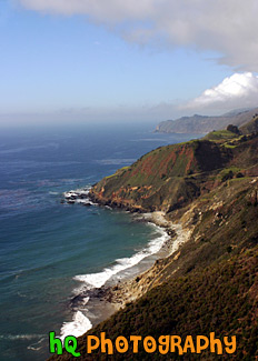
#352 — A scenic picture of the coast along the Pacific Ocean in Northern California. This picture was taken along the scenic highway of Highway 1 between Monterey and Santa Barbara. In the distance you can see a scenic bridge along the road.
Coast Scene & Hills
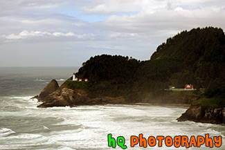
#457 — A scenic picture taken of the Heceta Head Lighhouse located on the Oregon coast, just after the famous Sea Lion Caves. The lighthouse is a working lighthouse and has a height of 205 feet above the Pacific Ocean. To the right of the lighthouse is the Keeper's house. There are some spectacular view seen from the front porch of the Keeper's house. Whales sometimes stop by at high tide and use the shallow rocks to scratch the barnacles off their sides. Up by the light house is some of the best whale watching one can do from dry land. Heceta Head Lighthouse is one of the most visited lighthouses in the United States drawing thousands of visitors each year to sense its history, romantic aura, and spectacular view. The Heceta (pronounced he-SEE-tuh) Head Lighthouse, constructed in 1874, was named for Spanish explorer Don Bruno De Heceta. Its light is the most powerful beacon on the Oregon coast, visible 21 miles out to sea.
Heceta Head Lighthouse, Oregon Coast
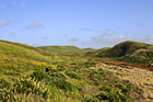
#763 — A scenic picture of a Marin County coastal view located at Kehoe Beach in California. In this picture you can see the green hills and long grass as the wind blows on this beautiful spring day.
Marin County Coast View
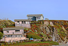
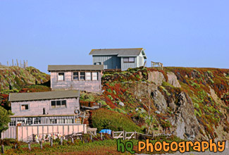
#452 — A scenic picture taken of three houses on a hill along the coast of Highway 1 in California. The beach to the Pacific Ocean starts right at the bottom of the hill as you can see the sand in the right corner. This picture was taken along the coast north of Marin County.
Three Coastal Houses on Hill
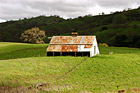
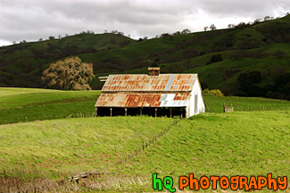
#317 — This is a scenic picture of an old barn in the middle of a big green grass field and hills. This barn is located over the hills of East San Jose. The hills are extremely green because of the un normal amount of rainfall that has hit this area in 2005 so far.
Green Grass and Old Barn
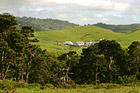
#468 — A scenic picture taken of a farm in Marin County, California. This picture was taken in the spring season when California received tons of rain therefore explaining the very green land and hills surrounding this farm. Marin County is located just north of San Francisco across the Golden Gate Bridge.
Farm in Marin County, California
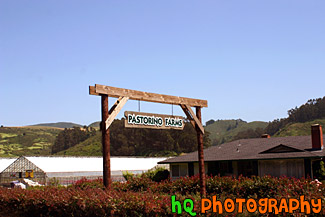
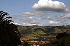
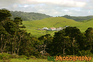
#214 — A photo of a little ranch or farm that is located in the hills of Half Moon Bay, California.
View of a Ranch at Half Moon Bay