Photos of California Hills (60)
There are (60) photos of the keyword, California Hills, available on our website. They are pictured below.The pictures are organized by category.
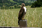
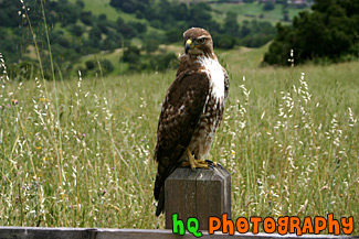
#382 — A scenic picture taken of a still hawk on a post in the hills of Palo Alto, California. This hawk is looking at me as I get closer and is deciding whether to fly away or not!
Hawk on Post
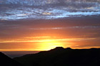
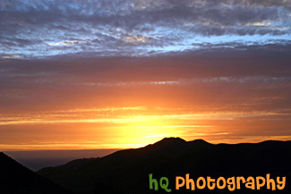
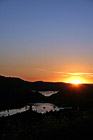
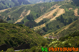
#405 — This picture was taken of a beautiful sunset near the entrence to Yosemite National Park just a couple miles west of Groveland and Big Oak Flat. You can see part of the reservoir to Don Pedro Lake in between the hills. Yosemite is located in east-central California and lies 105 miles north of Fresno, 195 miles east of San Francisco, 313 miles north of Los Angeles and 350 miles northwest of Las Vegas. The gross area acres for the national park is Gross Area Acres for 761,266 and receives about 3,300 total recreational visits per year. The elevation in the park ranges from from 2000 feet to over 13,000 feet. The cliffs, waterfalls, steep mountains and deep lakes of Yosemite National Park were all formed over millions of years by earthquakes, glaciers and numerous other forces of nature.
Sunset at Hills near Yosemite
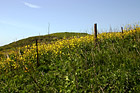
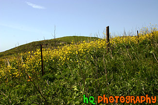
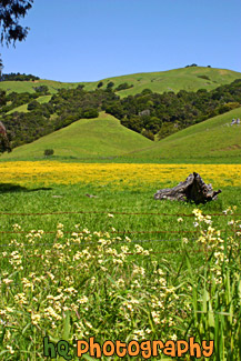
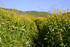
#374 — A scenic picture taken on of California Falselupine (Thermopsis Macrophylla) past Pt. Reyes near the California coast and Pacific Ocean in Marin County. This picture was taken on a sunny spring day in April.
California Yellow Wildflowers
#542 — A scenic picture taken of a bright orange, red, and blue sunset over the hills just behind the Golden Gate Bridge in San Francisco. The picture was taken on the Marin County side of the bridge looking towards the Pacific Ocean.
Sunset Over Hill at San Francisco
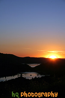
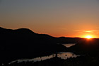
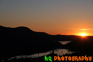
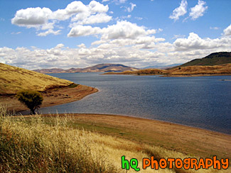
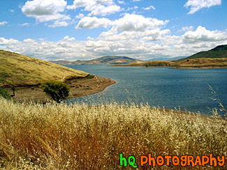
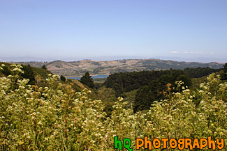
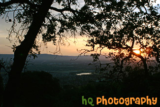
#665 — A scenic picture taken of a sunset behind the reservoir to Don Pedro Lake in between the hills and mountains surrounding Yosemite National Park in California. The picture was taken near the entrence to Yosemite National Park just a couple miles west of Groveland and Big Oak Flat. Yosemite is located in east-central California and lies 105 miles north of Fresno, 195 miles east of San Francisco, 313 miles north of Los Angeles and 350 miles northwest of Las Vegas.
Sunset Behind Don Pedro Lake
#224 — A pretty sunset along the coast of Highway 101 in California just north of Santa Barbara.
Sunset on the 101
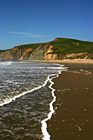
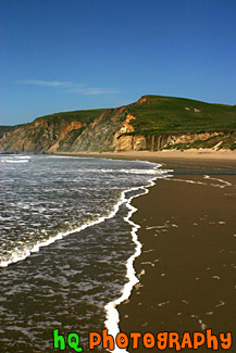
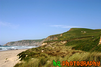
#369 — A scenic picture taken at Kehoe Beach in Marin County, California. In this picture you can see the white bubbles from the ocean wave coming to shore and making interesting lines towards the hill in the background.
Kehoe Beach Wave Lines
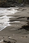
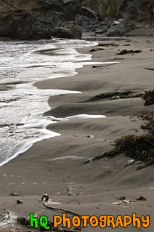
#1826 — A scenic vertical picture taken of the beach land at Muir Beach which is located near San Francisco in California. You can see seaweed on the beach and hills in the sand where the water is seen.
Beach Sand, Seaweed, & Water
#367 — A scenic photo taken of a beautiful landscape scene with green grass, blue sky, close up wild flowers, and yellow flowers in Marin County, California. Marin County is just north of San Francisco. From 1850 to 1950 the population of Marin increased by 85,000 people. Twenty years later there were an additional 123,000 residents. Population growth has slowed since then and is now about 245,000. In 1972 the Golden Gate National Recreational Area was created which encompasses the Marin Headlands, Muir Woods and thousands of acres along the Pacific Coast.
Beautiful Marin County Landscape
#364 — A scenic photo taken of a beautiful landscape scene with green grass, blue sky, and yellow flowers in Marin County, California. Marin County is just north of San Francisco. From 1850 to 1950 the population of Marin increased by 85,000 people. Twenty years later there were an additional 123,000 residents. Population growth has slowed since then and is now about 245,000. In 1972 the Golden Gate National Recreational Area was created which encompasses the Marin Headlands, Muir Woods and thousands of acres along the Pacific Coast.
Marin County Landscape of Hills
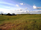
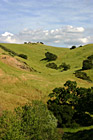
#6 — Rolling hills of Palo Alto, California on a sunny day. This photo was taken on the eastern hills between Palo Alto and Los Altos in the Bay Area.
Rolling Hills in California
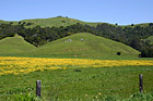
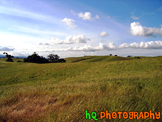
#350 — A scenic picture and contrast between a very green hill and partly cloudy blue skies. This picture was taken in San Jose of the very green hills (which are starting to turn brown) from the tremendous early 2005 rainfall.
Green Hill & Scenic Sky Scene
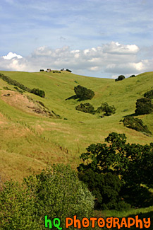
#766 — A scenic picture taken of a green hill filled with lots of green trees on a blue sky sunny day in East San Jose, California.
Green Hill & Trees
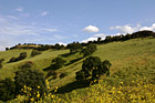

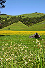
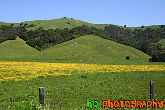
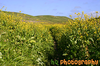
#765 — A scenic picture taken of a green hill, green trees, and yellow wildflowers blooming during spring in Northern California. This picture was taken in the East San Jose area.
Green Hill & Yellow Wildflowers
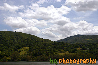
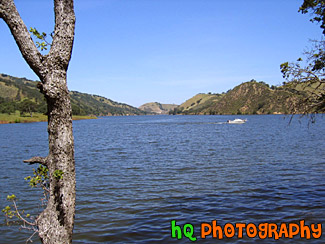
#885 — A scenic picture taken of a lake in the foreground, green rolling hills in the mid-ground, and interesting puffy white clouds and blue sky in the sky. This photo was taken near the Santa Cruz Mountains on the way to Santa Cruz, California near Highway 17.
Green Hill, Lake, & Puffy Clouds
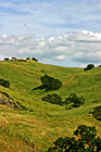
#473 — A scenic picture taken of some green hills with the shadows of the clouds on the hills from the partly cloudy sky. This picture was taken in South/East San Jose near the Silver Creek Valley area.
Green Hills & Partly Cloudy Sky
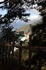
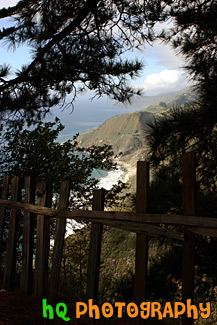
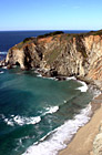
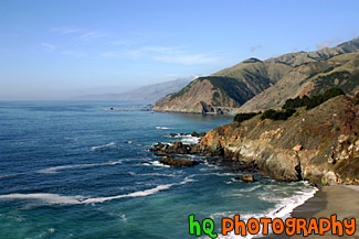
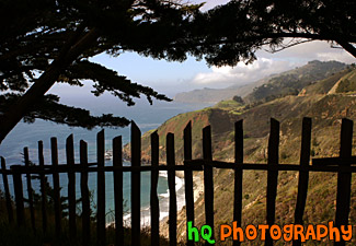
#1774 — A scenic vertical picture taken along the Highway 1 coast in California. This picture was taken looking down at the Pacific Ocean through a fence and trees on a hill. Hills along the coast are seen in the background.
Highway 1 Coast
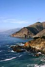
#294 — A scenic photograph taken along the coast of Highway 1 going south towards Los Angeles in California. This photo displays the beautiful Pacific Ocean with the blue and sunny skies.
Pacific Ocean Along Highway 1, California
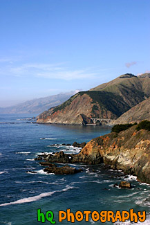
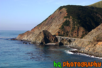
#793 — A scenic picture taken of the Pacific Ocean and the west coast in California in a beautiful sunny day. In this picture you can see many hills of the coast along with rocks and the scenic road and a beautiful bridge in the background.
Pacific Ocean Coast in California
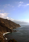
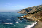
#346 — A scenic view of the Pacific Ocean driving down the coast view on Highway 1 in California. This picture was taken between the cities of Monterey and Santa Barabara by the coast. In this picture you can see the low clouds finishing up fading away from the raise of the sun which makes for a beautiful scene.
Pacific Ocean Scenic Coast
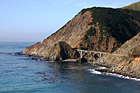
#1773 — A scenic picture taken along the west coast of the Pacific Ocean. In this picture you can see a bridge, the ocean, and the blue sky on this sunny day along the hills seen to the east.
Bridge Along West Coast
#296 — This is a scenic photo taken along the coast of highway 1 in California. Highway 1 is a highway that runs along the coast of the Pacific Ocean with some breathtaking views.
Coast Along Highway 1, California
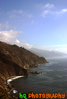
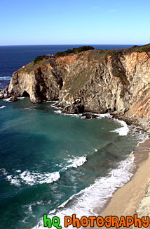
#352 — A scenic picture of the coast along the Pacific Ocean in Northern California. This picture was taken along the scenic highway of Highway 1 between Monterey and Santa Barbara. In the distance you can see a scenic bridge along the road.
Coast Scene & Hills
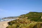
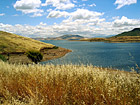
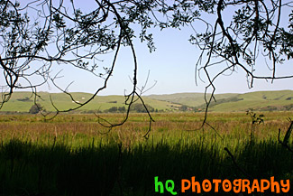
#763 — A scenic picture of a Marin County coastal view located at Kehoe Beach in California. In this picture you can see the green hills and long grass as the wind blows on this beautiful spring day.
Marin County Coast View
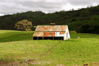
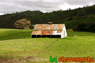
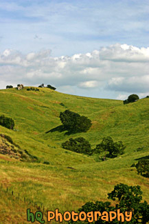
#317 — This is a scenic picture of an old barn in the middle of a big green grass field and hills. This barn is located over the hills of East San Jose. The hills are extremely green because of the un normal amount of rainfall that has hit this area in 2005 so far.
Green Grass and Old Barn
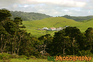
#468 — A scenic picture taken of a farm in Marin County, California. This picture was taken in the spring season when California received tons of rain therefore explaining the very green land and hills surrounding this farm. Marin County is located just north of San Francisco across the Golden Gate Bridge.
Farm in Marin County, California
#214 — A photo of a little ranch or farm that is located in the hills of Half Moon Bay, California.
View of a Ranch at Half Moon Bay
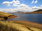
#15 — A scenic photo taken of a lake out in the country side of the sate of California. This lake is a popular campground for many outdoor people. It is located on the out-skirts of the bay area, east of San Francisco more towards Sacramento.
California Lake
#45 — A scenic photo of a lake scene taken in Northern California on a partly cloudy day.
California Lake Scene
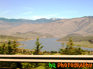
#67 — A view of Lake Shasta, California while driving North on I5. You can tell this photo was taken while the car was moving because the trees in the foreground are blurry but the lake itself is in focus.
Lake Shasta from I5
#44 — A landscape scene in Northern California near Gilroy of a lake and puffy clouds on a sunny day.
Landscape Lake Scene
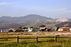
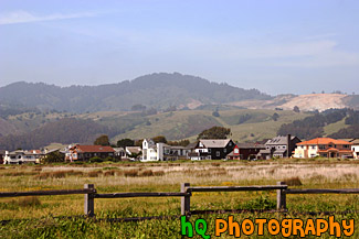
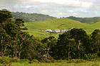
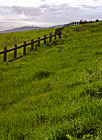
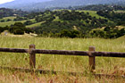
#955 — A scenic picture taken of a beautiful landscape scene located along the coast in California at Half Moon Bay. In this picture you see an old wooden fence in the foreground with a grass field that leads to some houses and green hills in the background. Half Moon Bay is located about 30 miles south of San Francisco, and only an hour's drive from pretty much anywhere in the Bay Area. Half Moon Bays' community offers numerous Bed and Breakfasts, several motels and some world-renowned hotels. Activities include surfing, whale watching, horseback riding on the beach, a historical Main Street with unique shops, two wineries, bird refuges, hiking and two lighthouses.
Half Moon Bay Hills & Houses
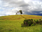
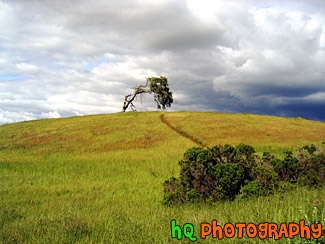
#4 — A photo of a lonely tree with a storm approaching on the golden hills of the California Bay Area. This photo was taken during Spring 2003 in Palo Alto area in CA.
Lonely Tree & Storm
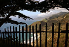
#295 — This is a scenic photo that was taken along the coast of the Pacific Ocean along Highway 1 in California. This photo looks through a fence down at the coast and Pacific Ocean. Highway 1 is a coastal highway running down the coast of California.
Pacific Ocean View Through Fence
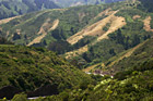
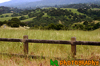
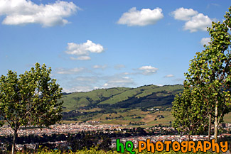
#956 — A scenic photo taken of the wesstern Bay Area in California looking towards the 280 freeway which runs near Half Moon Bay, Stanford, Los Altos, and Palo Alto. In this picture you can see the golden hills which surround the Bay Area and a small lake in the middle of the photo. This photo was taken on a sunny day.
Bay Area Landscape Scene
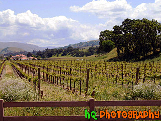
#329 — This is a scenic beautiful picture taken of a bright green grass field following a cury wooden fence in the hills of Palo Alto, California. This picture was taken up a trail behind the campus of Stanford University. The grass is especially green right now because of the tremendous rainfall the bay area has been having during this time period. Usually these fields are a golden yellow color because of the sunshine and lack of rainfall, hence the name "Golden Hills" of California. This hills can no longer live up to that name since they are all green! But they are so beautiful!
Bright Green Grass & Fence in Palo Alto
#785 — A scenic picture taken close up of some golden and green hills located on the path towards Half Moon Bay, California. During late spring and the summer months in California, these golden hills are a very common site.
Close up of Golden Green Hills
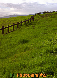
#887 — A scenic picture taken in the country side of the Los Altos Hills in the Bay Area of California. In this picture an old wooden fence lines the foreground and the country green fields and hills can be seen in the background.
Country Fence & Green Fields
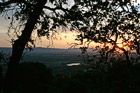
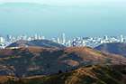
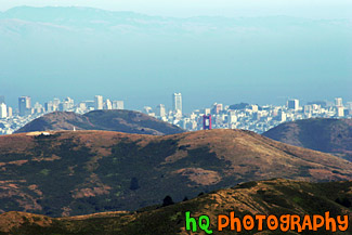
#373 — A scenic picture taken a top a hill in East San Jose overlooking the entire city and bay area. This picture shows a scenic house amongst the view of the city during a spectacular sunset.
East San Jose Hill Sunset
#888 — A scenic picture taken of the East San Jose landscape, green hills, blue sky, and houses in the area. This photo was taken in the Evergreen area.
East San Jose Landscape & Houses
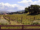
#21 — A photo of a farm in the countryside of Northern California. This farm was located out near Sacramento but not quite in the city. A fence and a wine field can be seen in the picture.
Out in the Country
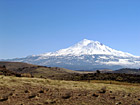
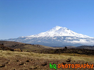
#66 — Mt. Shasta located in Northern California on the Cascade Range. Mount Shasta stands 14,162 feet high. Avalanche Gulch route is one of the most popular and climbed routes in the United States with an estimated 15,000 climbers that attempt the summit annually. With 17 established routes, each with variations, there is climbing available for beginners as well as advanced mountaineers. The terrain consists of loose volcanic talus, rock & ice, and glaciers. This photo was taken on a sunny day.
Mount Shasta
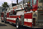
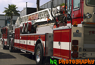
#396 — A scenic picture taken of a Fire Truck in downtown Beverly Hills, California. The fire truck says "Beverly Hills" on the sign on the ladder of the truck.
Beverly Hills Fire Truck
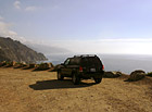
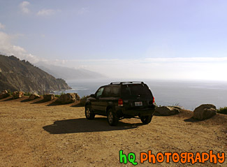
#431 — A scenic picture taken of a 2003 Ford Escape located on a dirt road close to the cliff by the coast of the Pacific Ocean on California's coast.
Ford Escape on Dirt Road Ocean View
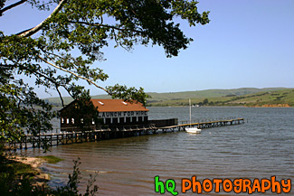
#803 — A scenic picture taken of the Tomales Bay near Point Reyes in Marin County, California. In this picture you can see the hills in the background of marin county and a sail boat parked by this boat launch in the foreground. Tomales bay is a coastal estuary located on the central California coast approximately 40 miles northwest of San Francisco.
Marin County Boat Launch
#806 — A scenic picture of a beautiful hiking trail located by the coast in Marin County, California at Kehoe Beach. Marin County is a county located in California's San Francisco Bay Area across the Golden Gate Bridge fom San Franicsco. In this picture you can see Marin county's beautiful green hills along with the yellow falselupine wildflowers.
Marin County Coastal Trail
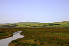
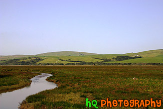
#948 — A scenic picture taken of the grasslands and hills in Marin County, California. This photo was taken near Point Reyes. In the photo you can see a stream of water along with the green hills in the background and green grassy field in the foreground. This photo was taken on a beautiful sunny day with blue sky seen all around.
Marin County Fieldland and Hills
#365 — A scenic picture taken in Point Reyes, California in Marin County. Point Reyes is home to many native land mammals which number about 37 species. Marine mammals also add to this total by another 12 species. The biological diversity stems from a favorable location in the middle of California and the natural occurrence of many distinct habitats which makes Point Reyes a fun place to visit.
Point Reyes Landscape Scene
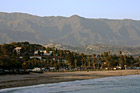
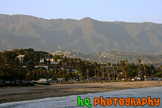
#752 — A scenic picture taken of Santa Barbara, California along the beach with a view of the many palm trees along the coast and the mountains in the background on a sunny day. In front of the mountain you can see the little hills filled with houses of the rich and famous.
Santa Barbara Beach & Mountains
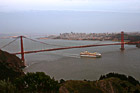
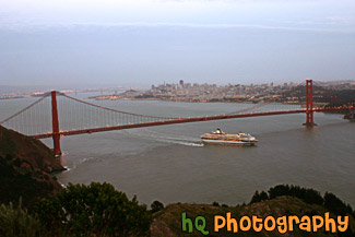
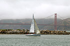
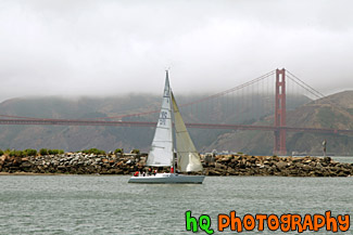
#363 — A scenic picture taken of the entire Golden Gate Bridge in San Francisco with a view of the city behind and a big cruise ship leaving the bay area underneath. This picture was taken at dusk from the top of Hawk Hill which is located just north of San Francisco in the Marin Headlands.
Cruise Ship Under Golden Gate Bridge
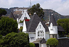
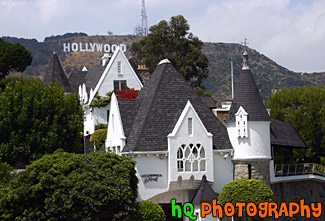
#388 — A scenic picture of the famous Los Angeles landmark, the Hollywood sign. This sign is located on the hills just north of the Hollywood strip and was taking with a scenic white, pointy house in the foreground. The Hollywood Sign originally said "Hollywoodland" in 1923 before it was shortened in 1945. The Hollywood Sign is the most famous sign in the world. It is located on Mount Lee in Griffith Park overlooking the city of Hollywood. It's illegal to hike to the Hollywood Sign, but there are many good vantage points from the streets of Hollywood. The Sign is a trademark of the Hollywood Chamber of Commerce. The Sign was declared Los Angeles Cultural-Historical Monument #111 in 1973 by the Cultural Heritage Board of the City of Los Angeles.
Hollywood Sign & Scenic House
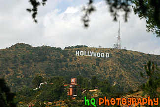
#390 — This is a picture taken of the famous Los Angeles landmark, The "Hollywood" sign. The Hollywood Sign originally said "Hollywoodland" in 1923 before it was shortened in 1945. The Hollywood Sign is the most famous sign in the world. It is located on Mount Lee in Griffith Park overlooking the city of Hollywood. It's illegal to hike to the Hollywood Sign, but there are many good vantage points from the streets of Hollywood. The Sign is a trademark of the Hollywood Chamber of Commerce. The Sign was declared Los Angeles Cultural-Historical Monument #111 in 1973 by the Cultural Heritage Board of the City of Los Angeles.
Hollywood Sign on Hill
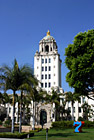
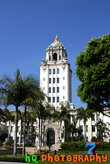
#393 — A scenic picture of the Beverly Hills, California City Hall located in downtown Beveryly Hills on the outskirt of Los Angeles. The Beverly Hills City Hall has gracefully presided over the city's civic life since 1932. Architect Willliam Gage created the Spanish Renaissance building in typical government style of that era. The beauty of the building, with its tiled dome and gilded cupola, soon transcended the typical government building and has become a beloved local landmark of Beverly Hills. The city of Beverly Hills was wealthy and famous long before it was discovered by the movie industry. At the beginning Beverly Hills was blessed with a commodity more precious in Southern California than jewels: water.
Beverly Hills City Hall
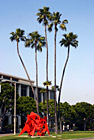
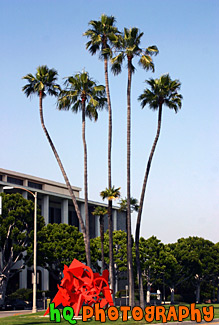
#398 — A scenic picture taken of downtown Beverly Hills, California of some interesting shaped palm trees and a red structure. The city of Beverly Hills was wealthy and famous long before it was discovered by the movie industry. At the beginning Beverly Hills was blessed with a commodity more precious in Southern California than jewels: water.
Downtown Beverly Hills, California Palm Trees
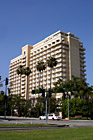
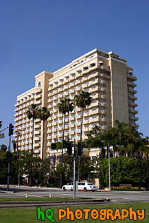
#953 — A scenic picture taken of a hotel located in downtown Beverly Hills, California. A limousine is driving in front of the hotel on this beautiful sunny day.
Hotel in Downtown Beverly Hills
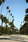
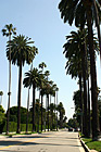
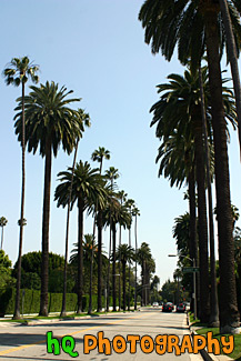
#723 — A scenic picture taken of many palm trees alternating between tall and short along a road perpendicular to Sunset Blvd. in Beverly Hills, California.
Palm Trees Along Beverly Hills Road
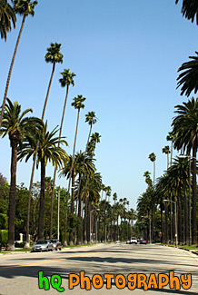
#751 — A scenic picture taken of the hundreds of palm trees located in Beverly Hills while approaching the famous Sunset Boulevard street. This picture was taken on a sunny day with blue sky above the palm trees. Sunset Boulevard is one of the world's most famous streets. Sunset Boulevard passes through Hollywood, then becomes the Sunset Strip as it passes through West Hollywood, weaves its way through Beverly Hills and Bel-Air, and finally winds its way through the rustic foothills of the Santa Monica mountains, to finally end at the Pacific Ocean near Malibu.
Palm Trees Leading to Sunset Blvd.
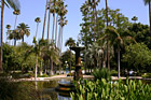
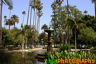
#892 — A scenic picture taken of the water fountain in the middle of Will Rogers Memorial Park located in downtown Beverly Hills, California. There are many pretty palm trees surrounding this beautiful park as you can tell in the picture. The Will Rogers Memorial Park was the first municipal park in Beverly Hills, originally opened under the name of Sunset Park in 1915. The park was renamed in 1952 to honor the entertainer and honorary mayor of Beverly Hills, Will Rogers.
Will Rogers Memorial Park Fountain