Photos of Blue Sky Bridge (28)
There are (28) photos of the keyword, Blue Sky Bridge, available on our website. They are pictured below.The pictures are organized by category.
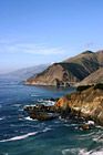
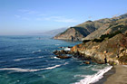
#793 — A scenic picture taken of the Pacific Ocean and the west coast in California in a beautiful sunny day. In this picture you can see many hills of the coast along with rocks and the scenic road and a beautiful bridge in the background.
Pacific Ocean Coast in California
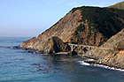
#1773 — A scenic picture taken along the west coast of the Pacific Ocean. In this picture you can see a bridge, the ocean, and the blue sky on this sunny day along the hills seen to the east.
Bridge Along West Coast
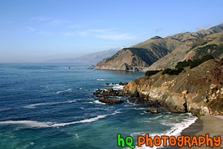
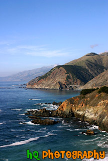
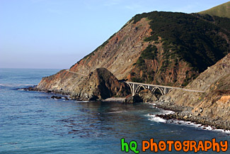
#352 — A scenic picture of the coast along the Pacific Ocean in Northern California. This picture was taken along the scenic highway of Highway 1 between Monterey and Santa Barbara. In the distance you can see a scenic bridge along the road.
Coast Scene & Hills
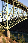
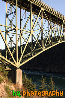
#1817 — A scenic vertical picture taken of the side of the Deception Pass Bridge which is located in Washington State. This picture was taken on a sunny evening.
Deception Pass Bridge (Side View)
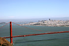
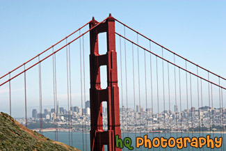
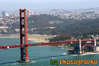
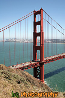
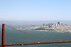
#1390 — A scenic picture taken looking down at the Golden Gate Bridge with the city of San Francisco seen in the background on this sunny fog-free day in the bay area.
Golden Gate Bridge & The City
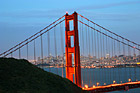
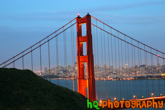
#362 — A scenic picture of the Golden Gate Bridge in San Francisco at night with a view of San Francisco city in the background. In the distance you can see the lights of the city lit up as well as the lights of the bridge. The Golden Gate Bridge seems to be "glowing" in this picture from the effect of night-fall approaching and city lights beginning to come on. This picture was taken from the Marin Headlands (north side) of the bridge from a place called Battery Spencer just slightly after dusk.
Golden Gate Bridge at Night & San Francisco City
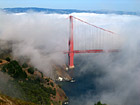
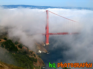
#215 — A scenic photo of fog covering the Golden Gate Bridge located in San Francisco, California. This picture was taken during the summer months when the fog really covers the Golden Gate Bridge. The real "Golden Gate" is the strait that the bridge spans. It was first named "Chrysopylae," meaning "golden gate," by Captain John C. Fremont in 1846. This photo was taken from the top of Hawk Hill which is located just north of San Francisco in the Marin Headlands. Total length of the bridge is 1.7 miles and the clearance above the high water is 220 feet.
Golden Gate Bridge Covered in Fog
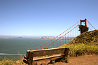
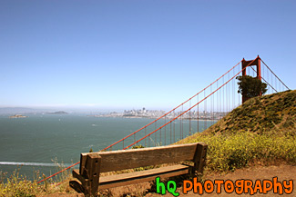
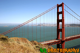
#992 — A scenic picture taken of an empty bench and the Golden Gate Bridge off to the right along with the city of San Francisco, the bay waters, and Alcatraz in the background. This picture was taken on a beautiful sunny day.
Bench & Golden Gate Bridge
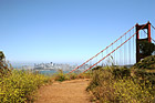
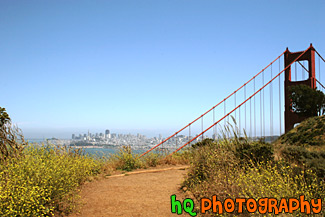
#991 — A scenic picture taken of yellow wildflowers located on the sides of a trail leading to the Golden Gate Bridge. You can also see the city of San Francisco and the bay waters in the distance on this beautiful sunny day.
Golden Gate Bridge & Wildflowers on Trail
#587 — A scenic picture taken of the Golden Gate Bridge in California. In this picture you can see the city of San Francisco in the background and Alcatraz Island off to the left. This picture of the Golden Gate Bridge was taken from a place called Battery Spencer in the Marin Headlands.
Golden Gate Bridge from Battery Spencer
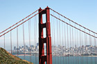
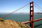
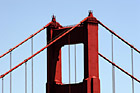
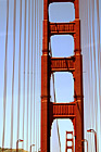
#2063 — A scenic picture taken of the Golden Gate Bridge located in San Francisco on a blue sky sunny day. This photo is taken of just one section of the bridge.
Golden Gate Bridge in San Franciso
#2065 — A scenic picture taken of the San Francisco side of the Golden Gate Bridge on a beautiful sunny afternoon.
Golden Gate Bridge Side View
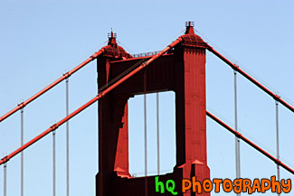
#426 — A scenic picture of a close up of the tip of the famous Golden Gate Bridge located in San Francisco, California on a sunny blue sky day. The Golden Gate Bridge is a historic symbol that represents the city of San Francisco. Joseph B. Strauss was the original chief engineer of the bridge and designed a rather unsightly cantilever and suspension structure in 1916. Though attempts were made to refine the design, it wasn't until consulting architects Irving F. Morrow and his wife Gertrude C. Morrow stepped in that the current look and design were imagined and implemented. The bridge opened for traffic 1937.
Golden Gate Bridge Tip
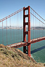
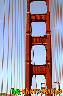
#2064 — A scenic vertical picture taken of the Golden Gate Bridge during the day with blue sky seen above. San Francisco can be seen in the background.
Golden Gate Bridge Vertical View
#590 — An interesting vertical picture taken of the famous Golden Gate Bridge located in San Francisco, California. This picture was taken while driving in a car on the bridge looking up at the red frame on a sunny blue sky day.
On The Golden Gate Bridge
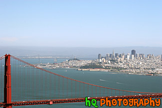
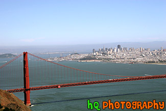
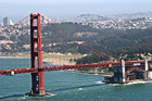
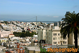
#1391 — A scenic picture taken of the city of San Francisco in the background and the Golden Gate Bridge in the foreground in this sunny fog-free day in the bay area.
San Franicsco & Golden Gate
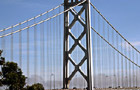
#593 — A close up picture taken on the arch of the Bay Bridge which is located in San Francisco, California and connects with Oakland. There are no pedestrian walkways or vista points on the Bay Bridge, but you can drive on it and stop midway at Treasure Island to view the span. The Bay Bridge is a very popular commuting bridge as over a quarter million vehicles cross the San Francisco Bay Bridge daily.
Arch of Bay Bridge
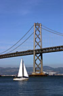

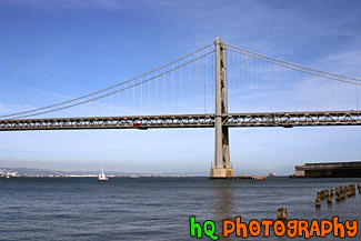
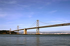
#564 — A scenic picture taken of the Bay Bridge which is located in San Francisco, California and connects with the city of Oakland. In this picture there is a single sailboat floating in front of the bridge on a blue sky sunny day.
Bay Bridge & Sailboat
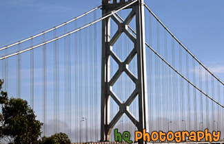
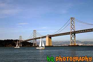
#1392 — A scenic picture taken of one of the archs of the Bay Bridge which is located in San Francisco, California. This photo was taken on a sunny day with blue sky all around. A sail boat can be seen under the bridge.
Bay Bridge Arch
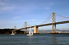
#565 — A full view picture taken of the Bay Bridge and some sailboats sailing by on a sunny day in San Francisco, California. The bay bridge connects the city of San Francisco with the city of Oakland.
Full View of Bay Bridge & Sailboats
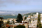
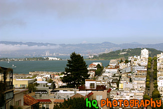
#783 — A scenic picture looking at Treasure Island and Oakland in the background from San Francisco, California. In the picture you can see the Oakland-Bay Bridge on the other side of Treasure Island. You can also see the interesting buildings, apartments, and homes of San Francisco in the foreground.
Oakland & Treasure Island from S.F.
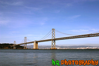
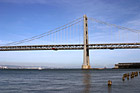
#784 — A scenic picture taken of the entire San Francisco - Oakland Bay Bridge located in San Francisco, California. This picture was taken on a sunny day in the spring season. The Bay Bridge opened to traffic on November 12, 1936. Its total cost, including an electric railroad which has since been abandoned, was $79.5 million. The best ways to enjoy the Bay Bridge are: From the San Francisco waterfont along Embarcadero Street, where you can see and photograph the span, and walk under it.
San Francisco Bay Bridge & Blue Sky
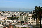
#801 — A scenic picture taken of downtown San Francisco, California. In this picture you can see the Bay Bridge in the background, a palm tree in the foreground and the many unique buildings, apartments, and homes of San Francisco in the middle. This picture was taken on an sunny day with blue sky and some low fog in the background.
San Francisco Buildings & Bay Bridge
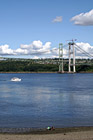
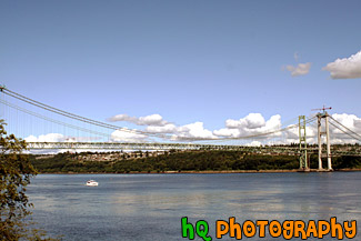
#1089 — A scenic picture taken of the "double" Narrows Bridge and a boat underneath. Being built next to the old Narrows Bridge built in 1950 is the new bridge which is nearly 80 percent complete. The new bridge opens to traffic in summer 2007, but renovations on the 1950 bridge go on for another 11 months after that. In summer 2008, when the new and existing bridges open in their final form, the 1950 span will take drivers westbound on two general purpose lanes and one carpool lane. The new bridge will carry eastbound traffic on two general purpose lanes, one carpool lane and a fourth "drop" lane.
Narrows Bridge & Boat
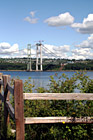
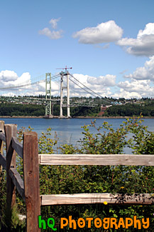
#1086 — A scenic picture taken of a wooden fence in the foreground of the "double" Narrows Bridge. Being built next to the old Narrows Bridge built in 1950 is the new bridge which is nearly 80 percent complete. The new bridge opens to traffic in summer 2007, but renovations on the 1950 bridge go on for another 11 months after that. In summer 2008, when the new and existing bridges open in their final form, the 1950 span will take drivers westbound on two general purpose lanes and one carpool lane. The new bridge will carry eastbound traffic on two general purpose lanes, one carpool lane and a fourth "drop" lane.
Narrows Bridge Construction & Fence
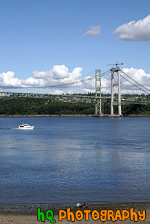
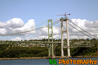
#1087 — A scenic picture taken of the Narrows Bridge project in process as the new bridge is being built right beside the old bridge of 1950. The new bridge opens to traffic in summer 2007, but renovations on the 1950 bridge go on for another 11 months after that. In summer 2008, when the new and existing bridges open in their final form, the 1950 span will take drivers westbound on two general purpose lanes and one carpool lane. The new bridge will carry eastbound traffic on two general purpose lanes, one carpool lane and a fourth "drop" lane.
Narrows Bridge Project, Tacoma
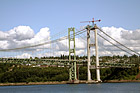
#1095 — A scenic picture taken of a close up of the "double" Narrows Bridge. Being built next to the old Narrows Bridge built in 1950 is the new bridge which is nearly 80 percent complete. The new bridge opens to traffic in summer 2007, but renovations on the 1950 bridge go on for another 11 months after that. In summer 2008, when the new and existing bridges open in their final form, the 1950 span will take drivers westbound on two general purpose lanes and one carpool lane. The new bridge will carry eastbound traffic on two general purpose lanes, one carpool lane and a fourth "drop" lane.
Narrows Bridge up Close
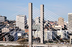
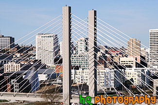
#933 — A close up scenic picture taken of downtown Tacoma and the scenic bridge where you can see the buildings of Tacoma through it. Tacoma, Washington, is located on the West Coast nestling between Commencement Bay and the Puget Sound. It is about 36 miles south of Seattle and 28 miles north of the capital of Washington, Olympia. Tacoma's historic and innovative downtown has expanded down the hillside to absorb and include its Puget Sound waterfront. With new condos, retail and the International Museum of Glass. Tacoma's Waterfront Downtown is reborn.
Tacoma, Washington Downtown
